
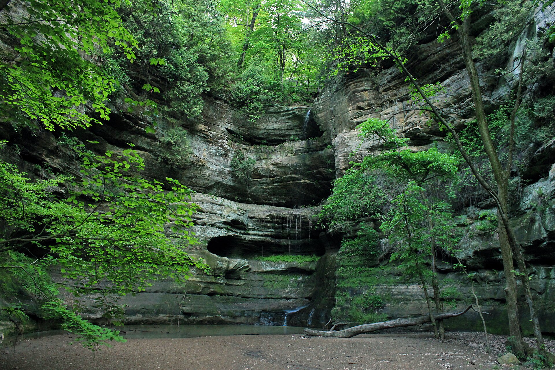
Illinois has a reputation for being flat. Then you walk into a mossy sandstone canyon at Starved Rock, hear a waterfall spilling over the rim somewhere ahead, and realize the reputation is wrong.
About 90 minutes from Chicago, along the Illinois River, Starved Rock State Park has 18 canyons cut by glacial meltwater, wooded bluffs, river overlooks and about 13 miles of marked trails. Some hikes take 20 minutes. Others take most of a day. Almost all of them involve stairs. Lots of stairs.
This guide covers the Starved Rock State Park hiking trails in detail: distances, difficulty, which canyons are open in 2026 (a big trail project has closed some popular ones), how to read the trail map, where to park, when the waterfalls actually flow, eagle watching, and simple plans for a short visit, half a day or a full day.
Cover photo: a waterfall canyon at Starved Rock State Park. Photo: Good Free Photos / Wikimedia Commons
What Are the Best Hiking Trails at Starved Rock?
The best Starved Rock State Park hiking trails are the Starved Rock Overlook (0.6 mile round trip), French Canyon (0.8 mile), Lover’s Leap and Eagle Cliff overlooks (1.4–1.6 miles), Wildcat Canyon (2 miles) and St. Louis Canyon (3 miles). The park has about 13 miles of trails and 18 canyons, entry is free, and trails are open 7 a.m. to sunset. In October 2026, LaSalle, Tonti, Pontiac, Basswood and Lonetree canyons are closed for construction.
Starved Rock at a Glance
| Location | Near Utica and Oglesby, north-central Illinois, on the Illinois River |
| From Chicago | About 95 miles, roughly 1.5 to 2 hours |
| Trails | About 13 miles of marked trails |
| Canyons | 18 sandstone canyons |
| Entry and parking | Free |
| Trail hours | 7 a.m. to sunset, year-round (no hiking after dark) |
| Visitor Center | 9 a.m. to 4 p.m. daily; closed on winter holidays |
| Park phone | 815-667-4726 |
| Best for waterfalls | March to June, right after rain or snowmelt |
| Dogs | Allowed on a leash |
| 2026 closures | LaSalle, Tonti, Pontiac, Basswood and Lonetree canyons, and Sandstone Point |
Are Starved Rock Trails Open in 2026?
Most trails are open, but not all. Illinois is spending $18 million to rebuild trails, bridges and staircases at Starved Rock. Work started in winter 2025 and is expected to run through summer 2027, done in stages so only some areas close at a time.
Closed as of October 2026:
- LaSalle, Tonti, Pontiac, Basswood and Lonetree canyons, and Sandstone Point
- The bluff trail from the top of Wildcat Canyon to Sandstone Point
- The river trail from Wildcat Canyon to LaSalle and Tonti canyons
- The river trail over French Canyon Creek and Cove, and the bluff trail over Pontiac Canyon
- The LaSalle Canyon parking lot (Parkman’s Plain, off Route 71)
Open: the Visitor Center, the Lodge, the campground, Starved Rock, French Canyon, Lover’s Leap and Eagle Cliff overlooks, Wildcat Canyon, Aurora Canyon, St. Louis Canyon, and the eastern canyons from their own parking lots (Hennepin, Ottawa, Kaskaskia and Illinois).
What this means in practice: you can no longer walk the whole park end to end along the river. Plan to drive between the western trails (by the Visitor Center) and the eastern canyons. Closures change as work moves along, so check the Illinois DNR’s Starved Rock trail improvement page, or call the park, the week of your visit. If you meet caution tape on the trail, turn around and pick another route.
Starved Rock Hiking Trails Compared
One thing that confuses people: the distances on the park’s trail map are one way from the Visitor Center. The table below doubles them, so you see the real round-trip distance.
| Destination | Round trip from Visitor Center | Difficulty | Status (Oct. 2026) |
|---|---|---|---|
| Starved Rock Overlook | 0.6 mile | Easy to moderate, stairs | Open |
| French Canyon | 0.8 mile | Moderate, rocky | Open |
| Lover’s Leap Overlook | 1.4 miles | Moderate | Open |
| Eagle Cliff Overlook | 1.6 miles | Moderate | Open |
| Beehive Overlook | 1.8 miles | Moderate | Open |
| Wildcat Canyon | 2 miles | Moderate, many stairs | Open |
| Aurora and St. Louis canyons | 3 miles | Moderate | Open |
| LaSalle and Tonti canyons | About 4 miles | Moderate | Closed |
| Hennepin Canyon | 6.2 miles (shorter from its own lot) | Long | Open from its lot |
| Ottawa and Kaskaskia canyons | 7.8–8 miles (short from their lot) | Long | Open from their lot |
| Illinois Canyon | 9.4 miles (short from its lot) | Long | Open from its lot |
Distances come from the Illinois DNR trail guide. Difficulty is our practical rating, not an official grade. Most people walk about a mile every 30 to 45 minutes here, because of the stairs.
1. Starved Rock Overlook: Best Short Hike
Distance: 0.6 mile round trip · Time: 20 to 40 minutes · Difficulty: easy to moderate, with a long staircase
Start here. The park is named after this 125-foot sandstone butte, and a short walk and a lot of wooden stairs from the Visitor Center put you on top. Boardwalks loop around the summit with views up and down the Illinois River, over the Starved Rock Lock and Dam and across to Plum Island.
It’s the best quick payoff in the park, and in winter it’s one of the best places to watch bald eagles fishing below the dam. It does get crowded on weekends, so come early or late in the day.

2. French Canyon: Best Short Canyon Hike
Distance: 0.8 mile round trip · Time: 30 to 45 minutes · Difficulty: moderate, rocky and often wet
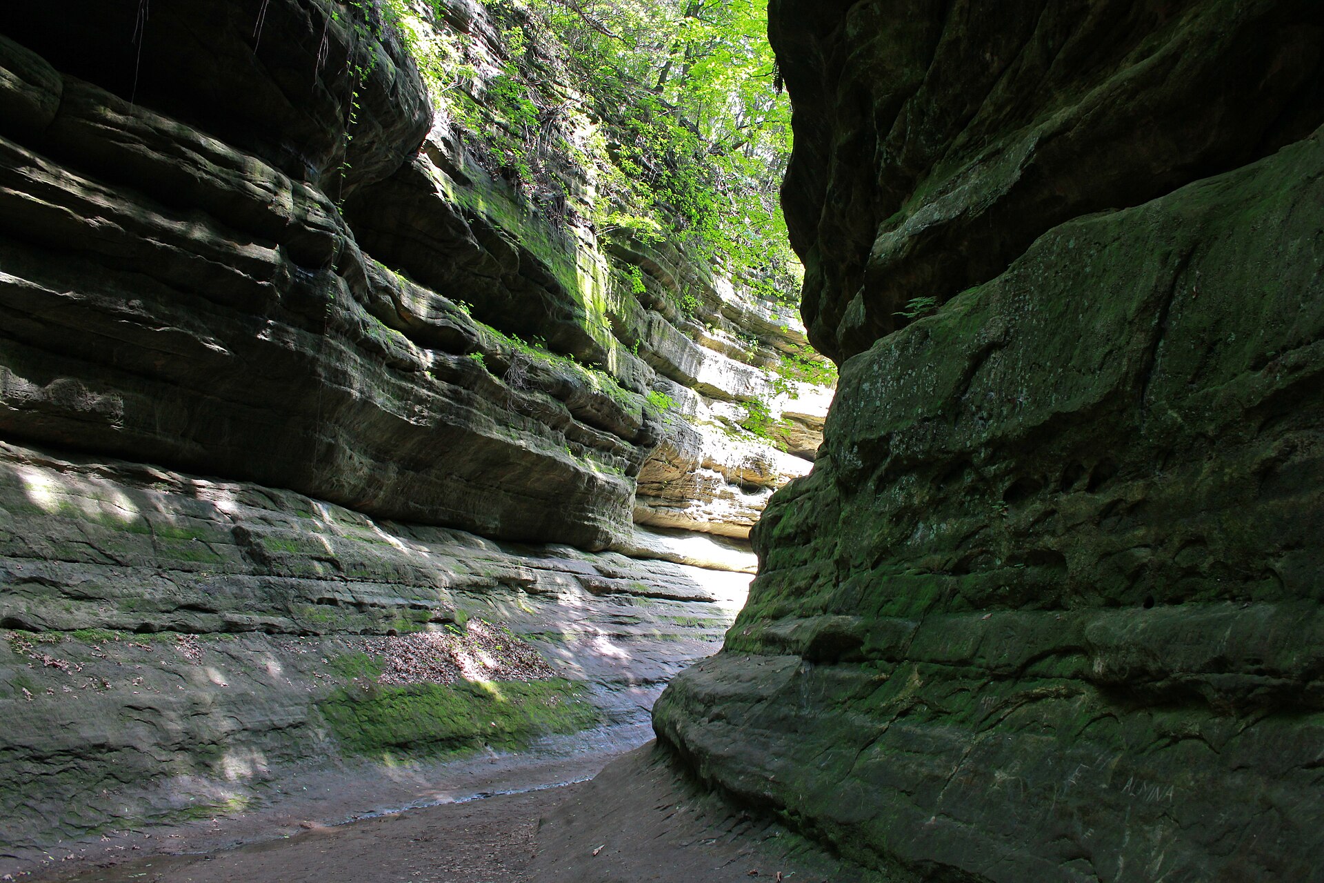
French Canyon is the closest canyon to the Visitor Center and the easiest way to see what makes Starved Rock special. The trail leads into a narrow slot of sandstone walls, cool and shady even in summer. In spring, a thin waterfall runs at the back.
It’s short, but don’t expect a sidewalk. The canyon floor is a creek bed of wet rock and sand, and the walls are close. Wear shoes you don’t mind getting muddy. Pair it with the Starved Rock Overlook and you’ve seen the two classics in about an hour.
3. Wildcat Canyon: Best Canyon Hike
Distance: 2-mile loop from the Visitor Center · Time: 1 to 1.5 hours · Difficulty: moderate, with about 9 staircases
If you have time for only one real hike, make it Wildcat Canyon. The loop takes in two canyons and three overlooks, and Wildcat itself is one of the deepest canyons in the park. When it’s running, its waterfall drops from the rim all the way to the canyon floor far below.
The route follows the bluff trail through oak forest, with stops at Lover’s Leap, Eagle Cliff and Beehive overlooks, then drops down long staircases into the canyon. Coming back up is the workout. In fall, the colors around the rim are spectacular.
2026 note: Wildcat Canyon is open from the Visitor Center and Lodge side, but you can’t continue east to Sandstone Point, LaSalle or Tonti. Return the way you came.
4. St. Louis Canyon: Best Waterfall Hike
Distance: 3 miles round trip from the Visitor Center, or much shorter from its own lot on Route 178 · Difficulty: moderate
St. Louis Canyon, on the park’s west end, ends in a wide sandstone amphitheater with one of the most reliable waterfalls at Starved Rock in spring. It’s a lovely, mostly gentle walk through the woods along a creek, and a great choice if you want a waterfall without too many stairs.
For the shortest walk, use the St. Louis Canyon parking lot off Route 178. In winter, the falls can freeze into a tall ice column. Admire it from a distance and never stand under hanging ice. Ice climbing isn’t allowed in St. Louis Canyon.
5. Aurora Canyon: Best Quiet Add-On
Distance: part of the 3-mile round trip with St. Louis Canyon · Difficulty: moderate
Many hikers walk right past Aurora Canyon on the way to St. Louis Canyon. It’s small and shady, with mossy walls and a seasonal trickle of a waterfall. Add it on for a few extra minutes and a lot fewer people.

6. Lover’s Leap, Eagle Cliff and Beehive: Best River Views
Distance: 1.4 to 1.8 miles round trip · Difficulty: moderate
These three overlooks sit one after another on the bluff trail heading east from the Visitor Center, all with big views over the Illinois River and its wooded islands. Lover’s Leap is the classic photo spot. Eagle Cliff looks up and down the river and is a good spot for birdwatching. Beehive is the quietest of the three.
They’re easy to combine on the way to Wildcat Canyon. Stay behind the railings. The sandstone edges crumble, and people have been seriously hurt here going past barriers for a photo.

7. Ottawa, Kaskaskia, Hennepin and Illinois Canyons: Best Quiet Hikes
Distance: 6 to 9.4 miles round trip from the Visitor Center, but short walks from their own parking lots · Difficulty: easy to moderate from the lots
The park’s east end is the quiet side. With the middle trails closed in 2026, the smart move is to drive east along Route 71 and use each canyon’s own lot.
- Ottawa and Kaskaskia canyons: two canyons close together, reached from a shared lot. Kaskaskia has a pretty spring waterfall, and nearby Council Overhang is a huge sandstone overhang where two canyons meet.
- Hennepin Canyon: a long canyon with a waterfall after heavy rain.
- Illinois Canyon: the farthest east and one of the quietest canyons, with a walk along a creek that often needs crossing on rocks. It’s muddy in spring.

LaSalle and Tonti Canyons (Closed in 2026)
LaSalle Canyon, where the trail famously passes behind the waterfall, and Tonti Canyon, home to one of the park’s tallest falls, are usually two of the most popular hikes at Starved Rock. As of October 2026, both are closed for construction, along with the river trail that leads to them and the Parkman’s Plain parking lot. Keep them on your list for 2027, and check the IDNR updates for a reopening date.
How to Read the Starved Rock Trail Map
The trails are well signed once you know the system. Maps are posted at every parking lot and at major junctions.
| Marker | Meaning |
|---|---|
| Brown | Bluff trail (along the top of the bluffs) |
| Red | River trail (along the Illinois River) |
| Green | Interior canyon or connecting trail |
| Yellow dots | Heading away from the Lodge or Visitor Center |
| White dots | Heading back toward the Lodge or Visitor Center |
Download the official IDNR trail map (it’s a PDF on the Starved Rock page of the Illinois DNR website) to your phone before you go, because signal can be weak in the canyons. Older maps don’t show the 2026 closures. Near trail maps, you’ll also see red QR codes. In an emergency, call 911 and scan the code to share your exact location with dispatch.
Want a guide in your pocket? The Prairie State Hike app has audio-guided hikes of the park’s most popular trails for about a dollar.
When Are the Starved Rock Waterfalls Running?
Starved Rock’s waterfalls usually flow from March through June, and best of all a day or two after heavy rain or snowmelt. They often dry up from late June through October. In a cold winter, they freeze into icefalls.
There are no rivers feeding these falls, just runoff from the land above. So the photos you see online were almost certainly taken in spring. If you visit in August after a dry spell, you’ll find beautiful canyons, but mostly damp rock where the waterfalls should be.
Best Time to Hike Starved Rock
| Season | What it’s like | Our take |
|---|---|---|
| Spring (March–May) | Waterfalls at their best, wildflowers, muddy trails | Best for waterfalls |
| Summer (June–August) | Green and shady, humid, falls drying up, busy weekends | Go early in the morning |
| Fall (September–early November) | Gorgeous colors, cool hiking weather, the biggest crowds | Most beautiful |
| Winter (December–February) | Frozen waterfalls, bald eagles, few people, icy stairs | Best for eagles and solitude |
Beat the crowds: the busy season runs from mid-March to early November, and the worst time is Friday through Sunday, 11 a.m. to 3 p.m. When the lots fill up, the park closes them and reopens them after 3 p.m., once visitors start leaving. Arrive before 9 a.m. or come on a weekday.
Eagle watching in winter
Bald eagles fish along the Illinois River all year, but the big show is usually in January, when the river freezes and dozens of eagles gather around the open water by the Starved Rock Lock and Dam, on Leopold and Plum islands. Good viewing spots are the top of Starved Rock, the river wall across from the Visitor Center and the Illinois Waterway Visitor Center on the other side of the river. Bring binoculars, and look for the local Eagle Watch Weekend in January.
How Hard Are the Trails at Starved Rock?
Distances are short, but nearly every hike involves wooden staircases, sandstone steps, roots and mud. A 2-mile hike here can feel like 4 miles somewhere flat. The park suggests planning about 30 to 45 minutes per mile.
- Beginners: Starved Rock Overlook and French Canyon. Short, but still with stairs and rocks.
- Families: add Lover’s Leap, or drive to St. Louis Canyon for a gentler waterfall walk.
- Fit hikers: the Wildcat Canyon loop, then drive east for Ottawa, Kaskaskia and Illinois canyons.
Accessibility: none of the trails to the canyons or overlooks are wheelchair accessible because of the stairs and uneven ground. The Visitor Center, Lodge and some picnic areas are the most accessible parts of the park.
New to hiking? Our hiking for beginners guide covers what to wear and bring.
Hiking Starved Rock With Kids
Kids usually love it here, with caves of sandstone, waterfalls and the legend behind the name. Start at the Visitor Center exhibits, then do the Starved Rock Overlook and French Canyon. Hold hands near the overlooks and on wet stairs, and turn back when little legs are done instead of pushing for one more canyon. Climbing on the canyon walls isn’t allowed and isn’t safe.
Where to Park for Starved Rock Hiking Trails
| Parking lot | Best for |
|---|---|
| Visitor Center (main lot) | Starved Rock, French Canyon, the overlooks and the Wildcat Canyon loop |
| Lodge lot | Top of French Canyon, western trails toward St. Louis Canyon |
| Overflow lot | Backup on busy days |
| St. Louis Canyon lot (Route 178) | The shortest walk to St. Louis and Aurora canyons |
| Hennepin Canyon lot | Hennepin Canyon |
| Ottawa / Kaskaskia lot | Ottawa and Kaskaskia canyons, Council Overhang |
| Illinois Canyon lot | Illinois Canyon |
| Parkman’s Plain / LaSalle lot | Closed in 2026 |
All parking is free, and no permit or pass is needed.
Trail Rules to Know
- Stay on marked trails. Climbing canyon walls, rock climbing and rappelling are not allowed.
- No swimming, wading or sliding in the canyon pools, creeks or river.
- No hiking after dark. Trails are open 7 a.m. to sunset.
- Dogs on a leash. Bring water for them, since they can’t drink from the waterfalls, creeks or river, and pick up after them. Dogs aren’t allowed on guided hikes or inside buildings, except service animals.
- No bikes or drones on the trails.
- No alcohol on the trails.
- Groups of 20 or more need written permission from the park.
What to Wear and Bring
| Bring | Why |
|---|---|
| Hiking shoes or boots with grip | Mud, wet sandstone and hundreds of stairs |
| Water and snacks | There’s no food on the trails |
| Offline trail map | Cell signal is weak in the canyons |
| Bug spray | Mosquitoes in the canyons in summer |
| Rain jacket | Spring showers, which also start the waterfalls |
| Traction cleats (winter) | Icy stairs and boardwalks |
| Binoculars | Eagles and river birds |
Starved Rock Hiking Itineraries
Two hours: the classics
Park at the Visitor Center. Climb to the Starved Rock Overlook, then walk to French Canyon. If you still have energy, continue to Lover’s Leap and back. Finish with the exhibits at the Visitor Center.
Half a day: canyons and overlooks
Starved Rock Overlook, then the full Wildcat Canyon loop, taking in Lover’s Leap, Eagle Cliff and Beehive overlooks on the way. Grab lunch at the Lodge.
Full day: waterfalls east and west
- Morning: Starved Rock, French Canyon and the Wildcat Canyon loop from the Visitor Center.
- Lunch: at the Lodge.
- Afternoon: drive to the St. Louis Canyon lot for St. Louis and Aurora canyons, or drive east for Ottawa, Kaskaskia and Council Overhang. Be off the trail by sunset.
Two days? Spend day two at Matthiessen State Park, about 2 miles south. Its Dells area is a smaller, very photogenic canyon with waterfalls, and it’s usually quieter than Starved Rock.
How to Get to Starved Rock
Starved Rock is near the small towns of Utica and Oglesby in LaSalle County. From Chicago, take I-55 south and I-80 west to Utica (exit 81), then follow the signs south across the river on Route 178. The drive is about 95 miles and usually takes 1.5 to 2 hours. From Peoria, it’s about 1 hour 15 minutes via I-39 and I-80. There’s no public transportation to the park, so you’ll need a car.
Other Things to Do at Starved Rock
- Trolley and boat tours: tickets are sold at Starved Rock Lodge, including seasonal river cruises and winter wildlife trolley tours.
- Fishing and paddling: fish the Illinois River for walleye, white bass and catfish. Bring your own kayak or canoe and launch at Lone Point Shelter. There are no rentals in the park.
- Picnics: eight first-come picnic shelters, with water and restrooms.
- Visitor Center: exhibits on the area’s geology, wildlife and Native American history.
Why Is It Called Starved Rock?
The name comes from a legend. In the 1760s, after the Ottawa chief Pontiac was killed, the story goes that a band of Illinois people fled to the top of this 125-foot rock to escape attacking Ottawa and Potawatomi warriors, and starved there rather than surrender. It’s a powerful story, but historians say there’s no real evidence it happened.
The true history is still remarkable. The Illinois people lived across the river for generations at the Grand Village of the Kaskaskia. French explorers Marquette and Jolliet passed through in 1673, and the French built Fort St. Louis on top of the rock in 1682. In 1911, Starved Rock became Illinois’ second state park. The canyons themselves are much older: glacial meltwater carved them into soft St. Peter Sandstone more than 14,000 years ago.
Where to Stay Near Starved Rock
- Starved Rock Lodge: a historic log lodge from the 1930s, right in the park, with hotel rooms, cabins, a restaurant, café and bar. Trails start at the door. Book early for fall weekends.
- Starved Rock campground: just south of the park off Route 71, open year-round, with reservations online through the state’s camping system. The east loop opens April 1.
- Utica: a small town at the park’s doorstep with inns, cabins, restaurants and wineries.
- Oglesby, LaSalle, Peru and Ottawa: chain hotels and more restaurants, 10 to 20 minutes away.
Love canyon and waterfall hikes? See our guides to hiking at Ricketts Glen State Park, the best hikes in Hocking Hills and Watkins Glen State Park.
Starved Rock Hiking FAQs
What are the best Starved Rock State Park hiking trails?
Starved Rock Overlook, French Canyon, the Wildcat Canyon loop, Lover’s Leap and St. Louis Canyon. In 2027, add LaSalle and Tonti canyons once they reopen.
How many miles of trails does Starved Rock have?
About 13 miles of marked trails, reaching 18 canyons and several river overlooks.
Is Starved Rock free?
Yes. Entry and parking are free. You only pay for lodging, camping, food and tours.
Which Starved Rock canyons are closed in 2026?
As of October 2026: LaSalle, Tonti, Pontiac, Basswood and Lonetree canyons, plus Sandstone Point and the Parkman’s Plain lot. Work is expected to continue into summer 2027.
When are the waterfalls at Starved Rock running?
Usually March through June, best right after rain. They often dry up from late June to October and can freeze in winter.
How long does it take to hike Starved Rock?
An hour covers the overlook and French Canyon. Half a day lets you add the Wildcat Canyon loop. Plan 30 to 45 minutes per mile because of the stairs.
Where do I get the Starved Rock trail map?
Download it from the Illinois DNR’s Starved Rock page, or look at the maps posted at every parking lot and major junction.
Can I bring my dog to Starved Rock?
Yes, on a leash. Bring water for your dog and pick up after it.
How far is Starved Rock from Chicago?
About 95 miles southwest, roughly 1.5 to 2 hours by car via I-55 and I-80.
Is Starved Rock good for beginners?
Yes. Starved Rock Overlook and French Canyon are short. Just expect stairs and uneven, sometimes muddy ground.
Final Thoughts
Starved Rock surprises almost everyone who visits. Within a short walk of the parking lot, you’re in a cool green canyon or standing high above the Illinois River, and it’s hard to believe you’re a short drive from Chicago.
For a first visit, keep it simple: Starved Rock Overlook, French Canyon and the Wildcat Canyon loop. Come in spring for waterfalls, in October for color, or in January for eagles. Check the closure page before you leave home, wear shoes that can handle mud, and plan for more stairs than you think.