
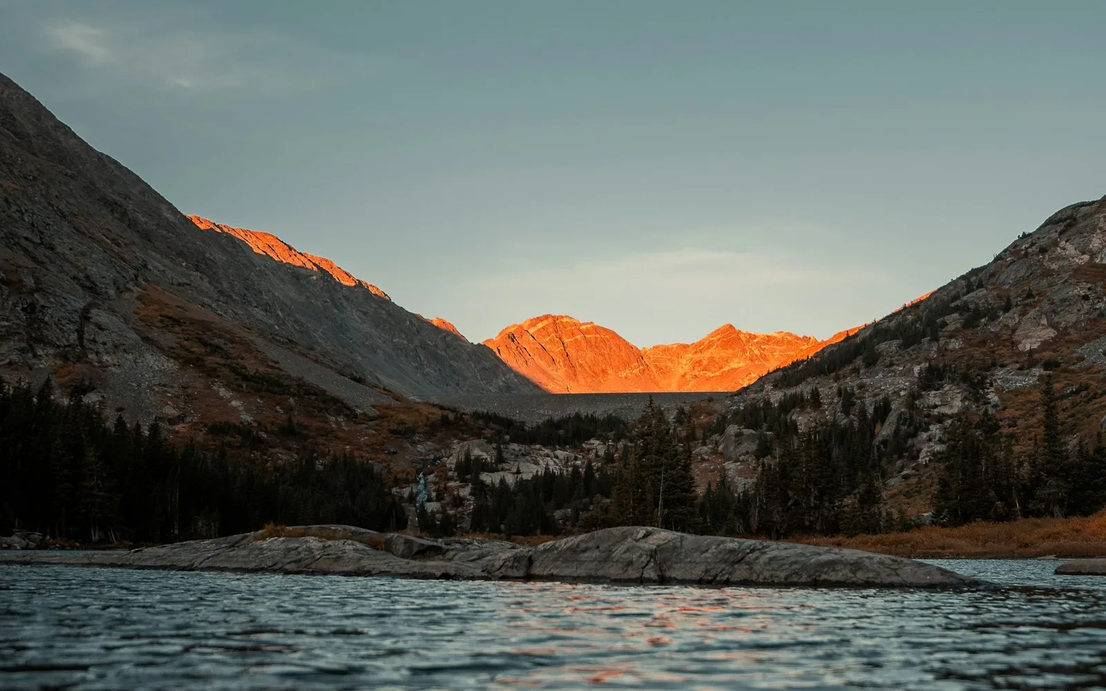
Blue Lakes is one of those places where the photos are real. Three glacier-carved lakes sit stacked up a high mountain basin, each a different shade of turquoise, with the jagged 14,150-foot Mount Sneffels rising behind them. In July the meadows on the way up fill with wildflowers.
The Blue Lakes Trail in Colorado sits in the Mount Sneffels Wilderness near Ridgway, and it’s become so popular that the Forest Service brought in new rules in 2026 and is planning a permit system for the future. If you’re going, you’ll want to know those rules before you pack.
This guide covers the trail lake by lake, the real distances and elevations, the 2026 regulations, camping, the drive in, and how to handle the altitude and afternoon storms.
Quick answer
- Lower Blue Lake: about 6.5 miles round trip, about 1,680 feet of gain, 4–6 hours.
- Blue Lakes Pass: about 9 miles round trip, about 3,800 feet of gain, 7–9 hours.
- Elevation: trailhead about 9,360 ft; Lower Blue Lake about 10,920 ft; Blue Lakes Pass about 13,000 ft.
- Difficulty: moderate to the lower lake; strenuous beyond it.
- Permit: none needed in 2026. A permit system is planned, starting 2027 at the earliest.
- New 2026 rules: pack out human waste, bear-resistant food storage for campers, overnight groups of 6 max, 2-night max, no camping at the middle and upper lakes.
- Campfires and drones: not allowed.
- Best time: late June to mid-September, starting early in the morning.
Blue Lakes Trail at a Glance
| Official name | Blue Lakes Trail #201 |
| Location | Mount Sneffels Wilderness, Uncompahgre National Forest, near Ridgway, Colorado |
| Mountain range | San Juan Mountains (Sneffels Range) |
| Trail type | Out and back (or a point-to-point over Blue Lakes Pass) |
| Lower lake | About 3.2 miles one way |
| Blue Lakes Pass | About 4.5 miles one way |
| Wilderness boundary | About 1.4 miles from the trailhead |
| Dogs | Allowed; keep them leashed or under strict control |
| Toilet at trailhead | Yes (vault toilet) |
| Water at trailhead | No |
| Snow-free season | Usually late June to mid-September |
Where Is the Blue Lakes Trail?
The trail is in southwest Colorado, between Ridgway, Ouray and Telluride. It starts from the Blue Lakes Trailhead at the end of East Dallas Creek Road (County Road 7), on the north side of Mount Sneffels.
Not the Blue Lakes near Breckenridge
Colorado has more than one “Blue Lakes.” The Blue Lakes near Breckenridge, by Hoosier Pass, are a totally different place with a short walk from a parking area. This guide is about the Mount Sneffels Blue Lakes near Ridgway. Double-check your map before you drive.
Directions
- From Ridgway, head west on Colorado Highway 62 for about 4.8 miles.
- Turn left onto County Road 7 (East Dallas Creek Road).
- Stay right at the CR 7A fork and continue to the end of the road, about 9 miles total.
- The last couple of miles are rough dirt. A high-clearance vehicle is recommended, and heavy rain can make the road impassable.
It’s about 30–40 minutes from Ridgway and roughly an hour from Ouray.
Parking
The trailhead got a rebuilt parking lot and new restrooms, finished in fall 2025. Even so, it fills very fast on summer weekends, especially from July 4th through Labor Day. Arrive early, don’t double-park, and if you park along the road, leave room for emergency vehicles.
2026 Rules for Blue Lakes (Read Before You Go)
The lakes have been loved a little too much. Trampled shorelines, trash and even E. coli in the water led the Forest Service to add new rules in the Mount Sneffels Wilderness starting May 31, 2026.
New for 2026
- Pack out human waste. Bring a waste bag (often called a WAG bag) and carry it out. Don’t put it in the trailhead toilet.
- Bear-resistant food storage (an approved bear canister or container) is required for overnight trips.
- Overnight groups are limited to 6 people, with a maximum 2-night stay.
- No camping at the middle and upper lakes. Limited dispersed camping is still available near Lower Blue Lake.
- Some areas around the lower lake are roped off for restoration. Stay out of them.
Rules that were already in place
- No campfires in the Blue Lakes–Dallas Creek drainage. Bring a stove.
- Camp at least 100 feet from trails and water.
- No drones anywhere in the wilderness.
- No overnight stock (horses, etc.).
Do You Need a Permit for Blue Lakes?
Not in 2026. The Forest Service has said no fees and no permits will be required before 2027. It’s working with Recreation.gov on a future system, and earlier plans talked about limiting daily visitors and moving overnight camping to a few designated sites at the lower lake.
The details for 2027 and beyond weren’t final when this guide was written. Check the Grand Mesa, Uncompahgre and Gunnison National Forests news page before planning a trip next year.
The Blue Lakes Hike, Step by Step
1. Trailhead to the wilderness boundary (0–1.4 miles)
Go through the gate, and at the fork just past the start, stay right for Blue Lakes (the left fork goes to Blaine Basin). Sign the trail register. The trail climbs steadily through spruce and fir forest, with a few glimpses of the peaks through the trees.
2. Meadows and creek crossing (1.4–2.5 miles)
After the wilderness sign, the forest opens into meadows with big views of the Sneffels Range. In midsummer this is wildflower central: columbine, bluebells, paintbrush and more. You’ll also cross a creek, which can be high in June.

3. Lower Blue Lake (about 3.2 miles)
The trail climbs a bit more, and then Lower Blue Lake appears, a big turquoise lake framed by cliffs and peaks. It’s the largest of the three and, for many people, the prettiest. This is where most day hikers stop, eat lunch and turn around.
The color is strongest on sunny days, around midday, when light hits fine rock particles suspended in the water. On cloudy days it looks more green or gray.
4. Middle Blue Lake (about 11,500 feet)
Past the lower lake, the trail switchbacks steeply up toward the upper basin. It’s a big jump in effort and altitude. Middle Blue Lake sits in a rockier, more alpine setting, closer to the towering wall of Mount Sneffels.
5. Upper Blue Lake
A bit higher still is Upper Blue Lake, tucked into the tundra right below the peaks. Views back down over the lower lakes are fantastic from here.
6. Blue Lakes Pass (about 13,000 feet)
The official trail keeps climbing steep switchbacks to Blue Lakes Pass, a notch on the ridge south of Mount Sneffels. From the top you look down into Yankee Boy Basin on the other side. The trail continues down to the Yankee Boy / Wright’s Lake trailhead, about 0.7 miles below the pass.
Routes from the pass up Mount Sneffels itself are unmaintained climbing routes, not hikes. Only go if you have the experience.
Distance and Elevation by Destination
| Destination | Elevation | Round trip | Elevation gain | Difficulty |
|---|---|---|---|---|
| Wilderness boundary | About 9,900 ft | About 2.8 mi | Modest | Easy–moderate |
| Lower Blue Lake | About 10,920 ft | About 6.5 mi | About 1,680 ft | Moderate |
| Middle and Upper lakes | About 11,500+ ft | About 7.5–8.5 mi | About 2,200–2,800 ft | Strenuous |
| Blue Lakes Pass | About 13,000 ft | About 9 mi | About 3,800 ft | Strenuous |
Numbers for the trailhead, lower lake and pass come from the San Juan Mountains Association. Upper-lake figures are estimates, and apps vary.
How Hard Is the Blue Lakes Trail?
To the lower lake, it’s a moderate hike with a steady climb. What makes it harder than the numbers suggest is the altitude. You start above 9,300 feet and finish near 11,000, so even fit hikers from low elevations often feel short of breath.
Going beyond Lower Blue Lake is strenuous. The switchbacks to the upper lakes and pass are steep, rocky and above treeline.
Altitude tips
- Spend a night or two in Ridgway or Ouray before the hike if you’re coming from sea level.
- Drink water and eat snacks regularly.
- Go at your own pace. Fitness doesn’t protect you from altitude sickness.
- If you get a bad headache, nausea or feel very weak, head down.
Best Time to Hike Blue Lakes
| Season | What to expect |
|---|---|
| June | Snow often lingers above the lower lake; creek crossings run high |
| July–August | Peak wildflowers and peak crowds; almost daily afternoon thunderstorms in monsoon season |
| Early–mid September | Fewer people, cooler air, early fall color in the aspens on the drive |
| Late fall–spring | Snow, avalanche danger and possible road closure; CR 7 may close in winter, adding about 9 extra miles round trip |
Afternoon storms
From early July to late August, thunderstorms build almost every afternoon in the San Juans. Start at sunrise, aim to be off high ground by early afternoon, and turn back if you hear thunder. The pass and upper lakes are especially exposed to lightning.
Camping at Blue Lakes
- Camping is allowed only near Lower Blue Lake in 2026. Middle and upper lakes are closed to camping.
- Sites are limited and first come, first served. Have a backup plan.
- Use existing, already-impacted spots at least 100 feet from trails and water.
- Carry a bear canister, a stove (no fires), and waste bags.
- Maximum group size is 6, maximum stay is 2 nights.
- You’ll probably have neighbors. Keep noise down.
Car camping near the trailhead
Dispersed camping is allowed along the last couple of miles of CR 7 inside the National Forest boundary. Respect private land below it. Spots go quickly on summer weekends.
What to Bring
- 2–3 liters of water, plus a filter (always treat lake and stream water)
- Rain jacket and warm layer, even on a sunny morning
- Sturdy hiking boots or shoes
- Sun protection: the sun is strong at altitude
- Snacks and lunch
- Offline map (COTREX is a free option for Colorado trails)
- Waste bag for human waste
- Bear canister if camping
Leave No Trace at Blue Lakes
- Pack out everything, including dog poop bags and toilet paper.
- Stay on the trail, even through mud. Walking around puddles widens the trail.
- Don’t pick wildflowers.
- Don’t feed wildlife, even chipmunks.
- Respect roped-off restoration areas.
Photography Tips
- For the brightest turquoise, shoot Lower Blue Lake in late morning to midday sun.
- Climb a little toward the middle lake for an overhead view of the lower lake.
- Use wildflowers as a foreground in July, but shoot from the trail.
- A polarizing filter cuts glare and makes the water color pop.
Blue Lakes vs. Other Colorado Lake Hikes
| Hike | Effort | Highlight |
|---|---|---|
| Blue Lakes (lower lake) | Moderate, high altitude | Turquoise lake under Mount Sneffels |
| Ice Lake Basin | Strenuous | Electric-blue lakes near Silverton |
| Hanging Lake | Moderate, steep | Clear lake and waterfalls (reservation required) |
| Emerald Lake | Easy–moderate | Three lakes in Rocky Mountain National Park |
Frequently Asked Questions
How long is the Blue Lakes Trail?
About 6.5 miles round trip to Lower Blue Lake, and about 9 miles round trip to Blue Lakes Pass.
How much elevation gain is on the Blue Lakes Trail?
About 1,680 feet to the lower lake and about 3,800 feet to the pass.
Do you need a permit for Blue Lakes in 2026?
No. The Forest Service has said no permits or fees will be required before 2027.
Can you camp at Blue Lakes?
Yes, but only near Lower Blue Lake in 2026, in limited sites. Camping at the middle and upper lakes is not allowed.
Are campfires allowed at Blue Lakes?
No. Campfires are prohibited in the Blue Lakes–Dallas Creek drainage.
Can you bring a dog to Blue Lakes?
Yes. Keep your dog leashed or under strict control, and carry out all poop bags.
Do you need a 4×4 to reach the trailhead?
Not usually, but a high-clearance vehicle is recommended for the last couple of miles, and heavy rain can make the road impassable.
Why are the Blue Lakes so blue?
Fine rock particles from the surrounding mountains hang in the water and scatter sunlight, giving it that bright turquoise color.
Is Blue Lakes near Breckenridge?
No. The Blue Lakes Trail in this guide is near Ridgway. The Blue Lakes near Breckenridge are a different place.
Is the Blue Lakes Trail open?
The trailhead reopened in October 2025 after reconstruction. Check the Forest Service alerts page for current conditions before you go.
Final Thoughts
Blue Lakes is one of the most beautiful alpine hikes in Colorado, and it’s worth the effort and the early alarm. Most people will be thrilled with Lower Blue Lake. If you have the legs and good weather, the upper lakes and the pass make it a day you won’t forget. Just follow the 2026 rules, carry out your waste, and help keep this place blue for the next people.
More Colorado hikes: Ice Lake Basin near Silverton, Hanging Lake and Emerald Lake in Rocky Mountain National Park.
Trail facts and 2026 rules come from the Grand Mesa, Uncompahgre and Gunnison National Forests and the San Juan Mountains Association. Rules are changing, so check for updates before your trip.