
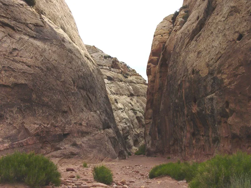
Most hikes in Capitol Reef make you climb for the view. Grand Wash does the opposite. You walk along a flat, sandy canyon floor while the walls get taller and closer, until you’re standing between cliffs of pale sandstone hundreds of feet high.
The Grand Wash Trail in Capitol Reef is one of the easiest and most rewarding walks in the park. There’s no big climb, kids love it, and the Narrows section feels like a small, dry version of Zion’s famous canyon. The one thing you have to take seriously is weather, because this is a flash flood canyon.
This guide covers both trailheads, the current road situation, what you’ll see along the way, how long it takes, and how to stay safe.
Quick answer
- Distance: 2.2 miles one way between the two trailheads (NPS), or 4.4 miles round trip.
- Elevation change: about 200 feet. It’s nearly flat.
- Time: 1–1.5 hours one way; 2–3 hours round trip.
- Difficulty: easy. The sand and gravel make it a little tiring.
- Highlight: the Narrows, about half a mile of tall, close canyon walls.
- Road update: the NPS listed Grand Wash Road as closed on its November 1, 2026 road report. Use the Highway 24 trailhead and check conditions before you go.
- Biggest danger: flash floods. Never enter if storms are forecast.
- Dogs: not allowed on Capitol Reef trails.
Grand Wash Trail at a Glance
| Location | Fruita District, Capitol Reef National Park, Utah |
| Trail type | Through-hike or out and back |
| Distance | 2.2 miles one way |
| Elevation change | About 200 feet |
| Difficulty | Easy |
| Surface | Sand, gravel and small rocks in a dry wash |
| Trailheads | Highway 24 (east end) and end of Grand Wash Road (west end) |
| Shade | Some in the Narrows, little elsewhere |
| Pets | Not allowed |
| Best seasons | Spring and fall |
Important: Grand Wash Road Status
Grand Wash has two ways in. The west trailhead sits at the end of Grand Wash Road, a 1.3-mile dirt spur off the park’s Scenic Drive. That road can close after floods, snow or mud, and for long stretches during repair work.
On the park’s road conditions report dated November 1, 2026, Grand Wash Road was listed as closed. It was also listed closed in late summer 2026. The Scenic Drive itself was open to regular cars.
What this means for you:
- Plan to start at the Highway 24 trailhead.
- Don’t drive around a closed gate.
- Check the park’s current conditions page or call the park’s recorded info line before your trip, because conditions change quickly.
Where Is Grand Wash?
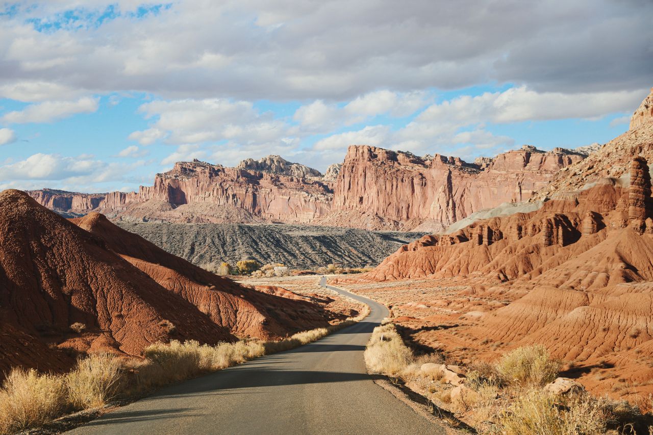
Grand Wash cuts east to west through the Waterpocket Fold in the central Fruita area of Capitol Reef, close to the visitor center, campground and historic orchards. It’s about 45 minutes from Hanksville and around 15 minutes from Torrey.
Highway 24 trailhead (east)
This trailhead is right off Utah Highway 24, a few miles east of the visitor center, along the Fremont River. It has a small paved parking area. You don’t need to drive the Scenic Drive to get here.
Grand Wash Road trailhead (west)
When open, you reach it by driving the Scenic Drive south from the visitor center, then turning onto the dirt Grand Wash Road for 1.3 miles to the end. The same lot serves the Cassidy Arch Trail. The road is usually fine for passenger cars when it’s open and dry.
Fees
Capitol Reef charges an entrance fee for the Scenic Drive beyond the Fruita area. Driving Highway 24 through the park is free. If you only use the Highway 24 trailhead, check current fee rules at the visitor center, and carry your America the Beautiful pass if you have one.
What the Grand Wash Hike Is Like
Here’s the walk from the Highway 24 end, which is the way most people go right now.
1. The canyon mouth
You start in a wide, open wash with reddish cliffs on both sides. Near the mouth, look for old mining tunnels in the rock. They date back to the uranium days. Don’t go inside.
2. Walls closing in (about the first mile)
The sand gets softer and the walls grow taller. The cliffs here are Navajo Sandstone, the same pale, cross-bedded rock that forms the white domes Capitol Reef is named after. Look for little round holes in the walls, a weathering pattern called tafoni.
3. The Narrows (roughly 1 to 1.5 miles in)
This is the part everyone comes for. For about half a mile, the canyon squeezes down and the walls shoot straight up. It’s cool and shady even in warm weather, and voices echo off the rock.
It’s not a slot canyon, so you won’t squeeze through anything. It’s more like walking down a stone hallway with the sky far above.
4. Opening up to the west end
After the Narrows the canyon widens again. If Grand Wash Road is open, you can keep going to the west trailhead and the Cassidy Arch junction. Otherwise, the end of the Narrows makes a perfect turnaround point.
How Long Does It Take?
| Plan | Distance | Time |
|---|---|---|
| Highway 24 to the Narrows and back | About 3 miles | 1.5–2 hours |
| Full out and back (one trailhead) | 4.4 miles | 2–3 hours |
| One way with a car shuttle (when road is open) | 2.2 miles | 1–1.5 hours |
| Grand Wash + Cassidy Arch (when road is open) | About 4.5–5.5 miles | 3–4 hours |
How Hard Is Grand Wash?
The NPS rates it easy. It’s one of the best family hikes in the park. The only real challenge is the loose sand, which works your legs a bit like walking on a beach. There’s no climbing and no exposure.
It’s not a paved or wheelchair-accessible path, though. Expect gravel, rocks and soft sand.
Flash Flood Safety (Please Read)
Grand Wash is a dry wash because water carves it out during storms. A thunderstorm miles away can send a wall of muddy water down the canyon, even if the sky above you is blue. In the Narrows, there’s nowhere to climb out.
- Check the forecast and the visitor center’s flash flood potential before you go.
- Don’t enter if thunderstorms are forecast for the area, especially in July, August and September.
- Watch for warning signs: rising water, muddy water, floating debris, or a roaring sound upstream.
- If water starts rising, get to higher ground immediately. Don’t try to outrun it down the canyon.
- Never drive into a flooded wash or across a closed road.
Best Time to Hike Grand Wash
| Season | What to expect |
|---|---|
| March–May | Pleasant temperatures, blossoms in the Fruita orchards in spring |
| June–August | Hot; go early. Monsoon storms raise flood risk, mostly July–September |
| September–October | Great hiking weather, fruit-picking season in Fruita |
| November–February | Cold and quiet; roads may close for snow, ice or mud |
Morning is best year-round. The light in the Narrows is softer and the sand is cooler.
Combine Grand Wash with Cassidy Arch
Cassidy Arch is a big arch high on the rim above Grand Wash, named after the outlaw Butch Cassidy, who is said to have hidden out in this area. The Cassidy Arch Trail starts at the Grand Wash Road trailhead and climbs about 3.4 miles round trip to a viewpoint on top of the arch.
When Grand Wash Road is closed, Cassidy Arch is much harder to reach. If it reopens, the classic combo is: Grand Wash Narrows in the morning, Cassidy Arch in the afternoon.
Other Nearby Hikes
- Hickman Bridge: about 1.8 miles round trip to a large natural bridge, also off Highway 24.
- Cohab Canyon: a short climb above Fruita with views over the orchards.
- Capitol Gorge: another canyon walk with pioneer inscriptions (check its road status too).
Staying in Hanksville? See our guide to visiting Capitol Reef from Hanksville, the best things to do in Hanksville and where to stay in Hanksville.
What to Bring
- Water: at least 1.5 liters per person
- Hat and sunscreen for the open parts
- Shoes that handle sand (trail runners work well)
- A snack to enjoy in the shady Narrows
- A weather check before you start
Grand Wash vs. Other Utah Canyon Hikes
| Hike | Distance | Difficulty | Wet? |
|---|---|---|---|
| Grand Wash | 4.4 mi round trip | Easy | No |
| Kanarra Falls | About 4 mi round trip | Moderate–strenuous | Yes, you walk in the creek |
| Zion Narrows | Varies | Moderate–strenuous | Yes, river hike |
| Corona Arch | 3 mi round trip | Moderate | No |
Frequently Asked Questions
How long is the Grand Wash Trail?
2.2 miles one way between the trailheads, or 4.4 miles round trip.
Is Grand Wash Road open?
It was listed as closed on the park’s November 1, 2026 road report. Check current conditions before you go and use the Highway 24 trailhead if it’s still closed.
Is Grand Wash easy?
Yes. It’s nearly flat. Soft sand is the only real challenge.
How far are the Narrows from Highway 24?
About a mile in. The Narrows run for roughly half a mile.
Is Grand Wash a slot canyon?
Not really. It’s a tall, narrow canyon, but you won’t need to squeeze through anything.
Can I bring my dog?
No. Pets aren’t allowed on trails in Capitol Reef National Park.
Is Grand Wash dangerous?
Only in stormy weather. Flash floods are a real risk, so stay out if rain is forecast.
Do I need a permit?
No hiking permit is needed. A park entrance fee applies to the Scenic Drive.
Final Thoughts
Grand Wash is Capitol Reef at its most relaxing: an easy walk, huge walls, cool shade and almost no effort. Start from Highway 24, walk to the end of the Narrows, and head back. Just check the weather first and treat any storm warning as a hard no.
More in Utah: Corona Arch near Moab, the waterfall canyon at Kanarra Falls, and Queen’s Garden Trail in Bryce Canyon.
Trail facts and road status come from the National Park Service. Road conditions change often, so check the park’s latest update.