
Most people meet Hanksville through a windshield. They pull off Highway 24, fill the tank at the gas station that’s carved into a rock, grab a burger, and keep rolling toward Moab or Capitol Reef.
Which is a shame, because the strangest scenery in Utah starts about ten minutes outside town. Head west and the ground turns into grey, wrinkled badlands that look like the Moon. Head north and you’re wandering between sandstone “goblins,” or turning sideways to squeeze through a slot canyon barely wider than your shoulders.
Capitol Reef is next door. Lake Powell is under an hour south. And hardly anyone sticks around long enough to see any of it properly.
So think of this as your guide to doing it right. Below are the best places to visit near Hanksville, Utah, how long each drive actually takes, which roads need high clearance, when the light is worth waking up for, and simple itineraries so you don’t burn a morning figuring out where to go.
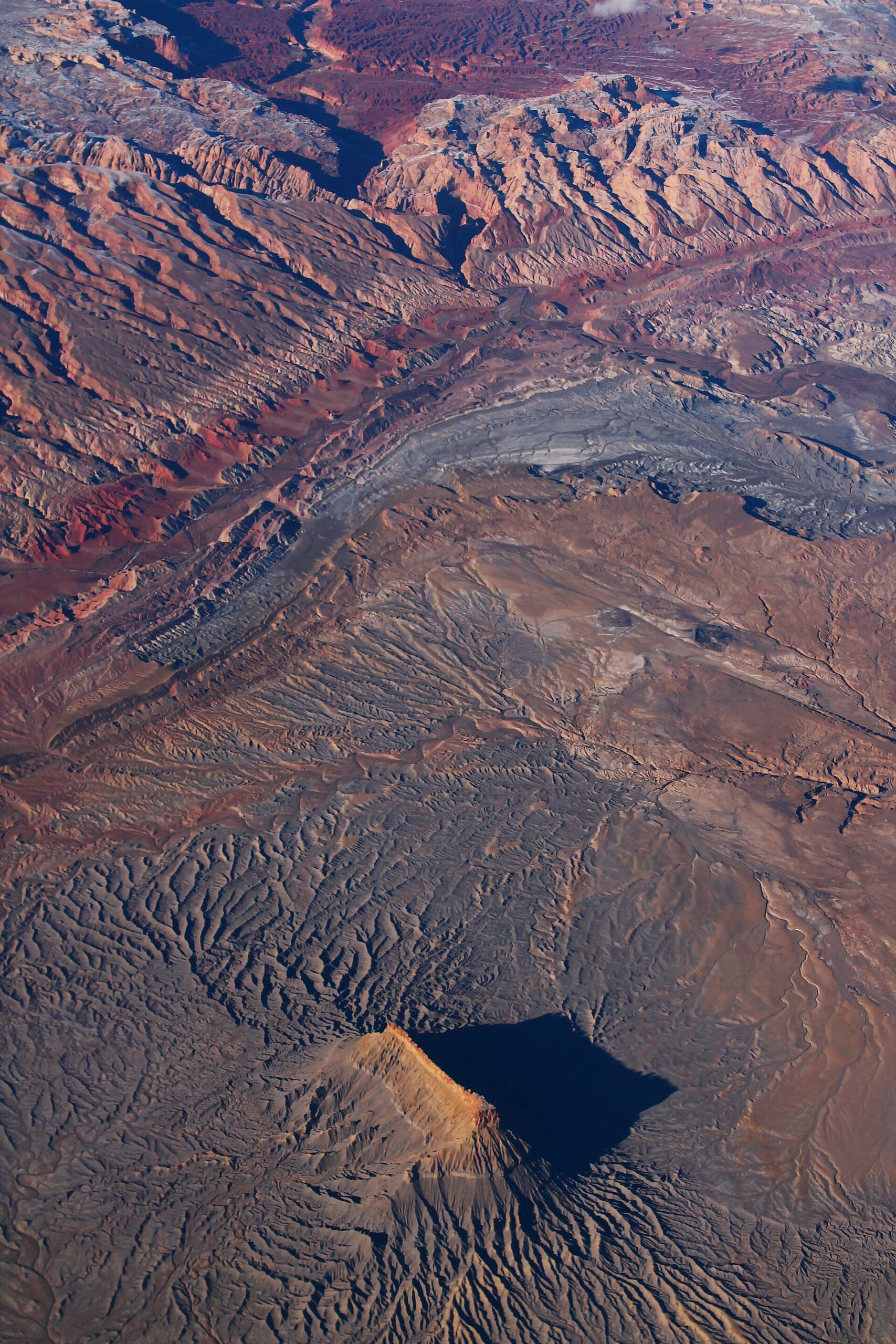
What Are the Best Places to Visit Near Hanksville, Utah?
The best places to visit near Hanksville, Utah are Goblin Valley State Park, Capitol Reef National Park, Little Wild Horse Canyon, Moonscape Overlook, Factory Butte, the Bentonite Hills, Cathedral Valley, Temple Mountain, Horseshoe Canyon, the North Wash slot canyons, Hite Overlook on Lake Powell and the Henry Mountains. Most sit 20 to 60 minutes from town, which makes Hanksville one of the handiest bases for a Southern Utah road trip.
In This Guide
- Where is Hanksville, Utah?
- Is Hanksville worth visiting?
- Distance and drive-time table
- The 12 best places to visit near Hanksville
- More places worth a stop
- Best things to do in Hanksville
- How many days you need
- Best time to visit Hanksville
- Hanksville itinerary (1 and 2 days)
- Where to stay and eat
- Driving and road conditions
- FAQs
Where Is Hanksville, Utah?
Hanksville is a tiny town in Wayne County, south-central Utah, where Highway 24 meets Highway 95. On a map it sits roughly halfway between Capitol Reef National Park and the Green River and Moab area, with Lake Powell to the south.
Don’t expect much of a town. A couple hundred people live here, there are a handful of motels and diners, and that’s about it. What Hanksville does have is location. It’s the last reliable place for fuel and food before long, empty stretches of highway in every direction, and that emptiness is exactly why the land around it still feels so raw.
How Far Is Hanksville From Major Cities?
| From | Approx. Distance | Approx. Drive Time |
|---|---|---|
| Torrey (Capitol Reef gateway) | 50 miles | 1 hour |
| Green River, UT | 60 miles | 1 hour |
| Moab, UT | 115 miles | 2 hours |
| Bryce Canyon National Park | About 140 miles | 2.5 to 3 hours |
| Salt Lake City, UT | 220 miles | 3.5 to 4 hours |
| Las Vegas, NV | 330 miles | 5 to 5.5 hours |
| Denver, CO | 400 miles | 6 to 6.5 hours |
Is Hanksville Worth Visiting?
Yes. If you like desert scenery, hiking, photography, dirt roads or dark skies, Hanksville is well worth a couple of days. Just come for the landscape, not the town. There’s no shopping strip or nightlife here, only a cheap bed, a hot meal and some of the weirdest terrain in the West on your doorstep.
How weird? The Mars Society picked a patch of desert just outside town for its Mars Desert Research Station, where crews practice living like astronauts on the Red Planet. Hollywood has used the area too, including Goblin Valley’s starring role in Galaxy Quest.
There’s a practical reason to stay here as well. Rooms are usually cheaper and easier to get than in Torrey or Moab, and you’re sitting right between Capitol Reef and the San Rafael Swell.
Hanksville Utah Attractions: Distance and Drive-Time Table
Out here, miles can lie. Thirty miles of pavement takes half an hour, while thirty miles of washboard dirt can eat up most of a morning. So pay as much attention to the “Road” column as to the distance. All figures are approximate and measured from the center of town.
| Destination | Distance | Drive Time | Road | Best For |
|---|---|---|---|---|
| Bentonite Hills & Mars Desert Research Station | ~8–10 mi | 20–25 min | Paved + dirt | Sunset photos |
| Factory Butte | ~16 mi | 25–30 min | Paved + graded dirt | Scenery, OHV riding |
| Moonscape Overlook | ~19 mi | 40–50 min | Paved + rough dirt | Sunrise, camping |
| Little Egypt Geologic Site | ~20 mi | 25 min | Paved + short dirt | Quick hoodoo stop |
| North Wash / Leprechaun Canyon | ~28 mi | 30–35 min | Paved | Easy slot canyon walks |
| Temple Mountain | ~30 mi | 35 min | Paved | Rock art, mining history |
| Goblin Valley State Park | ~35 mi | 40–45 min | Paved | Families, hoodoos, stargazing |
| Capitol Reef NP (Visitor Center) | ~37 mi | 40–45 min | Paved | Hiking, history, orchards |
| Little Wild Horse Canyon | ~42 mi | 45–50 min | Paved | Slot canyon hiking |
| Hite Overlook (Lake Powell) | ~42 mi | 45 min | Paved | Scenic drive, viewpoints |
| Cathedral Valley | ~40 mi | 1.25–1.5 hrs | Paved + rough dirt | Remote monoliths |
| Henry Mountains | 20–40 mi | 1–1.5 hrs | Dirt / 4×4 | Solitude, bison, summer cool |
| Horseshoe Canyon (Great Gallery) | ~48 mi | 1.5–2 hrs | Paved + 30 mi graded dirt | Ancient rock art hike |
The 12 Best Places to Visit Near Hanksville, Utah
These run roughly from the easy crowd-pleasers to the places that take a bit more grit to reach. Mix and match them to fit your days. Almost every one of the best things to do near Hanksville can be paired with at least one other stop on the same road.
1. Goblin Valley State Park
At a glance: about 35 miles / 40–45 minutes on paved roads · $20 per vehicle (national park passes don’t work here) · great for families and stargazers
You come over a low rise, park at the overlook, and there it is: a whole valley packed with thousands of squat, mushroom-headed rocks, all leaning at slightly different angles like a crowd waiting for something. Locals call them goblins. Geologists call them hoodoos, carved out of soft red Entrada sandstone.
What makes Goblin Valley near Hanksville different from most parks is that nobody hands you a trail. You walk down the steps from the pavilion and just wander. Kids disappear around corners, adults start naming the rock shapes, and an hour goes by faster than you’d expect.
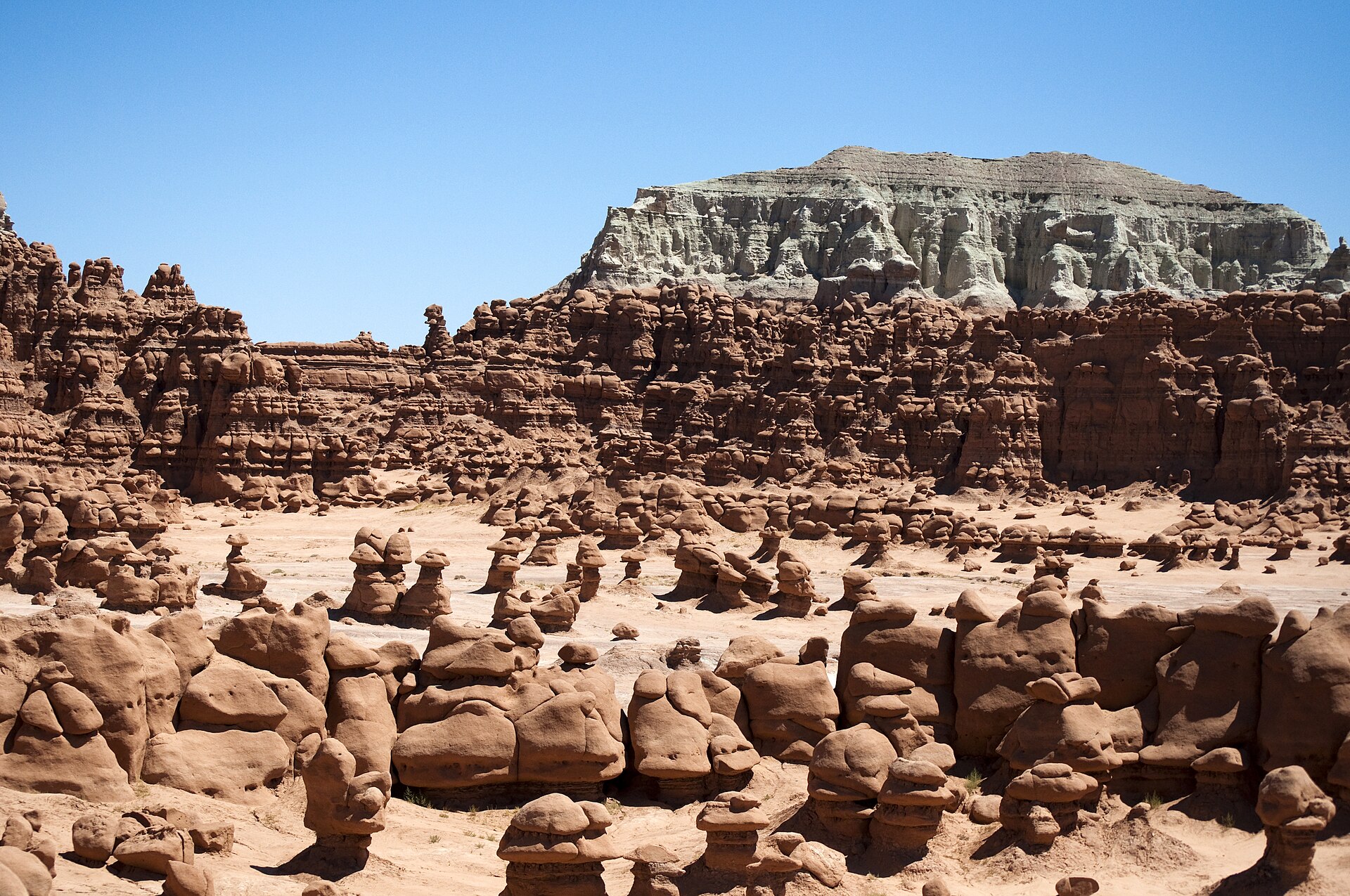
Valley 1 is right below the overlook and gets the most foot traffic. Keep going into Valleys 2 and 3 and the crowds thin out fast. For an actual hike, the trail to Goblin’s Lair leads to the mouth of a huge, echoing chamber. Going down into the Lair from above is a technical rappel that needs gear and a park permit, so most people just visit the entrance. The Carmel Canyon Loop and Curtis Bench Trail are easier options with wide views toward the Henry Mountains, and there’s a free disc golf course near the campground.
Timing matters more than you’d think. Under the midday sun, the goblins go flat and orange. In the first couple of hours after sunrise, or the last couple before sunset, long shadows give every rock a face. Stay after dark if you can. Goblin Valley is a certified International Dark Sky Park, and the Milky Way over the hoodoos is something you won’t see from a city.
Good to know: There’s almost no shade, and summer afternoons regularly push past 100°F, so bring more water than feels necessary. Climbing on the goblins isn’t allowed. On busy spring and fall weekends the park can fill up, and you may wait at the gate, so arrive early or late. Flying a drone needs a small permit. The campground ($45 a night, including entry) and two yurts can be booked ahead if you want sunset and sunrise in the same visit.
2. Capitol Reef National Park
At a glance: about 37 miles / 40–45 minutes to the visitor center · Highway 24 through the park is free, the Scenic Drive has a fee · best for hiking, history and scenic drives
Drive west from Hanksville and the grey badlands slowly give way to red and cream cliffs stacked hundreds of feet high. That’s the Waterpocket Fold, a nearly 100-mile wrinkle in the Earth’s crust, and Capitol Reef near Hanksville protects the most dramatic part of it.
It’s the quiet one among Utah’s “Mighty 5” national parks. You won’t find the shuttle lines of Zion or the timed-entry scramble of Arches. You will find domes, arches, narrow canyons and, oddly, old fruit orchards planted by Mormon pioneers along the Fremont River.
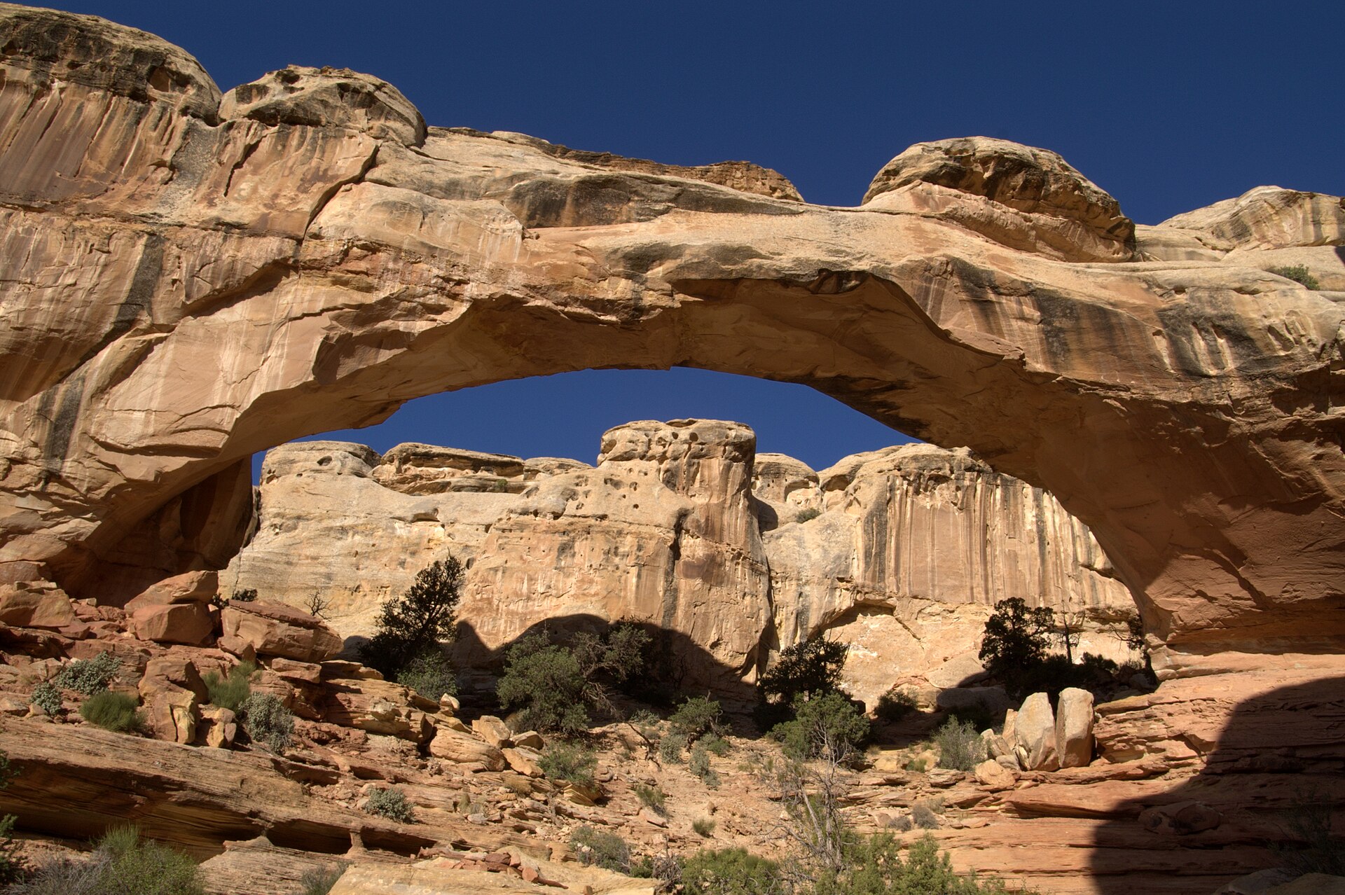
If you only have a few hours, start with the Hickman Bridge Trail. It’s about 1.8 miles round trip and ends under a massive natural stone bridge. Up for something steeper? Cassidy Arch is roughly 3.4 miles round trip and puts you right on top of an arch named after Butch Cassidy, who supposedly used these canyons as a hideout.
On the way in, pull over at the Petroglyph Panel boardwalk on Highway 24 to see Fremont-era rock carvings. Then take the 7.9-mile Scenic Drive, which isn’t a loop, so you’ll come back the same way. Dirt spurs off it lead into Grand Wash and Capitol Gorge, both flat, easy walks between towering walls. And yes, the pies at the Gifford Homestead are worth the stop when they’re in season. They often sell out by early afternoon.
In spring and fall, parking at Hickman Bridge fills up by mid-morning, so go early. Fees and trail conditions change from time to time, so check the official Capitol Reef National Park website before you head out.
3. Little Wild Horse Canyon and Bell Canyon Loop
At a glance: about 42 miles / 45–50 minutes · 8-mile loop, around 700–800 ft of gain, 4–6 hours · free (BLM land) · the best first slot canyon in the area
The first mile is just a sandy wash, and you might wonder what the fuss is about. Then the walls start closing in. The light turns orange, the air cools off, and before long the canyon is so tight you’re shuffling sideways with your backpack held in front of you.
That’s Little Wild Horse, and if you only hike one slot canyon on your Utah road trip, this is a strong pick. It doesn’t need ropes or canyoneering skills, and the trailhead is just a few minutes past the Goblin Valley turnoff, so it pairs nicely with the park on the same day.
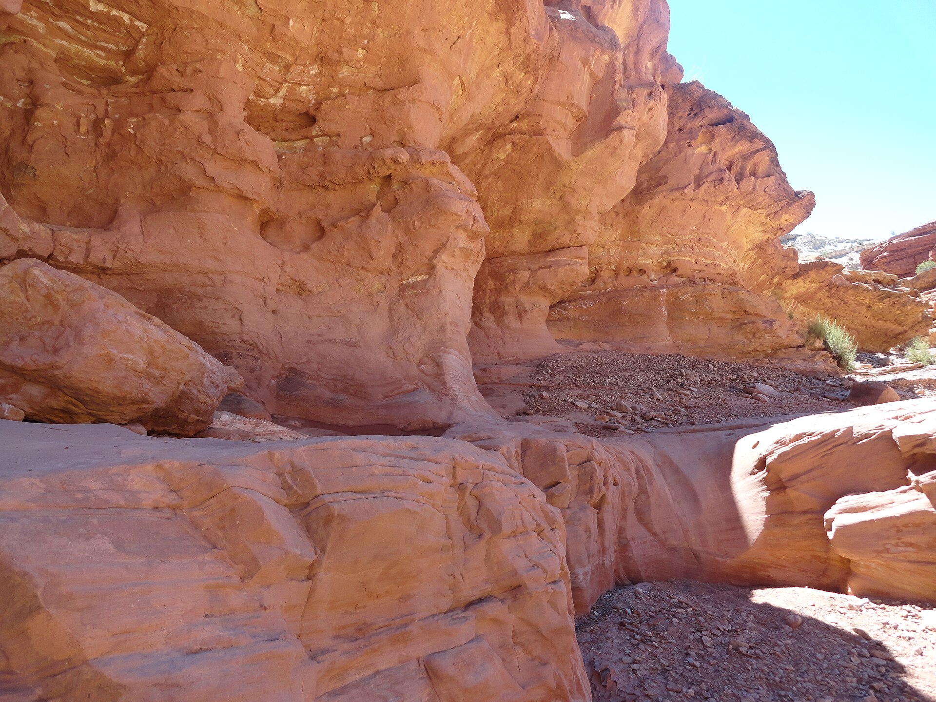
The classic route is a loop. You go up Little Wild Horse, cross over on an old 4×4 track, and come back down through Bell Canyon, which is wider and a little less dramatic. Hiking it in that direction also means you’re moving with the crowd through the tightest squeezes instead of meeting people head-on.
Not up for 8 miles? Just walk up Little Wild Horse for a mile or two, enjoy the best of the narrows, and turn around. That shorter out-and-back takes about 2 to 3 hours.
Two serious notes. First, don’t go in if there’s any chance of rain, even miles away. Slot canyons flood fast, and people have died in them. Second, the stretch between the two canyons is completely exposed, so carry at least 2 to 3 liters of water each. Depending on the season, you might also wade through a few pools. Check the BLM trailhead information and the National Weather Service forecast before you start.
4. Moonscape Overlook (Skyline Rim)
At a glance: about 19 miles / 40–50 minutes, the last part on rough dirt · free (BLM land) · best at sunrise, popular for free camping
Picture this. It’s still dark when you leave Hanksville. You bump down a dirt road with your headlights on, park at the end, and walk a few steps to a sandstone ledge. As the sky starts to glow, a huge basin below you slowly appears: ridge after ridge of smooth grey clay, rippled like frozen waves, with barely a plant in sight.
That’s Moonscape Overlook, and it’s the photo that put Hanksville on a lot of people’s bucket lists. There’s no hike. The view is right there at the end of the road, which is part of the appeal.
How to Get to Moonscape Overlook
From Hanksville, drive west on Highway 24 for about 10 to 11 miles. Just past mile marker 106, turn right (north) onto Factory Butte Road, signed as BLM Road 0091. Stay on this graded dirt road for several miles, then turn right onto BLM Road 0913 toward Skyline View and follow it to where the road ends at the rim.
Here’s what trips people up: the signs use BLM numbers, not the road names you’ll see on Google Maps. Download offline maps before you leave town, and save these approximate coordinates: 38.4522, -110.8381.
Most cars handle the main Factory Butte Road fine when it’s dry. The last stretch to the rim is rougher, and high clearance is recommended. After rain, forget it. The clay turns into a slick, gluey mess that can trap even a 4×4.
Tips for Visiting Moonscape Overlook
Go for sunrise if you can. The basin faces east, so first light brings out soft pinks, purples and blues. By midday it all turns to one flat shade of grey. Stay well back from the edge, too. The rim is crumbly clay and sandstone, and it’s a long way down.
Want to be there when the sun comes up without the pre-dawn drive? Dispersed camping is allowed near the overlook. There are no toilets or water, and the wind can be brutal, so plenty of people end up sleeping in their cars. Drones are currently allowed on this BLM land, but rules change, so double-check before you fly.
5. Factory Butte
At a glance: about 16 miles / 25–30 minutes · free (BLM land) · great for quick photo stops and off-roading
You can’t miss Factory Butte. On the drive to Moonscape it looms up out of the badlands like an enormous stone building, which is exactly how early settlers saw it when they gave it the name. It rises roughly 1,400 feet above the banded grey hills around it.
Since you’re driving right past it anyway, stop for a few minutes near the junction with the Moonscape road. From there, layers of clay sweep toward the foot of the butte in stripes of grey, tan and blue.
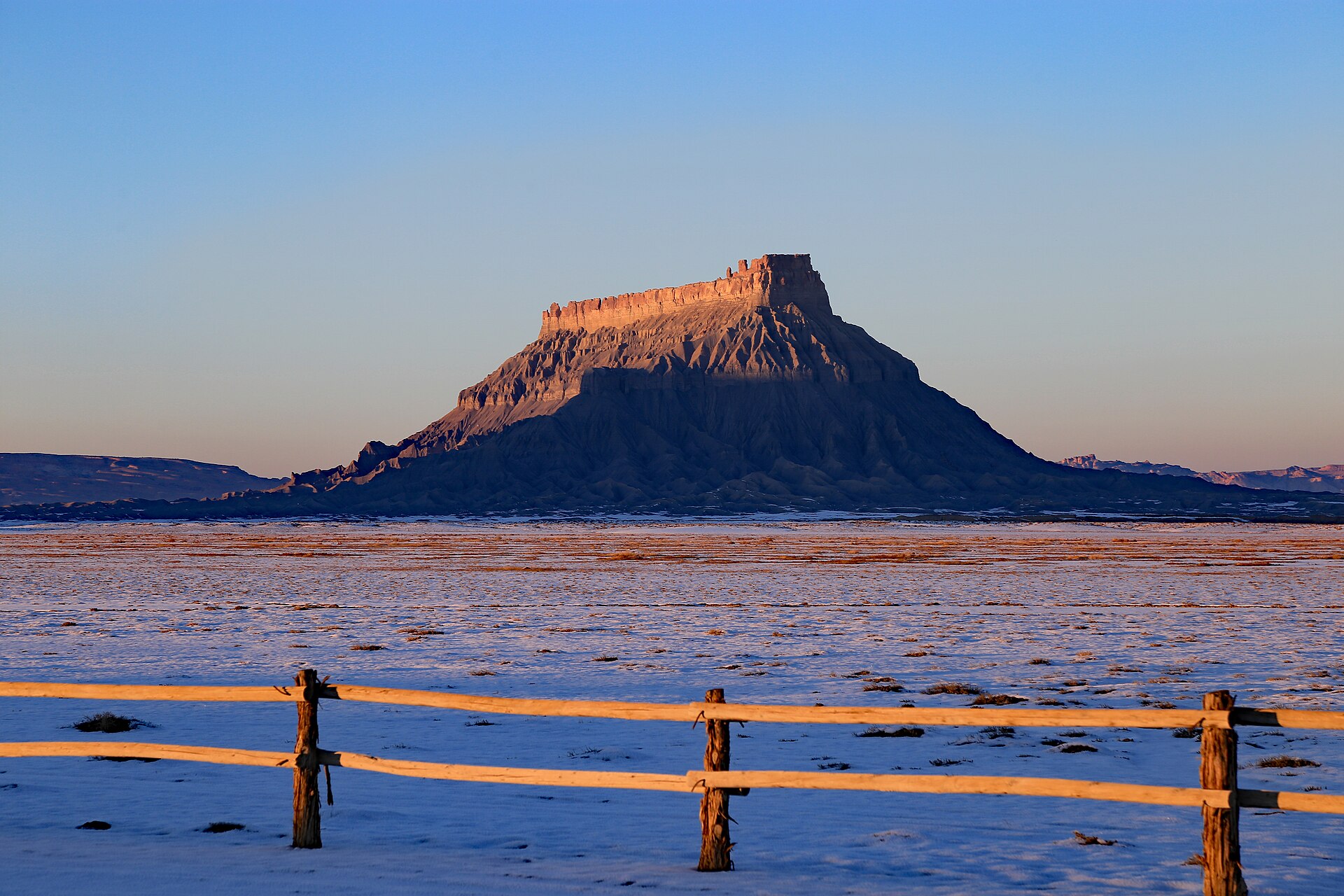
Photographers love it at sunrise and sunset, when the butte warms up to gold. It’s also dirt bike and ATV country: the area is managed for off-highway vehicles, and the nearby “Swing Arm City” open area is a playground for riders. If you didn’t bring your own machine, outfitters in Hanksville rent them and run tours.
One request: stick to the marked routes. That grey crust looks tough, but tire tracks can scar it for years.
6. Bentonite Hills and the Mars Desert Research Station
At a glance: about 8–10 miles / 20–25 minutes · free (BLM land) · best at sunset and blue hour
These are the hills you’ve probably seen on Instagram: rolling mounds striped in purple, red, cream and grey, like someone layered a cake and left it out in the desert. People call them Utah’s “rainbow mountains,” and they’re the closest of the big Hanksville sights to town.
To get there, take Highway 24 a few miles west and turn onto Cow Dung Road (yes, really). After about 3 miles of dirt, you’ll pass a cluster of white buildings that look like a movie set. That’s the Mars Desert Research Station, where research crews spend weeks living as if they were on Mars. The most colorful hills are a few miles farther south.
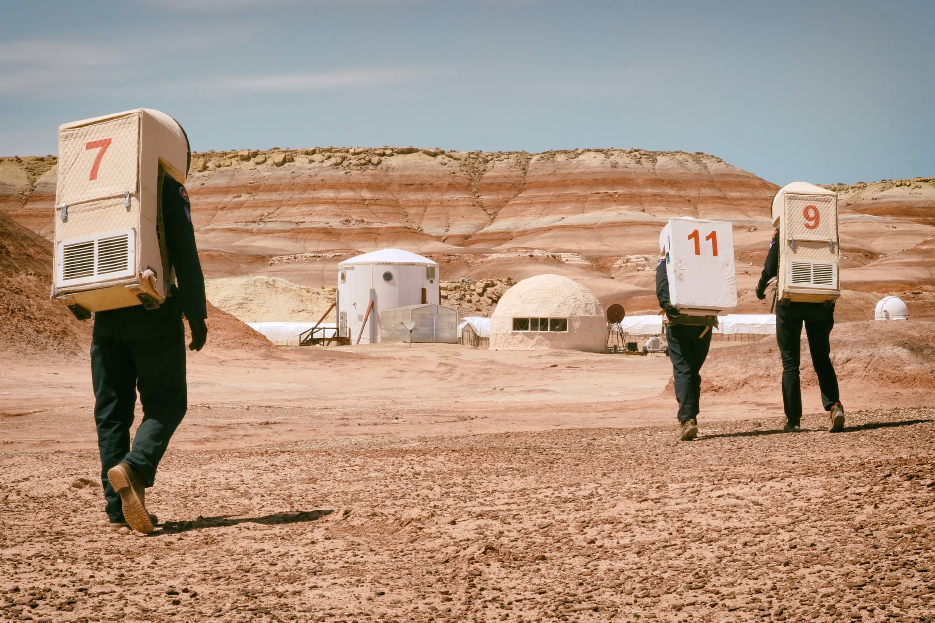
The station is private and closed to visitors, so look from the road, don’t block the access track, and keep drones away from it. Save your visit for late afternoon or an overcast day. Under harsh midday sun the stripes wash out almost completely, but at sunset and blue hour the colors really come alive.
There aren’t any marked trails, and footprints on the soft clay last a long time, so walk in the washes instead of up the slopes. Stay away entirely after rain, when the road turns slick and sticky. And don’t mix this spot up with the “Bentonite Hills” pin inside Cathedral Valley on Google Maps. That one needs a river crossing and a lot more time.
7. Cathedral Valley (Temples of the Sun and Moon)
At a glance: about 40 miles / 1.25–1.5 hours to the Temples · high-clearance vehicle recommended · for travelers who like remote places
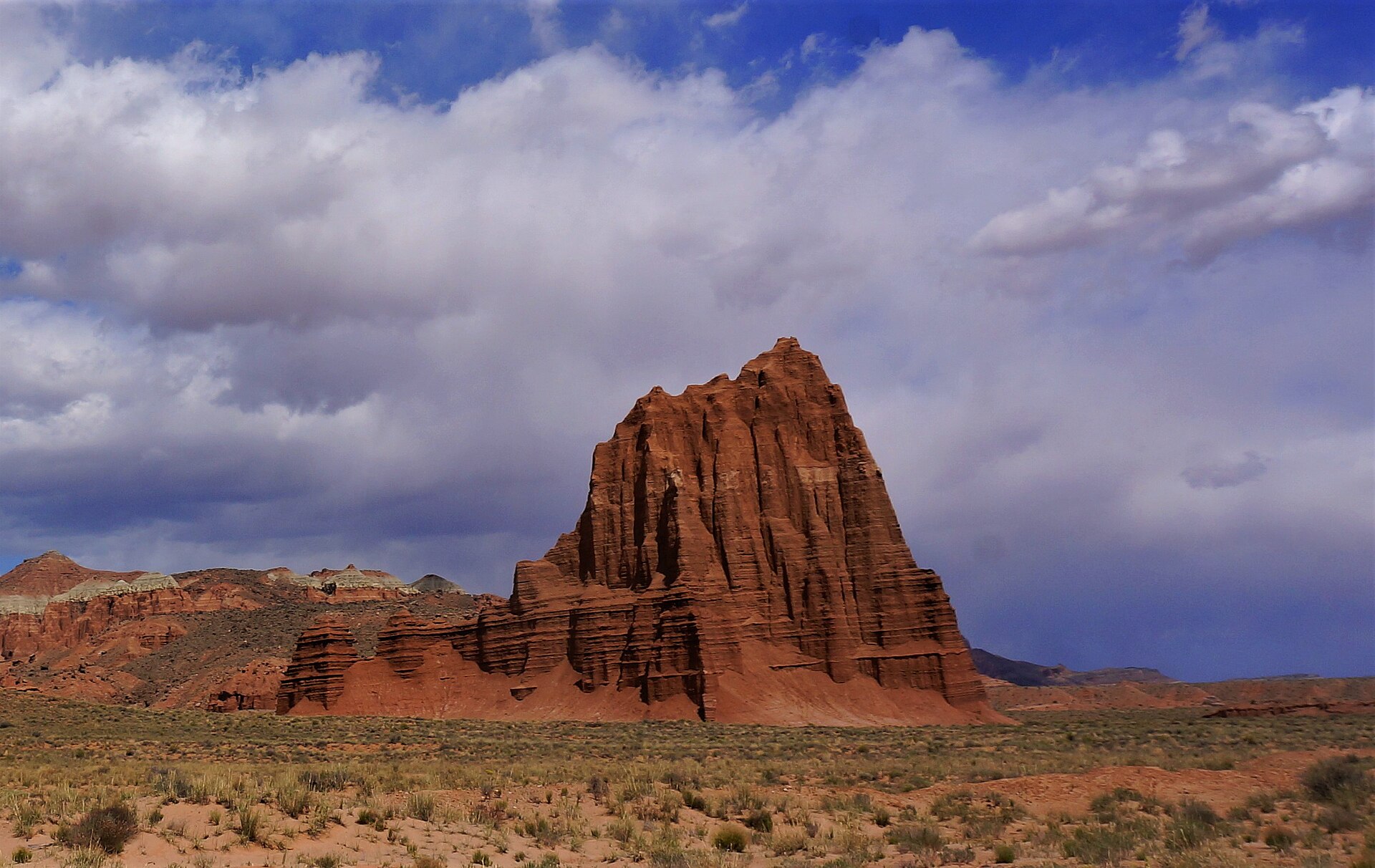
Most visitors to Capitol Reef never make it to Cathedral Valley, and that’s exactly why it’s worth the effort. This is the park’s wild northern district: long dirt roads, big empty desert and not much else, until two sandstone giants appear on the horizon.
The Temple of the Sun and Temple of the Moon stand on their own in the middle of the valley, hundreds of feet tall, looking a bit like cathedrals someone forgot to finish. From Hanksville, the easiest way in is the Caineville Wash Road, which leaves Highway 24 near Caineville. It’s about 15 miles of dirt to the Temples, and this route skips the Fremont River crossing on the loop’s western side.
While you’re there, walk over to Glass Mountain nearby, a strange mound of glittering selenite crystals. The full 58-mile Cathedral Valley Loop is a different story. It needs a true 4×4 and most of a day because of the river ford.
Before heading out, ask about road conditions at the Capitol Reef visitor center, since storms can close these roads. This is national park land, so bring your park pass and leave the drone in the car. No 4×4? Several local outfitters run guided Cathedral Valley tours.
8. Temple Mountain and the San Rafael Swell
At a glance: about 30 miles / 35 minutes on paved roads · free (BLM land) · for history buffs, rock art and quieter canyons
Almost everyone who turns onto Temple Mountain Road is heading to Goblin Valley, and almost all of them miss what’s just past the turnoff. Skip the left turn to the state park, keep going straight, and a jagged peak rises ahead at the southern edge of the San Rafael Swell. That’s Temple Mountain.
In the mid-1900s this was uranium country. Old mine openings still dot the cliffs, rusted equipment sits where it was left, and you can make out the remains of a small mining camp. Much older history is here too: ancient pictographs painted on the rock close to the road. If you’re after quieter slot canyons than Little Wild Horse, Crack Canyon and Chute Canyon are nearby, but research the routes carefully first.
The BLM camping area near Temple Mountain is a solid backup when Goblin Valley’s campground is full. Just don’t go poking into old mine shafts. They can hold loose rock, bad air and radiation, and none of that is worth the photo.
9. Horseshoe Canyon and the Great Gallery (Canyonlands)
At a glance: about 48 miles / 1.5–2 hours, including around 30 miles of graded dirt · 7-mile round-trip hike with a steep 750-foot descent and climb, 5–6 hours · no entrance fee · for rock art lovers and strong hikers
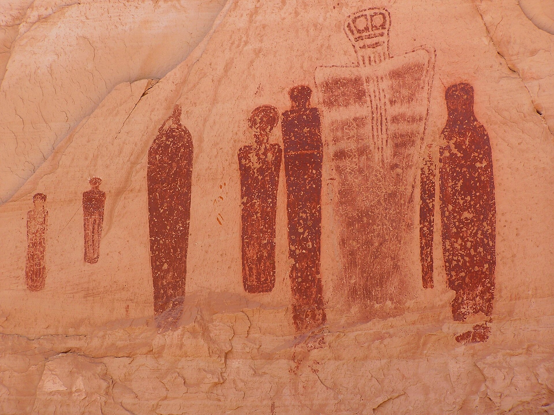
After an hour of dust and washboard, a steep walk down into a sandy canyon, and a few miles under cottonwoods, you round a bend and see them: a long row of tall, ghostly figures painted on the canyon wall. Some are life-sized. Most have no arms, just long tapered bodies and hollow eyes, staring out over the wash.
That’s the Great Gallery, one of the most important rock art panels in North America, painted in what archaeologists call the Barrier Canyon style. Horseshoe Canyon is a detached piece of Canyonlands National Park, and because it takes real effort to reach, you’ll rarely share it with more than a handful of people.
How to Get to Horseshoe Canyon
From Hanksville, head north on Highway 24 toward Goblin Valley. Just past the Goblin Valley turnoff, turn east onto the signed dirt road and follow the Horseshoe Canyon signs for about 30 miles to the west rim trailhead. In dry weather most 2WD cars make it, but expect washboard, a few sandy patches and a slow drive. When it’s wet, don’t try. Don’t trust your GPS out here either. Use a map and follow the signs.
The Great Gallery Hike
The trail drops steeply off the rim, then follows the sandy canyon floor past three smaller panels (the High Gallery, Horseshoe Shelter and the Alcove Gallery) before you reach the main event. Save some energy. The climb back out at the end, usually in full sun, is the toughest part of the day.
Leave your dog at home, since pets aren’t allowed below the rim. You can camp at the trailhead, which has a vault toilet but no water, but not inside the canyon. Skip summer afternoons if you can, and please don’t touch the paintings: oils from skin slowly destroy the pigments. Rangers often lead hikes here in spring and fall.
10. North Wash Slot Canyons and Hog Springs (Highway 95)
At a glance: about 25–30 miles / 30–35 minutes on paved road · short slot canyon walks right off the highway
Head south out of Hanksville on Highway 95 and within half an hour the road drops into North Wash, a narrow corridor of red rock with side canyons branching off like fingers. This is serious canyoneering country. Most of these slots need ropes, harnesses and experience.
A couple of them, though, are perfect for a leg stretch. Leprechaun Canyon is the favorite. A short walk up a brushy valley leads into a shaded, surprisingly dramatic slot, and you simply turn around when it gets technical. Farther down the road, the Hog Springs picnic area has an easy trail beside a little stream that ends at a small waterfall and pool. After miles of bare rock, the green feels almost unreal.
Go only as far as you can safely get back without gear, and keep an eye on the sky. The same flash flood rules apply here as anywhere else in slot country.
11. Hite Overlook and Lake Powell
At a glance: about 42 miles / 45 minutes on paved road · big canyon views, easy scenic drive
Keep going past North Wash and Highway 95, the Bicentennial Highway Scenic Byway, opens into a maze of deep red canyons. Then the road climbs to Hite Overlook, and suddenly you’re looking down at the top end of Lake Powell, the Colorado River, and a steel arch bridge stretched across the gorge.
A short, flat path along the rim gives you a few different angles. Don’t be surprised if the “lake” looks more like a river. Water levels here swing a lot from year to year, and some years the old marina sits high and dry.
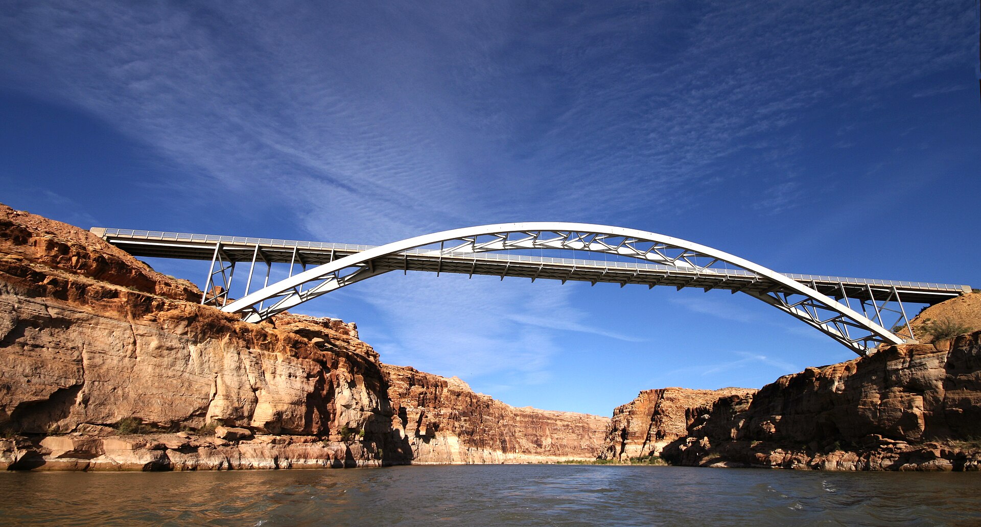
One word of warning: there’s next to nothing along Highway 95. Services are few and far between and cell signal is patchy at best, so top off your tank in Hanksville before you leave.
12. The Henry Mountains
At a glance: 20–40 miles depending on route / 1–1.5 hours · dirt roads, high clearance or 4×4 recommended · for solitude, wildlife and cooler summer air
Every time you look south from Hanksville, they’re there: a cluster of high peaks, often capped with snow, floating above the desert. Those are the Henry Mountains, and they were among the very last ranges in the lower 48 states to be mapped. Spend an afternoon up there and it’s easy to see how they stayed off the map for so long.
The range is home to one of the few wild, free-roaming bison herds left in the country. You’re not guaranteed to see them, but keep your eyes open on the high meadows. Mount Ellen, the tallest peak, tops out around 11,500 feet, so when the desert is baking in July, it’s a lot cooler up top.
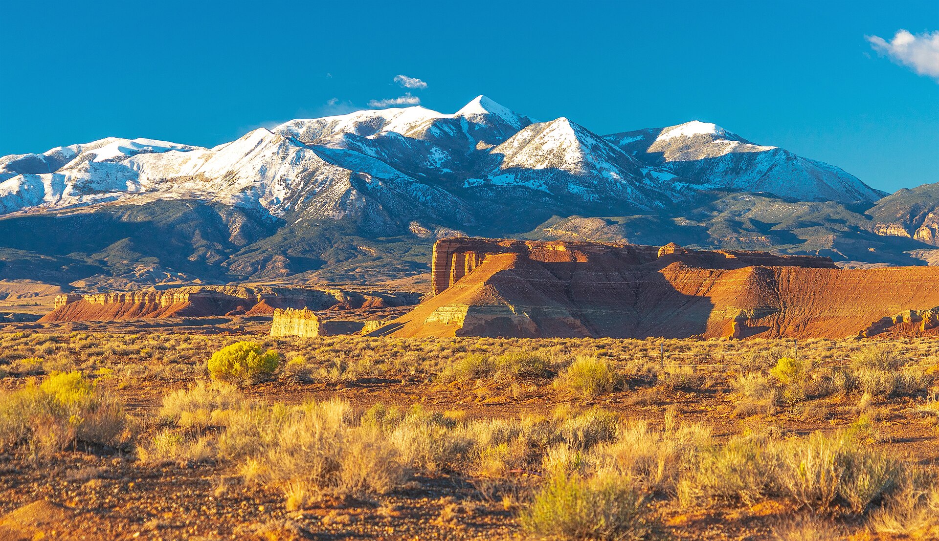
Roads into the range start near Hanksville and along Highway 95. Stop at the BLM field office in town first to ask what’s open, since the upper roads are usually snowed in from late fall to late spring. Bring a paper map, extra water and a good spare tire. There’s a real chance you won’t pass another vehicle all day.
More Places Worth a Stop Near Hanksville
Got a spare hour or a free afternoon? These don’t make the top 12, but each one is worth it if it’s on your way.
- Little Egypt Geologic Site: About 20 miles south on Highway 95, then a short dirt road. It’s a small field of red and white hoodoos, like a mini Goblin Valley with no fee and usually nobody else around.
- Wild Horse Window: A short hike near Goblin Valley leads to a big arch-like opening in the cliff that frames the sky. It’s a nice add-on if you’re already in the area.
- Molly’s Castle: A striking sandstone tower above the Muddy Creek canyon, reached by a rough 4×4 road off Goblin Valley’s backcountry. High clearance only.
- Notom-Bullfrog Road: A long dirt road that runs south along the Waterpocket Fold toward Lake Powell, with huge views of the tilted rock layers. Check conditions first, as parts can wash out.
Best Things to Do in Hanksville, Utah
Hanksville won’t keep you busy for long on its own, but a few spots are worth a stop between adventures. (For a full list sorted by activity, from ATV riding to stargazing, see our guide to the best things to do in Hanksville, Utah.)
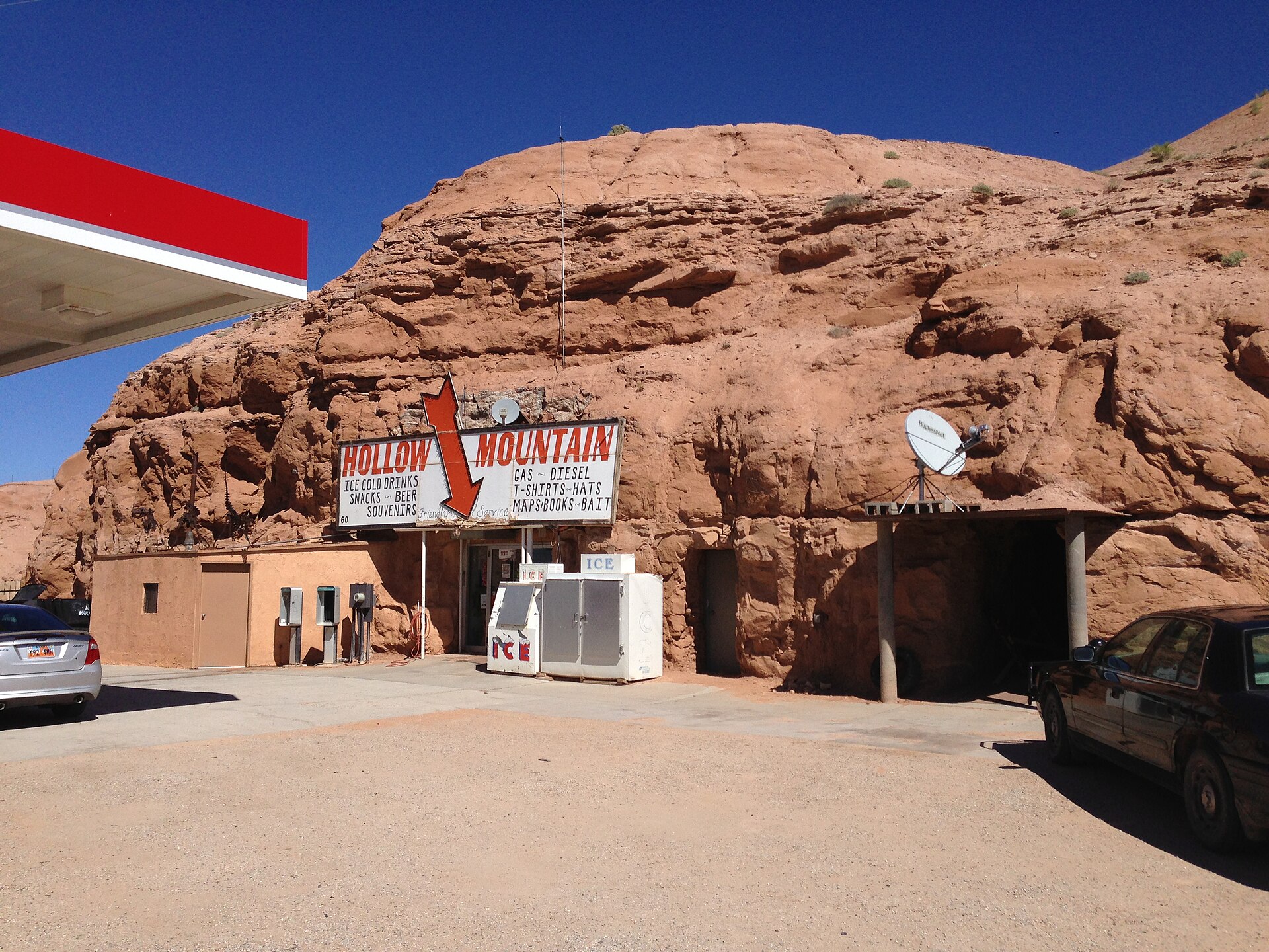
Start with Hollow Mountain, the gas station and store at the junction of Highways 24 and 95. The pumps sit outside, but the store itself was blasted right into a sandstone hill. You walk through a door in the rock to buy your snacks. It’s a classic road trip photo, and you’ll probably be filling up there anyway.
Over at the BLM Henry Mountain Field Station you’ll find the historic Wolverton Mill, an old water-powered mill preserved on the grounds, and the staff there are the best source for current road conditions. After dark, just step outside. Even from a motel parking lot, the stars here are something else. And if you’d rather leave the dirt roads to someone else, local outfitters run off-road, UTV and canyoneering tours.
Longer Day Trips and Road Trip Connections
Hanksville plugs neatly into bigger Utah road trip routes. Moab, with Arches and Canyonlands, is about two hours east. Head west on Highway 24 and then Scenic Byway 12 through Capitol Reef, Boulder and Escalante, and you’ll reach Bryce Canyon in about three hours, one of the most beautiful drives in the country. From Bryce, Zion is roughly two hours more.
If that’s your route, our guides to the best things to do in Bryce Canyon National Park and the best things to do in Zion National Park will help you plan the next stops.
How Many Days Should You Spend in Hanksville?
Plan on 2 to 3 days in Hanksville. Two full days is enough for Goblin Valley, Little Wild Horse Canyon, Moonscape Overlook, Factory Butte, the Bentonite Hills and a good taste of Capitol Reef. A third day opens up Horseshoe Canyon, Cathedral Valley or a slow drive down Highway 95.
Only have one day? Spend it on Goblin Valley and the Moonscape and Factory Butte area. Those are the places you really can’t see anywhere else.
Best Time to Visit Hanksville, Utah
The best time to visit Hanksville is spring (March to May) and fall (September to October). Days are warm without being brutal, nights are cool, and the trails and dirt roads are usually in good shape.
| Season | What to Expect | Good For |
|---|---|---|
| Spring (Mar–May) | Mild days, occasional wind, busiest season | Hiking, slot canyons, photography |
| Summer (Jun–Aug) | Highs often 95–100°F+, monsoon storms from July | Sunrise outings, stargazing, Henry Mountains |
| Fall (Sep–Oct) | Comfortable temps, clear skies, fewer crowds by late Oct | Everything |
| Winter (Nov–Feb) | Cold nights below freezing, some businesses close | Solitude, crisp photography, cheap lodging |
Summer deserves a special warning. From about July through September, monsoon storms roll in on many afternoons. They can flood slot canyons in minutes and turn clay roads into mud for days. If you’re visiting then, do your canyon hikes and dirt road drives in the morning and keep checking the forecast. For month-by-month temperatures and timing, see our guide to the best time to visit Hanksville, Utah.
Hanksville, Utah Itinerary: 1-Day and 2-Day Plans
1-Day Hanksville Itinerary
Set your alarm early and be at Moonscape Overlook for sunrise, then stop at Factory Butte on the drive back. Grab breakfast in town and head north to Goblin Valley State Park while it’s still cool.
When the midday heat kicks in, duck into the shade of Little Wild Horse Canyon for a short out-and-back hike. Come back to Goblin Valley in the late afternoon, when the light turns the hoodoos gold, and stick around after dark for the stars.
2-Day Hanksville Itinerary
Day 1: Moon, Mars and Capitol Reef. Start with sunrise at Moonscape Overlook and a quick stop at Factory Butte. Then drive west into Capitol Reef. Hike to Hickman Bridge, walk the Petroglyph Panel boardwalk, and grab a pie at the Gifford Homestead if they’re in season. Spend the afternoon on the Scenic Drive with a stroll into Grand Wash or Capitol Gorge. On the way back east, time your arrival at the Bentonite Hills for sunset.
Day 2: Goblins and slot canyons. Get an early start on the full Little Wild Horse and Bell Canyon loop before the day heats up. After lunch, take a short detour to Temple Mountain and its pictographs. Finish at Goblin Valley for the late light and camp in the park for a night under very dark skies.
Have a 3rd day? Choose Horseshoe Canyon if ancient rock art is your thing, Cathedral Valley if you’ve got a high-clearance vehicle and like remote places, or Highway 95 to Little Egypt, North Wash and Hite Overlook for an easy paved scenic drive. For an hour-by-hour plan with sunrise and sunset timing, see our full Hanksville, Utah itinerary.
Where to Stay Near Hanksville
There aren’t many beds in Hanksville, so book ahead for spring and fall. Whispering Sands Motel is a simple, well-reviewed motel on Highway 95, within walking distance of a few places to eat. For more space, Muddy Creek Mining Company has cabins with kitchens, handy for longer stays or small groups. Duke’s Slickrock Campground & RV Park covers tents, RVs and a few small cabins right in town.
If you’d rather wake up among the hoodoos, the Goblin Valley State Park campground and yurts can be reserved ahead of time. The tiny community of Caineville, west of town, has a few places to stay closer to Capitol Reef. For the most choice, Torrey is about an hour away on the far side of the park.
On a budget? Much of the surrounding land is BLM, and free dispersed camping is allowed in many spots, including established sites around Factory Butte, Moonscape Overlook and Temple Mountain. There are no facilities, so bring everything and pack it all out.
Where to Eat in Hanksville
Eating out in Hanksville is simple, and in winter some places cut their hours, so don’t count on a late dinner off-season. Stan’s Burger Shak is the classic road trip burger-and-shake stop. Duke’s Slickrock Grill does hearty American plates and a popular breakfast. For tacos and Mexican food, try Outlaw’s Roost near Hollow Mountain, and Blondie’s Eatery & Gift is good for a casual meal and a souvenir.
Groceries are a different story. The shelves are basic, so stock up on snacks, water and camp food in Green River, Torrey or Moab on your way in.
Driving and Road Conditions Around Hanksville
You’ll need a car to explore here, no way around it. Highways 24 and 95 are well paved, but many of the best places near Hanksville sit at the end of dirt roads. A few habits will save you a lot of trouble:
- Fill up in Hanksville. Gas stations are few and far between, especially heading south on Highway 95.
- Download offline maps. Cell service drops out fast once you leave town.
- Watch the weather. The clay roads to Moonscape, the Bentonite Hills and Cathedral Valley can become impassable after rain, sometimes for days.
- High clearance helps. A normal SUV handles most graded roads when they’re dry. Cathedral Valley’s river ford and many Henry Mountains routes need a real 4×4.
- Carry the basics. Extra water, a full-size spare, a tire plug kit and a paper map.
- Slow down at dawn and dusk. Pronghorn, deer and cattle wander onto the roads.
What to Pack for a Hanksville Trip
A few things make a big difference out here: a large water jug to keep in the car, a hydration pack for hikes, a wide-brim hat and sunscreen, shoes with good grip that can get wet in slot canyons, a headlamp for sunrise starts and stargazing, a warm layer for cold desert nights, and a tire repair kit and air compressor for the dirt roads.
Leave No Trace in the Desert
That dark, knobby crust on the ground around Hanksville is alive. It’s called cryptobiotic soil, and a single footstep can wipe out decades of growth. Stick to roads, trails, bare rock and sandy washes, pack out every scrap of trash (toilet paper included), and look at rock art without touching it.
Plan Your Hanksville Trip
- What to do: activities sorted by type in our guide to the best things to do in Hanksville, Utah.
- When to go: month-by-month weather in our guide to the best time to visit Hanksville, Utah.
- Where to sleep: cabins, motels, RV parks and camping in our guide to where to stay in Hanksville, Utah.
- How to plan the days: our Hanksville, Utah itinerary for 1, 2 or 3 days.
- Goblin Valley day trip: directions, fees and tips in our Goblin Valley from Hanksville guide.
- Capitol Reef day trip: the drive, hikes and a one-day plan in our Capitol Reef from Hanksville guide.
- The badlands up close: directions and photo tips in our Factory Butte, Utah guide and Moonscape Overlook, Utah guide.
Frequently Asked Questions About Hanksville, Utah
What is Hanksville, Utah known for?
Hanksville is best known for its Mars-like and Moon-like desert scenery, especially Moonscape Overlook, Factory Butte and the Bentonite Hills. It’s also the closest town to Goblin Valley State Park and home to the Mars Desert Research Station.
How far is Goblin Valley from Hanksville?
Goblin Valley State Park is about 35 miles north of Hanksville. The drive takes roughly 40 to 45 minutes on paved roads via Highway 24 and Temple Mountain Road.
How far is Capitol Reef from Hanksville?
The Capitol Reef National Park visitor center is about 37 miles west of Hanksville on Highway 24, around 40 to 45 minutes by car. The park’s eastern boundary is a little closer.
Do you need a 4×4 to visit Moonscape Overlook?
Usually not. Plenty of people make it in ordinary SUVs when the road is dry, though high clearance is recommended for the last stretch. Don’t try it after rain, when the clay gets dangerously slick.
Can you visit the Mars Desert Research Station?
No. It’s a private research facility and isn’t open to the public. You can see it from Cow Dung Road on the way to the nearby Bentonite Hills.
Is Little Wild Horse Canyon good for beginners?
Yes. It’s one of the most beginner-friendly slot canyons in Utah and doesn’t need any technical gear. Expect a little scrambling and maybe some wading. Skip it completely if there’s any chance of rain.
Can you camp for free near Hanksville?
Yes. Much of the land around Hanksville is managed by the BLM, and dispersed camping is allowed in many areas, including established sites near Factory Butte, Moonscape Overlook and Temple Mountain. There are no facilities, so come self-sufficient.
Is the America the Beautiful pass accepted at Goblin Valley?
No. Goblin Valley is a Utah state park with its own fee ($20 per vehicle). Your national parks pass does work at Capitol Reef, and Horseshoe Canyon has no entrance fee at all.
What is the best month to visit Hanksville?
April, May, late September and October usually bring the best mix of comfortable temperatures and settled weather for hiking and dirt road driving.
Is Hanksville a good base for a Utah road trip?
Yes. It sits between Capitol Reef and Moab, with Goblin Valley, the San Rafael Swell and Lake Powell all close by. For a lot of travelers, it’s one of the most central and affordable bases for seeing Southern Utah.
Final Thoughts: Is Hanksville Worth Adding to Your Utah Road Trip?
Nobody drives to Hanksville for Hanksville. They come for what’s around it: hoodoos, slot canyons, grey lunar badlands, striped hills, ancient paintings and a national park, all within about an hour of one gas station built into a rock.
Give it at least two days. Watch the weather before you hit the dirt roads, and save your mornings and evenings for the light. Most people will still just fill up and drive through. You don’t have to be one of them, and once you’ve seen what’s out there, the places to visit near Hanksville, Utah may be the part of the trip you talk about most.
Planning the rest of your trip? See our guides to things to do in Bryce Canyon National Park and things to do in Zion National Park, or browse all of our travel guides.