
Some hikes make you work for an hour before anything interesting happens. Golden Canyon isn’t one of them.
Five minutes after you leave the parking lot on Badwater Road, you’re walking up a twisting corridor of yellow and gold rock. The walls are wrinkled and folded like crumpled paper. Every bend shows you a new shape. And if you keep going, the canyon ends at Red Cathedral, a huge wall of deep red cliffs that seems to glow when the sun hits it.
The Golden Canyon Trail in Death Valley is one of the most popular hikes in the park, and for good reason. It’s close to Furnace Creek, it’s easy to find, and you can make it as short or as long as you like. But it also confuses a lot of first-time visitors, because “Golden Canyon” isn’t really one trail. It’s the start of a whole network of routes through the badlands.
This guide clears that up. You’ll find all four route options with real distances from the National Park Service, what you’ll see along the way, how hard each one feels, where to park, the best time to go, and the safety tips that matter most in Death Valley.
Quick answer
- Best route for most people: Golden Canyon to Red Cathedral, about 3 miles round trip, 1.5 to 2 hours.
- Best loop: Golden Canyon and Gower Gulch, 4.3 miles (plus 1 mile if you add Red Cathedral).
- Longest option: the complete circuit via Zabriskie Point, 7.8 miles, about 4.5 hours, strenuous.
- Best time: November to March, starting in the morning.
- Trailhead: Golden Canyon parking lot on Badwater Road, 2 miles south of Highway 190. Paved, with a vault toilet. No water.
- Don’t hike it on a hot summer day, and never during rain or flash flood warnings.
Golden Canyon Trail at a Glance
| Location | Death Valley National Park, California (near Furnace Creek) |
| Trailhead | Golden Canyon parking area, Badwater Road, 2 miles south of CA-190 |
| Other starting point | Zabriskie Point, on CA-190, 3.5 miles east of Badwater Road |
| Red Cathedral (out and back) | 3 miles, about 577 ft of elevation, 1.5–2 hours, moderate |
| Gower Gulch Loop | 4.3 miles (+1 mile for Red Cathedral), about 850 ft, 2.5 hours, moderate |
| Complete Circuit | 7.8 miles, about 834 ft, 4.5 hours, strenuous |
| Badlands Loop (from Zabriskie) | 2.7 miles, about 535 ft, 1.5–2 hours, moderate |
| Best season | November to March |
| Facilities | Paved parking with room for RVs, vault toilet. No drinking water. |
| Dogs | Not allowed on Death Valley trails |
| Permit | None for day hiking. Park entrance fee applies. |
Distances, times and elevation figures come from the National Park Service. Hiking apps often list slightly different numbers, so treat them all as “about.”
Where Is Golden Canyon?
Golden Canyon is in the heart of Death Valley National Park, just a few minutes’ drive from Furnace Creek, the park’s main visitor area. It sits right at the edge of the badlands, the wrinkled yellow hills you see from Zabriskie Point.
How to get to the Golden Canyon trailhead
- From Furnace Creek, drive south on Highway 190 to the junction with Badwater Road.
- Turn south onto Badwater Road.
- After about 2 miles, turn left (east) into the signed Golden Canyon parking area.
The whole drive is on paved roads, so any car can do it. The trailhead is about 10 minutes from Furnace Creek and roughly 2 hours from Las Vegas.
Tip: Cell service in Death Valley is patchy. Download an offline map and the NPS trail map before you leave town.
Golden Canyon parking
The lot is paved, with large spaces for RVs and buses, and there’s a vault toilet. There’s no drinking water, so fill your bottles at Furnace Creek first.
In winter and spring, the lot gets busy by mid-morning, especially on weekends and holidays. Arrive early and you’ll get a spot and cooler air. If it’s full, you can start from Zabriskie Point instead (see the routes below).
Golden Canyon Routes: Which One Should You Hike?
Here’s what confuses people: you’ll see Golden Canyon listed online as 2 miles, 3 miles, 4 miles, 6 miles and 8 miles. They’re all “right,” because they’re different routes that start in the same place.
| Route | Distance | Time | Difficulty | Best for |
|---|---|---|---|---|
| Golden Canyon to Red Cathedral | 3 mi round trip | 1.5–2 hrs | Moderate | First-time visitors |
| Gower Gulch Loop | 4.3 mi loop | 2.5 hrs | Moderate | A loop with more variety |
| Gower Gulch Loop + Red Cathedral | About 5.3 mi | 3+ hrs | Moderate | The best of both |
| Complete Circuit (via Zabriskie Point) | 7.8 mi loop | 4.5 hrs | Strenuous | Fit hikers with a full morning |
| Badlands Loop | 2.7 mi loop | 1.5–2 hrs | Moderate | Starting from Zabriskie Point |
You can also just walk into the canyon for 20 or 30 minutes and turn around. Even a short walk shows you the best part of the lower canyon.
Route 1: Golden Canyon to Red Cathedral (3 miles round trip)
This is the one we’d suggest for most people. It’s the classic Golden Canyon hike: in and back the same way, with Red Cathedral as the finish line.
The first mile follows a wide, gravelly wash with a gentle uphill. The walls rise higher as you go, and side canyons branch off in every direction. You’ll pass small numbered signposts. These are stops on the park’s interpretive trail and explain the geology around you.
At the Red Cathedral junction, take the left fork. The last half mile or so is where it gets more interesting. The canyon narrows, the floor gets rockier, and the NPS notes minor scrambling, like stepping up 4-foot ledges and ducking under low rock overhangs. Nothing technical, but you’ll use your hands once or twice.
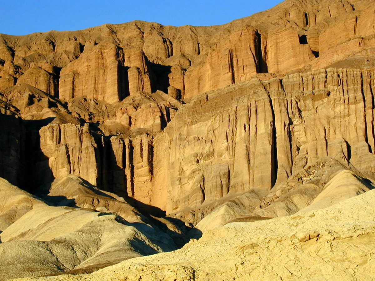
Then the walls open up and Red Cathedral towers above you: a natural amphitheater of red, fluted cliffs. Find a rock in the shade, have a snack, and enjoy the quiet before heading back down.
Good for: First-time visitors, families with kids who don’t mind rocks, photographers, anyone short on time.
Route 2: Golden Canyon and Gower Gulch Loop (4.3 miles)
If you’d rather not walk back the way you came, this loop is the answer. You walk up Golden Canyon, climb up into the badlands with views of Manly Beacon, then drop down through Gower Gulch and follow a short path along the base of the hills back to the parking lot.
It’s more varied than the out-and-back, and Gower Gulch has a different feel: darker rock, a narrower canyon, and splashes of color from minerals in the walls. You’ll also pass old mining prospects from Death Valley’s borax days. Look, but never go inside a tunnel or shaft.
A few things to know:
- Near the bottom of Gower Gulch, the canyon ends at a dryfall about 25 feet high. The trail goes around it on the north side. Follow the path; don’t try to climb down the dryfall.
- The NPS says to look for small signs at each major junction. Some junctions are easy to miss, so check your map.
- Add the Red Cathedral spur on the way up for about 1 extra mile round trip. It’s worth it.
Which way should you go? Most hikers go counterclockwise: up Golden Canyon first, down Gower Gulch. That way you climb the gentler canyon and see Red Cathedral while you’re fresh.
Good for: Hikers who want a loop and a bit more challenge.
Route 3: The Complete Circuit via Zabriskie Point (7.8 miles)
This is the big one. It links Golden Canyon, Red Cathedral, the badlands, Zabriskie Point and Gower Gulch into one long loop. The NPS rates it strenuous and estimates 4.5 hours.
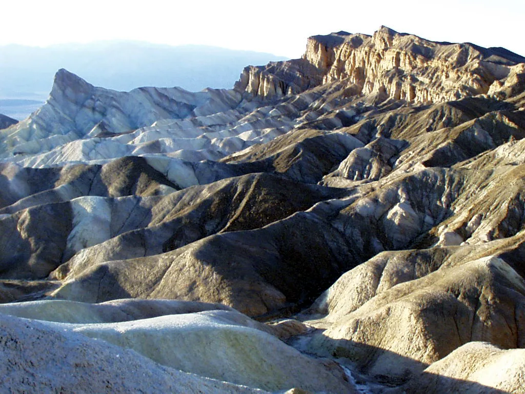
Climbing up to Zabriskie Point through the badlands is the highlight. You walk right past Manly Beacon, the pointed peak in so many Death Valley photos, then reach the famous viewpoint, which the NPS suggests as a lunch stop. From there, the trail drops back down through the badlands and Gower Gulch to your car.
You can also start this loop at Zabriskie Point if the Golden Canyon lot is full.
Good for: Fit hikers on a cool day with a full morning, plenty of water and a map.
Route 4: The Badlands Loop from Zabriskie Point (2.7 miles)
Staying near Zabriskie Point, or want something different? This loop starts at the viewpoint parking lot and winds down into the badlands and back up again. It connects with the Golden Canyon trails, so you can see Manly Beacon up close without driving to Badwater Road. The NPS warns to pay close attention in the narrow drainages, where it’s easy to take a wrong turn.
What You’ll See on the Golden Canyon Trail
The golden walls
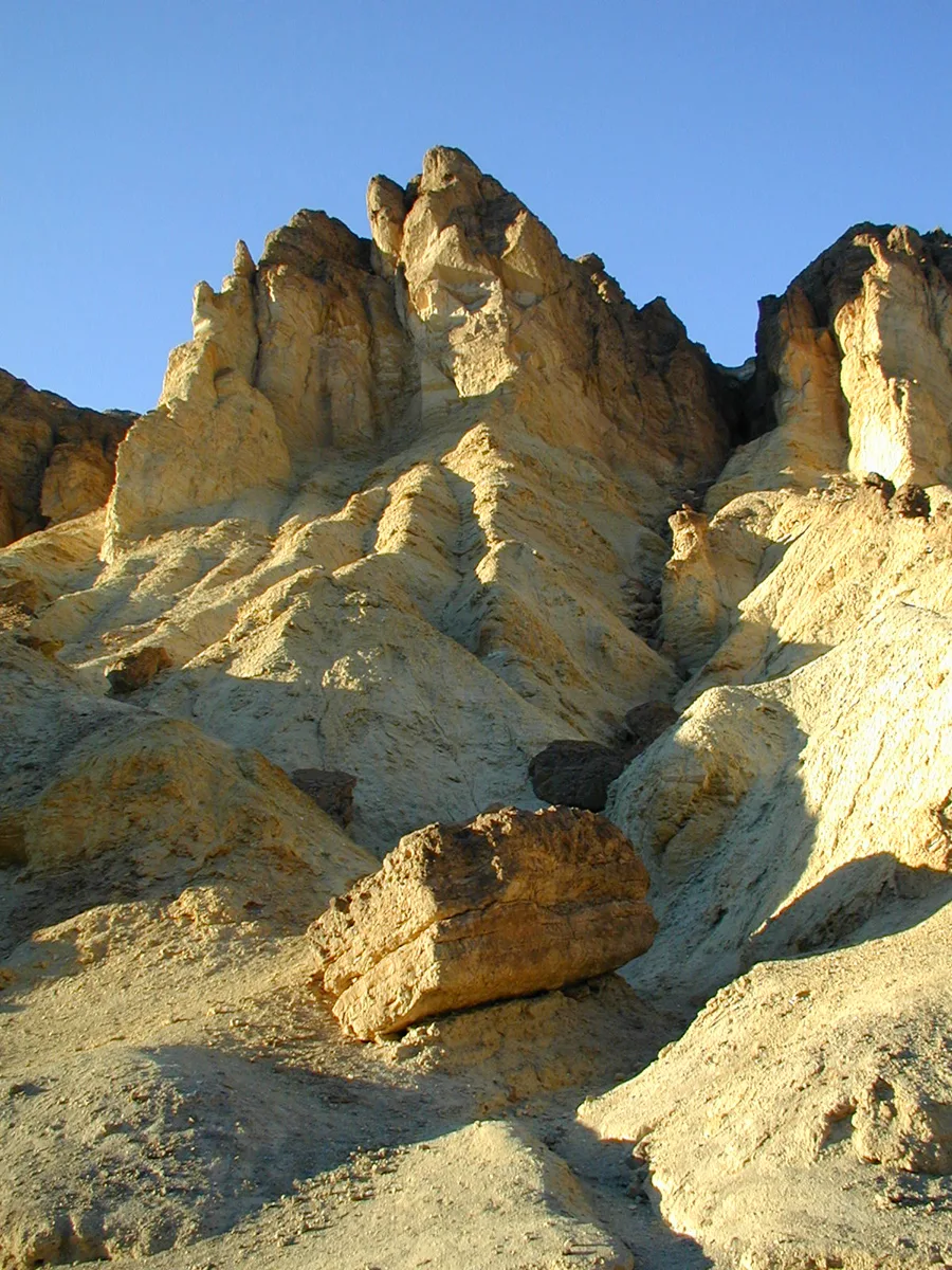
The canyon’s color comes from layers of sediment that settled in an ancient lake millions of years ago, then got tilted, lifted and carved by water. In the early morning and late afternoon, the walls turn a rich honey gold. At midday they look pale and washed out, which is one more reason to go early.
Bits of an old road
Keep an eye on the ground in the lower canyon. You may spot chunks of old asphalt. A road once ran up Golden Canyon, but flash floods tore it apart decades ago, and the park never rebuilt it. It’s a good reminder of how powerful water is here, even in the driest place in North America.
Red Cathedral
Red Cathedral is the highlight of the main hike. Its tall, deeply grooved walls are stained red by iron oxide. It’s a fun contrast after a mile of yellow rock.
Manly Beacon
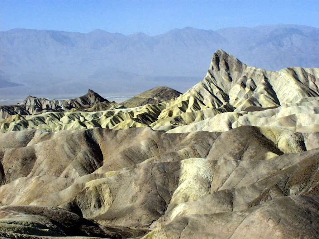
On the Gower Gulch and Complete Circuit routes, you’ll climb into the badlands and see Manly Beacon, a sharp, golden peak that sticks up above everything else. It’s named after William Lewis Manly, who helped guide a group of lost pioneers out of Death Valley in 1849–50.
Gower Gulch
Gower Gulch feels wilder than Golden Canyon. Interestingly, much of the water that now runs through it was diverted there decades ago to protect Furnace Creek from floods, which made the gulch erode faster. That’s why it has such a deep, raw look.
How Hard Is the Golden Canyon Trail?
For most healthy adults, the hike to Red Cathedral is moderate. The climb is gradual, and you gain only about 577 feet over 1.5 miles. What makes it feel harder:
- The surface: loose gravel and rocks most of the way. It’s not a smooth path.
- The scramble near Red Cathedral: a few 4-foot ledges and low overhangs.
- The sun: there’s very little shade, even in winter.
- The heat: on a warm day, a “moderate” hike can become dangerous fast.
The longer loops add more climbing, short steep sections on loose dirt, and junctions where you need to pay attention.
Is Golden Canyon good for beginners and kids?
Yes, if you pick the right route. The first mile is wide and fairly gentle, so even young kids can walk part of it and turn around. Older kids usually love the scrambling near Red Cathedral. Wear proper shoes, bring more water than you think, and turn back if anyone is struggling.
The trail isn’t suitable for strollers or wheelchairs.
Best Time to Hike Golden Canyon
| Month | Typical Furnace Creek high / low | Hiking verdict |
|---|---|---|
| November | Mid-70s / low 50s °F | Great |
| December | Mid-60s / around 40 °F | Excellent |
| January | Mid to upper 60s / around 40 °F | Excellent |
| February | Low 70s / mid-40s °F | Excellent |
| March | Low 80s / mid-50s °F | Good, go early |
| April–October | 90s to well over 110 °F | Early morning only, or skip |
These are typical averages. Death Valley can always surprise you with a heat spike, a cold wind or a rainstorm, so check the forecast.
Winter (December to February)
This is the best time to hike Golden Canyon. Days are mild and sunny. Mornings can be chilly, so start with a light jacket and pack it as you warm up. Winter days are short, so aim to finish well before sunset, especially on the longer loops.
Spring and fall
November and March can be lovely, but warm spells happen. Start early and pick a shorter route if it’s heating up.
Summer
Summer in Death Valley is extreme. Temperatures often pass 110 °F, and the badlands trap heat. The NPS advises against hiking at low elevations after 10 a.m. in summer. If you’re here in summer, walk only a short way into the canyon at sunrise, or skip it.
Best time of day
Morning. The air is cooler, the parking lot has space, and the low sun lights up the golden walls. Late afternoon is beautiful too, but make sure you’re out before dark.
What to Bring
- Water: at least 2 liters per person for the Red Cathedral hike in winter, more for the loops or warm days. There’s no water on the trail.
- Salty snacks: you sweat more than you notice in dry air.
- Shoes with good grip: trail runners or light hikers. Sandals and smooth sneakers slip on loose gravel.
- Sun protection: hat, sunglasses, sunscreen, light long sleeves.
- A light layer: winter mornings and wind can be cold.
- Offline map: especially for the Gower Gulch and Zabriskie Point routes.
- Headlamp: in case you’re slower than planned.
- Small first aid kit.
New to hiking? Read our hiking for beginners guide. For gear, see our picks for the best waterproof hiking jacket (handy on windy winter mornings) and hiking poles for the loose descents in Gower Gulch.
Golden Canyon Safety Tips
- Flash floods: Golden Canyon and Gower Gulch are drainage channels. Never enter them if rain is forecast, even if it’s sunny where you are. Storms in the hills can send water down with little warning.
- Heat: watch for headache, dizziness, nausea or confusion. Stop, find shade, drink and turn back. Turn around when half your water is gone.
- Navigation: on the loops, side canyons and washes all look alike. Follow the small junction signs and check your map.
- Old mines: never enter mine tunnels or shafts in Gower Gulch.
- Loose rock: don’t climb the soft badland slopes. They crumble easily and are damaged by footprints.
- Tell someone your plan and when you’ll be back.
Park Rules and Fees
- Entrance fee: Death Valley charges an entrance fee per vehicle, good for 7 days. Buy your pass online before you go, as service in the park is unreliable. America the Beautiful passes are accepted.
- Permits: not needed for day hikes.
- Dogs: not allowed on park trails, even if carried.
- Drones: not allowed in national parks.
- Leave No Trace: pack out all trash, and don’t collect rocks.
Golden Canyon vs. Other Death Valley Hikes
| Hike | Distance | What makes it special |
|---|---|---|
| Golden Canyon to Red Cathedral | 3 mi | Golden badlands, red cliffs, easy access |
| Mosaic Canyon | Up to 4 mi | Polished marble narrows and scrambling |
| Mesquite Flat Sand Dunes | About 2 mi | Classic sand dunes, sunrise and sunset photos |
| Natural Bridge | 1 mi | A huge rock bridge on a short walk |
| Badwater Basin | 1 mi | Salt flats at the lowest point in North America |
Choose Golden Canyon if you want colorful badlands and route options. Choose Mosaic Canyon if you want narrow, polished slot-like passages. Both are short enough to do on the same day.
Things to Do Near Golden Canyon
- Zabriskie Point: 3.5 miles east of Badwater Road on Highway 190. Go for sunrise, when the badlands light up gold and pink.
- Badwater Basin: about 15 miles south on Badwater Road. Walk out onto the salt flats at 282 feet below sea level.
- Natural Bridge: a short, easy canyon walk off Badwater Road.
- Artists Drive: a one-way scenic drive through hills streaked with pink, green and purple.
- Furnace Creek: the visitor center, food, gas and lodging.
- Dante’s View: a high viewpoint looking straight down on Badwater Basin.
Suggested Half-Day Plan
- Sunrise: watch the badlands light up at Zabriskie Point.
- 8:00 a.m.: drive to the Golden Canyon trailhead and hike to Red Cathedral (or the Gower Gulch Loop).
- 10:30 a.m.: drive south to Natural Bridge and Badwater Basin.
- Afternoon: Artists Drive on your way back to Furnace Creek.
- Sunset: head west to the Mesquite Flat Sand Dunes.
Frequently Asked Questions
How long is the Golden Canyon Trail in Death Valley?
To Red Cathedral and back is about 3 miles. The Gower Gulch Loop is 4.3 miles, or about 5.3 with the Red Cathedral spur. The complete circuit via Zabriskie Point is 7.8 miles.
How long does it take to hike Golden Canyon?
About 1.5 to 2 hours to Red Cathedral and back, 2.5 hours for the Gower Gulch Loop, and about 4.5 hours for the complete circuit.
Is Golden Canyon hard?
The Red Cathedral hike is moderate, with a gradual climb and a little scrambling near the end. The complete circuit is strenuous.
Is Golden Canyon worth it?
Yes. It’s one of the easiest ways to see Death Valley’s famous badlands up close, and Red Cathedral is a great reward for a short hike.
What is the best time to hike Golden Canyon?
November to March, in the morning. Avoid hot summer days.
Where do you park for Golden Canyon?
At the paved Golden Canyon parking area on Badwater Road, about 2 miles south of Highway 190. You can also start from Zabriskie Point.
Is there water or a bathroom at Golden Canyon?
There’s a vault toilet at the trailhead but no drinking water. Fill up at Furnace Creek.
Can you bring dogs to Golden Canyon?
No. Pets aren’t allowed on trails in Death Valley National Park.
Do you need a permit to hike Golden Canyon?
No permit is needed for a day hike, but you must pay the park entrance fee.
Can kids hike Golden Canyon?
Yes. The lower canyon is fairly gentle, and kids usually enjoy the scramble near Red Cathedral. Bring plenty of water and turn back if it gets warm.
Is Golden Canyon a loop?
The Red Cathedral hike is out and back. If you want a loop, take the Gower Gulch Loop or the complete circuit.
Can you hike Golden Canyon in summer?
Only very early, and only a short way. The NPS advises against low-elevation hiking after 10 a.m. in summer.
Was Star Wars filmed in Golden Canyon?
Several Death Valley locations appeared in Star Wars, and Golden Canyon is often named among them. Whether or not you’re a fan, it feels like another planet.
Final Thoughts
Golden Canyon is the perfect introduction to Death Valley. In about two hours, you get winding golden walls, a little scrambling, and a giant red cliff at the end. If you have more time and energy, the Gower Gulch Loop or the complete circuit to Zabriskie Point shows you the badlands from the inside.
Go early, go in the cooler months, carry plenty of water, and stay out of the canyon if rain is coming. Do that, and this will likely be one of the highlights of your trip.
Planning more? Read our guides to Mosaic Canyon, the Mesquite Flat Sand Dunes, and the best winter hiking trails in the USA. Heading to the Eastern Sierra after Death Valley? Don’t miss the Big Pine Lakes Trail.
Before you go: check the official NPS Golden Canyon page and Death Valley alerts and conditions.