
There’s no trail. No signs. No path to follow. Just a parking lot, a sea of golden sand in front of you, and the tallest dune off in the distance. You pick a line and start walking.
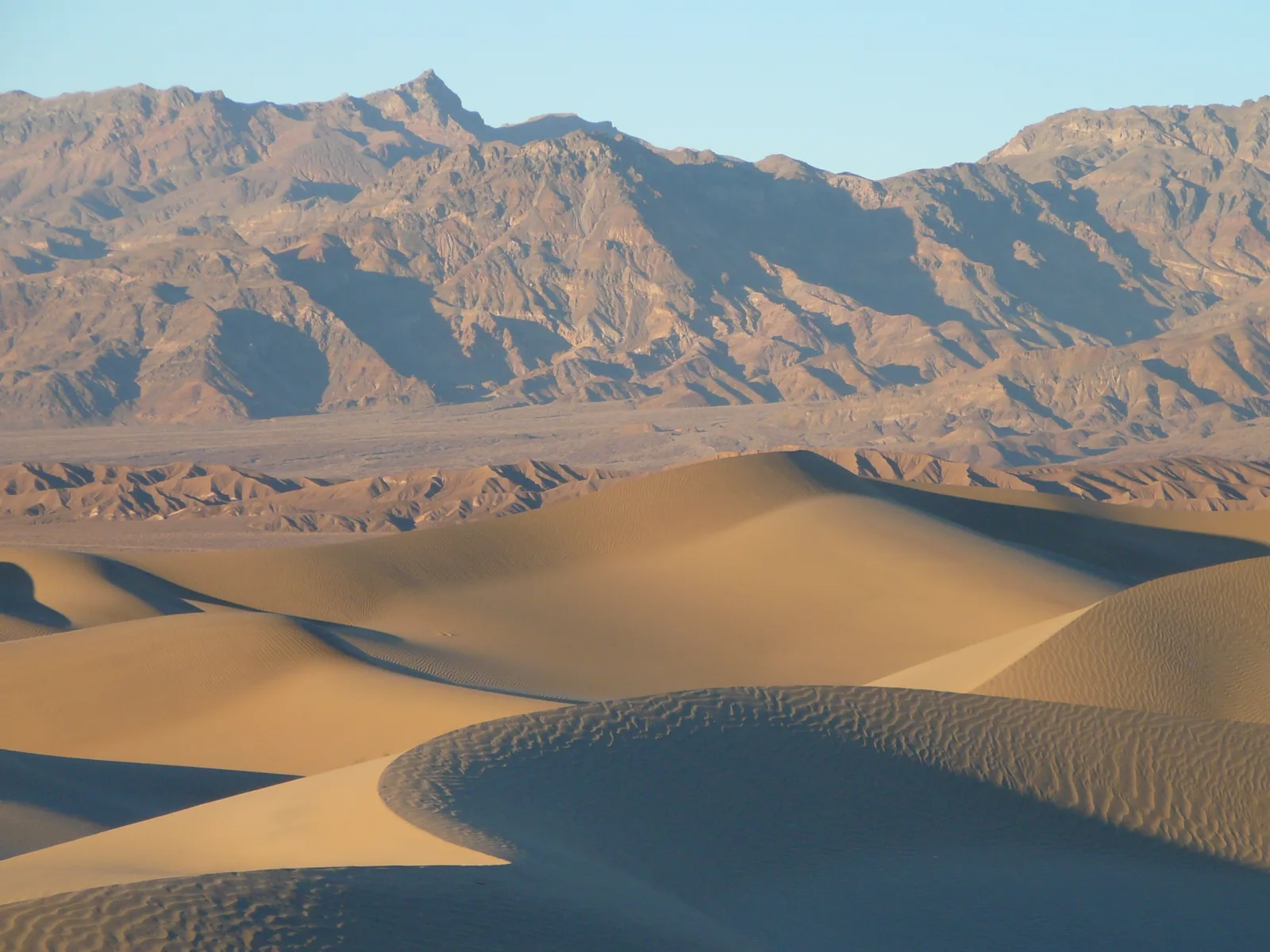
That’s what makes the Mesquite Flat Sand Dunes hike one of the most memorable things to do in Death Valley. It feels like a scene from a movie, and in a way it is. The rolling ridges, the ripples in the sand, the long shadows at sunrise and sunset are what most people picture when they think of a desert.
The dunes are the easiest dunes to reach in the park, right off Highway 190 near Stovepipe Wells. But “easy to reach” doesn’t mean easy to walk. Sand is hard work, there’s zero shade, and it’s surprisingly easy to lose your sense of direction out there.
This guide covers everything: how far to the high dune, the best time to go, photo tips, sandboarding, stargazing, the wildlife you might spot, and the safety tips that keep a fun walk from turning into a bad day.
Quick answer
- Distance: about 2 miles round trip to the high dune (NPS).
- Time: about 1.5 hours, but most people stay longer.
- Elevation gain: about 185 feet.
- Difficulty: easy to moderate. Walking in soft sand is tiring.
- Trail: none. You walk cross-country.
- Best time: sunrise or sunset, November to March.
- Parking: paved lot off CA-190, just east of Stovepipe Wells, with vault toilets.
- Dogs: not allowed, even if carried.
Mesquite Flat Sand Dunes at a Glance
| Location | Death Valley National Park, just east of Stovepipe Wells Village |
| Parking | Paved lot off CA-190, with pull-through spaces for buses and RVs |
| Distance | About 2 miles round trip to the highest dune |
| Elevation gain | About 185 ft |
| Time | About 1.5 hours |
| Difficulty | Easy to moderate |
| Trail | No official trail (cross-country) |
| Highest dune | About 100 ft tall |
| Facilities | Vault toilets. No water. |
| Best time | Sunrise or sunset, November to March |
| Pets | Not allowed |
Where Are the Mesquite Flat Sand Dunes?
The dunes sit in the middle of Death Valley, near the small village of Stovepipe Wells. They’re about 24 miles west of Furnace Creek on Highway 190.
How to get there
- Drive Highway 190 toward Stovepipe Wells.
- Just east of the village, look for the signed Mesquite Flat Sand Dunes parking area on the north side of the road.
- Park in the paved lot. The dunes start right in front of you.
It’s all paved, so any vehicle can get there. There are vault toilets in the lot, but no water. Fill up at Stovepipe Wells or Furnace Creek.
Tip: Cell service is patchy here. Save the parking lot’s location on your phone’s map before you walk out, so you can find your way back after dark.
How to Hike the Mesquite Flat Sand Dunes
Since there’s no trail, “hiking the dunes” just means walking out into the sand. Most people aim for the tallest dune, which you can see from the parking lot. It’s about a mile away.
Step 1: Pick your target
Before you leave the lot, look for the highest dune. Note where it is compared to the mountains around you. Those mountains are your landmarks. Once you’re down between dunes, you can’t see the parking lot.
Step 2: Walk the ridges
Walking on the firm crests of the dunes is usually easier than slogging through the soft sand in the low spots. The flats between dunes near the start are packed and crusty, so the first part is easy.
Step 3: Climb the high dune
The last climb up the tallest dune is the hardest part. Every step slides back a little. Take it slow. At the top, you get a 360-degree view of the dune field, the valley and the mountains.
Step 4: Head back the way you came
Follow your own footprints back, as long as the wind hasn’t erased them. Use the mountains and the road to keep your direction. In the dark or after sunset, a GPS app with your car’s location saved is a lifesaver.
Don’t want to go that far? You don’t have to. Even 15 minutes of wandering gets you into beautiful sand ripples and away from the crowds near the lot.
Mesquite Flat Sand Dunes hiking options
There’s no single “right” way to hike Mesquite Flat Sand Dunes. Pick the option that fits your time and energy:
| Option | Rough time | Best for |
|---|---|---|
| Look from the parking area | 10–15 minutes | Quick stop, limited mobility |
| Walk to the nearest dunes | 30–45 minutes | Families, kids, casual visitors |
| Wander deeper into the dune field | 45–90 minutes | Photographers, clean sand ripples |
| Hike to the tallest dune and back | About 1.5 hours or more | Active hikers who want the big view |
These are rough planning times, not set routes. There are no distance markers out on the sand.
Easy tricks for walking in sand
- Zigzag up steep faces. Going up a gentler slope or angling side to side takes far less effort than charging straight up the steepest side.
- Step in other people’s footprints on climbs. Packed sand gives you better grip.
- Take short steps and rest often. Sand drains your legs faster than you expect.
- Save energy for the return. You still have to walk back across the same sand.
- Don’t trust old footprints for navigation. The wind can wipe them out surprisingly fast.

How Hard Is the Dunes Hike?
On paper, 2 miles and 185 feet sounds easy. In practice, sand makes it feel harder:
- Soft sand takes much more effort than a normal trail. Your legs work hard on every step uphill.
- No shade at all. Not one tree you can rest under for long.
- The sand heats up fast in the sun and can get hot enough to burn bare feet.
- Navigation: all the dunes look alike once you’re among them.
For most people, the walk is easy to moderate. Kids usually have a blast, running down the dune faces. Just make sure everyone has water and you stay together.
Best Time to Hike the Mesquite Flat Sand Dunes
Sunrise: best for photos and solitude
Sunrise is the top choice. The sand is cool, the wind is often calm, and the ripples are fresh and untouched after the night breeze. Low sunlight makes long shadows that show off every curve. You’ll also have fewer people in your photos.
Sunset: best for golden color
Sunset is the most popular time. The dunes turn deep gold and orange, and the mountains glow pink. It gets busier, so walk farther out to find clean sand. Bring a headlamp, because it gets dark fast once the sun drops.
Night: best for stars
Death Valley is an International Dark Sky Park, and the dunes are one of the best places to stargaze. On a moonless night, the Milky Way stretches across the sky. On a full moon night, the dunes glow silver and you can walk without a headlamp.
Sunrise or sunset: which is better?
Both are worth it. Pick sunrise if you want cooler sand, calmer wind, fresh ripples and fewer people. Pick sunset if you’re already exploring Death Valley all day and want to end with warm golden light. If you can only do one and love photography, go with sunrise.
Midday: skip it
Midday light is flat and harsh, and the sand gets hot even in cooler months. In summer, the NPS says not to hike the dunes after 10 a.m.
Best season
| Season | Conditions | Verdict |
|---|---|---|
| November–February | Mild days, cold nights | Best time to visit |
| March–April | Warm days, wildflowers in good years, windier | Great at sunrise or sunset |
| May–September | Extreme heat, sand can be dangerously hot | Only right at dawn, or skip |
| October | Hot early, cooling later | Okay at sunrise/sunset |
Watch out for wind
Windy days are common, especially in spring. Blowing sand stings your skin, gets in your eyes and can damage cameras. If it’s very windy, save the dunes for another day or stay near the parking lot.
Photography Tips for the Dunes
- Go early or late. Shoot in the first and last hour of sunlight for long shadows and warm color.
- Walk far for clean sand. The dunes near the lot are covered in footprints. Clean ripples are usually 15–30 minutes out.
- Look for lines. Ridge lines, S-curves and ripples lead the eye through your photo.
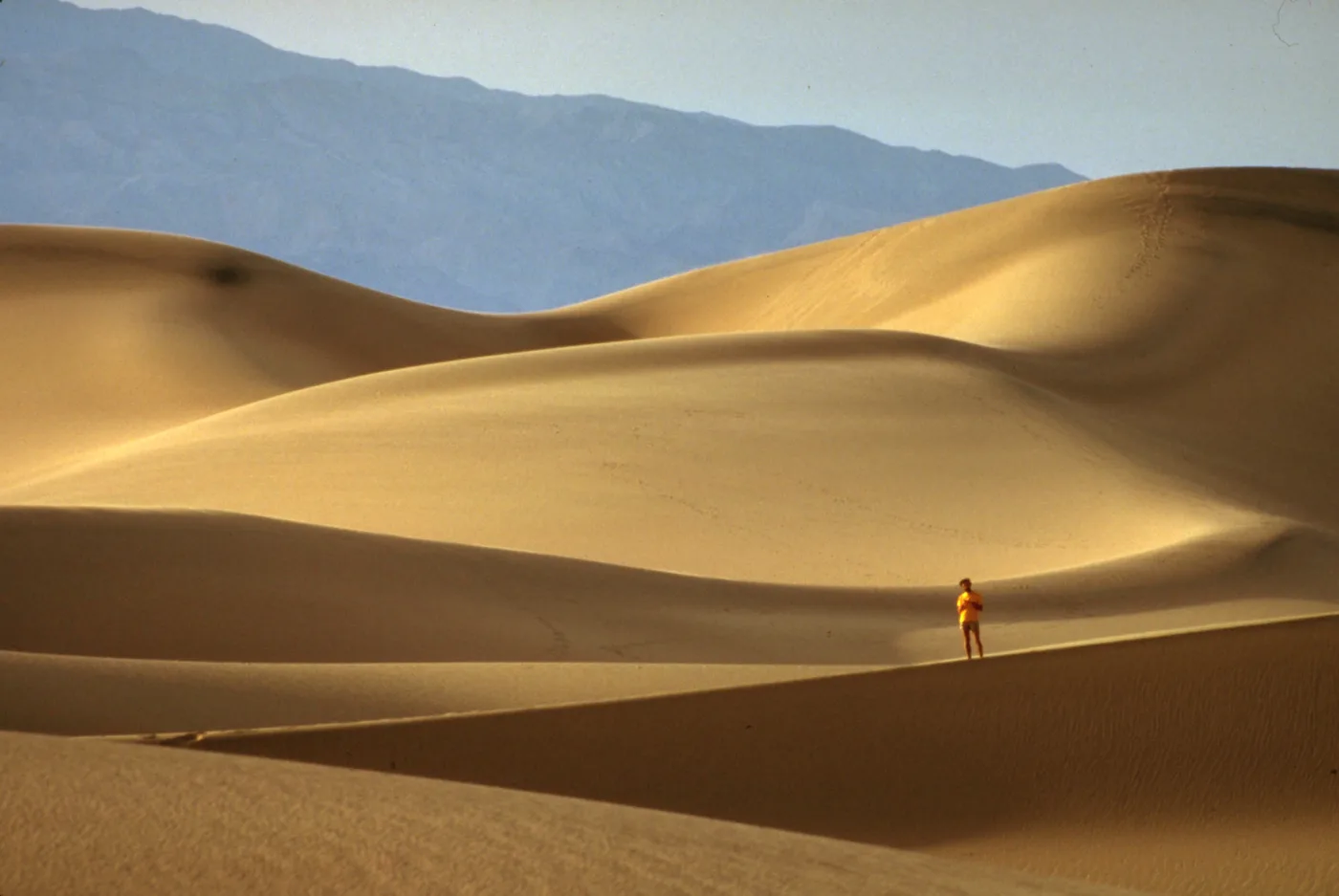
- Use people for scale. A tiny hiker on a ridge shows how big the dunes are.
- Protect your gear. Change lenses inside your car, keep your camera in a bag, and bring a blower brush.
- Check behind you. Don’t walk through the ripples you’re about to photograph.
- Try the mesquite trees. Mesquite bushes on small mounds make great foregrounds.
Sandboarding at Mesquite Flat
Yes, you can sandboard here. The NPS allows sandboarding at the Mesquite Flat and Saline Valley dunes. There are no rentals in the park, so bring your own board or sled. Sandboarding isn’t allowed at some other dunes in the park, so check the NPS sand dunes page before you go elsewhere.
The highest dune here is about 100 feet tall, so runs are short. It’s more about fun than speed. Be respectful of photographers and other visitors.
What Lives in the Dunes?
The dunes look empty, but they’re full of life. You just have to look for clues.
- Tracks: early morning is the best time to see tracks from the night before. Look for tiny lines of footprints and tail drags.
- Kangaroo rats: these little nocturnal rodents hop around at night and rarely need to drink water.
- Sidewinder rattlesnakes: they move sideways across the sand and leave J-shaped tracks. They’re mostly active at night and in warmer months. Watch where you step and put your hands, and use a light at night.
- Beetles, lizards and coyotes are also around.
- Mesquite trees: the dunes are named after them. Their bean pods were a traditional food for the Timbisha Shoshone people, whose homeland includes Death Valley.
Why Are They Called Mesquite Flat Sand Dunes?
The name comes from the honey mesquite trees that grow here. These tough desert plants send roots deep down to reach water, and shifting sand often buries their trunks. Some look like clumps of branches poking straight out of the dunes. In spring, they grow green leaves and yellow flowers.
The dunes themselves exist because of a simple recipe, according to the NPS: the mountains to the north wear down and supply sand, the wind blows it across the valley, and the mountains to the south stop it. Over time, that trapped sand piles up into the ridges you walk on today.
Can You See the Dunes Without Hiking?
Yes. This is one of the best things about Mesquite Flat. The dunes stretch out right in front of the paved parking lot, and there’s a viewpoint and information signs, so you can enjoy the scene without walking far.
Keep in mind that the dunes themselves are not a smooth or accessible surface. Once you step off the pavement, it’s uneven ground and soft sand. Visitors with limited mobility can still get a great view and sunset photos from the parking area.
What to Wear
- Closed-toe trail shoes with good grip. Sand gets in, but shoes protect you from hot sand, sharp twigs and thorny plants.
- Light layers in winter. Mornings and evenings can be cold, then it warms up fast in the sun.
- Light-colored, breathable clothes in warmer months, with long sleeves for sun protection.
- A wide-brim hat and sunglasses. Sunlight reflects off the sand, so it feels brighter than you expect.
- A buff or bandana to cover your face if the wind picks up.
A Few Fun Facts
- Three dune shapes: crescent, linear and star dunes all appear here.
- Not huge, but famous: the tallest dune here is about 100 feet. Death Valley’s Eureka Dunes are much taller, but Mesquite Flat is by far the easiest to visit.
- Movie fame: Death Valley has been a filming location for many movies, including scenes in early Star Wars. The dunes area is often linked to those shoots.
- Where does the sand come from? Mostly from the surrounding mountains, washed down by water and piled up by wind trapped in this part of the valley.
What to Bring
- Water: at least 1–2 liters per person, even for a short sunset walk.
- Closed shoes: sand can be hot, and there are thorny plants. Many people go barefoot on cool sand, but carry shoes.
- Gaiters or high socks to keep sand out of your shoes (optional).
- Sun protection: hat, sunglasses, sunscreen.
- Warm layer: it gets cold quickly after sunset in winter.
- Headlamp or flashlight for sunset, night and stargazing walks.
- Phone with GPS and your car location pinned.
- Bag for your camera to keep out sand.
Gear help: our guide to the best waterproof hiking jacket covers good wind-blocking layers, and our hiking for beginners guide has a simple packing checklist.
Safety Tips
- Heat: avoid the dunes after 10 a.m. in summer. Sand reflects heat and can get very hot.
- Getting lost: note landmarks, save your car’s location, and don’t wander too far after dark.
- Snakes: watch where you step, especially near bushes and at night.
- Wind and sand storms: if visibility drops, head back to your car.
- Stay together with kids. It’s easy to lose sight of each other behind a dune.
- Tell someone your plan if you’re going far or out at night.
Park Rules
- No pets in the dunes, even if carried (NPS).
- No driving off roads. Vehicles aren’t allowed on the dunes.
- No drones in the national park.
- Entrance fee required for Death Valley. Buy your pass online before you arrive.
- Leave No Trace: pack out everything, including food scraps.
Mesquite Flat Sand Dunes vs. Other Death Valley Hikes
| Hike | Distance | Best for |
|---|---|---|
| Mesquite Flat Sand Dunes | About 2 mi | Sunrise, sunset, photos, kids, stars |
| Mosaic Canyon | Up to 4 mi | Marble narrows and scrambling (10 minutes away) |
| Golden Canyon | 3 mi (Red Cathedral) | Golden badlands and route options |
| Badwater Basin | About 1 mi | Salt flats, lowest point in North America |
Best Hikes and Things to Do Near Mesquite Flat Sand Dunes
Looking for more Mesquite Flat Sand Dunes Death Valley hikes and stops nearby? These are the best ones to pair with your dune walk:
- Mosaic Canyon: polished marble narrows, just a few minutes west of Stovepipe Wells.
- Stovepipe Wells Village: general store, restaurant, gas, lodging and a campground.
- Salt Creek Interpretive Trail: easy boardwalk loop with pupfish in spring.
- Harmony Borax Works: short historic walk near Furnace Creek.
- Golden Canyon and Zabriskie Point: about 30 minutes east.
Suggested Day Plan
- Sunrise: walk out to the high dune for photos.
- Mid-morning: hike Mosaic Canyon before it gets warm.
- Lunch: Stovepipe Wells.
- Afternoon: drive to Furnace Creek and hike Golden Canyon.
- Sunset: Zabriskie Point, or back to the dunes.
- Night: stargazing from the dunes parking area.
Frequently Asked Questions
How long is the Mesquite Flat Sand Dunes hike?
About 2 miles round trip to the highest dune, according to the NPS. There’s no set trail, so you can walk as far or as little as you like.
How long does it take to hike Mesquite Flat Sand Dunes?
About 1.5 hours to the high dune and back. Photographers often spend 2–3 hours.
How tall is the highest dune at Mesquite Flat?
About 100 feet.
Is there a trail at Mesquite Flat Sand Dunes?
No. You walk cross-country across the sand. Pick a landmark and keep track of where your car is.
When is the best time to visit the dunes?
Sunrise or sunset between November and March. Avoid midday, and avoid summer after 10 a.m.
Can you bring dogs to the Mesquite Flat Sand Dunes?
No. Pets aren’t allowed in the dunes, even if you carry them.
Can you sandboard at Mesquite Flat Sand Dunes?
Yes. Sandboarding is allowed at Mesquite Flat and Saline Valley dunes. Bring your own board.
Are there bathrooms at the dunes?
Yes, vault toilets in the parking lot. There’s no water.
Can you walk on the dunes at night?
Yes. It’s a great place for stargazing. Bring a headlamp, watch for snakes in warmer months and save your car’s location.
Are there snakes in the dunes?
Yes, sidewinder rattlesnakes live here. They’re mostly active at night and in warmer weather. Watch your step.
Is the dunes hike good for kids?
Yes. Kids love running down the dunes. Keep everyone together and bring water.
Was Star Wars filmed at the Mesquite Flat Sand Dunes?
Death Valley appeared in early Star Wars filming, and the dunes area is often linked to it. Either way, it feels like another planet.
Is Mesquite Flat Sand Dunes worth visiting?
Yes. It’s some of Death Valley’s most famous desert scenery, and it’s right off Highway 190 on a paved road, so it’s one of the easiest stops in the park.
Can you hike Mesquite Flat Sand Dunes in winter?
Yes. Winter is the most comfortable time to hike the dunes. Just be ready for cold mornings, wind and the odd rainstorm.
Can you see the dunes without hiking?
Yes. You get a wide view straight from the parking lot, so even a quick stop is worth it.
What are the best hikes near Mesquite Flat Sand Dunes?
Mosaic Canyon is the best nearby hike, just a few minutes west. Golden Canyon near Furnace Creek is about 30 minutes east.
Final Thoughts
The Mesquite Flat Sand Dunes hike is simple: park, walk into the sand and go as far as you want. But it’s one of the most magical experiences in Death Valley, especially when the low sun turns everything gold or the stars come out above the ridges.
Go at sunrise or sunset, carry water, note your landmarks, and leave the dog at home. Pair it with Mosaic Canyon just down the road and you’ve got a perfect half day.
More trip ideas: Golden Canyon Trail, the best winter hiking trails in the USA and the best hikes in Joshua Tree.
Before you go: check the official NPS Mesquite Flat Sand Dunes page, the NPS sand dunes guide, Death Valley hiking info and current conditions.