
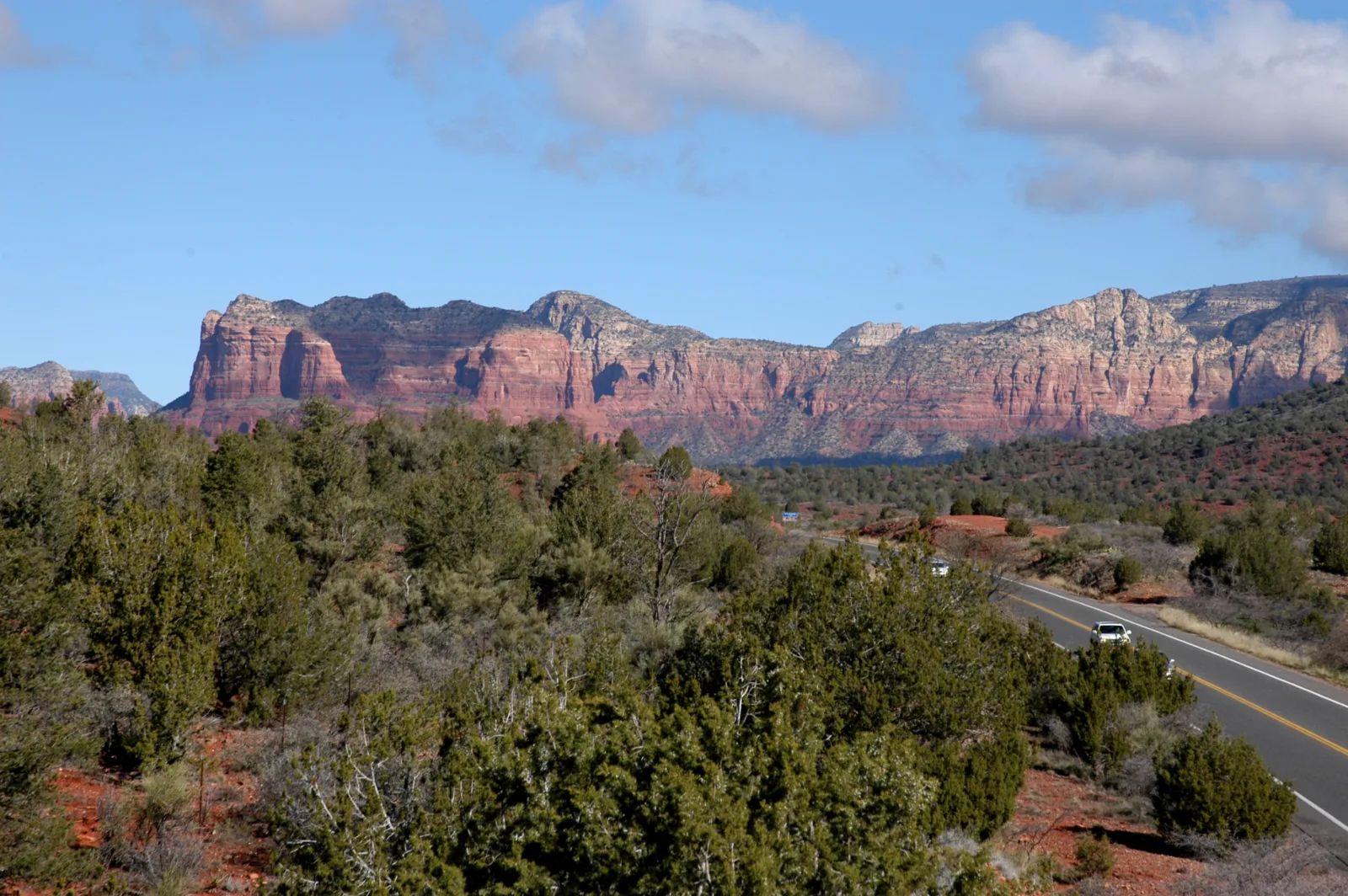
If you drive into Sedona from Phoenix, Bell Rock is the first big red rock that makes you say “wow.” It rises right beside Highway 179, shaped like a giant church bell, and it’s one of the easiest famous landmarks in Sedona to walk up to.
Here’s the thing most visitors don’t know: there’s no single “Bell Rock Trail.” There’s a wide, easy pathway, a longer loop that circles Bell Rock and Courthouse Butte, and an unofficial climb up the rock itself. Each one feels like a different hike.
This guide explains all three in simple terms, so you can pick the right one for your group. You’ll also find parking tips, pass rules, sunrise advice and what to know about the Bell Rock vortex.

Quick answer
- Easiest option: Bell Rock Pathway, a wide, gentle trail. Walk as far as you like (30–90 minutes).
- Best full hike: Courthouse Butte Loop, about 3.8–4.3 miles around Bell Rock and Courthouse Butte, roughly 350 feet of total climbing, 1.5–2.5 hours.
- Bell Rock climb: an unofficial scramble up the sandstone. The lower ledges are fun. The top is for experienced scramblers only.
- Parking: Bell Rock Vista (larger, south) or Courthouse Vista (smaller, north), both on Highway 179.
- Pass: Red Rock Pass or America the Beautiful pass required at both lots.
- Best time: sunrise or early morning, spring and fall.
Bell Rock at a Glance
| Location | Highway 179, just north of the Village of Oak Creek, about 6 miles south of the main Sedona roundabout |
| Land manager | Coconino National Forest |
| Main trails | Bell Rock Pathway #96, Courthouse Butte Loop #135 |
| Bell Rock summit | About 4,919 feet |
| Difficulty | Easy (pathway), easy to moderate (loop), hard (upper climb) |
| Shade | Very little |
| Dogs | Allowed on a leash |
| Bikes | Yes, mountain bikes share the pathway |
| Horses | Not allowed on Bell Rock Pathway |
| Restrooms | Vault toilets at Bell Rock Vista |
Which Bell Rock Hike Should You Do?
| Option | Distance | Time | Who it’s for |
|---|---|---|---|
| Bell Rock Pathway out and back | 1–3 miles | 30–90 min | Families, first-timers, casual walkers |
| Courthouse Butte Loop | 3.8–4.3 miles | 1.5–2.5 hours | Anyone wanting a “real” hike with changing views |
| Bell Rock climb (lower ledges) | Short | 30–60 min | Confident walkers with grippy shoes |
| Bell Rock climb (near the top) | Short but steep | 1+ hour | Experienced scramblers only |
Option 1: Bell Rock Pathway
The Bell Rock Pathway is a wide, mostly hard-packed dirt trail that runs north from the Bell Rock Vista lot, past the west side of Bell Rock, toward Courthouse Vista. Most of it is gentle, with a few short hills and some rocky spots around the base of the rock.
This is the best pick if you have kids, older family members, or just a little time. You’ll be right next to Bell Rock within minutes, and you can turn back whenever you want. It’s also popular with trail runners and mountain bikers, so keep to one side.
Option 2: Courthouse Butte Loop
The Courthouse Butte Loop circles both Bell Rock and its big neighbor, Courthouse Butte. The Forest Service puts it at about 4.3 miles with roughly 350 feet of total elevation change. Starting from Courthouse Vista makes it a bit shorter, closer to 3.8–4 miles.
What makes this loop special is that the crowds drop off fast. Most people stop at Bell Rock. Once you head around the east side of Courthouse Butte, it gets quiet and you get views you’d never see from the road, including the rock some hikers call Spaceship Rock.
The trail is mostly gentle but completely open to the sun, so carry plenty of water. Part of the east side runs through the Munds Mountain Wilderness, where bikes aren’t allowed.
Which direction?
Either works. Going clockwise from Courthouse Vista lets you get the busy Bell Rock section out of the way first and enjoy the quiet half afterward.
Option 3: Climbing Bell Rock
Bell Rock doesn’t have an official summit trail. What it has is a rough “Bell Rock Climb” route marked here and there by cairns that leads up the north and west sides onto a series of sandstone ledges.
- The lower ledges are fine for most active people with good shoes. You’ll get great views of Courthouse Butte and the valley.
- Higher up, the rock gets steep and exposed. You need to use your hands, and a slip could be serious.
- The true top is a technical scramble that most hikers shouldn’t attempt.
The rule is simple: if going up feels shaky, coming down will feel worse. Turn around before that point. Search and rescue teams are called to Bell Rock regularly for people who climbed higher than they could safely descend.
Bell Rock Parking and Red Rock Pass
Bell Rock Vista (south lot)
This is the bigger lot, on the east side of Highway 179 just north of the Village of Oak Creek. It has paved parking, vault toilets, a fee machine and an info kiosk. Start here for the Bell Rock Pathway or the longer loop.
Courthouse Vista (north lot)
Smaller, a little farther north. It’s the closest lot to Bell Rock itself and the shortest start for the Courthouse Butte Loop. Turning in from the northbound lanes means a careful left turn across traffic.
Yavapai Vista
Another nearby pullout used as overflow. It also serves Cathedral Rock hikers, so it fills early.
Passes
You need a Red Rock Pass or an America the Beautiful pass to park at these lots. At the time of writing, Red Rock Passes were sold as daily, weekly and annual passes, and you can buy them from machines at the trailhead (cards only), online or in local shops.
Parking tips
- Both lots fill by mid-morning in spring and fall, but people come and go quickly, so a spot often opens up.
- Don’t park on the highway shoulder.
- Sunrise and late afternoon are the easiest times to park.
Is Bell Rock Good for Kids and Beginners?
Yes, it’s one of the best family hikes in Sedona. The pathway is wide and easy, the rock is right there, and kids love scrambling on the lowest ledges. Just keep young children close once the rock gets steeper, and bring more water than you think you’ll need.
Bell Rock at Sunrise and Sunset
Bell Rock faces the morning sun beautifully. At sunrise the red rock glows orange, the air is cool and the lots are nearly empty. Bring a headlamp if you’ll be walking before daylight. A cheap one works fine; see our budget headlamp picks.
Sunset is pretty too, with warm light on the surrounding buttes. Just leave time to walk out before dark.
Photo tips
- For the classic bell shape, shoot from the pathway on the west side.
- Use the winding trail or desert plants as a foreground.
- From the lower ledges, look east for great shots of Courthouse Butte.
- Stay on durable rock or trails for photos. The dark crusty soil (cryptobiotic soil) takes decades to recover.
The Bell Rock Vortex
Bell Rock is known as one of Sedona’s “vortex” sites, places where many visitors say they feel calm or energized. That’s a matter of personal belief, not science, but plenty of people come here to sit quietly or meditate.
Whatever you believe, please be kind to the place. Don’t build rock stacks or “medicine wheels,” and don’t leave crystals or offerings. Rangers remove them because they damage the area.
Best Time to Hike Bell Rock
| Season | What to expect |
|---|---|
| March–May | Comfortable temperatures, busy lots, spring wildflowers in good years |
| June–August | Hot with no shade; go at sunrise. Lightning storms from July |
| September–November | Great weather and clear views |
| December–February | Cool and quiet; rock can be slick after rain or snow |
What to Bring
- At least 1 liter of water for the pathway, 2 liters for the loop
- Hat, sunglasses and sunscreen
- Shoes with good grip if you plan to climb
- Red Rock Pass or America the Beautiful pass
- A snack and a phone with an offline map
Safety Tips
- Don’t climb higher than you can comfortably come down.
- Avoid the rock when it’s wet or icy.
- Watch for bikes on the pathway.
- Leave the rock if lightning is around. Bell Rock is very exposed.
- Pack out everything, including food scraps.
Bell Rock vs. Other Sedona Hikes
| Trail | Distance | Difficulty | Best for |
|---|---|---|---|
| Bell Rock Pathway | 1–3 mi | Easy | Families and quick visits |
| Courthouse Butte Loop | 3.8–4.3 mi | Easy–moderate | Quiet loop with big views |
| Soldier Pass | About 4.5 mi | Easy–moderate | Sinkhole, pools and a cave |
| Cathedral Rock | About 1 mi | Strenuous | Short, steep scramble |
| Boynton Canyon | 6 mi | Moderate | Shady canyon walk |
Frequently Asked Questions
How long is the Bell Rock Trail?
It depends on your route. A walk on the Bell Rock Pathway can be 1–3 miles round trip. The Courthouse Butte Loop is about 3.8–4.3 miles.
Is Bell Rock an easy hike?
The pathway and loop are easy to easy-moderate. Climbing high on the rock is not easy.
Can you climb to the top of Bell Rock?
There’s no official trail to the top. The lower ledges are fine for most people, but the top requires real scrambling and isn’t recommended for regular hikers.
Where do you park for Bell Rock?
Bell Rock Vista or Courthouse Vista, both on Highway 179. A Red Rock Pass or America the Beautiful pass is required.
Is Bell Rock good for sunrise?
Yes. It’s one of the easiest sunrise spots in Sedona, and parking is simple early in the day.
Is Bell Rock a vortex?
It’s one of Sedona’s well-known vortex sites. The experience is personal, but the views are real either way.
Are dogs allowed at Bell Rock?
Yes, on a leash. Bring water for them, since there’s no shade.
How long does it take to hike around Bell Rock?
About 1.5–2.5 hours for the full Courthouse Butte Loop at an easy pace.
Final Thoughts
Bell Rock is Sedona made easy. You can see it in 20 minutes or spend a whole morning circling it. Start with the pathway, add the loop if you’re enjoying yourself, and keep the climbing to the lower ledges unless you’re truly comfortable on steep rock.
Want more? Try the cave and pools on the Soldier Pass Trail, the arch at Devils Bridge or the quiet Boynton Canyon. For more warm-weather ideas, see our best winter hiking trails in the USA.
Trail facts come from the Coconino National Forest. Pass prices and rules change, so check before you go.