

At the end of the Devils Bridge Trail in Sedona, a giant red sandstone arch stretches across an open gap, with green valleys and red cliffs rolling away behind it. It’s the largest natural arch in the Sedona area and one of the most photographed spots in Arizona.
Getting there takes a bit of planning, though. There are several ways in, and picking the wrong parking lot can double your hike. One approach needs a real 4×4. The last stretch is a steep staircase of rock. And on busy mornings, the line to stand on the arch for a photo can take an hour.
This guide covers it all: every route and its distance, where to park, the free Sedona Shuttle, 4×4 access, directions, a step-by-step trail guide, whether it’s safe to walk on the bridge, sunrise tips, the best seasons, and what to bring.
Cover photo: Devils Bridge, Sedona. Photo: Kelly Chen / Pexels
Devils Bridge Trail Sedona: The Short Answer
The Devils Bridge Trail itself is 1.6 miles round trip with about 370 feet of climbing, but most people can’t drive to its trailhead without a high-clearance 4×4. With a regular car, start at Mescal Trailhead (about 4 miles round trip) or Dry Creek Vista Trailhead (about 4.6–5.8 miles round trip), or ride the free Sedona Shuttle. It’s a moderate hike with steep rock steps at the end, and takes 2–4 hours. Go at sunrise or late afternoon to beat the heat, crowds and photo line.
Devils Bridge Trail: Quick Facts
| Detail | Information |
|---|---|
| Location | West Sedona, Coconino National Forest, Arizona |
| Official trail | Devil’s Bridge Trail No. 120: 1.6 miles round trip |
| Elevation gain (official trail) | About 371 feet |
| Trailhead elevation | 4,605 feet |
| Arch height | About 50 feet |
| Common hike with a regular car | About 4 miles round trip from Mescal Trailhead |
| Difficulty | Moderate, with steep rock steps near the top |
| Time needed | 2–4 hours, plus any photo wait |
| Parking pass | Red Rock Pass ($5/day) or an interagency pass |
| Shuttle | Free Sedona Shuttle to Mescal and Dry Creek Vista |
| Best seasons | Spring and fall |
| Dogs | Allowed on a leash |
| Water on trail | None |
Where Is Devils Bridge in Sedona?
Devils Bridge is in the red rock country north of West Sedona, inside Coconino National Forest. All the access points are off Dry Creek Road, which leaves State Route 89A on the west side of town. From Uptown Sedona, the paved trailheads are only about 15–20 minutes away by car, though spring and holiday traffic can stretch that.
It isn’t a roadside viewpoint. Even if you drive a 4×4 to the closest trailhead, you still have to hike up to the arch.
How Long Is the Devils Bridge Trail? Every Route Compared
This is where most people get confused. The official Devil’s Bridge Trail is short, just 0.8 mile each way, but its trailhead sits at the end of a rough dirt road. So your real distance depends on where you park.
| Starting point | Round trip | Road to get there | Best for |
|---|---|---|---|
| Devil’s Bridge Trailhead (end of FR 152) | 1.6–2 miles | Rough dirt road, high-clearance 4×4 only | Jeeps and 4×4 tours |
| Mescal Trailhead (via Chuckwagon Trail) | About 3.8–4.2 miles | Paved | Most hikers with a regular car |
| Dry Creek Vista (walking up FR 152) | About 4.6 miles | Paved | Simple route, but dusty and shadeless |
| Dry Creek Vista (via Chuckwagon Trail) | About 5.8 miles | Paved | A longer, prettier trail walk |
Our pick: start at Mescal Trailhead. It’s on a paved road, the walk in is on real trail instead of a dusty jeep road, and the views of the red cliffs start right away.
Devils Bridge Trail Difficulty: How Hard Is It?
Devils Bridge is a moderate hike. Most of the walk is gentle, on sandy, rocky trail through juniper and desert shrubs. The hard part is the last few hundred yards, where the trail climbs a steep series of natural stone steps. Some of them are knee-high, and shorter hikers will use their hands for balance. It’s not technical climbing, but it’s steep, and it’s harder coming down.
- Heat: There’s very little shade. In summer, the sun and the hot rock can be dangerous by late morning.
- The rock steps: Steep, uneven and slick when wet or icy.
- Heights: The area around the arch has big drop-offs.
- Crowds: The narrow steps get congested on busy days.
Can beginners do it? Yes, in mild, dry weather, if you’re comfortable walking about four miles and climbing steep steps. If heights bother you, you can still enjoy the arch from the viewpoint without walking out on it. New to hiking? Read our hiking for beginners guide.
How Long Does the Devils Bridge Hike Take?
| Route | Typical time |
|---|---|
| From the 4×4 trailhead | 1–1.5 hours |
| From Mescal Trailhead | 2–3 hours |
| From Dry Creek Vista | 2.5–4 hours |
| Photo line on a busy day | Add up to an hour or more |
Where to Park for Devils Bridge Trail
Parking is the biggest headache of this hike. All the lots are small, and they fill early, often before 7 a.m. on spring and fall weekends.
1. Mescal Trailhead (best for regular cars)
A small paved lot just off Long Canyon Road. It fills quickly, but spots often open up again in the late afternoon. Check here first.
2. Dry Creek Vista Trailhead
At the end of the pavement on Dry Creek Road, where the rough dirt road (FR 152) begins. It’s a bigger lot but still fills early. From here you either walk about a mile up the jeep road to the official trailhead, or take the longer Chuckwagon Trail.
3. Devil’s Bridge Trailhead (4×4 only)
A small lot about 1.3 miles up FR 152. The road is rocky and rutted, needs a high-clearance vehicle (realistically a 4×4), and isn’t recommended in wet weather. Most rental car contracts don’t allow driving on roads like this.
Parking pass: You’ll need a Red Rock Pass ($5 a day) displayed on your dashboard at these Forest Service trailheads. Interagency passes like America the Beautiful also count. Shuttle riders don’t need one.
If every lot is full, don’t park on the roadside or in the brush. Sedona tickets and tows. Take the shuttle, or come back later in the day.
Sedona Shuttle to Devils Bridge
The free Sedona Shuttle is the easiest way to skip the parking battle. Its trailhead route stops at both Dry Creek Vista and Mescal trailheads, leaving from the West SR 89A Park & Ride on the west side of town.
- Cost: Free, no reservation needed.
- Hours: About 7 a.m. to 5:30 p.m.
- Days: Daily during busy seasons (for example, February 26 to April 26 in 2026) and fewer days per week, often Thursday to Sunday, at other times. Check the current timetable before you go.
- Tip: Note the last return bus before you start, and build in time for the photo line.
The shuttle doesn’t run early enough for sunrise, so sunrise hikers need to drive and park.
Directions to Devils Bridge Trail
To Mescal Trailhead: From the roundabout where SR 179 meets SR 89A in Sedona, drive southwest on SR 89A for 3.1 miles. Turn right onto Dry Creek Road and go 2.7 miles, then turn right onto Long Canyon Road. Mescal Trailhead is 0.1 mile ahead on the right.
To Dry Creek Vista: Follow the same route up Dry Creek Road but stay on it past Long Canyon Road. Where the pavement ends at the fork, the Dry Creek Vista lot is on your right.
To the 4×4 trailhead: From Dry Creek Vista, continue on the dirt road (FR 152) for about 1.3 miles and turn right into the Devil’s Bridge Trailhead lot. Only attempt this with a capable high-clearance vehicle, and never in or after heavy rain.
Devils Bridge Trail Map
From Mescal, the route is: Mescal Trailhead → Mescal Trail east across a wash → left on Chuckwagon Trail → right on the Devil’s Bridge connector → cross FR 152 at the official trailhead → Devil’s Bridge Trail → rock steps → the arch. All junctions are signed.
The Coconino National Forest’s free Red Rock Country recreation guide shows all these trails, and the Sedona Shuttle publishes simple hiking maps for each stop. Download a map before you go, since cell service drops in places. Mountain bikers also use Chuckwagon and Mescal, so keep an ear out and step aside when they pass.
Devils Bridge Trail Guide: Step by Step
1. Mescal and Chuckwagon Trails
From Mescal Trailhead, head east on red-dirt trail and cross a dry wash. In about 15 minutes, you meet the Chuckwagon Trail. Turn left and follow it as it winds through juniper and manzanita, with red cliffs ahead of you. About 10 minutes later, turn right toward Devil’s Bridge. It’s an easy, scenic warm-up.
2. The Official Trailhead and Lower Trail
The connector brings you out at FR 152, with the official Devil’s Bridge Trailhead just across the road. From here the trail climbs gradually through a pinyon-juniper forest. The first half mile is easy, and you’ll start seeing the cliffs that hide the arch.
3. The Rock Steps
Then the trail turns steep. A rough staircase of sandstone ledges climbs toward the top of the cliff. Take it slowly, use your hands where you need to, and give way to people coming down. This section can back up on busy days, so be patient.
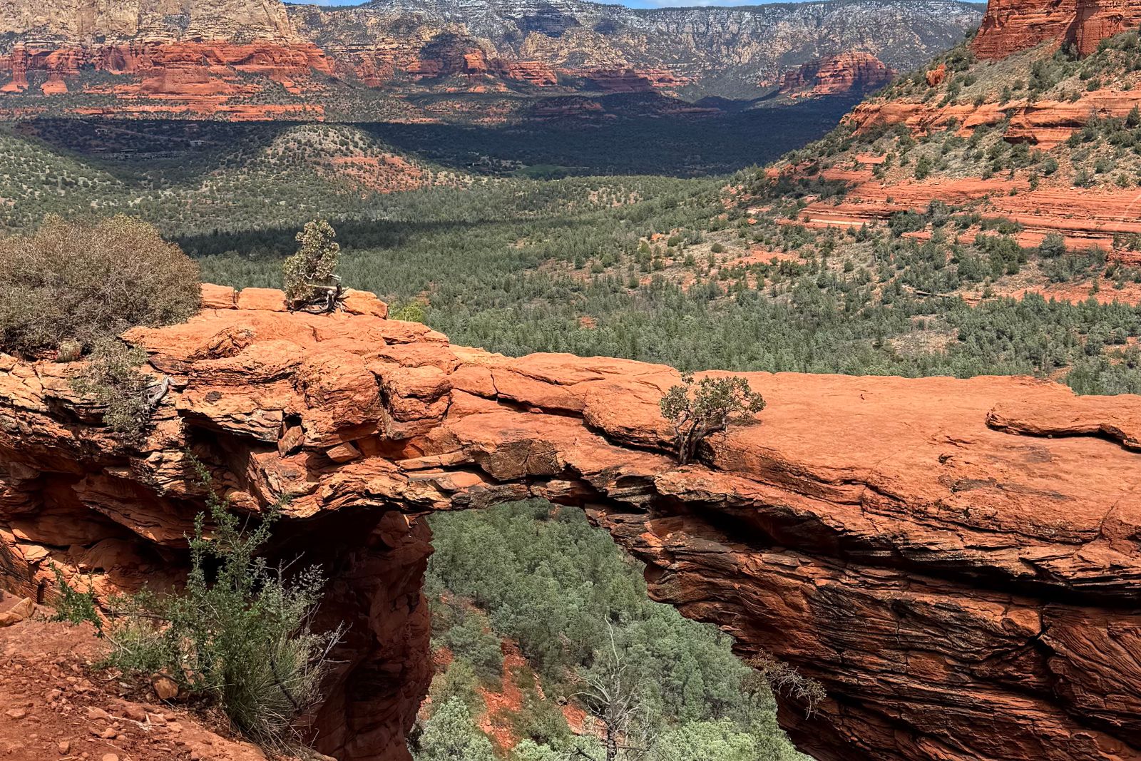
4. Devils Bridge
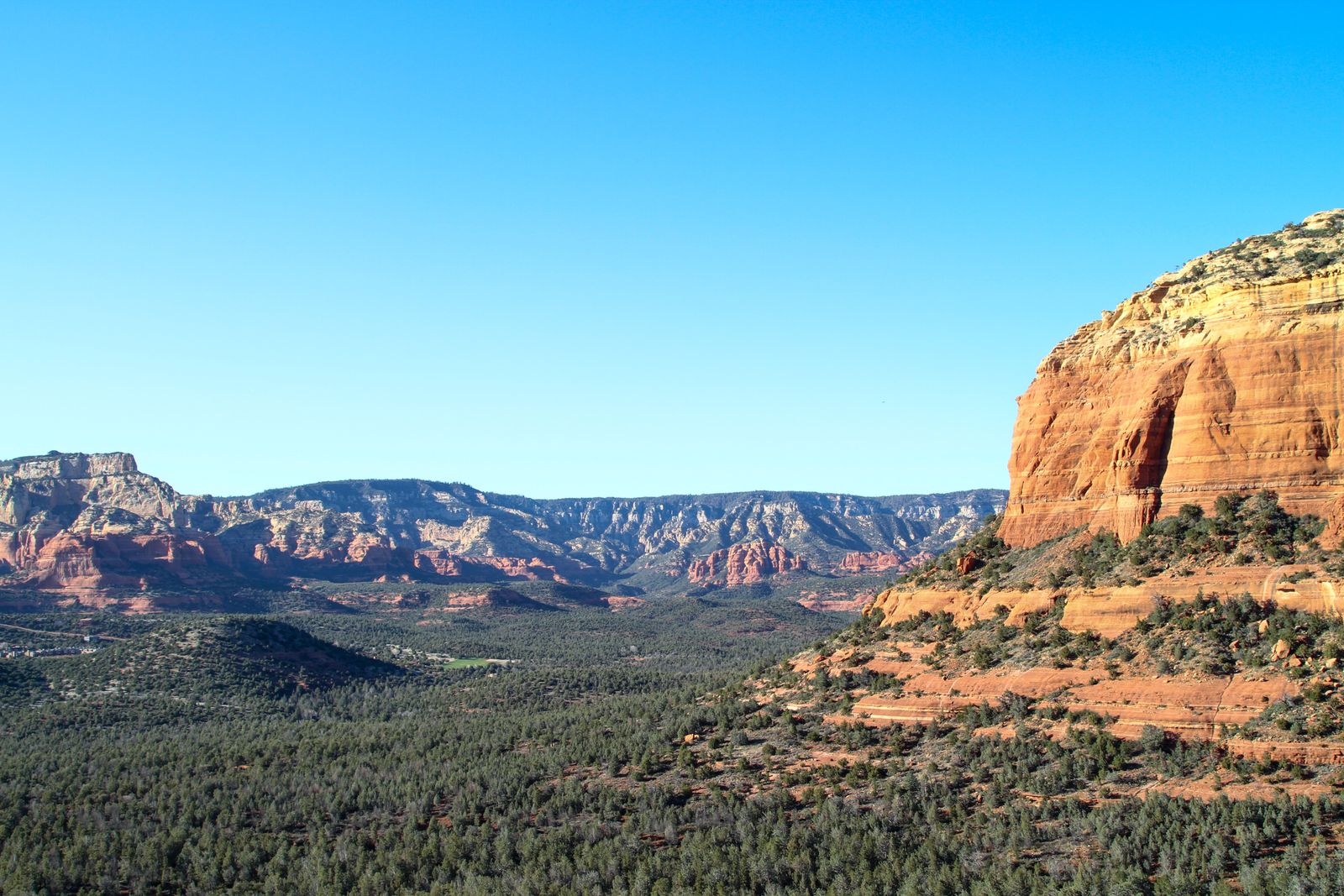
At the top, the trail levels out and you reach the arch. Devils Bridge spans a deep gap, about 50 feet high, with views across the valley to the red mesas and cliffs beyond. It formed over a very long time as wind and water wore away softer rock, leaving the stronger sandstone span behind.
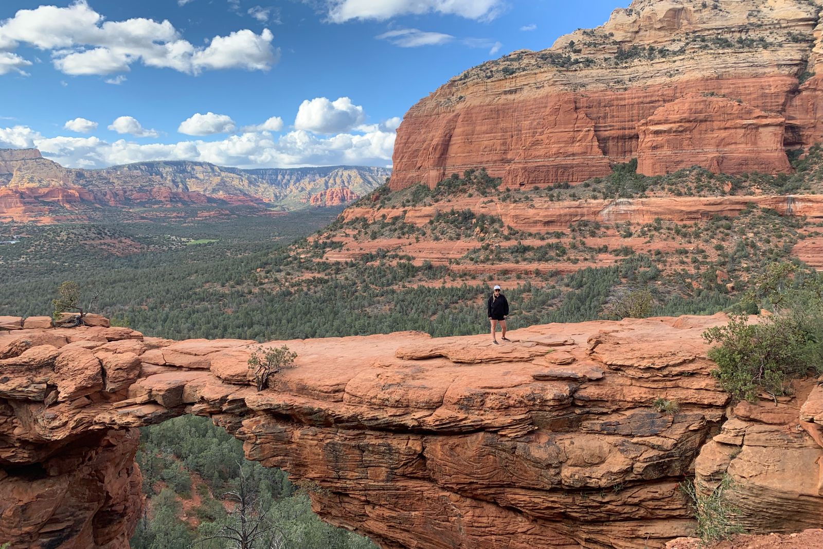
The classic photo is taken from a rocky viewpoint just below and to the side of the arch, looking up at someone standing on top. If there’s a line, it forms near the end of the bridge.
Can You Walk on Devils Bridge? Is It Safe?
Yes, people walk out onto the arch every day, and it’s wide enough for a careful walk to the middle. But there are steep drops on both sides and no railings, and falls have happened here.
- Don’t go out on the bridge when it’s wet, icy, windy or crowded.
- No jumping, running or posing near the edges.
- Never step backward to frame a photo without looking.
- Hold children’s hands, or skip the bridge with kids.
- You don’t have to walk on it. The view of the arch from the side is just as good.
The Photo Line: How Long Is the Wait?
On spring weekends and holidays, the line to stand on the bridge can take an hour or more. On quiet weekdays or early mornings, there may be no wait at all. Hikers usually take turns snapping photos for the person ahead of them. Keep your turn short, and be kind to the people waiting.
Devils Bridge at Sunrise
Sunrise is the best time to hike Devils Bridge. The red rocks glow, the air is cool, parking is easier, and the photo line is short or gone. The trade-off is starting in the dark.
- Bring a real headlamp, not just your phone.
- Download the map, and maybe scout the route the day before.
- Allow about an hour from Mescal to reach the arch at a steady pace.
- Take the rock steps slowly in low light.
- Wear a warm layer. Desert mornings are chilly, even in spring.
Sunset alternative: late afternoon is quieter too, and the arch catches warm light. Just bring a headlamp for the walk out.
Best Time of Year to Hike Devils Bridge
| Season | What to expect |
|---|---|
| Spring (March–May) | Ideal temperatures and wildflowers after wet winters. The busiest time, with full lots and long photo lines. |
| Summer (June–September) | Very hot by mid-morning. Start at dawn. July–September monsoon storms bring lightning and slick rock. |
| Fall (October–November) | Excellent weather and softer light. Still busy on weekends. |
| Winter (December–February) | Quieter and cool. Occasional snow or ice on the shaded steps. |
Right now (late October): it’s one of the best times of year for this hike, with comfortable days and cool mornings. Weekends are still busy, so go early or on a weekday.
Devils Bridge by Jeep: Off-Road Options
FR 152 is a popular off-road route, and several Sedona jeep tour companies drive it. A 4×4 can get you to the official trailhead, cutting the hike to about 1.6–2 miles round trip. But no vehicle reaches the arch itself; you still walk the last 0.8 mile and climb the rock steps.
- Your own vehicle: Only with genuine high clearance and off-road experience. Check the road after rain and your rental agreement first.
- Jeep tours: Fun if you want the ride, but confirm the tour actually includes time to hike to the arch. Many don’t.
- Regular car: No 4×4 needed if you start at Mescal or Dry Creek Vista.
Devils Bridge With Kids and Dogs
Kids: School-age kids who are used to hiking usually love it. The final steps are a fun scramble for them, but keep them close at the top, where the drop-offs are real. For little ones, the heat and four-mile round trip from Mescal can be too much; go early and bring lots of water and snacks.
Dogs: Leashed dogs are allowed in Coconino National Forest. The hot rock and lack of shade are hard on paws, though, so avoid warm afternoons and carry water for your dog.
What to Pack for Devils Bridge Trail
- At least 1–2 liters of water per person (more in summer). There’s no water on the trail.
- Shoes with grippy soles for the sandstone steps
- Sun hat, sunglasses and sunscreen
- Snacks, especially if you might wait in the photo line
- Headlamp for sunrise or sunset hikes
- A light jacket for cool mornings
- Red Rock Pass if you’re parking
- Offline map, charged phone and a small first-aid kit
Photography Tips
- The classic: from the viewpoint below and beside the arch, shoot up at a person on top, with the valley behind.
- Go wide: include the whole span and the cliffs around it to show the scale.
- Light: sunrise and late afternoon give the warmest red tones. Midday light is harsh and flat.
- On the way: the Chuckwagon Trail has great views of the red cliffs with desert plants in the foreground.
Sample Morning Plan
- Sunrise minus 1 hour: Park at Mescal and display your Red Rock Pass.
- By headlamp: Walk the Mescal and Chuckwagon trails to the official trailhead.
- Sunrise: Reach the arch, take photos with little or no line, and enjoy the view.
- Mid-morning: Back at the car before the heat and crowds peak.
- After: Breakfast in West Sedona, then explore more red rock trails in the afternoon.
Where to Stay Near Devils Bridge
- West Sedona: the closest base, about 10–15 minutes from Dry Creek Road, with good-value hotels and restaurants. It’s also handy for Boynton Canyon and Soldier Pass.
- Uptown Sedona: walkable shops, galleries and dining, about 20 minutes to the trailheads.
- Village of Oak Creek: south of town near Bell Rock and Cathedral Rock, but a longer drive to Devils Bridge.
- Cottonwood: cheaper rooms about 30 minutes southwest.
Spring weekends sell out early, so book ahead. Planning more of Arizona? See our Desert Botanical Garden Phoenix guide and our Echo Canyon Loop Trail guide in Chiricahua.

Devils Bridge Trail FAQs
How long is the Devils Bridge Trail in Sedona?
The official trail is 1.6 miles round trip from its 4×4 trailhead. From Mescal Trailhead it’s about 4 miles round trip, and from Dry Creek Vista about 4.6–5.8 miles.
Where do you park for Devils Bridge?
With a regular car, park at Mescal Trailhead or Dry Creek Vista. Both need a Red Rock Pass and fill early. Or take the free Sedona Shuttle.
Is the Devils Bridge hike hard?
It’s moderate. Most of it is easy, but the last stretch climbs steep rock steps, and the heat can make it tougher.
Can you drive to Devils Bridge?
Only to the official trailhead, and only with a high-clearance 4×4 on rough FR 152. From there, it’s still 0.8 mile on foot to the arch.
Is it safe to walk on Devils Bridge?
Many people do it safely, but there are steep drops and no railings. Stay off it when it’s wet, icy, windy or crowded, and never pose near the edges.
How long is the wait for a photo on Devils Bridge?
On busy days, an hour or more. Early mornings and weekdays usually have little or no wait.
Do you need a pass to hike Devils Bridge?
No hiking permit is needed, but you need a Red Rock Pass ($5 a day) or an interagency pass to park at the trailheads.
Does the Sedona Shuttle go to Devils Bridge?
Yes. The free shuttle stops at Dry Creek Vista and Mescal trailheads, from the West SR 89A Park & Ride, roughly 7 a.m. to 5:30 p.m. on its operating days.
Is sunrise good at Devils Bridge?
It’s the best time: great light, cool air and the shortest photo line. Bring a headlamp, since you’ll start in the dark.
Are dogs allowed on the Devils Bridge Trail?
Yes, on a leash. Avoid hot afternoons, as the rock gets very hot for paws.
How tall is Devils Bridge?
About 50 feet high. It’s the largest natural sandstone arch in the Sedona area.
Is the Devils Bridge Trail Worth It?
Yes. Few short hikes anywhere end at something as dramatic as a red rock arch floating over a canyon. It’s busy for a reason.
The secret is all in the planning: start at Mescal or take the shuttle, go at sunrise or late afternoon, carry more water than you think you need, and take the rock steps slowly. And remember, you don’t have to stand on the bridge to fall in love with the view.