
In the middle of the Mojave Desert, tucked between giant granite boulders, sits a stone dam built by cattle ranchers more than a hundred years ago. After a wet winter, water pools behind it and mirrors the rocks around it. In a dry year, it’s a sandy basin, but the walk is still one of the best short hikes in Joshua Tree.
The Barker Dam Trail in Joshua Tree is an easy 1.1-mile loop that packs in a lot: huge boulders, Joshua trees, a piece of ranching history, a protected rock art site and a real chance of spotting bighorn sheep.
Here’s everything you need, in plain English: distance, parking, the dam’s history, whether there will be water, the rock art, wildlife, photo tips and the best time to go.
Quick answer
- Distance: 1.1-mile loop (1.7 miles from Echo T parking).
- Elevation gain: about 50 feet.
- Time: 30–60 minutes.
- Difficulty: easy, with some rock steps and sand.
- Water in the dam: only after heavy rain. Usually dry.
- Highlights: historic dam, rock art, boulders, bighorn sheep.
- No dogs, no strollers.
- Best time: fall to spring, early morning.
Barker Dam Trail at a Glance
| Location | Near Hidden Valley, Joshua Tree National Park, California |
| Distance | 1.1 miles (1.8 km) loop |
| Elevation gain | About 50 feet |
| Time | 30–60 minutes |
| Difficulty | Easy |
| Surface | Packed dirt, granite boulders, sandy washes |
| Facilities | Parking and vault toilets; no drinking water |
| Shade | Very little |
| Pets / strollers | Not allowed |
| Parking | Often full September–May; Echo T lot nearby |
Where Is Barker Dam and How Do You Get There?
Barker Dam is just north of Hidden Valley in the western part of the park.
- Enter at the West Entrance (Joshua Tree town) and follow Park Boulevard.
- At Intersection Rock (across from Hidden Valley), turn north on the road signed for Hidden Valley Campground, Barker Dam and Keys Ranch.
- Follow the signs to the Barker Dam parking lot at the end of the road. About 2 miles from Park Boulevard.
Download the park map first; there’s little cell service.
Parking and the Echo T option
The lot fills quickly on busy days, especially from September to May. If it’s full, use the Echo T lot just to the west. The Echo T Connector Trail adds about 0.6 mile, making your hike about 1.7 miles total.
How Hard Is It?
It’s easy and mostly flat. You’ll walk on packed dirt and soft sand, step up a few rock stairs, and pass between boulders in a couple of narrow spots. No scrambling is needed. Most families and beginners do fine.
It isn’t wheelchair accessible, and the park doesn’t allow strollers on the trail.
Step-by-Step: The Barker Dam Loop
Most people walk the loop clockwise, reaching the dam first.
1. Into the boulders
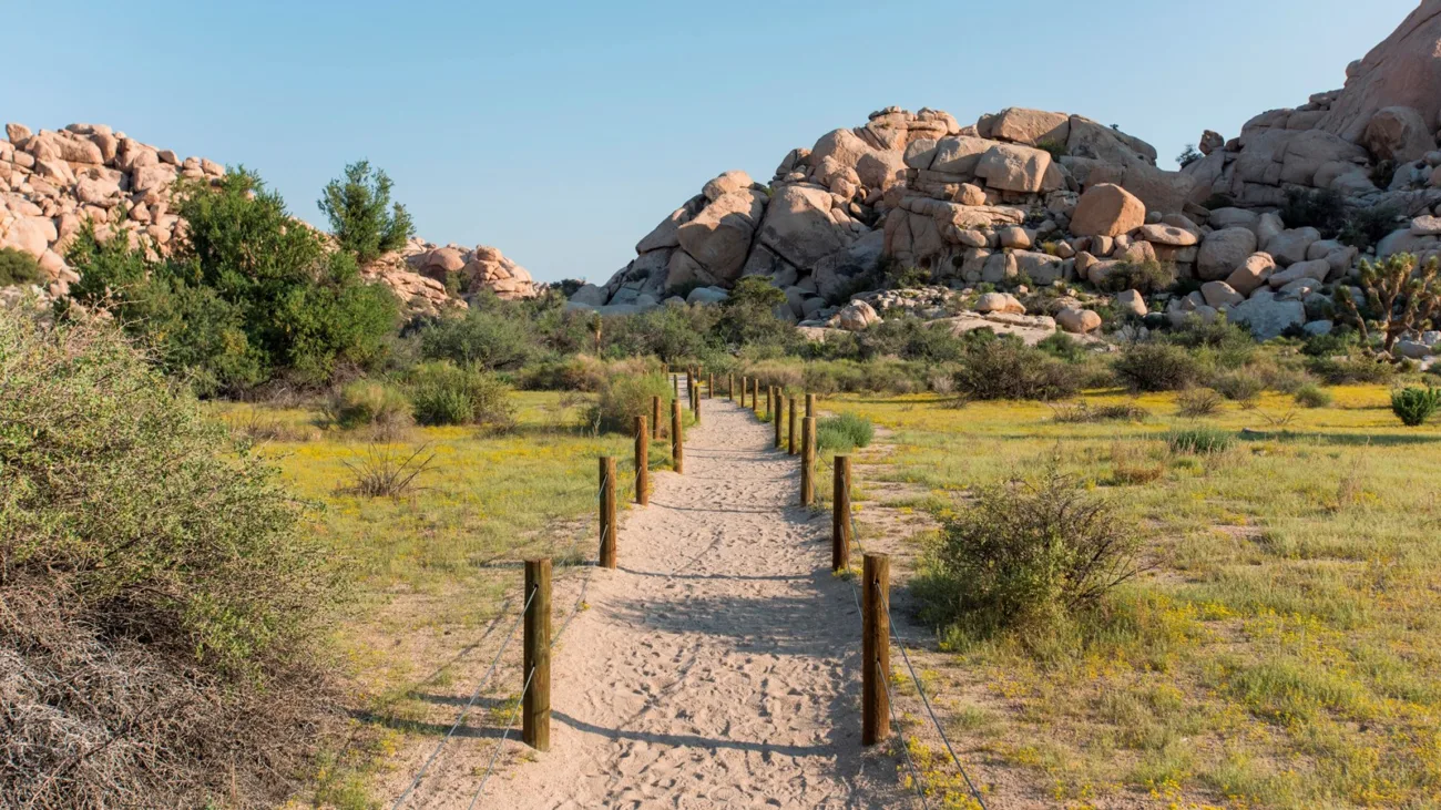
From the parking lot, a fenced path leads toward towering rock piles. Within minutes you’re walking between giant granite boulders, some the size of houses.
2. Barker Dam
The trail squeezes through the rocks and opens onto the reservoir and the old stone dam. If there’s water, this is the famous mirror view. If it’s dry, you’ll see a sandy basin with the curved concrete wall at one end. Either way, stay on the trail. Walking on the dam isn’t allowed.
3. Back through the desert
The loop heads away from the dam through a sandy wash with Joshua trees, yuccas and junipers. It’s open and quiet here.
4. The rock art site
Near the end of the loop, a short side path leads to a boulder with rock art and an information sign. View it from the sign area. Don’t touch or climb on the boulder.
5. Return to the lot
The trail curves back to the parking area past more boulders and plants.
Barker Dam History
Water was everything for desert ranchers. Around 1900, cattleman C.O. Barker and partners built a dam here to catch rain running off the rocks, creating a watering hole for cattle. In 1949–1950, rancher Bill Keys raised the dam about six feet to hold more water, and carved his name and other words into the top of it. The dam is also called Big Horn Dam.
Signs along the trail explain more. Keys Ranch, his old homestead, is nearby and can be seen on ranger-led tours.
Will There Be Water at Barker Dam?
Probably not, unless it’s rained a lot recently. The park says the reservoir is typically dry and fills only after heavy rain. Winter storms give you the best chance, but even a wet season doesn’t guarantee water.
- Don’t rely on old photos online. Ask at a visitor center for the latest.
- Even dry, the hike is worth it for the boulders, history and rock art.
Reflection photo tips (when there’s water)
- Go early morning, when the air is often still and the water is like glass.
- Get low near the water’s edge (from the trail) to double the rocks in the reflection.
- Late afternoon gives warm light on the boulders.
The Rock Art at Barker Dam
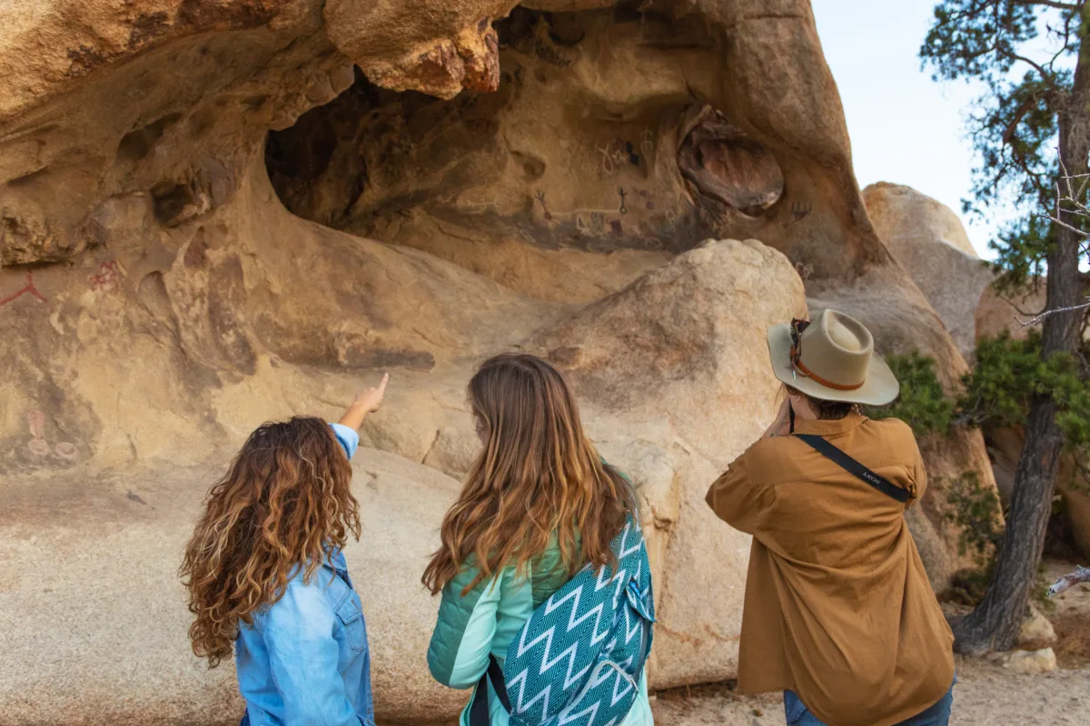
Native peoples lived in and traveled through this area long before ranchers came. The rock art here includes petroglyphs (designs pecked into the rock) and painted figures.
Something to know: many of the bright painted lines were traced over with paint decades ago, reportedly by a film crew, to make them show up better on camera. So not every bright color is original. The site is still culturally important and protected.
- Stay behind the sign area.
- Never touch, trace or climb on the rock. There may be more art on surfaces you can’t see.
- Take photos only.
Wildlife: Bighorn Sheep and More
Barker Dam is one of the best places in the park to spot desert bighorn sheep, especially when there’s water. Look for them on the rocks above the reservoir, early in the morning or late in the day. If you see some, stay quiet, keep your distance and use a zoom lens.
You may also see birds drinking at the water, lizards sunning on the rocks, ground squirrels and jackrabbits.
Best Time to Visit
| Season | What to expect |
|---|---|
| December–March | Best chance of water after storms; cool days |
| March–May | Pleasant, wildflowers in good years, very busy |
| October–November | Cooling down; dam usually dry |
| June–September | Hot, often over 100°F. Early morning only. |
Early morning is best all year: cooler, easier parking, softer light and more wildlife.
Is It Good for Families?
Yes. It’s short, flat and full of things for kids to see: giant rocks, an old dam, ranch history and maybe bighorn sheep. Keep kids close on rocky steps and at the rock art. Use a baby carrier instead of a stroller.
What to Bring
- Water: at least 1 liter per person (the park’s advice), more when warm.
- Shoes with grip for sand and rock steps.
- Hat, sunglasses and sunscreen.
- Camera with zoom for wildlife.
- Light jacket on winter mornings.
Safety and Respect
- Stay off the dam.
- Don’t touch the rock art.
- Avoid summer midday heat.
- Give wildlife plenty of space.
- Stay on the trail; desert soil takes years to recover.
Barker Dam vs. Hidden Valley vs. Ryan Mountain
| Trail | Distance | Difficulty | Best for |
|---|---|---|---|
| Barker Dam | 1.1 mi loop | Easy | History, rock art, wildlife |
| Hidden Valley | 1 mi loop | Easy | Giant boulders |
| Ryan Mountain | 3 mi | Difficult | Big summit views |
Barker Dam and Hidden Valley are 5 minutes apart, so many people do both in one morning.
Frequently Asked Questions
How long is Barker Dam Trail?
A 1.1-mile loop, or about 1.7 miles from Echo T parking.
How long does it take?
30–60 minutes.
Is it easy?
Yes, with about 50 feet of climbing and a few rock steps.
Does Barker Dam have water?
Only after heavy rain. It’s usually dry.
Are there petroglyphs?
Yes, at a protected rock art site. Some markings were painted over in the past.
Can you walk on the dam?
No, it’s closed to walking.
Are dogs or strollers allowed?
No.
Can you see bighorn sheep?
Sometimes, especially early in the day and when water is present.
Where do I park if the lot is full?
Use the Echo T lot to the west and take the connector trail.
Is it worth it when dry?
Yes, for the boulders, history and rock art.
Final Thoughts
Barker Dam is a little bit of everything Joshua Tree has to offer in one easy loop: boulders, desert plants, history, rock art and wildlife. Go early, keep your expectations for water low, and you’ll leave happy either way.
Next up: Hidden Valley, Ryan Mountain, Fortynine Palms Oasis or our list of the best hikes in Joshua Tree.
Official info: NPS: Barker Dam Trail and Joshua Tree alerts and conditions.