
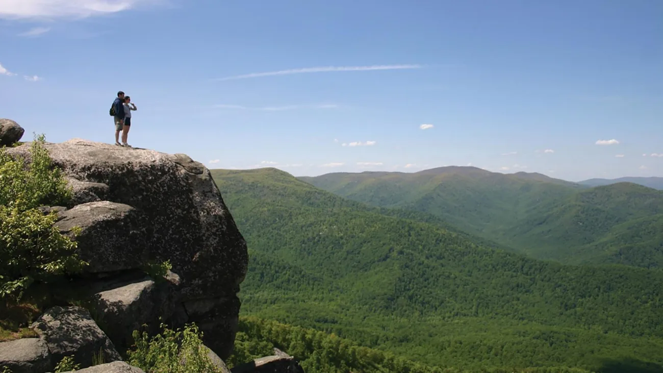
Most hikes in Virginia are long walks through the woods. Old Rag is a jungle gym. Halfway up, the trail turns into a maze of giant granite boulders: you squeeze through cracks, climb up rock chimneys, hop across gaps and pull yourself over ledges, all with huge views over the Blue Ridge.
The Old Rag Mountain hike in Shenandoah National Park is the most famous, and most challenging, day hike in the park. It needs planning: a day-use ticket in most months, an early start for parking, and enough energy for 9.4 miles. This guide covers it all in plain English.
Quick answer
- Classic route: Old Rag Circuit, 9.4-mile loop.
- Elevation gain: 2,348 feet.
- Time: about 7.5 hours (NPS estimate).
- Difficulty: very strenuous, with a long hands-on rock scramble.
- Tickets: advance day-use ticket required March 1–November 30 (plus park entrance pass).
- Parking: Old Rag Parking Area near Nethers. The main lot was closed for rebuilding May–November 2026; use the overflow lots.
- No scramble option: Berry Hollow route, 5.4 miles round trip.
- Dogs: not allowed.
Old Rag at a Glance
| Location | East side of Shenandoah National Park, Virginia |
| Route | Ridge Trail → summit → Saddle Trail → Weakley Hollow Fire Road → Ridge Access Trail |
| Distance | 9.4-mile loop |
| Elevation gain | 2,348 feet |
| Summit | About 3,284 feet |
| Time | About 7.5 hours |
| Difficulty | Very strenuous |
| Ticket | $2 per person, March 1–November 30 |
| Dogs | Not allowed |
| Best seasons | Spring and fall |
Where Is Old Rag?
Old Rag stands alone on the east side of Shenandoah National Park, separate from the main ridge. You can’t reach the classic trailhead from Skyline Drive. Instead, you drive country roads to the park boundary near the village of Nethers.
Directions (from the NPS)
- From Sperryville: Route 211 to Route 522 south for 0.8 mile, right on Route 231 for 8 miles, right on Route 601, then follow signs about 3 miles.
- From Madison: Route 29 Business to Route 231 for 12.8 miles, left on Route 602, and follow signs about 3 miles.
It’s about 2 hours from Washington, D.C. Download directions; cell service is spotty near the mountain.
Day-Use Tickets: You Need One
From March 1 through November 30, everyone hiking the Ridge, Saddle or Ridge Access trails needs an Old Rag day-use ticket, bought in advance, in addition to a Shenandoah entrance pass.
- Cost: $2 per person on Recreation.gov.
- When: most tickets release 30 days ahead; a second batch releases 5 days ahead.
- Valid: only for your chosen date.
- Not a parking pass: a ticket doesn’t guarantee a parking spot.
October weekends sell out fast. From December through February, no Old Rag ticket is needed, but you still need the park entrance pass.
Parking (2026 Construction Update)
The main Old Rag parking lot closed on May 4, 2026 for a rebuild (new paving and drainage, a permanent contact station and a new vault toilet) with work expected to finish in November 2026. During construction, hikers use the overflow lots and a temporary trail route, with portable toilets in both lots.
- Check the park’s alerts to see whether the main lot has reopened.
- Arrive early; lots fill on weekends, especially in fall.
- Never park on the roadside or in private driveways.
How Hard Is Old Rag?
The park rates it very strenuous, and it earns that:
- Distance: 9.4 miles is a full day.
- Climbing: 2,348 feet, much of it steep.
- The scramble: about a mile of boulder climbing that uses your arms as much as your legs.
- Heights: some spots have real drops nearby.
- Bottlenecks: on busy days, you’ll wait in line at tight spots.
Someone who can walk 10 flat miles may still find Old Rag exhausting. It’s not a good first big hike. Shorter people sometimes need a boost at a few high steps.
Step-by-Step: The Old Rag Circuit
Hike it clockwise, so you climb the scramble going up, not down.
1. Ridge Access and Ridge Trail
From the parking area, follow signs to the blue-blazed Ridge Trail. It climbs steadily through oak and hickory forest on switchbacks, a normal but steep Appalachian climb.
2. First views
As you climb, the trees open at granite outcrops with views over the valley farms and ridges.
3. The rock scramble
Then the trail becomes a puzzle. Follow the blue blazes painted on rocks through about a mile of boulders. Expect to:
- Squeeze through narrow slots between huge rocks.
- Climb down into a crack and back out the other side.
- Pull yourself up chest-high ledges.
- Step across gaps.
Keep both hands free. Take your time and let faster groups pass where it’s safe. If a move feels wrong, look for the blazes; there’s usually an easier line.
4. The summit
The top is a jumble of boulders with 360-degree views across the Shenandoah Valley and the Blue Ridge. It’s one of the best views in Virginia. Find a rock, eat lunch and stay back from edges.
5. Saddle Trail down
The descent on the blue-blazed Saddle Trail is a normal, rocky trail with no scrambling. You’ll pass Byrd’s Nest Shelter and Old Rag Shelter (day-use only).
6. Weakley Hollow Fire Road
Below Old Rag Shelter, the trail becomes a fire road. At the T-intersection turn right, then bear right onto the yellow-blazed Weakley Hollow Fire Road. It’s long, gentle and shady along streams.
7. Back to the car
Turn right on the Ridge Access Trail, then left on the Ridge Trail back to the start. This last stretch feels long on tired legs.
Old Rag Without the Scramble: Berry Hollow
Want the summit without the boulders? Take the Berry Hollow route: Berry Hollow Road (fire road) to the Saddle Trail and up to the summit.
| Route | Distance | Gain | Time | Main challenge |
|---|---|---|---|---|
| Old Rag Circuit | 9.4 mi | 2,348 ft | About 7.5 hrs | Long, with rock scramble |
| Berry Hollow (out and back) | 5.4 mi | About 1,760 ft | About 6 hrs | Steep, but no scramble |
Berry Hollow parking is very small, and you still need a day-use ticket in season.
Best Time to Hike Old Rag
| Season | What to expect |
|---|---|
| Spring (April–May) | Green leaves, mild temps, wildflowers. Rain makes granite slick. |
| Summer | Hot, humid, buggy, with afternoon storms. Start early, bring lots of water. |
| Fall (Sept–Nov) | Best weather and colors (peak usually mid to late October). Busiest; book tickets early. |
| Winter | No ticket needed, quiet trails, open views. Ice on the scramble can make it dangerous. |
Weekdays are much less crowded than weekends.
Safety Tips
- Skip the scramble in rain, ice or thunderstorms.
- Start early. Never be in the scramble after dark.
- Carry at least 3 liters of water in warm weather; there’s none on the mountain.
- Use a small backpack that won’t snag in tight spots.
- Stow trekking poles before the scramble.
- Know your turnaround time; the descent is still 4–5 miles.
- Rescues on Old Rag are common and slow. Don’t push past your limits.
What to Bring
- Day-use ticket (on your phone or printed) and park pass
- 2–3+ liters of water
- Lunch and salty snacks
- Shoes with sticky rubber soles
- Small backpack
- Light gloves (optional) for rough granite
- Layers and rain jacket
- Headlamp, first-aid kit, offline map
Kids and Dogs
Dogs are not allowed on Old Rag trails. Kids: confident, sporty older kids often love the scramble, but it’s long and has real drops. Younger kids should try an easier Shenandoah hike first. See our best hikes in Shenandoah National Park for family options.
Where to Stay
- Sperryville: charming small town about 25–30 minutes away.
- Luray: more hotels; also near Luray Caverns.
- Culpeper or Madison: more options to the east.
Old Rag vs. Other Virginia Hikes
| Hike | Distance | Highlight |
|---|---|---|
| Old Rag Circuit | 9.4 mi | Rock scramble, 360° summit |
| McAfee Knob | About 7.8 mi | Famous ledge photo spot |
| Hawksbill (Shenandoah) | About 2.9 mi loop | Highest point in the park |
| Marys Rock (Shenandoah) | About 3.7 mi | Summit views, no scramble |
Frequently Asked Questions
How long is the Old Rag hike?
The classic circuit is 9.4 miles.
How long does it take?
About 7.5 hours on average; some people take longer on busy days.
Do I need a ticket?
Yes, from March 1 to November 30: a $2 day-use ticket from Recreation.gov, plus a park pass.
Is Old Rag dangerous?
The scramble has drops where a fall could be serious, especially when rock is wet or icy.
Can I avoid the scramble?
Yes, hike the Berry Hollow route to the summit (5.4 miles round trip).
Where do I park?
At the Old Rag Parking Area near Nethers. During 2026 construction, use the overflow lots.
Are dogs allowed?
No.
What’s the best month?
October for colors, May for green and mild weather. Book tickets early.
Can I reach Old Rag from Skyline Drive?
Not the classic trailhead. You drive local roads to the park boundary.
Is Old Rag worth it?
Yes. It’s the most exciting day hike in Shenandoah.
Final Thoughts
Old Rag is part hike, part climbing adventure, and the summit view makes every boulder worth it. Book your ticket, start early, wear sticky shoes and keep your hands free. If the scramble isn’t your thing, Berry Hollow gets you the same summit with less drama.
Official info: NPS: Old Rag Circuit, NPS: Old Rag day-use ticket FAQ and Recreation.gov tickets.