
Most hikes follow a trail. The Narrows follows a river.
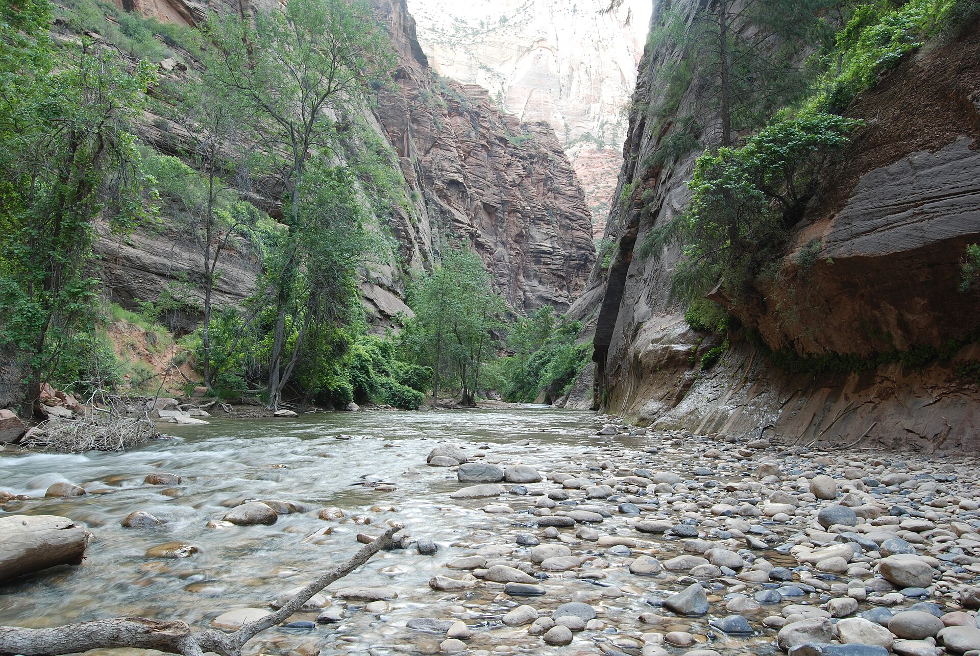
You walk a paved path to the end of the dry trail, step into the Virgin River, and keep going upstream between sandstone walls that climb a thousand feet above your head. For most of the hike your feet are in the water. Sometimes it’s ankle-deep. Sometimes it’s at your knees. And now and then, it’s a lot deeper than you expected.
That’s what makes The Narrows in Zion National Park so special, and why it needs more planning than a normal trail. The same route can be easy one day and closed the next, depending on river flow, water temperature and storms you can’t even see. The good news: you don’t need a permit for the classic hike, and you don’t need to go far for it to be one of the best days of your trip. This guide covers the route, permits, river flow, gear, timing and the safety details that really matter.
⚠️ October 2026 update: The bottom-up Narrows, the Riverside Walk and the Zion Canyon shuttle are operating as normal, subject to daily river and weather conditions. But the Zion-Mount Carmel Highway has been closed between Canyon Junction and the East Entrance since a large rockfall on September 30, 2026. That road is the usual way from Springdale to the top-down trailhead at Chamberlain’s Ranch, so top-down trips now involve a much longer drive around. Check the park’s alerts before you go.
What Is The Narrows in Zion National Park?
The Narrows is the narrowest section of Zion Canyon, where you hike up the Virgin River itself between walls up to 1,000 feet tall, with the canyon sometimes only 20 to 30 feet wide. Most people hike it “bottom-up” from the Temple of Sinawava (shuttle stop 9). No permit is needed for that route, and you can turn around whenever you like, up to Big Spring, about 5 miles in. The 16-mile “top-down” route from Chamberlain’s Ranch needs a wilderness permit.
The Narrows at a Glance
| Detail | What to Know |
|---|---|
| Trailhead | Temple of Sinawava, Zion Canyon shuttle stop 9 |
| Dry approach | Riverside Walk, about 1 mile each way, paved |
| Bottom-up distance | As short as you like, up to about 10 miles round trip to Big Spring |
| Bottom-up permit | Not needed |
| Top-down distance | About 16 miles one way from Chamberlain’s Ranch |
| Top-down permit | Required (day hike or one night camping) |
| Time in the water | At least 60% of a bottom-up hike; at least 80% top-down |
| Difficulty | Moderate to strenuous, depending on flow and distance |
| Closes when | Flow above 150 CFS (120 CFS for top-down) or a Flash Flood Warning |
| Best season | Usually summer to early fall, conditions permitting |
| Main risks | Flash floods, cold water, slippery rocks, hypothermia, cyanobacteria |
| Must-have gear | Closed-toe shoes, sturdy walking stick, quick-dry layers, dry bag, drinking water |
| Pets | Not allowed |
In This Guide
- How to get to The Narrows
- Bottom-up vs top-down
- The bottom-up route, mile by mile
- Permits and rules
- River flow (CFS) and closures
- Flash floods, cold water and cyanobacteria
- What to wear and bring
- Best time to hike, month by month
- Beginners, kids, non-swimmers and solo hikers
- FAQs
Is The Narrows Worth Hiking?
Yes. On most Zion trails, you look down into the canyon. In The Narrows, you’re inside it. The walls close in, the light bounces orange and gold off the sandstone, hanging gardens drip from the cliffs, and the river decides how fast you move. It feels nothing like Angels Landing or Emerald Pools.
You also don’t have to “finish” it. Even an hour in the river gives you a real taste. Many people have their best Narrows day by going a couple of miles, soaking it in and turning back while they still have energy.
How to Get to The Narrows
Where Does The Narrows Start?
The bottom-up hike starts at the Temple of Sinawava, the last stop (stop 9) on the Zion Canyon shuttle. From there you follow the paved Riverside Walk about a mile along the river to where the path ends. Past that point, the river is the trail.
The Temple of Sinawava has restrooms and a water bottle filling station. Use both. There are no toilets in The Narrows, and you can’t drink the river water.
Taking the Shuttle
During shuttle season, private cars can’t drive the Zion Canyon Scenic Drive, so you’ll ride the free park shuttle. In 2026, it runs from March 7 to November 28, and again from December 26 to January 2. There’s no ticket or reservation, and buses come every 5 to 10 minutes. The ride from the visitor center to the Temple of Sinawava takes about 45 minutes, so add roughly 90 minutes of shuttle time to your day.
Outside shuttle season (in 2026, November 29 to December 25, and early January to early March), you can usually drive your own car to the Temple of Sinawava, but parking is limited.
Don’t Miss the Last Shuttle
| 2026 Dates | First Shuttle (Visitor Center) | Last Shuttle Out of Temple of Sinawava |
|---|---|---|
| Mar 7 – May 16 | 7 a.m. | 7:15 p.m. |
| May 17 – Sep 12 | 7 a.m. | 8:15 p.m. |
| Sep 13 – Oct 24 | 7 a.m. | 7:15 p.m. |
| Oct 25 – Nov 28 | 7 a.m. | 6:15 p.m. |
| Dec 26 – Jan 2 | 8 a.m. | 5:45 p.m. |
Remember you still have to wade back and walk the Riverside Walk after your turnaround. Aim to reach the stop well before the last bus. If you miss it, it’s a long walk of about 8 miles back to the visitor center.
Bottom-Up vs Top-Down Narrows
| Bottom-Up | Top-Down | |
|---|---|---|
| Start | Temple of Sinawava (shuttle stop 9) | Chamberlain’s Ranch, outside the park |
| Permit | Not needed | Wilderness permit required |
| Distance | Your choice, up to about 10 miles round trip | About 16 miles one way |
| Time | 1 hour to a full day | 10 to 14 hours, or 2 days with a camping permit |
| Direction | Upstream, then back down | Downstream only |
| Closes above | 150 CFS | 120 CFS |
| Flexibility | Turn around anytime | Fully committed once you start |
| Transport | Park shuttle | Private shuttle or car to a remote trailhead |
| Best for | Almost everyone | Experienced, fit wilderness hikers |
Bottom-Up: Best for Most Visitors
For a first visit, go bottom-up. You walk upstream as far as you want, then turn around and come back the same way. There’s no minimum distance and no set goal. Thirty minutes, three hours or all day to Big Spring are all valid hikes. If you get tired, cold, nervous about the current or see the weather turn, you just head back.
Top-Down: The 16-Mile Wilderness Trip
The top-down route starts at Chamberlain’s Ranch on the plateau northeast of the park and follows the North Fork of the Virgin River 16 miles down to the Temple of Sinawava, dropping about 1,300 feet. The park says at least 80% of it is spent wading, walking and sometimes swimming, and hikers should be ready for deep sections where swimming is required, even at low flow. It takes most people 10 to 14 hours in one long day. With an overnight permit, you can split it over two days at one of 12 designated campsites roughly halfway down.
Once you start, you’re committed. There are few ways out of the canyon, so you need a solid weather window, strong fitness, cold-water gear and good river-hiking judgment. You also need your own ride to Chamberlain’s Ranch. Several Springdale outfitters run hiker shuttles. Normally that’s about an hour and a half from Springdale via the Zion-Mount Carmel Highway, but with that highway closed after the September 2026 rockfall, the drive is currently much longer. Confirm the route with your shuttle company.
Rough top-down timetable (from the park, allowing for breaks): Bulloch’s Cabin about 1 hour, the First Narrows about 3.5 hours, a waterfall about 4.25 hours, Deep Creek about 5 hours, Kolob Creek about 5.75 hours, Big Spring about 7.25 hours, Orderville Canyon about 10 hours, and the Temple of Sinawava after about 12 hours.
The Bottom-Up Narrows Route, Step by Step
Distances below are approximate, measured from the Temple of Sinawava. They help you plan a realistic turnaround, but your pace in the water decides how far you get.
| Landmark | Approx. Distance From Trailhead | What You’ll Find |
|---|---|---|
| End of Riverside Walk | 1 mile | Paved path ends; step into the river |
| Mystery Falls | Just past the start | A thin waterfall sliding down the left wall |
| Orderville Canyon junction | About 2.5 miles | Side canyon on the right; great rest spot |
| Wall Street | About 2.5 to 3.5 miles | The narrowest, tallest, most famous section |
| Floating Rock and beyond | About 3.5 to 4.5 miles | Quieter, wilder river with fewer people |
| Big Spring | About 4.7 to 5 miles | Springs pouring from the wall; bottom-up limit |
Riverside Walk to the River
The first mile is an easy, paved stroll beside the river, with hanging gardens on the cliffs and a good chance of seeing squirrels, mule deer and canyon wrens. It takes most people 20 to 30 minutes each way. At the end there’s a wide, sandy area where people swap shoes, adjust gear and step into the water.
The Lower Narrows to Orderville Canyon
The first stretch is the busiest. The canyon gets steadily narrower and taller, you’ll pass Mystery Falls on the left, and you’ll cross the river many times, picking the shallowest line. Reaching the Orderville Canyon junction is a satisfying goal for many first-timers. You can wander up to a quarter mile into Orderville, but no farther from this direction.
What Is Wall Street in The Narrows?
Just above Orderville Canyon, the walls squeeze in and shoot straight up. This is Wall Street, the section you’ve probably seen in photos. The canyon can be little wider than the river, the light turns soft and reflected, and the scale is hard to believe. It’s the highlight for most hikers. But if you’re short on time or the water is high, don’t treat it as a must. The lower Narrows is still stunning.
Beyond Wall Street to Big Spring
Above Wall Street, the crowds thin out and the canyon feels wilder, with more deep pools and boulder hopping. Bottom-up hikers must turn around at Big Spring, where water pours out of the canyon wall. Going all the way there and back is a strenuous, roughly 10-mile, all-day trip, and the park caps group size at 12 people above the Orderville junction.
How Long Does The Narrows Take?
Walking upstream through water is much slower than walking on a trail. Many people cover only about 1 mile an hour in the river, sometimes less at higher flows.
| Plan | Rough Round-Trip Time (from Temple of Sinawava) |
|---|---|
| Riverside Walk only | 1 to 1.5 hours |
| Short taste of the river | 2 to 3 hours |
| To Orderville Canyon | 3.5 to 5 hours |
| Through Wall Street | 5 to 7 hours |
| To Big Spring | 8 to 10+ hours (full day) |
Your actual time depends on river flow, water depth, crowds, balance, fitness, water temperature and how many photos you stop for. A good rule: when you’ve used about half your time or energy, turn around.
How Difficult Is The Narrows?
The Narrows is moderate to strenuous. The distance isn’t the hard part. The challenge is walking upstream against moving water over slippery, rounded rocks you often can’t see. The park compares it to walking on wet bowling balls, and that’s accurate. Your legs, ankles and core work the whole time, and the higher the flow, the harder it gets.
There’s very little elevation gain on the bottom-up route, so it isn’t a lung-buster like Angels Landing. But after several hours of balancing in cold water, most people are more tired than they expected.
Do You Need a Permit for The Narrows?
No permit is needed for the bottom-up hike from the Temple of Sinawava up to Big Spring. A wilderness permit is required for every top-down trip from Chamberlain’s Ranch, whether you do it in one day or with one night of camping.
Top-down permits come through the park’s wilderness permit system, with an advance reservation window and some last-minute availability, and are issued only when the river is open. Check the park’s Narrows permits page for current dates and how to apply, since the process can change.
Narrows Rules to Know
- Bottom-up limits: no farther than Big Spring, and no more than a quarter mile into Orderville Canyon.
- Group size: a maximum of 12 people above the Orderville junction.
- No pets in The Narrows (they’re also not allowed on the Riverside Walk).
- No inflatable tubes on any river in the park.
- No guided tours in the wilderness section. Commercial guides can’t lead groups up The Narrows.
- Pack out everything, including food scraps. There are no toilets, so use the restroom before you start, and carry a human waste bag for emergencies.
Narrows River Flow (CFS) Explained
River flow is measured in cubic feet per second (CFS) at a gauge on the North Fork of the Virgin River, and it’s the single most useful number for planning. Here’s how the park describes conditions at different flows:
| Flow | What It’s Like |
|---|---|
| Below 70 CFS | Moderately difficult. Knee-deep crossings on a slippery, uneven bottom, with frequent pools up to waist-deep |
| 70 to 120 CFS | Challenging. Walking against the current gets hard; thigh-deep crossings are frequent and pools can be chest-deep |
| 120 to 150 CFS | Very challenging. Bottom-up still open; top-down closed |
| Above 150 CFS | Closed to all travel |
Is 100 CFS Safe for The Narrows?
At 100 CFS the bottom-up route is open if there’s no flash flood warning, but it’s a very different hike from 40 or 50 CFS. The current pushes hard, crossings are deeper, and you’ll move much more slowly. Fit, confident hikers with a good stick often still enjoy it. Families, beginners and anyone unsure in moving water should plan a short trip or pick another day. No single CFS number makes The Narrows “safe.” Weather, cold, your fitness and your group all matter too.
When Does The Narrows Close?
The Narrows closes when the river runs above 150 CFS (bottom-up) or 120 CFS (top-down), and whenever the National Weather Service issues a Flash Flood Warning. It stays closed for at least two hours after a warning is lifted.
Long closures usually come from spring snowmelt, typically April and May and sometimes later. How long depends on the winter. In 2023, a huge snow year, it was closed from early April until mid-June. In 2024 it closed from mid-April to mid-May. In drier years it can stay open most of the spring. Shorter closures come from summer monsoon storms, usually July through September.
Narrows Safety: What You Need to Know
Flash Floods
Flash floods are the biggest danger in The Narrows. A storm miles upstream, one you’ll never see or hear, can send a surge of water down the canyon in minutes, even seconds. It can carry mud, rocks and whole tree trunks, and in the narrowest sections there may be no high ground to climb to.
Before you go, check the daily flash flood potential rating at the visitor center or online. If it’s “Probable” or “Expected,” don’t go in. Risk is highest during the monsoon, July through September, but the park warns flash floods can happen at any time of year.
Warning signs: the water suddenly turns muddy, rises or speeds up, you see floating twigs and debris, or you hear a roar upstream. Don’t wait to see what happens. Get to the highest ground you can reach immediately, and stay there until the water drops.
Cyanobacteria: Don’t Drink the Water or Go Under
Zion monitors toxic cyanobacteria in the Virgin River. The park’s advice is simple: don’t drink the river water, even filtered (normal hiking filters and tablets don’t reliably remove the toxins), and don’t put your head under. Keep a close eye on children, who are more at risk, and never let dogs near the river. Bring all the drinking water you’ll need from the Temple of Sinawava.
Hypothermia, Even in Summer
This one surprises people. It can be 100°F in Springdale while you spend hours wet, in the shade, in water much colder than the air, with a breeze funneling through the canyon. The park says The Narrows is cooler than anywhere else in Zion Canyon. Watch for uncontrolled shivering, clumsiness, confusion or slurred speech. If someone shows these signs, get them out of the water, swap wet layers for dry ones, get food into them and head back.
Slips, Twisted Ankles and Crushed Toes
These are the most common injuries. Take short steps, keep your weight low, test each foot placement, use your stick as a third leg, and cross where the water is calm and shallow rather than where it’s fast and narrow. Face upstream when crossing strong current.
What to Wear and Bring for The Narrows
Shoes
Wear closed-toe shoes with good grip. Sturdy hiking shoes or boots work, and dedicated canyoneering shoes work best. They’ll get completely soaked, which is normal. The park specifically says sandals, Crocs and bare feet are not appropriate, because they often lead to twisted ankles and crushed toes.
A Walking Stick
Bring one. A sturdy wooden stick or strong trekking pole gives you a third point of contact on the slippery bottom and lets you test water depth before you step. In strong current, one solid stick is often more useful than two light trekking poles. Please don’t break branches off trees in the canyon for this.
Clothing
Wear quick-drying, non-cotton layers like synthetic or wool. Wet cotton gets cold and heavy fast. Even in summer, pack a warm layer in your dry bag. In spring, fall and winter, cold-water gear matters a lot more (see below).
Narrows Packing List
- Closed-toe shoes with grip, plus neoprene socks when the water is cold
- Sturdy walking stick
- Quick-dry clothes and a warm spare layer
- Plenty of drinking water (the park suggests about a gallon per person per day in hot weather)
- Salty snacks and lunch
- Dry bag or waterproof pack liner
- Waterproof case for your phone and car keys
- Small first-aid kit
- Headlamp for long days
- Human waste bag and a bag for your trash
There’s no cell signal in the canyon, so download a map and check the forecast before you board the shuttle.
Should You Rent Narrows Gear?
The park doesn’t rent gear, but several outfitters in Springdale do, and most let you pick it up the evening before so you can catch an early shuttle. Packages usually come in two levels:
| Package | What’s Included | When It Makes Sense |
|---|---|---|
| Warm-weather package | Canyoneering shoes, neoprene socks, walking stick | Summer and early fall |
| Cold-weather package | The above plus dry pants or a dry bib, sometimes a dry bag | Late spring, October, November |
| Dry suit | Full waterproof suit worn over warm layers | Winter and very cold water |
On a hot summer day at low flow, your own sturdy hiking shoes and a stick are usually enough. Rental shoes are mainly worth it for their grip and because they save your own boots from a soaking. When the water is cold, rented dry pants or a dry suit can be the difference between a great day and a miserable, risky one. Book ahead on busy weekends.
Best Time to Hike The Narrows
Summer through early fall usually gives the best mix of lower flow and warmer water, and it’s when most people hike The Narrows. Late August through September is often the sweet spot. But there’s no guaranteed month: spring snowmelt can close it for weeks, and summer monsoon storms can close it for a day. Always check conditions the morning of your hike.
| Month | Typical Narrows Conditions |
|---|---|
| Dec – Feb | Often open but very cold water; dry suit territory; ice possible; short days |
| Mar – Apr | Snowmelt often pushes flow over 150 CFS; frequently closed in wet years |
| May | Could be excellent or closed; hardest month to predict |
| June | Often reopens as runoff drops; warming water; long days |
| July – Aug | Warmest water and low flow, but peak flash-flood season |
| September | Often the best balance; storms ease later in the month |
| October | Usually open and stable; water getting cold; cold-weather gear helps |
| November | Cold water, short days, quiet canyon, golden cottonwoods early on |
Spring: plan The Narrows as a bonus, not the centerpiece. Summer: warm water but check the flash flood forecast every morning, and don’t rely on a “30% chance of rain” app forecast. Canyon risk is different from rain risk. Fall: more stable weather, but colder water and shorter days. Winter: it becomes a cold-water canyon trip, not the season to improvise.
For month-by-month temperatures and storm patterns, see our Zion National Park weather guide, and for crowds and the shuttle schedule, our guide to the best time to visit Zion National Park.
Best Time of Day
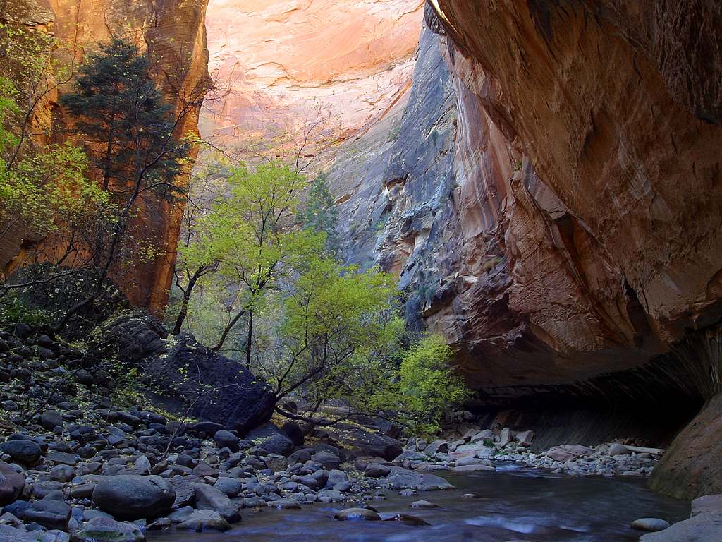
Go early. Catch one of the first shuttles (7 a.m. for most of 2026). You’ll get quieter water, more daylight, more margin if conditions change, and no rush for the last bus. The lower Narrows is busiest from about 10 a.m. to 2 p.m. In summer, mornings also tend to be calmer, before afternoon storms build. For photos, late morning to early afternoon is when sunlight hits the upper walls and bounces that famous orange glow down into the canyon.
Is The Narrows Right for You?
Is The Narrows Good for Beginners?
Yes, for prepared beginners on a good day. Because you can turn around anytime, it’s easy to tailor. Just don’t mistake the paved Riverside Walk for the whole hike. Once you’re in the river, you need balance, decent footwear, comfort in moving water and the willingness to turn back. For most first-timers, 2 to 4 hours in the river is plenty.
Can Kids Hike The Narrows?
Active older kids often love it, on the right day. What matters more than age is the child’s height compared with the water depth, their balance, how well they swim, how they handle cold, and the flow that day. Young children get cold quickly and are more at risk from cyanobacteria, so keep their heads out of the water. For little ones, the Riverside Walk plus a short, careful splash at the river’s edge on a warm, low-flow day is often perfect. Don’t take small children deep in just because the route is open.
Is The Narrows Safe for Non-Swimmers?
Much of the bottom-up hike is wadeable, but even at low flow there can be pools up to waist-deep or deeper, and the bottom drops without warning. If you can’t swim, stay conservative: probe ahead with your stick, avoid deep pools, stick close to your group and turn around before the water goes past your comfort level.
Can You Hike The Narrows Alone?
You can, especially on the busy lower section, but a partner gives you a big safety margin if you twist an ankle. If you go solo, tell someone your plan and turnaround time, carry good gear, know the shuttle schedule and turn back early.
Can You Do The Narrows Without Getting Wet?
Not really. Once the Riverside Walk ends, the river is the trail. If you want to stay dry, walk the Riverside Walk, which is paved and suitable for wheelchairs with some assistance, and enjoy the view of the canyon mouth from the end.
The Narrows vs Other Zion Hikes
| The Narrows | Angels Landing | Riverside Walk | Emerald Pools | |
|---|---|---|---|---|
| Type | River hike | Steep ridge climb | Paved riverside path | Regular trail |
| Permit | No (bottom-up) | Yes, for the chains | No | No |
| Main risk | Flash floods, cold | Heights, heat | Very low | Low |
| Length | Flexible | About 5.4 mi round trip | 2.2 mi round trip | 1.2–3 mi |
| Best for | Unique scenery from inside the canyon | Big views from above | Families, rest days | Easy to moderate hiking |
Got two days? Do Angels Landing (or Scout Lookout, no permit needed) one day and The Narrows the next. Doing both in one day is possible but rarely fun. For every trail side by side, see our guide to the best hikes in Zion National Park.
Fitting The Narrows Into Your Zion Trip
One day in Zion: take an early shuttle to the Temple of Sinawava, do the Riverside Walk and The Narrows through the morning, then rest over lunch. Spend the late afternoon on something easy like the Pa’rus Trail. Don’t plan Angels Landing after a long Narrows day.
Two days: give The Narrows its own morning. Day one: Angels Landing or Scout Lookout and Emerald Pools. Day two: The Narrows and a relaxed afternoon. If the river is closed on your Narrows day, swap the days if you can.
For full hour-by-hour plans, see our Zion National Park itinerary. Staying in Springdale makes early Narrows starts much easier, since the gear shops are there too. See our guide to hotels near Zion National Park.
What If The Narrows Is Closed?
Have a backup ready. Good options include the Riverside Walk itself, Scout Lookout, Emerald Pools via the Kayenta Trail, Taylor Creek in Kolob Canyons, or Northgate Peaks on the Kolob Terrace. (Canyon Overlook is usually a great choice too, but can’t be reached from Zion Canyon while the Zion-Mount Carmel Highway is closed.) A closure should change your plan, not ruin your trip.
How to Check Narrows Conditions
Do this on the morning of your hike, not just when you book the trip:
- The park’s current conditions and alerts page, for closures.
- The USGS gauge for the North Fork of the Virgin River, for current CFS.
- The National Weather Service flash flood potential rating for Zion.
- The weather forecast, including upstream areas.
- The shuttle schedule and last bus time.
- Any current cyanobacteria advisories.
Rangers at the Zion Canyon Visitor Center post all of this each morning and are happy to answer questions.
Common Narrows Mistakes
- Assuming it’s safe because lots of people are in there.
- Skipping the flow and flash flood checks.
- Wearing sandals or water shoes with no toe protection or grip.
- Underestimating cold water, even on a hot day.
- Drinking from the river or dunking your head.
- Pushing for Big Spring or Wall Street just because it’s the “goal.”
- Forgetting the walk and wade back, and missing the last shuttle.
- Relying on rented gear instead of judgment. Gear helps. Good decisions matter more.
Related Guides
Still putting your plans together? You might also find these useful:
- Zion National Park With Kids
- Closest Airport to Zion National Park
- Las Vegas to Zion National Park
- Emerald Pool Zion National Park
The Narrows Zion National Park: FAQs
Do you need a permit for The Narrows in Zion?
Not for the bottom-up hike from the Temple of Sinawava up to Big Spring. A wilderness permit is required for the 16-mile top-down route from Chamberlain’s Ranch.
How long is The Narrows hike?
As long as you want. The bottom-up route goes up to Big Spring, about 10 miles round trip and a full day. Most people hike 2 to 6 hours. Top-down is about 16 miles one way.
How hard is The Narrows?
Moderate to strenuous. There’s little climbing, but walking upstream on slippery rocks in moving water is tiring, and it gets harder as flow rises.
When does The Narrows close?
When river flow goes above 150 CFS (120 CFS for top-down trips) and whenever a Flash Flood Warning is issued, plus at least two hours after the warning lifts.
What CFS is good for hiking The Narrows?
Lower is easier. Below 70 CFS is moderately difficult with knee-deep crossings. From 70 to 150 CFS it gets much harder, with thigh-deep crossings and chest-deep pools.
What shoes should I wear in The Narrows?
Closed-toe hiking shoes, boots or canyoneering shoes with good grip. Sandals, Crocs and bare feet aren’t appropriate.
Do I need a walking stick?
It’s strongly recommended. A sturdy stick helps your balance on the slippery bottom and lets you check depth before stepping.
Can you drink water from the Virgin River?
No. Because of toxic cyanobacteria, the park says not to drink river water, even filtered, and not to put your head under. Fill up at the Temple of Sinawava.
What is the best month to hike The Narrows?
Usually late summer to early fall, especially September, when flow is low and the water is still fairly warm. Check flash flood risk every day.
How cold is the water in The Narrows?
Roughly in the 60s°F in summer, 50s in spring and fall, and dropping to the upper 30s and 40s in winter. It’s always colder than the air on a warm day.
How far is Wall Street in The Narrows?
Wall Street starts just above the Orderville Canyon junction, roughly 2.5 miles from the Temple of Sinawava. Plan on 5 to 7 hours round trip to walk through it.
Can kids hike The Narrows?
Active older kids often can on a warm, low-flow day. Consider their height, swimming ability, cold tolerance and the cyanobacteria advice. Small children are better off with the Riverside Walk.
Can you hike The Narrows without getting wet?
No. Past the end of the Riverside Walk, the river is the trail. To stay dry, walk the Riverside Walk and turn around at its end.
Is The Narrows the Best Hike in Zion?
It might be the most unusual one. Angels Landing gives you height. Observation Point gives you scale. Canyon Overlook gives you a huge view for very little effort. But The Narrows puts you inside the landscape in a way no dry trail can. The water slows you down, the walls close in, and the light changes around every bend.
And because there’s no fixed turnaround on the bottom-up route, you can shape the day to fit your group. It just needs the river on your side. Check the flow, check the weather and the flash flood forecast, wear proper shoes, grab a stick, and then decide how far you really need to go. For more ideas around your Narrows day, see our guide to the best things to do in Zion National Park.