
Here’s a fun fact before we start: Wind Cave isn’t really a cave. It’s a big, shallow alcove tucked into the cliffs of Pass Mountain, about 800 feet above the desert. But sitting in its shade after the climb, looking out over saguaros and the whole east side of the Phoenix area, you won’t care what it’s called.
The Wind Cave Trail at Usery Mountain Regional Park in Mesa is one of the most popular short hikes in the Phoenix area. It’s 1.5 miles each way with 812 feet of climbing, which Maricopa County rates difficult because of steep grades and rugged terrain.
This guide covers everything in simple words: distance, difficulty, directions, the park fee and hours, what to expect on the climb, the alcove and its hanging gardens, the best time to go and safety tips.
Quick answer
- Distance: 1.5 miles one way, 3 miles round trip (Maricopa County Parks).
- Elevation gain: 812 feet.
- Time: 1.5–2.5 hours round trip.
- Difficulty: difficult (steep grades, rugged terrain).
- Use: hiking only.
- Park: Usery Mountain Regional Park, 3939 N. Usery Pass Rd., Mesa, AZ 85207.
- Fee: county park day-use fee per vehicle.
- Best season: November to April, early morning.
Wind Cave Trail at a Glance
| Location | Usery Mountain Regional Park, Mesa, Arizona |
| Park address | 3939 N. Usery Pass Road, Mesa, AZ 85207 |
| Mountain | Pass Mountain |
| Distance | 1.5 miles one way (3 miles round trip) |
| Elevation gain | 812 feet |
| Difficulty | Difficult |
| Time | 1.5–2.5 hours |
| Route | Out and back, hiking only |
| Destination | Shallow rock alcove with desert views |
| Fee | Park day-use fee per vehicle |
| Park phone | 602-506-2930 (Maricopa County Parks) |
| Best season | November to April |
Trail figures come from Maricopa County Parks and Recreation. Some apps say 3.2 miles.
Where Is the Wind Cave Trail?
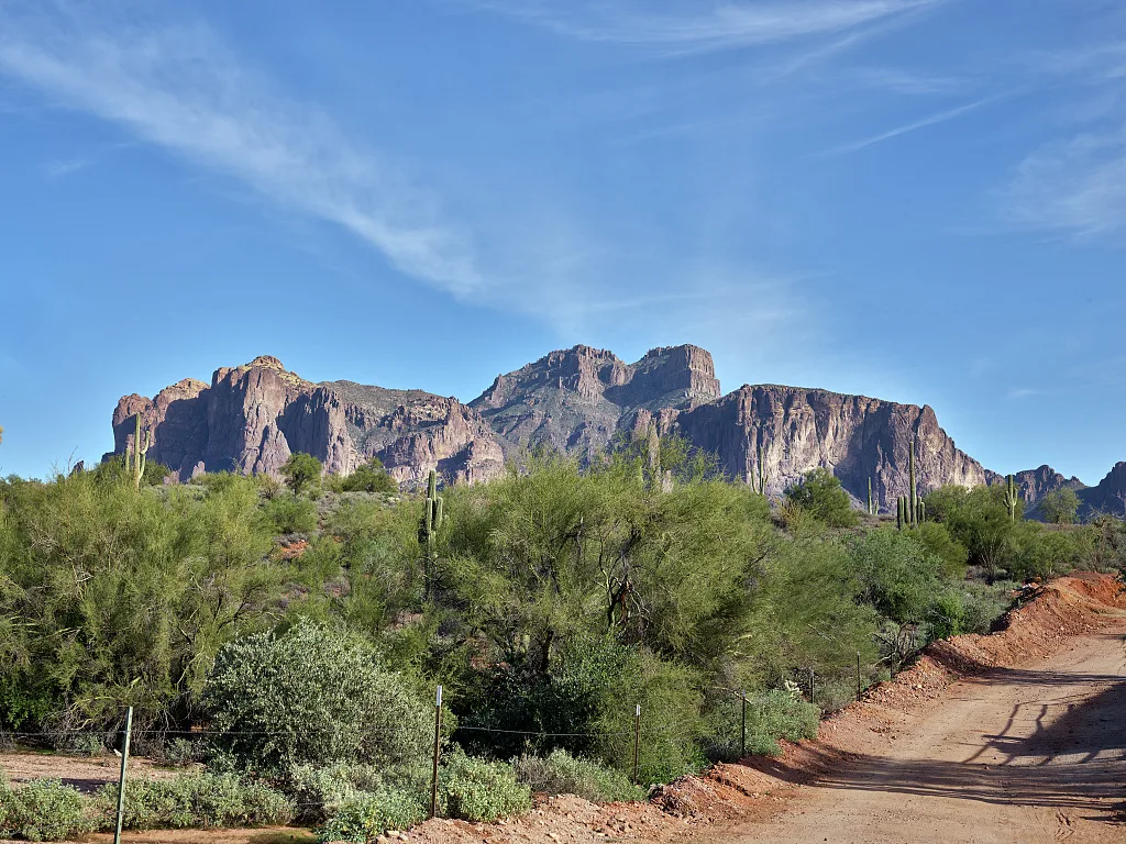
Usery Mountain Regional Park is on the east edge of Mesa, about 30–40 minutes from central Phoenix. It sits at the foot of the Goldfield Mountains, next to Tonto National Forest. The Wind Cave Trail climbs the west face of Pass Mountain, the big mountain on the park’s north side.
It’s not in the Superstition Mountains, though you can see them to the east.
How to get there
- Head east on US-60 (Superstition Freeway) or the Loop 202 to Mesa.
- Take Ellsworth Road north; it becomes Usery Pass Road.
- Turn right into Usery Mountain Regional Park (3939 N. Usery Pass Rd.).
- Pay the fee and follow signs to the Wind Cave Trailhead.
All roads are paved, and any car can get there.
Fees and hours
Maricopa County charges a day-use fee per vehicle (annual passes are available). Park hours are seasonal; in the cooler months (November–April) the park is typically open from early morning to evening. Check the official park page for current fees and hours.
Parking
Wind Cave is the park’s most popular trail, so the trailhead lot fills on winter weekends. Arrive early. Restrooms are available in the park; carry all the water you’ll need for the climb.
How Hard Is the Wind Cave Trail?
Maricopa County rates it difficult. It’s only 1.5 miles to the cave, but:
- You climb 812 feet, almost all of it uphill on the way in.
- The upper half is steeper and rockier, with uneven steps.
- There’s no shade until you reach the alcove.
- The descent is loose and hard on knees.
Is it good for beginners?
Fit beginners can do it on a cool day. Go slowly and take breaks. If you get tired, just turn around; the views are good the whole way up.
Kids and older hikers?
Active kids usually enjoy it, especially the “cave” at the top. For anyone, fitness and balance matter more than age. If you’d like something easy, try the flat Merkle Trail (0.9 miles, barrier-free) in the same park.
What to Expect, Step by Step
1. The trailhead
The trail starts in classic Sonoran Desert: tall saguaros, barrel cacti, teddy bear cholla and palo verde trees, with Pass Mountain rising right in front of you.
2. The lower climb
The first part climbs at a steady, moderate grade with switchbacks. Behind you, views open up over Mesa and the Valley. This is the easier half.
3. The upper climb
Higher up, the trail gets steeper and rockier, with natural steps and loose stones. Take your time. You’ll see the pale band of cliffs above, where the alcove hides.
4. Wind Cave
The trail ends at the alcove, a broad, shallow overhang in the cliff. It forms where two kinds of rock meet: softer volcanic tuff and harder granite. Weathering wore away the softer rock and left this natural shelter.
Look up at the roof. According to Maricopa County Parks, water seeping through the rock supports hanging gardens of rock daisies, little plants growing right out of the ceiling. Please don’t touch them.
Sit in the shade and enjoy the view: the Phoenix metro stretching west, the Goldfield Mountains and, on clear days, Four Peaks and the Superstitions.
5. The descent
Go back the same way. Take short steps on the loose, steep parts. Trekking poles help.
Is It Really a Cave?
No. Wind Cave is a shallow alcove, not an underground cave. There are no tunnels to explore. Stay on the trail; going beyond the alcove means steep, unmaintained terrain and crumbly rock.
Best Time to Hike
| Season | What to expect |
|---|---|
| November–February | Best weather; busy weekends |
| March–April | Warm; wildflowers in good years; start early |
| October | Can be hot; go early |
| May–September | Dangerously hot; very early only, or skip |
Sunrise: lovely light and cooler temperatures. Follow park hours and bring a light if it’s dim.
Sunset: pretty from the alcove, but give yourself plenty of daylight for the rocky descent.
What to Bring
- Water: at least 1–2 liters per person, more when warm.
- Shoes with good grip for loose rock.
- Hat, sunglasses, sunscreen.
- Trekking poles for the descent. See our best hiking poles.
- Snack for the alcove.
- Light layer for winter mornings.
Safety Tips
- Heat: start early. Turn back if you feel unwell.
- Footing: loose gravel on steep rock, especially going down.
- Wildlife: watch for rattlesnakes, especially in spring and fall.
- Protect the alcove: no carving, no climbing on the walls, don’t touch the plants.
- Dogs: check current park rules; if allowed, keep them leashed and avoid heat.
Wind Cave vs. Other Usery Mountain Trails
| Trail | Distance | Elevation | Best for |
|---|---|---|---|
| Wind Cave | 1.5 mi one way | 812 ft | Short, steep climb with a view |
| Pass Mountain Loop | 7.5 mi round trip | 731 ft | Longer loop around the mountain |
| Merkle | 0.9 mi round trip | 68 ft | Easy, barrier-free walk |
| Blevins | 3.0 mi round trip | 98 ft | Gentle desert walk |
| Cat Peaks | 1.1 mi one way | 139 ft | Short desert hills |
Distances from Maricopa County Parks.
Things to Do Nearby
- Usery Mountain Nature Center: learn about local plants and animals.
- Merkle Trail: an easy cool-down walk.
- Saguaro Lake: boating and lake views to the north.
- Superstition Mountains: try the Hieroglyphic Trail for petroglyphs or the Peralta Trail for Weaver’s Needle.
Frequently Asked Questions
How long is the Wind Cave Trail?
1.5 miles one way, or 3 miles round trip.
How hard is it?
Maricopa County rates it difficult because of steep grades and rugged terrain.
What’s the elevation gain?
812 feet.
How long does it take?
About 1.5–2.5 hours round trip.
Is there a fee?
Yes, a Maricopa County park day-use fee per vehicle.
Is Wind Cave a real cave?
No, it’s a shallow alcove in the cliff.
Where is it?
In Usery Mountain Regional Park, Mesa, Arizona, on Pass Mountain.
Is it good for beginners?
Fit beginners can do it slowly in cool weather.
When is the best time?
November to April, early in the day.
Can I bike it?
No, it’s hiking only.
Is Wind Cave worth it?
Yes. It’s a great short workout with a fun destination and big views.
Final Thoughts
Wind Cave is the perfect morning hike near Mesa: a steep, honest climb through saguaros, a shady alcove with plants growing from the ceiling, and a big view over the Valley. Go early, bring water, and take the descent slowly.
More Phoenix-area hikes: Hieroglyphic Trail, Peralta Trail, Siphon Draw to Flatiron, Piestewa Peak and the best winter hiking trails in the USA.
Official info: Maricopa County Parks: Usery Mountain trails.