
You climb for about an hour and a half through a rocky canyon full of saguaros, strange rock towers and boulders. The trail gets steeper. Your legs start to burn. Then you step onto a ridge, and suddenly there it is: Weaver’s Needle, a giant spike of volcanic rock rising out of the wilderness in front of you.
That moment at Fremont Saddle is why the Peralta Trail in the Superstition Mountains is one of the most loved day hikes near Phoenix. It’s challenging enough to feel like a real mountain hike, but short enough to finish in a morning.
This guide explains everything in plain English: how long the hike really is (online numbers are confusing), how hard it feels, the dirt road to the trailhead, parking, the best time of year, what to bring, and how to stay safe in the Arizona desert.
Quick answer
- Most popular hike: Peralta Trailhead to Fremont Saddle and back.
- Distance: about 4.5–5 miles round trip (different sources measure 4.4 to 4.9 miles).
- Elevation gain: about 1,400–1,500 feet.
- Time: about 3 to 4 hours.
- Difficulty: moderate to strenuous.
- Highlight: the view of Weaver’s Needle from Fremont Saddle (about 3,766 ft).
- Trailhead: end of Peralta Road (Forest Road 77), off US-60 near Gold Canyon. Mostly well-graded dirt road.
- Best season: November to March.
Peralta Trail at a Glance
| Location | Superstition Wilderness, Tonto National Forest, Arizona |
| Official name | Peralta Trail #102 |
| Full trail length | About 6.2 miles one way (to the Dutchman Trail) |
| Popular day hike | Fremont Saddle, about 4.5–5 miles round trip |
| Elevation gain | About 1,400–1,500 ft |
| Trailhead elevation | About 2,400 ft |
| Fremont Saddle elevation | About 3,766 ft |
| Time | 3–4 hours |
| Difficulty | Moderate to strenuous |
| Route type | Out and back |
| Restroom | Pit toilet at trailhead, no water |
| Dogs | Allowed on a leash (check current Tonto NF rules) |
| Group size | Wilderness limit of 15 people |
| Best season | November to March |
Distances vary between guides and GPS apps. Treat all numbers as close estimates.
Why Are the Distances So Confusing?
You’ll see the Peralta Trail listed as 4.4 miles, 4.8 miles, 5 miles and 6.2 miles. Here’s why:
- 6.2 miles is the length of the whole Peralta Trail #102, one way, from the trailhead past Fremont Saddle and down the other side to the Dutchman Trail.
- 4.4 to 5 miles is the popular round trip from the trailhead to Fremont Saddle and back. Arizona Highways lists 4.4 miles; many GPS tracks record closer to 4.8–4.9.
For almost everyone, “hiking the Peralta Trail” means going to Fremont Saddle and back. That’s what this guide focuses on.
Where Is the Peralta Trailhead?
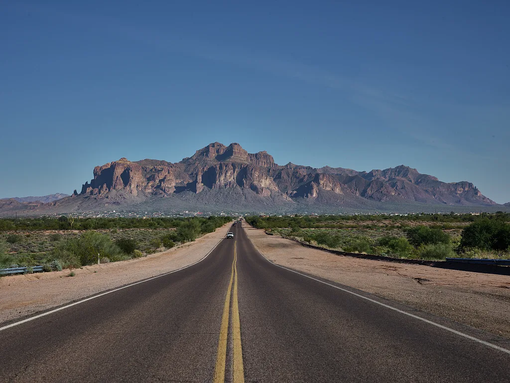
The trailhead is on the south side of the Superstition Mountains, east of Phoenix, near the small town of Gold Canyon. It’s roughly 45 miles (about an hour) from downtown Phoenix.
How to get there
- Drive east on US-60 past Apache Junction and Gold Canyon.
- About 7.6 miles east of the Idaho Road junction, turn left (north) onto Peralta Road (Forest Road 77).
- Follow Peralta Road toward the mountains. After a short paved section, it becomes a wide dirt and gravel road.
- Stay on the main road (it bears left and up near the end) until it ends at the Peralta Trailhead. The total drive on Peralta Road is about 7–8 miles.
Do you need 4WD?
No, not in normal dry conditions. The road is well maintained dirt and gravel, and regular cars make it every day. It can be washboarded and bumpy, so drive slowly. After heavy rain, washes along the road can flood. Don’t drive through running water.
Parking
The main lot holds roughly 50–60 cars, and it fills early on cool-weather weekends. There’s an overflow lot a short distance back down the road. Park only in marked spaces. Get there by 7 or 8 a.m. on weekends in winter and spring.
There’s a pit toilet but no drinking water. Bring all the water you need.
Fees: Day hiking the Peralta Trail doesn’t need a permit. Parking rules and passes on the Tonto National Forest can change, so check the Tonto National Forest website for any current pass requirement before you go.
What to Expect on the Peralta Trail
1. The lower canyon (first mile)
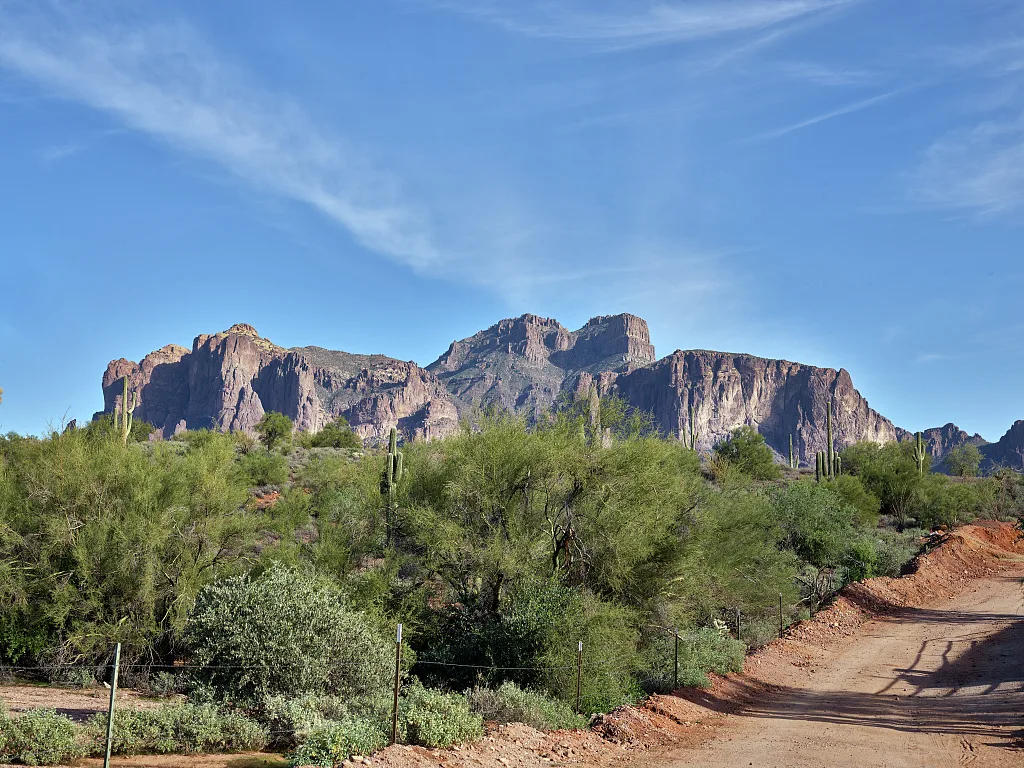
The trail starts at the north end of the parking lot and heads straight up Peralta Canyon. Right away, you’re among saguaros, palo verde trees, jojoba and chollas, with tall cliffs on both sides.
The path is well worn and easy to follow, but it’s rocky. You’ll step over rock slabs, small ledges and loose stones. After rain, there may be small pools or trickles of water in the canyon. Don’t count on it for drinking.
2. The rock towers (middle section)
As you climb, the canyon fills with odd rock shapes: towers, pinnacles and balanced boulders made of volcanic tuff. This is one of the most interesting parts of the hike, so stop and look around. The trail crosses the canyon bottom a few times and climbs steadily.
Some stretches go over smooth bedrock. It’s grippy when dry but slippery when wet or covered in sand.
3. The steep upper climb
The last section is the hardest. The trail climbs out of the canyon floor and up toward the ridge on rocky switchbacks. There’s less shade here. Take short breaks and keep drinking.
4. Fremont Saddle and Weaver’s Needle
Then the trail tops out at Fremont Saddle, a wide rocky gap at about 3,766 feet. In front of you, across a deep valley, Weaver’s Needle shoots up roughly 1,000 feet above the land around it. It’s one of the most famous views in Arizona.
Find a rock to sit on, eat lunch, and enjoy it. Many hikers wander a short way along the rocks near the saddle for different angles of the Needle. If you do, stay on obvious paths and watch your step near the edges.
5. The way back
You return the same way. Going down is easier on your lungs but hard on your knees, and loose rock makes it easy to slip. Take your time. Trekking poles help a lot here.
What Is Weaver’s Needle?
Weaver’s Needle is a tall volcanic spire in the middle of the Superstition Wilderness. It’s the eroded core of old volcanic rock, standing about 1,000 feet above its base and reaching about 4,553 feet in elevation.
It’s also tied to one of Arizona’s most famous legends: the Lost Dutchman’s Gold Mine. According to the story, Jacob Waltz (the “Dutchman”) hid a rich gold mine somewhere near the Needle in the 1800s. Treasure hunters have searched for it for over a century. Nobody has found it. You don’t need gold to enjoy the view, though.
Climbing the Needle itself is a technical rock climb with ropes. The Peralta Trail just takes you to the best view of it.
How Hard Is the Peralta Trail?
For most people, the hike to Fremont Saddle is moderate to strenuous. Here’s why:
- Constant climbing: about 1,400–1,500 feet in roughly 2.3 miles, almost all uphill on the way in.
- Rocky footing: loose stones, slabs and steps the whole way.
- Sun and heat: limited shade, especially near the top.
- The descent: tiring on your knees and ankles.
Is it good for beginners?
Fit beginners can do it on a cool day if they go slowly and bring plenty of water. If you’ve never hiked uphill for an hour or more, try an easier trail first. Our hiking for beginners guide can help you build up.
Can kids do it?
Older kids who are used to hiking usually do fine. Younger kids often enjoy the first mile of rock towers and can turn around whenever they get tired. There’s no shame in not reaching the saddle.
Best Time to Hike the Peralta Trail
| Season | Conditions | Verdict |
|---|---|---|
| November–February | Cool to mild days, cold mornings | Best time |
| March–April | Warming up, wildflowers in good rain years | Great, start early |
| October | Can still be hot | Early morning only |
| May–September | Dangerous heat, often over 100°F | Avoid |
HikeArizona recommends November, December, February and March, and warns against hiking when it’s 90°F or hotter. Winter mornings can be chilly at the trailhead, so bring a layer.
Rain: winter storms and the summer monsoon can flood the canyon and road washes. Skip the hike when storms are forecast.
What to Bring
- Water: at least 2–3 liters per person on a cool day, more if it’s warm.
- Salty snacks or lunch to eat at the saddle.
- Hiking shoes with good grip for slick rock slabs.
- Trekking poles for the descent. See our best hiking poles guide.
- Sun protection: hat, sunglasses, sunscreen.
- Light jacket: the saddle can be windy and cold in winter.
- Offline map: cell service is spotty.
- Headlamp: winter days are short.
- First aid kit, including tweezers for cactus spines.
Safety Tips
- Start early to beat heat and crowds.
- Turn back when half your water is gone.
- Watch for rattlesnakes, especially on warm days in spring and fall. Look before you put hands on rocks.
- Stay on the main trail. Past the saddle, the trail continues deep into the wilderness. If your goal is the saddle, turn around there.
- Cactus: give chollas plenty of room. Their segments stick to everything.
- Know the wilderness rules: group limit of 15, pack out all trash, no motorized equipment, no drones.
Peralta Trail vs. Other Superstition Mountains Hikes
| Trail | Distance (round trip) | Difficulty | Highlight |
|---|---|---|---|
| Peralta Trail to Fremont Saddle | About 4.5–5 mi | Moderate–strenuous | Weaver’s Needle view |
| Siphon Draw to the Flatiron | About 6 mi | Very strenuous, scrambling | Summit views over Phoenix |
| Hieroglyphic Trail | About 3 mi | Easy–moderate | Ancient petroglyphs |
| Wave Cave | About 3 mi | Moderate | Wave-shaped cave |
Want an even tougher Superstitions challenge? Read our Siphon Draw Trail to Flatiron guide.
Things to Do Near the Peralta Trail
- Lost Dutchman State Park: trails, camping and great sunset views of Superstition Mountain.
- Hieroglyphic Trail: a shorter hike to rock art near Gold Canyon.
- Superstition Mountain Museum: history of the Lost Dutchman legend, on the way to Tortilla Flat.
- Gold Canyon and Apache Junction: food, gas and places to stay.
- Phoenix: pair your trip with Camelback Mountain’s Echo Canyon Trail or a visit to the Desert Botanical Garden.
Suggested Half-Day Plan
- 6:30 a.m.: leave Phoenix.
- 7:30 a.m.: park at Peralta Trailhead and start hiking.
- 9:00 a.m.: reach Fremont Saddle. Snack and photos.
- 10:30 a.m.: back at the car.
- Lunch: Gold Canyon or Apache Junction, then the Superstition Mountain Museum or Lost Dutchman State Park.
Frequently Asked Questions
How long is the Peralta Trail in the Superstition Mountains?
The full Peralta Trail #102 is about 6.2 miles one way. The popular hike to Fremont Saddle and back is about 4.5–5 miles.
How long does it take to hike to Fremont Saddle?
About 3 to 4 hours round trip for most hikers, including a break at the top.
How hard is the Peralta Trail?
Moderate to strenuous, with about 1,400–1,500 feet of climbing on rocky ground.
Can you see Weaver’s Needle from the Peralta Trail?
Yes. The famous view is from Fremont Saddle at the top of the climb.
Do you need 4WD to reach Peralta Trailhead?
No. Peralta Road is graded dirt and gravel, fine for normal cars in dry weather.
Is there a fee to hike the Peralta Trail?
No permit is needed for day hikes. Check the Tonto National Forest website for any current parking pass rules.
Are dogs allowed on the Peralta Trail?
Yes, on a leash. Bring extra water for your dog and avoid warm days, because rocks get hot.
When is the best time to hike the Peralta Trail?
November through March. Avoid May through September because of extreme heat.
Is there water on the trail?
Not reliably. Carry all the water you need.
Is the Peralta Trail crowded?
Yes, on cool weekends. Go early or on a weekday.
Is the Peralta Trail worth it?
Absolutely. The rock towers in the canyon and the view of Weaver’s Needle make it one of the best day hikes near Phoenix.
Final Thoughts
The Peralta Trail packs a lot into a few miles: a rocky canyon full of saguaros, wild rock towers, a solid climb, and one of the most famous views in Arizona at the top. It’s hard enough to feel proud of, but doable for most fit hikers on a cool day.
Start early, bring more water than you think, wear grippy shoes, and take your time coming down. And while you’re at the saddle, keep an eye out for the Dutchman’s gold. You never know.
More Arizona hikes: Camelback Mountain Echo Canyon Trail, Picacho Peak Hunter Trail, Sabino Canyon hiking trails, Devils Bridge in Sedona and the best winter hiking trails in the USA.
Official info: Tonto National Forest.