
Not every great hike ends at a summit. This one ends in a quiet canyon where ancient people carved hundreds of symbols into the dark rock: spirals, animals, people and shapes no one can fully explain. After a wet winter, pools of water shine below the carvings like mirrors.
The Hieroglyphic Trail in the Superstition Mountains is one of the most rewarding easy-to-moderate hikes near Phoenix. It’s about 3 miles round trip from a trailhead in Gold Canyon, with a gentle climb into the mountains and a big payoff of petroglyphs and seasonal pools.
This guide covers everything simply: the exact trailhead address, directions, parking rules (important here), distance and difficulty, the petroglyphs and what they are, the pools, the best time to go and how to visit respectfully.

Quick answer
- Distance: about 3 miles round trip (1.5 miles each way).
- Elevation gain: about 500–650 feet.
- Time: 2–3 hours with time at the petroglyphs.
- Difficulty: easy to moderate.
- Trailhead: Cloudview Trailhead, 11231 E. Cloudview Ave., Gold Canyon, AZ 85118.
- Hours: trailhead open 5 a.m. to 10 p.m. (Pinal County).
- Parking: free but very limited; fills fast October–March; illegal parking is towed.
- Highlights: ancient petroglyphs and seasonal pools.
- Best time: November to March, early morning.
Hieroglyphic Trail at a Glance
| Location | Gold Canyon, Arizona (southwest Superstition Mountains) |
| Official name | Hieroglyphic Trail #101, Tonto National Forest |
| Area | Superstition Wilderness |
| Trailhead | Cloudview Trailhead, 11231 E. Cloudview Ave., Gold Canyon, AZ 85118 |
| Distance | About 3 miles round trip |
| Elevation gain | About 500–650 feet |
| Time | 2–3 hours |
| Difficulty | Easy to moderate |
| Route | Out and back |
| Fee | None |
| Trailhead hours | 5 a.m. to 10 p.m. |
| Best season | October to April |
Where Is the Hieroglyphic Trail?
The trail is on the southwest side of the Superstition Mountains, in the community of Gold Canyon, east of Apache Junction and about an hour from central Phoenix. It starts at the edge of a neighborhood and quickly climbs into the Superstition Wilderness in Tonto National Forest.
Trailhead address
Use Cloudview Trailhead, 11231 E. Cloudview Avenue, Gold Canyon, AZ 85118. That’s the address Pinal County lists. Don’t just type “Superstition Mountains” into your map app; there are many trailheads.
Directions
- Take US-60 east from Phoenix/Mesa toward Gold Canyon.
- Turn north on Kings Ranch Road.
- Follow the neighborhood roads (Baseline Ave., Mohican Rd., Valley View Dr. and Whitetail Rd.) to Cloudview Avenue.
- Turn east on Cloudview Avenue and follow it to the trailhead at the end.
It’s all paved. Use a map app for the final neighborhood turns.
Parking: Read This Before You Go
Parking is the biggest headache here. According to Pinal County:
- Spaces are very limited and fill quickly, especially October through March.
- If the lot is full, use the Lost Goldmine East Trailhead instead.
- Illegally parked vehicles are towed at the owner’s expense. Obey all no-parking and no-trespassing signs.
- Buses and vehicles or trailers longer than 37 feet aren’t allowed.
- Trailhead hours are 5 a.m. to 10 p.m.
Parking is free. Arrive early on weekends, and never park in the neighborhood.
Distance and Difficulty
The hike is about 3 miles round trip, with roughly 500–650 feet of climbing. GPS apps usually record 2.9–3.2 miles.
It’s easy to moderate. The climb is gradual most of the way, then the trail gets rockier near the canyon. Most beginners and families can do it in cool weather.
- Not paved or flat: expect rocks and loose gravel.
- Little shade.
- Kids love it, but watch them near the pools and drop-offs.
What to Expect, Step by Step
1. Cloudview Trailhead and the junction
From the trailhead, the path heads north toward the mountains. Near the start, the Lost Goldmine Trail crosses. Follow the signs for Hieroglyphic Trail #101.
2. Through the desert
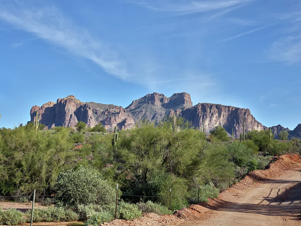
The trail climbs gently through saguaros, chollas, prickly pear and brittlebush. Behind you, views open over Gold Canyon. In spring after rain, you may see wildflowers.
3. Into Hieroglyphic Canyon
The trail enters the Superstition Wilderness and heads into a canyon. The ground gets rockier and the cliffs get closer, dark volcanic rock stained by time.
4. The petroglyphs
At the end of the trail, you’ll find large rock faces covered with petroglyphs: spirals, zigzags, human-like figures and animals that look like bighorn sheep and deer. Some are bold and easy to see; others are faint. Slow down and look carefully. There are more than you think.
5. The seasonal pools
Below the petroglyphs, natural rock basins collect rainwater. After winter storms, they can be full, clear pools, and water may even trickle over the rocks like a small waterfall. In dry spells, they shrink to puddles or disappear.
6. The return
Return the same way. The downhill walk has great views toward Gold Canyon. Watch your footing on loose rock.
The Petroglyphs: What Are They?
Hieroglyphics or petroglyphs?
Despite the trail’s name, these aren’t hieroglyphics (like ancient Egyptian writing). They’re petroglyphs: images pecked or carved into the rock surface.
Who made them?
They’re commonly linked to the ancestral Hohokam people, who lived in the Phoenix area for centuries. Many are believed to be well over a thousand years old.
What do they mean?
No one knows for sure. Some may mark water sources, events, beliefs or clan symbols. It’s best to enjoy them as part of a living cultural landscape that’s still important to Native peoples today.
How to visit respectfully
- Never touch the petroglyphs. Skin oils damage them.
- Don’t chalk, trace, scratch or climb on the rock art.
- Don’t swim in or disturb the pools.
- Take only photos. Damaging rock art is illegal under federal law.
Best Time to Hike
| Season | What to expect |
|---|---|
| December–February | Cool, best chance of water in the pools |
| March–April | Warm, wildflowers in good years |
| October–November | Cooling off; pools often dry |
| May–September | Dangerously hot; skip or go at dawn |
The best day is a cool morning a few days after winter rain, when the pools are full. Avoid the canyon during storms; water can rush down quickly.
What to Bring
- Water: 1–2 liters per person. Don’t drink pool water.
- Hiking shoes with grip.
- Hat, sunglasses, sunscreen.
- Snack to enjoy at the petroglyphs.
- Camera (zoom helps for high carvings).
- Light jacket for winter mornings.
Safety Tips
- Heat: even short desert hikes are dangerous when it’s hot.
- Slippery rock around the pools, especially when wet.
- Flash floods: stay out of the canyon in storms.
- Rattlesnakes: watch where you step and put your hands.
- Stay on the main trail. Beyond the petroglyphs, the canyon gets rough and unmaintained.
- Dogs: allowed on a leash in the national forest; bring water for them.
Hieroglyphic Trail vs. Other Superstition Hikes
| Trail | Distance (round trip) | Difficulty | Highlight |
|---|---|---|---|
| Hieroglyphic Trail | About 3 mi | Easy–moderate | Petroglyphs and pools |
| Peralta Trail to Fremont Saddle | About 4.5–5 mi | Moderate–strenuous | Weaver’s Needle view |
| Siphon Draw to Flatiron | About 5.5–6 mi | Very strenuous | Summit scramble |
| Wind Cave (Usery) | 3 mi | Difficult | Alcove with views |
Things to Do Nearby
- Lost Dutchman State Park: trails and big views of Superstition Mountain.
- Superstition Mountain Museum: history of the Lost Dutchman legend.
- Peralta Trail: a tougher hike just east of Gold Canyon.
- Gold Canyon: restaurants and places to stay.
Frequently Asked Questions
How long is the Hieroglyphic Trail?
About 3 miles round trip, or 1.5 miles each way.
How hard is it?
Easy to moderate, with a gentle climb and some rocky sections.
What’s the trailhead address?
Cloudview Trailhead, 11231 E. Cloudview Ave., Gold Canyon, AZ 85118.
Is parking free?
Yes, but it’s very limited and illegally parked cars are towed.
What are the trailhead hours?
5 a.m. to 10 p.m.
Are they real hieroglyphics?
No. They’re petroglyphs, likely made by the ancestral Hohokam.
Is there water at the end?
Sometimes. The pools fill after rain, mostly in winter and early spring.
How long does it take?
About 2–3 hours round trip.
Can kids do it?
Yes. It’s one of the best family hikes near Phoenix.
Can I touch the petroglyphs?
No. Look and photograph only.
Is the Hieroglyphic Trail worth it?
Absolutely. It’s an easy way to see ancient rock art in a beautiful desert canyon.
Final Thoughts
The Hieroglyphic Trail is short, friendly and full of meaning: a desert walk that ends with ancient carvings and, if you’re lucky, shimmering pools. Arrive early to get a parking spot, go after winter rains for water, and leave the rock art exactly as you found it.
More Arizona hikes: Peralta Trail, Wind Cave Trail, Siphon Draw to Flatiron, Camelback Mountain and the best winter hiking trails in the USA.
Official info: Pinal County: Cloudview Trailhead and parking and Tonto National Forest.