
Picture a giant boulder perched on top of two others, making a perfect stone window that frames the desert behind it. That’s Balanced Rock, and it’s the reward at the end of one of Big Bend’s best short hikes.
The Grapevine Hills Trail in Big Bend is only 2.2 miles round trip. Most of it is an easy walk up a sandy wash through a strange landscape of round boulders. The last quarter mile is a steep scramble up rock, and the drive to the trailhead is a rough dirt road that needs the right vehicle.
This guide covers everything simply: the road, distance and difficulty, the scramble, Balanced Rock, how the rocks formed, the best time to go, photo tips and safety.
Quick answer
- Distance: 2.2 miles round trip, out and back.
- Elevation change: about 80 feet (but the last 0.25 mile is steep and rocky).
- Time: 1–2 hours.
- Difficulty: easy wash, then a short, steep rock scramble.
- Road: 6.5 miles of rough dirt (Grapevine Hills Road), starting 3.3 miles west of Panther Junction.
- Vehicle: sturdy high-clearance vehicle required. No passenger cars, minivans or RVs.
- Parking: small dirt lot, about 10 cars.
- Shade: none. Pets: not allowed.
- Best season: October to April, early morning.
Grapevine Hills Trail at a Glance
| Location | Big Bend National Park, West Texas |
| Destination | Balanced Rock |
| Distance | 2.2 miles (3.5 km) round trip |
| Elevation change | About 80 feet |
| Time | 1–2 hours |
| Route | Out and back |
| Surface | Sandy gravel wash, then steep bedrock and boulders |
| Access road | Grapevine Hills Road, 6.5 miles of rough dirt |
| Vehicle | High clearance required |
| Parking | About 10 vehicles |
| Facilities | None at the trailhead |
| Pets | Not allowed on trails |
Getting There: Grapevine Hills Road
For many people, the drive is the hardest part. Here’s what the park says:
- The turnoff for Grapevine Hills Road is 3.3 miles west of Panther Junction on the main park road toward Chisos Basin and Study Butte.
- The trailhead is 6.5 miles down this very rough dirt road.
- You need a sturdy, high-clearance vehicle. The park clearly says: don’t try it in a passenger car, minivan or RV.
- Past the trailhead, the road usually needs 4×4.
Driving tips
- Ask at the Panther Junction Visitor Center about current road conditions. Rain can make it impassable.
- Drive slowly. Expect washboard, rocks and sandy spots. Plan on 20–30 minutes each way.
- Rental cars: check your contract; many don’t allow dirt roads, and “SUV” doesn’t always mean high clearance.
- Carry extra water in the car. There’s no cell service on most of the road.
Parking
The trailhead lot holds about 10 vehicles. On busy days, arrive early. There are no toilets or water, so stop at Panther Junction first.
How Hard Is the Hike?
It’s really two hikes in one:
- First 0.75 mile: an easy, gentle walk up a sandy gravel wash between boulder hills.
- Last 0.25 mile: a steep, rough climb over bedrock and between boulders. You may need your hands in spots.
The park warns that the descent can be slippery, and rangers regularly help hikers with foot, leg and ankle injuries here. Loose sand on smooth rock acts like ball bearings. Take your time coming down.
No ropes or climbing skills are needed. Most kids who like scrambling have a blast. If the final climb feels too much, the walk through the wash is still beautiful, and you can turn back there.
Step-by-Step: Hiking to Balanced Rock
1. The trailhead
The hike starts at a trail sign beside the small lot. Sign the register if there is one, check your water, and set off up the wash.

2. The sandy wash
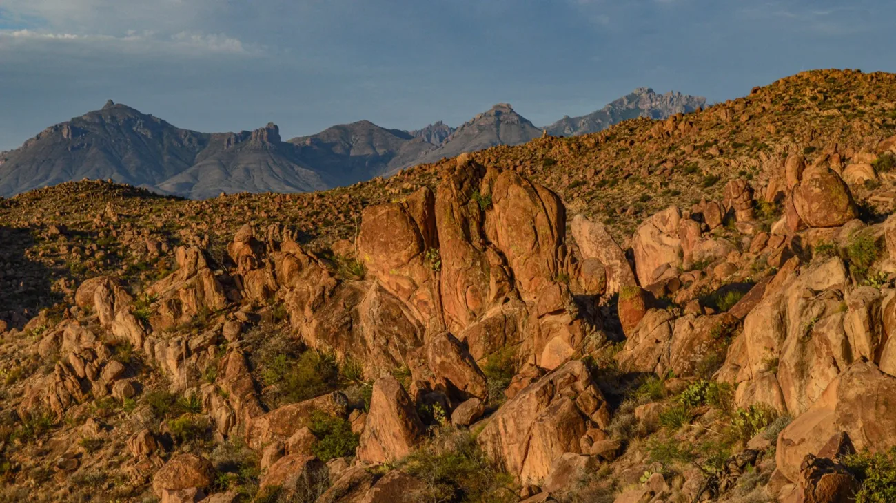
The trail follows a flat, sandy gravel wash. Round boulder hills rise on both sides, and they get bigger and stranger the farther you go. Look for desert plants like lechuguilla, sotol, ocotillo and prickly pear.
3. Into the boulders
The wash narrows, and huge rounded rocks crowd in around you. It looks like a giant dumped a bag of marbles here.
4. The final climb
The trail leaves the wash and climbs steeply up the rocks on the right. Watch for painted arrows and rock markers that show the way between boulders. Move slowly, use your hands for balance and avoid loose gravel patches.
5. Balanced Rock
At the top, Balanced Rock appears: a large boulder resting across two others, forming a window that frames the desert and the distant Chisos Mountains. Take a break and lots of photos.
6. Back down
Go back the same way. Face into the rock on steep bits, and test each foothold. Once you’re back in the wash, it’s an easy walk to the car.
Balanced Rock: Big Bend’s Natural Window
Balanced Rock isn’t held up by magic. As the rock weathered and cracked, softer material washed away and left this boulder resting on two others. Over time, it’ll keep changing, just very slowly.
Don’t mix it up with Balanced Rock in Arches National Park in Utah. That’s a totally different formation.
Please don’t climb on top of Balanced Rock or the boulders around it. It’s unsafe and can damage the formation.
Why Are the Grapevine Hills So Round?
The park calls the Grapevine Hills an exposed laccolith. Millions of years ago, molten rock pushed up between rock layers underground and bulged them into a dome, then cooled into hard igneous rock. Over time, the softer rock on top eroded away. Cracks split the hard rock into blocks, and weather rounded them into the piles of smooth boulders you see today.
Best Time to Hike
| Season | What to expect |
|---|---|
| November–February | Cool and pleasant; great hiking |
| March–April | Warm, cactus flowers, busy spring break |
| October | Cooling down; go early |
| May–September | Very hot with no shade. Sunrise only, or skip it. |
Early morning is best year-round: cooler, softer light and easier parking. Summer storms can also wash out the road.
Photography Tips
- Frame the window: stand back so Balanced Rock frames the desert and Chisos Mountains.
- Add a person for scale: have a friend stand safely beside (not under) the rock.
- Golden hour: morning and late afternoon light makes the boulders glow.
- Wide lens: helps fit the whole formation in tight spots.
If you stay for sunset, bring a headlamp. The scramble down is tough in the dark.
Wildlife and Snakes
The Grapevine Hills are part of the Chihuahuan Desert. You may see lizards, roadrunners, jackrabbits, and maybe a javelina. The park warns that snakes like to rest in the shade of boulders, so never put your hands or feet where you can’t see.
What to Bring
- Water: the park suggests about 1 liter per person per hour of hiking. Bring extra for the drive.
- Grippy shoes for the slick rock.
- Hat, sunglasses and sunscreen. No shade at all.
- Salty snacks.
- Small backpack so your hands are free on the scramble.
- Offline map and a charged phone.
- First-aid kit and a headlamp.
Safety Tips
- Use a high-clearance vehicle and check road conditions first.
- Avoid hiking in the heat of the day.
- Go slowly on the descent; it’s where most injuries happen.
- Follow the arrows near the top.
- Watch for snakes in shady rock gaps.
- Don’t stack rocks or make new markers. They confuse other hikers.
Grapevine Hills vs. Other Big Bend Hikes
| Trail | Distance | Difficulty | Highlight |
|---|---|---|---|
| Grapevine Hills | 2.2 mi | Easy, then a short scramble | Balanced Rock |
| Santa Elena Canyon | 1.6 mi | Easy–moderate | Rio Grande canyon walls |
| Lower Burro Mesa Pour-off | 1 mi | Easy | Dry waterfall chute |
| Lost Mine Trail | 4.8 mi | Moderate | Chisos Mountain views |
| Emory Peak | About 10.5 mi | Strenuous | Highest point in the park |
A Simple Half-Day Plan
- Early morning: check road conditions and fill water at Panther Junction.
- Drive: slowly down Grapevine Hills Road (20–30 minutes).
- Hike: 1–2 hours to Balanced Rock and back.
- After: visit the Fossil Discovery Exhibit, or head to the Chisos Basin for lunch and views.
Frequently Asked Questions
How long is Grapevine Hills Trail?
2.2 miles round trip.
How long does it take to reach Balanced Rock?
Most people take 1–2 hours round trip.
Is it hard?
The first part is easy. The last quarter mile is a steep, rocky scramble, and the descent can be slippery.
Do I need a high-clearance vehicle?
Yes. The park says not to use a passenger car, minivan or RV on Grapevine Hills Road.
How long is Grapevine Hills Road?
About 6.5 miles of rough dirt from the paved road to the trailhead.
Where is the turnoff?
3.3 miles west of Panther Junction.
Is there shade?
No, none at all.
Are dogs allowed?
No, pets aren’t allowed on Big Bend trails.
Is it good for kids?
Yes, for kids who like climbing on rocks, with close help on the scramble.
Is it the same Balanced Rock as in Arches?
No. This one is in Big Bend, Texas.
Is Grapevine Hills Trail worth it?
Absolutely, if you have the right vehicle. It’s one of the most fun short hikes in Big Bend.
Final Thoughts
Grapevine Hills packs a lot into a short hike: a weird, wonderful boulder field, a fun scramble and one of the most photographed rocks in Texas. Bring a high-clearance vehicle, start early, carry plenty of water and take the descent slowly.
More Big Bend and desert hikes: Santa Elena Canyon, Emory Peak, Devils Hall in Guadalupe Mountains and the best winter hiking trails in the USA.
Official info: NPS: Grapevine Hills (Balanced Rock) Trail and NPS: Grapevine Hills Road.