
You see it long before you get there. Driving down Ross Maxwell Scenic Drive, a massive wall of rock rises from the desert with a narrow slit cut straight through it. That slit is Santa Elena Canyon, where the Rio Grande squeezes between cliffs about 1,500 feet tall.
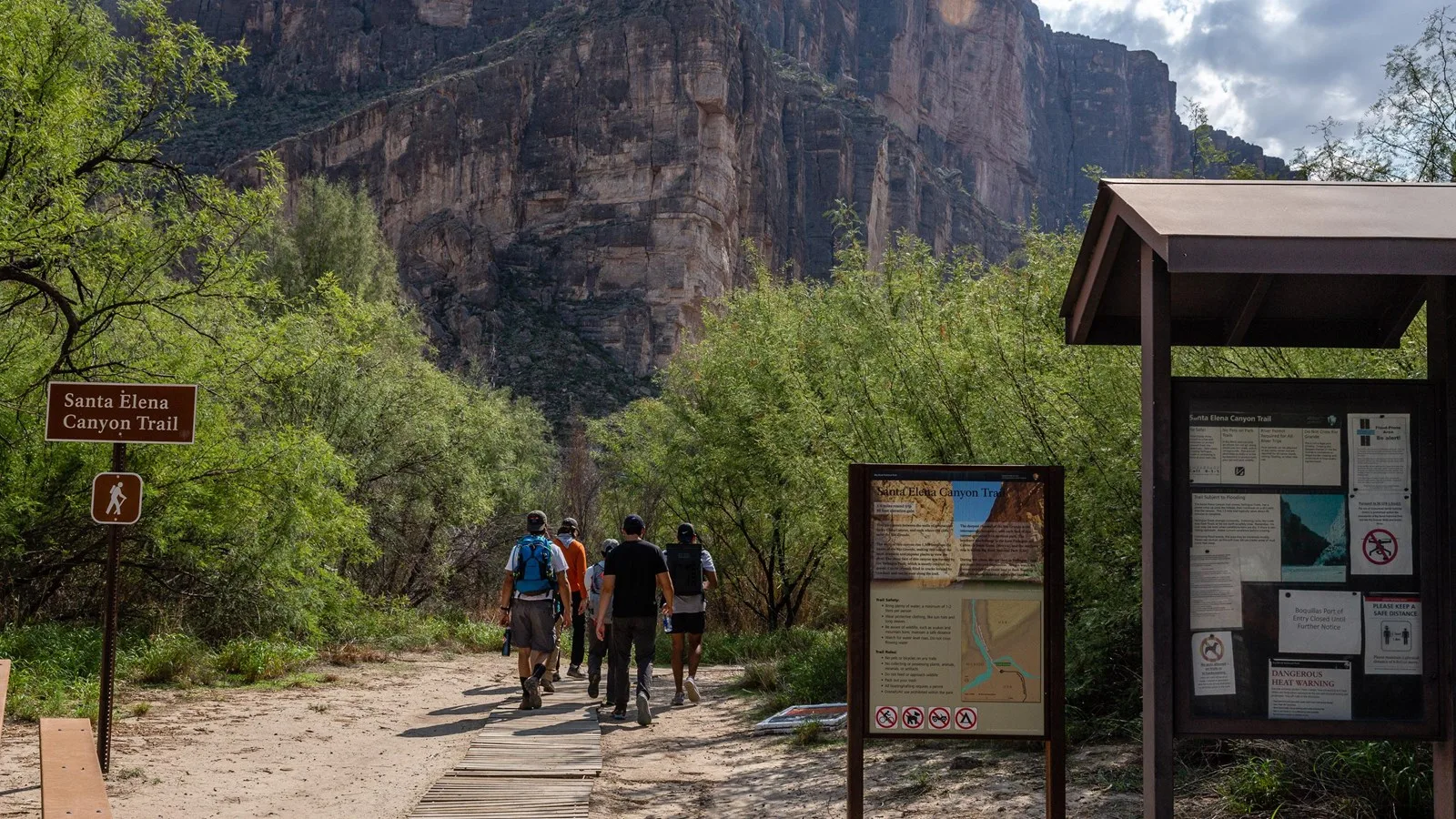
The Santa Elena Canyon Trail takes you right inside. It’s a short hike, only about 1.6 miles round trip, but standing on a sandy beach with Texas on one side, Mexico on the other and sheer limestone walls towering above you is one of the most unforgettable moments in Big Bend National Park.
This guide covers everything in simple words: distance, the Terlingua Creek crossing (the one thing that can stop you), how to get there, what to expect, the best time to go and how to stay safe.

Quick answer
- Distance: 1.6 miles round trip (NPS). Some guides say 1.7.
- Elevation change: about 80 feet.
- Time: about 1 hour.
- Difficulty: easy to moderate. A creek crossing, a steep bank and some steps.
- Trailhead: end of Ross Maxwell Scenic Drive, Big Bend National Park.
- The big variable: Terlingua Creek can be dry sand, thick mud or deep, fast water.
- Facilities: vault toilet at the trailhead. No water.
- Best time: October to April.
- Dogs: not allowed on any park trail.
Santa Elena Canyon Trail at a Glance
| Location | Big Bend National Park, Texas (southwest side) |
| Trailhead | End of Ross Maxwell Scenic Drive |
| Distance | 1.6 miles round trip |
| Elevation change | About 80 feet |
| Time | About 1 hour |
| Difficulty | Easy to moderate |
| Route type | Out and back |
| Main obstacle | Terlingua Creek crossing |
| Parking | Paved lot, about 20 vehicles |
| Restroom | Vault toilet |
| Pets | Not allowed on trails |
| Best season | October to April |
Trail facts come from the National Park Service.
Where Is Santa Elena Canyon?
Santa Elena Canyon is in the far southwest corner of Big Bend National Park in West Texas. Here, the Rio Grande has carved a deep, narrow canyon through a huge limestone uplift. The river is the border between the United States and Mexico: the cliff on your right as you face the canyon is in Texas, and the one on your left is in Mexico.
How far is it from Terlingua?
Many visitors stay in Terlingua or Study Butte, just outside the park’s west entrance. From there, plan on about an hour to an hour and a half to reach Santa Elena Canyon, depending on your route and how many stops you make. Big Bend is huge and remote, so always allow extra time.
How to Get to Santa Elena Canyon
Option 1: Ross Maxwell Scenic Drive (paved, recommended)
The paved Ross Maxwell Scenic Drive runs about 30 miles from its junction with the main park road down to Santa Elena Canyon. It’s one of the best drives in Texas, with viewpoints like Sotol Vista, Mule Ears and Tuff Canyon, plus the historic Castolon area. The trailhead is at the very end of the road.
Option 2: Old Maverick Road (gravel)
From near the park’s west entrance, the unpaved Old Maverick Road heads south about 13 miles to the canyon. It’s shorter if you’re coming from Terlingua, but it’s a dirt road that can be rough, washboarded or impassable after rain. Check current road conditions first.
Parking
The paved trailhead lot fits about 20 vehicles and fills on busy days, especially spring break and holidays. There’s a vault toilet. No water, so bring your own.
The Terlingua Creek Crossing: Read This First
Right at the start, you have to cross the mouth of Terlingua Creek, where it flows into the Rio Grande. Then you climb a short, steep bank to reach the trail. According to the NPS, depending on recent rain, the creek can be:
- Dry sand: easy walking.
- Thick mud: sticky and messy. Wear old shoes.
- Flowing water: sometimes ankle-deep, sometimes much more.
If the water is deep and swift, don’t cross. The trail may be impassable after summer flooding. Ask at a visitor center about current conditions.
If you can’t cross, you can still enjoy amazing views of the canyon mouth from near the parking area and from the Santa Elena Canyon Overlook on Ross Maxwell Scenic Drive.
What to Expect on the Trail
1. Trailhead to the creek
From the parking lot, a short path leads toward the canyon mouth. Even here, the view is jaw-dropping: two vertical walls with the river flowing out between them.
2. Cross Terlingua Creek
Cross the creek bed (see above), then scramble up the short, steep bank on the other side.
3. The switchbacks and steps
Next comes the only real climb: a series of switchbacks with concrete steps up the canyon wall. It’s short but steep. At the top, you get a great view back over the river and the desert you drove through.
4. Into the canyon
The trail then drops back down toward the river and heads into the canyon. Suddenly the desert disappears. It’s shady, cooler and quiet, except for the river. Cane, willows and other plants grow along the banks, and the walls shoot straight up on both sides.
5. The end of the trail
The trail ends where the canyon wall meets the river and there’s no more room to walk. This is the turnaround. Find a spot on the sand or rocks, look up at the cliffs, and enjoy one of the most dramatic places in Texas.
6. The way back
Return the same way. If storms are building anywhere upstream, don’t hang around. Creek levels can change.
How Hard Is the Santa Elena Canyon Trail?
It’s easy to moderate. Only about 80 feet of overall elevation change and about an hour of walking. The harder parts:
- The creek crossing (mud or water).
- The steep bank right after the creek.
- The steps and switchbacks.
- Sand and uneven ground inside the canyon.
Most beginners and families can do it when the creek is dry or low. It’s not stroller-friendly.
The Rio Grande Cliffs
The canyon walls rise about 1,500 feet above the river. Over millions of years, the Rio Grande cut down through layers of limestone as the land slowly rose. The result is one of the deepest, narrowest canyon mouths in the Southwest.
Can you see Mexico?
Yes. The cliff on the south side of the river is in Mexico. Stay on the U.S. side; crossing the river outside an official port of entry is illegal.
Can you float the canyon?
River trips through Santa Elena Canyon are possible when water levels allow, but they need a backcountry permit and planning (or a licensed outfitter). There’s no walking trail through the whole canyon.
Best Time to Hike Santa Elena Canyon
| Season | What to expect | Verdict |
|---|---|---|
| October–November | Cooling down, possible high water after fall storms | Great |
| December–February | Cool days, cold mornings, usually low water | Excellent |
| March–April | Warm, wildflowers, very busy (spring break) | Great, arrive early |
| May–September | Extreme heat, summer flooding possible | Early morning only |
Best time of day
Morning is cooler and quieter. In the afternoon, sunlight hits the canyon walls and makes great photos from the trailhead. Near sunset the canyon mouth glows, but the trail inside gets dark early, so carry a light.
Fees and Rules
- Entrance fee: Big Bend charges a per-vehicle entrance fee (good for 7 days). America the Beautiful passes work. Check the NPS website for current prices.
- No permit needed for the day hike.
- No pets on any park trail.
- Don’t stack rocks (cairns). The NPS says they can lead hikers off trail.
- Leave No Trace: pack out all trash.
What to Bring
- Water: the NPS recommends about 1 liter per person per hour of hiking.
- Old shoes or sandals with straps for the creek crossing.
- Sun protection: hat, sunscreen, light covering clothes.
- Layer: the canyon can feel cool and shady in winter.
- Camera.
- Offline map: cell service is very limited in Big Bend.
Safety Tips
- Don’t cross deep or fast water. Ever.
- Watch the weather upstream. Rain far away can raise the creek.
- Heat: Big Bend summers are brutal. Hike early.
- Snakes: watch where you step; keep your distance from all wildlife.
- Don’t swim in the Rio Grande. Currents can be strong.
- Groups: the NPS suggests keeping someone at the back of the group.
Other Stops on Ross Maxwell Scenic Drive
| Stop | Why go |
|---|---|
| Santa Elena Canyon Overlook | Classic view of the canyon mouth from above |
| Castolon Historic District | Old border trading post and history exhibits |
| Tuff Canyon | Short walk into a canyon of white volcanic ash |
| Mule Ears Viewpoint | Twin rock spires that look like mule ears |
| Sotol Vista | Huge view toward Santa Elena Canyon |
One-Day and Two-Day Plans
One day: the west side
- Morning: drive Ross Maxwell Scenic Drive with stops at Sotol Vista and Mule Ears.
- Late morning: hike Santa Elena Canyon (check the creek first).
- Lunch: picnic near Castolon.
- Afternoon: Tuff Canyon, then back to Terlingua.
Two days
- Day 1: Ross Maxwell Scenic Drive and Santa Elena Canyon.
- Day 2: the Chisos Mountains: hike the Lost Mine Trail or, for a big day, Emory Peak.
Frequently Asked Questions
How long is the Santa Elena Canyon Trail?
1.6 miles round trip, according to the NPS.
How long does it take?
About 1 hour, plus time for photos.
Is the Santa Elena Canyon Trail hard?
No, it’s easy to moderate. The creek crossing, steep bank and steps are the main challenges.
Do you have to cross a river?
You cross Terlingua Creek (not the Rio Grande) at the start. It can be dry, muddy or flowing.
Is the Santa Elena Canyon Trail open?
It’s usually open, but high water in Terlingua Creek can make it impassable, especially after summer storms. Check at a visitor center.
Can you see Mexico from Santa Elena Canyon?
Yes. The cliff across the river is in Mexico.
How tall are the walls?
About 1,500 feet above the river.
Are dogs allowed?
No. Pets aren’t allowed on any trail in Big Bend.
Is there a bathroom?
Yes, a vault toilet at the trailhead. No drinking water.
How do you get there from Terlingua?
Enter the park’s west entrance and take Ross Maxwell Scenic Drive (paved) or Old Maverick Road (gravel) to the canyon. Allow 1–1.5 hours.
Is Santa Elena Canyon worth it?
Absolutely. It’s one of the most iconic sights in Big Bend for very little effort.
Final Thoughts
Santa Elena Canyon is pure Big Bend: a long desert drive, a muddy creek, a few steps up a cliff, and then towering walls with the Rio Grande flowing between two countries. It’s short, but it stays with you.
Check the creek, bring old shoes and water, and give yourself time to enjoy the drive.
More Texas hikes: Lost Mine Trail, Grapevine Hills Trail to Balanced Rock, Emory Peak, Devils Hall in Guadalupe Mountains, Lighthouse Trail at Palo Duro and the best winter hiking trails in the USA.
Official info: NPS Santa Elena Canyon Trail.