
If Camelback and Piestewa Peak sound a bit too intense, Pinnacle Peak might be your perfect Phoenix-area hike. It has real climbs and big desert views, but the trail is wide, smooth and well cared for, with no scrambling.
The Pinnacle Peak Trail in Scottsdale winds around the side of a famous granite peak in North Scottsdale, past giant saguaros, huge boulders and viewpoints with names like Grandview and Owl’s Rest. It’s about 4 miles round trip with roughly 1,300 feet of total climbing, because the trail goes up and down.
One thing to know up front: the trail doesn’t go to the top of Pinnacle Peak. It goes around it. This guide explains that, plus distance, elevation, difficulty, hours (which change through the year), parking, rules, the best times to go and tips.
Quick answer
- Distance: 2 miles one way, about 4 miles round trip (City of Scottsdale).
- Elevation: about 1,300 feet of total climbing (up and down).
- Trailhead elevation: 2,570 ft. Highest trail point: 2,889 ft. Lowest point: 2,366 ft.
- Time: 1.5–2.5 hours round trip.
- Difficulty: moderate.
- Address: 26802 N. 102nd Way, Scottsdale, AZ 85262.
- Cost: free.
- Dogs and bikes: not allowed.
- Summit: the trail does not reach the top.
Pinnacle Peak Trail at a Glance
| Location | Pinnacle Peak Park, North Scottsdale, Arizona |
| Address | 26802 N. 102nd Way, Scottsdale, AZ 85262 |
| Phone | (480) 312-0990 |
| Distance | 2 miles one way (about 4 miles round trip) |
| Cumulative elevation gain | About 1,300 feet |
| Trailhead / high / low | 2,570 ft / 2,889 ft / 2,366 ft |
| Difficulty | Moderate |
| Surface | Well-maintained dirt trail |
| Route | Out and back |
| Fee | Free |
| Dogs / bikes | Not allowed |
| Best season | November to April |
Distance and elevation figures come from the City of Scottsdale.
Where Is Pinnacle Peak?
Pinnacle Peak Park is in far North Scottsdale, near the Troon area. The peak itself is a big granite spire that stands out from miles away. The park protects the desert around it and has a trailhead with parking, restrooms and drinking fountains.
Use this address in your map app: 26802 N. 102nd Way, Scottsdale, AZ 85262. From central Scottsdale, it’s about 30–40 minutes north.
Does the Trail Reach the Summit?
No. This surprises a lot of first-timers. The hiking trail winds along the side of the mountain. Its highest point is 2,889 feet, well below the actual granite summit. The top of Pinnacle Peak is only reached by technical rock climbing.
The city allows experienced climbers with proper gear to climb in three designated areas of the park. Hikers should stay on the trail.
Distance and Elevation Explained
The city lists the trail as 2 miles one way, so about 4 miles round trip if you go to the end and back. (Some city materials round it to 3.8 miles.)
The 1,300 feet of elevation gain confuses people, because the trailhead (2,570 ft) and the high point (2,889 ft) are only about 320 feet apart. The reason: the trail climbs to its high point, then drops all the way down to 2,366 ft at the far end. So you climb up, go down, then climb back up and go down again on the return. It all adds up.
| Turnaround point | Round trip (approx.) | Effort |
|---|---|---|
| Grandview | Shortest option | Moderate climb, big views |
| Highest trail point | Medium option | All the uphill, none of the far-side drop |
| End of trail (Jomax Rd side) | About 4 miles | Full workout with the climb back |
How Hard Is the Pinnacle Peak Trail?
It’s moderate. The trail is wide and smooth by desert standards, with no scrambling. The effort comes from steady climbs and the rolling up-and-down.
- Good for: most fit beginners, families with active kids, visitors who want a workout without exposure.
- Easier than: Camelback, Piestewa Peak and Tom’s Thumb.
- Shorten it: turn around at Grandview or the high point.
What to Expect, Step by Step
1. The trailhead
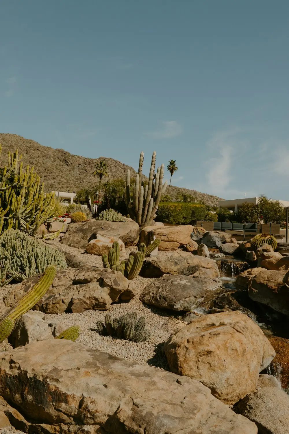
Start at the main parking lot, where you’ll find restrooms, drinking fountains and park information. The trail heads uphill right away through saguaros, chollas, palo verde trees and big granite boulders.
2. Climbing to Grandview
The first section climbs steadily to Grandview, a viewpoint looking out over North Scottsdale, golf courses and distant mountains. It’s a great turnaround for a shorter hike.
3. To the high point
The trail keeps winding up along the mountainside to its highest point at 2,889 feet. The granite spire of Pinnacle Peak towers right above you, and you’ll often see rock climbers on the walls.
4. Down to Owl’s Rest and the far end
From the high point, the trail drops down the west side, past the Owl’s Rest viewpoint, to the end of the trail near Jomax Road. There’s no parking or facilities at this end, so you turn around here.
5. The climb back
Remember: the return starts uphill. Save water and energy for it.
Hours: They Change Through the Year
Pinnacle Peak Park opens and closes at different times depending on the month, to match daylight. In winter, it opens later (around 7 a.m. for much of December and January); in summer, it opens as early as 5 a.m. The park is closed on Christmas Day.
Rangers start closing the far end of the trail before the posted closing time, so allow enough time to get back. Check the city’s Pinnacle Peak Park page for the current month’s hours before you go.
Can you hike at sunrise?
Only if the park is open by then. In winter, opening time is often after sunrise. In late spring and summer, early opening gives you cool morning light.
Parking and Rules
- Parking: free, at the main trailhead lot. It fills on winter weekends, so go early.
- No parking at the west end near Jomax Road.
- Dogs and bikes are not allowed on the trail. (Both are allowed at the nearby Brown’s Ranch Trailhead in the McDowell Sonoran Preserve.)
- Stay on the trail. Off-trail hiking isn’t allowed.
- Slacklining is prohibited.
Views, Plants and Wildlife
From the trail, you’ll see the McDowell Mountains, Four Peaks on clear days, the upscale golf communities of North Scottsdale and miles of open desert. The park is full of saguaros, cholla, prickly pear and palo verde, with lizards, Gambel’s quail, cactus wrens and roadrunners. Rattlesnake activity changes with the seasons, so watch where you step.
The park also hosts interpretive hikes, sunset and full-moon hikes and astronomy talks. Check the city calendar.
Best Time to Hike
| Season | What to expect |
|---|---|
| November–March | Perfect weather, busy weekends |
| April and October | Warm; go early |
| May–September | Very hot; go at opening time or skip |
What to Bring
- Water: the city recommends at least one quart (about 1 liter) per person; bring more when warm.
- Hiking shoes with grip.
- Hat, sunglasses, sunscreen.
- Light layer for chilly winter mornings.
- Camera for the views and climbers.
Pinnacle Peak vs. Other Phoenix-Area Hikes
| Trail | Distance (round trip) | Difficulty | Highlight |
|---|---|---|---|
| Pinnacle Peak | About 4 mi | Moderate | Smooth trail, desert views |
| Tom’s Thumb | About 4.6 mi | Difficult | Huge granite formation |
| Piestewa Peak | About 2.4 mi | Extremely difficult | 360° Phoenix view |
| Camelback Echo Canyon | About 2.3 mi | Extremely difficult | Scrambling, summit |
Frequently Asked Questions
How long is the Pinnacle Peak Trail?
2 miles one way, or about 4 miles round trip.
How hard is it?
Moderate. It has steady climbs but no scrambling.
What’s the elevation gain?
About 1,300 feet total, because the trail goes up and down.
Does it go to the summit?
No. The trail goes around the peak; its high point is 2,889 feet.
How long does it take?
About 1.5–2.5 hours round trip.
Is it free?
Yes. Parking and entry are free.
Are dogs allowed?
No. Dogs and bikes aren’t allowed on the trail.
What are the hours?
They change monthly. Check the city website before you go.
Can I park at the far end?
No. Park at the main trailhead only.
Is it good for beginners?
Yes, for beginners who can handle a few miles with hills.
Is Pinnacle Peak worth it?
Yes. It’s one of the most enjoyable, family-friendly mountain hikes in the Phoenix area.
Final Thoughts
Pinnacle Peak is the sweet spot of Scottsdale hiking: real climbing, beautiful desert, great views and a trail that’s kind to your ankles. Check the month’s hours, arrive early, bring water and save some energy for the climb back from the far end.
More Phoenix-area hikes: Tom’s Thumb, Piestewa Peak, Camelback Mountain, Wind Cave Trail and the best winter hiking trails in the USA.
Official info: City of Scottsdale: Pinnacle Peak Park.