

Late-season note (updated October 20, 2026): The Cascade Pass Trail and Cascade River Road were open at our last check, but fall has arrived in the high country. A late-September storm left several inches of fresh snow in the mountains, including at Sahale Glacier Camp, so expect snow and ice near the pass and on Sahale Arm. State Route 20 usually closes for winter in late November or early December. Check the park’s road and trail conditions right before you go.
The Cascade Pass hike is often called the best day hike in North Cascades National Park, and once you see the view, you’ll understand why. After a steady climb through old forest, you step out onto an open saddle surrounded by hanging glaciers, jagged peaks, and green alpine meadows. Few trails in the country deliver this much big-mountain scenery for this little distance.
The hike is 7.4 miles round trip with about 1,700 feet of climbing, and the Park Service rates it moderate. You don’t need any climbing skills in summer. You do need to plan for the long, rough drive up Cascade River Road, a short season, and fast-changing mountain weather.
This guide covers everything: difficulty, the trail step by step, the views and the peaks you’ll see, Sahale Arm, road access and parking, the best time to go, permits, wildlife, and what to bring.
Cover photo: Doubtful Lake and the North Cascades from Sahale Arm, above Cascade Pass. Photo: Sergei A / Unsplash
Cascade Pass Hike: Quick Facts
| Detail | Information |
|---|---|
| Location | North Cascades National Park, Washington |
| Trailhead | Cascade Pass Trailhead, end of Cascade River Road |
| Distance | 7.4 miles round trip (3.7 miles each way) |
| Elevation gain | About 1,700 feet |
| Trailhead elevation | About 3,660 feet |
| Pass elevation | About 5,400 feet |
| Difficulty | Moderate (Park Service rating) |
| Time needed | 4–6 hours |
| Trail type | Out and back |
| Switchbacks | More than 30 |
| Best season | Mid-July to late September |
| Entrance fee | None (the park has no entrance fee) |
| Day-hike permit | Not needed |
| Dogs | Not allowed |
| Road | 23 miles from Marblemount, mostly gravel; no vehicles over 22 feet |
| Extension | Sahale Arm: about 11.8 miles round trip, 3,940 feet of gain |
You may see “7 miles” on some sites. The Park Service measures it at 3.7 miles each way, so plan on 7.4.
Where Is Cascade Pass?
Cascade Pass is in North Cascades National Park in northern Washington, east of the small town of Marblemount. It’s one of the most famous mountain passes in the state. For thousands of years, Native peoples used it to cross the Cascades, and later explorers and miners followed the same route.
To reach it, you leave State Route 20 (the North Cascades Highway) at Marblemount and drive Cascade River Road about 23 miles to the trailhead at the road’s end.
- From Seattle: about 3 to 3.5 hours, including the slow final road
- From Bellingham: about 2.5 hours
If you’re driving the whole North Cascades Highway, the Maple Pass Loop at Rainy Pass makes a great second hike on the same trip.
Before you go: Marblemount is your last stop for gas and supplies, and there’s no cell service for most of the drive. Download maps and directions ahead of time.
The pass sits on the crest of the range. To the west is the Cascade River valley where you start. To the east, the trail drops into Pelton Basin and continues toward the remote village of Stehekin.

How Hard Is the Cascade Pass Hike?
The Cascade Pass hike is moderate. You climb about 1,700 feet in 3.7 miles, and the grade is steady rather than steep. Most of the gain comes in a long series of forest switchbacks, often counted at more than 30.
The trail is well built and easy to follow when it’s free of snow. There’s no scrambling, ladders, or exposure on the normal route to the pass.
What can make it harder:
- The switchbacks. They’re gentle but long, and some people find them tiring and repetitive.
- Lingering snow. Steep snow can cover parts of the upper trail into July. In those conditions, the Park Service says an ice axe may be needed.
- Weather. Rain, wind, fog, or early snow can roll in quickly.
- The descent. Coming down is easier on the lungs but harder on the knees.
| Section | Difficulty | What to expect |
|---|---|---|
| Forest switchbacks | Moderate | Steady climb, shade, few views |
| Upper switchbacks | Moderate | Trees thin out and views open |
| Traverse to the pass | Easy to moderate | Gentle grade across open slopes and meadows |
| Snowfields (early season) | Hard to hazardous | Steep, slippery snow |
| Return trip | Moderate | Long downhill on the same switchbacks |
Good to know: If you can comfortably hike 6–8 miles with 1,500+ feet of climbing, Cascade Pass is well within reach on a snow-free day.
Cascade Pass Trail Step by Step
1. Start at the end of Cascade River Road
The trailhead sits at about 3,660 feet, in a basin already ringed by peaks. Look up before you even start. Johannesburg Mountain towers above the parking lot, and in summer you may hear ice crack and tumble from its hanging glaciers.
The trail heads straight into the forest and starts climbing right away.
2. Climb the forest switchbacks
This is where you do most of the work. The trail zigzags up through big conifers on long, gentle switchbacks. There’s plenty of shade, and only the occasional view through the trees.
Set an easy pace and keep going. The switchbacks seem to go on forever, but they make the climb much gentler than it would be otherwise.
3. Leave the trees behind
As you climb higher, the forest thins and the switchbacks get shorter. The views start to open across the valley to Johannesburg, and soon you’re looking at peaks in almost every direction.
4. Traverse the meadows to the pass
The last stretch is the best part. The trail leaves the switchbacks and makes a long, gently climbing traverse across open slopes and subalpine meadows. In mid-summer, these are covered with wildflowers. Rock slopes beside the trail are home to marmots and pikas, so listen for their whistles and squeaks.
Stay on the trail here. These meadows are very fragile and take years to recover from trampling.

5. Reach Cascade Pass
At about 5,400 feet, you top out on Cascade Pass, a wide, open saddle on the crest of the range. To the east, the land drops into Pelton Basin and the Stehekin valley. Behind you are the peaks you’ve been staring at all the way up.
Find a rock to sit on, have lunch, and take it all in. Camping isn’t allowed at the pass, so it’s day use only.
6. Decide on Sahale Arm (optional)
From the pass, a trail climbs north toward Sahale Arm. This is a much harder extension that’s covered in detail below. If you’re tired or the weather is turning, the pass is a perfect place to turn around.
7. Head back down
Return the same way. The traverse and switchbacks go quickly on the way down, but watch your footing on rocks and roots, and take breaks if your knees complain.
Cascade Pass Hike Views: What Will You See?
The Cascade Pass hike views are the reason this trail is so famous. Here’s what to look for.
Johannesburg Mountain
The giant right above the trailhead. Its huge north face is draped in hanging glaciers, and avalanches and icefall are common in summer. It dominates the view for most of the hike.
Cascade Peak, Mix-up Peak, and Magic Mountain
These sharp peaks line the ridges around the pass, with steep rock walls and snowfields.
Sahale Mountain and Sahale Glacier
Above the pass to the north. Sahale Arm climbs toward its glacier, and on a clear day you can see it from the pass.
Pelton Basin and the Stehekin Valley
Look east from the pass and you’ll see a deep, glacier-carved valley dropping toward Stehekin and Lake Chelan.
Doubtful Lake (from Sahale Arm)
If you continue up Sahale Arm, you’ll look down on Doubtful Lake, a bright blue lake in a rocky bowl below the ridge. It’s one of the most photographed views in the park.
Cascade Pass vs. Sahale Arm
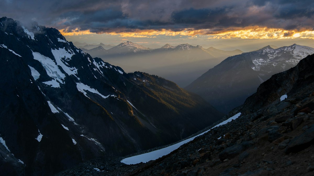
Sahale Arm is one of the most spectacular day hikes in Washington, but it’s a big step up from Cascade Pass.
| Feature | Cascade Pass | Sahale Arm to Sahale Glacier |
|---|---|---|
| Round-trip distance | 7.4 miles | About 11.8 miles |
| Elevation gain | About 1,700 feet | About 3,940 feet |
| Difficulty | Moderate | Strenuous |
| Terrain | Well-built trail | Steep trail, then loose rock and scree |
| Highlights | Glaciated peaks, meadows, the pass | Doubtful Lake, Sahale Glacier, views to Mount Rainier on clear days |
| Time | 4–6 hours | 7–10 hours |
| Best for | Most fit hikers | Strong, experienced hikers |
How it goes: From the pass, the trail climbs steeply north to the ridge, then follows the broad, flower-covered crest of Sahale Arm with Doubtful Lake below. Near the top it becomes a rough, steep climb over rock and scree to the toe of Sahale Glacier, where there’s a small designated camp.
Turn around anywhere. You don’t have to go all the way to the glacier. Many hikers go just far enough up the Arm to see Doubtful Lake, then head back.
Safety: Don’t walk onto the glacier itself unless you have glacier training and gear. Snow can linger on the upper Arm well into summer.
How Long Does the Cascade Pass Hike Take?
| Hiker type | Cascade Pass round trip |
|---|---|
| Fast, fit hikers | 3–4 hours |
| Most hikers | 4–6 hours |
| Relaxed pace with long breaks | 6–7 hours |
Add 3–4 hours or more if you continue up Sahale Arm. Don’t forget the drive: Cascade River Road alone can take an hour or more each way from Marblemount.
Cascade River Road, Parking, and Access
Getting to the trailhead is part of the adventure.
- Distance: About 23 miles from SR 20 at Marblemount to the trailhead
- Surface: Paved for roughly the first 10 miles, then gravel with potholes and washboard
- The last few miles are narrow, steep, and winding, with tight spots for passing
- Vehicle limits: No RVs, large trailers, or vehicles over 22 feet
- Clearance: The Park Service says the road isn’t suitable for sedans or low-clearance vehicles. Many cars do make it in good conditions, but a higher-clearance vehicle is safer.
- Rental cars: Check whether your rental agreement allows gravel roads.
Parking: The lot at the end of the road fills on sunny summer weekends. Arrive early, ideally before 8 a.m. Overnight camping at the trailhead isn’t allowed.
Seasonal opening: The upper road usually opens to the trailhead by late June, or early July in big snow years. Washouts and storm damage can close it at other times, so check the park’s road conditions before you drive up.
Best Time to Hike Cascade Pass
| Time of year | What to expect | Our take |
|---|---|---|
| June | Upper road may still be closed; lots of snow on the trail | Too early for most hikers |
| Early to mid-July | Road usually open; steep snow possible near the pass | Only with snow skills and gear |
| Late July to August | Mostly snow-free, wildflowers at their peak | The best time, but busy on weekends |
| September | Fewer bugs and crowds, fall color in the meadows | Excellent, but watch for early snow |
| October onward | Snow, ice, short days, SR 20 closes for winter | Only for experienced hikers in good weather |
Best month: August for the most reliable conditions and wildflowers. Mid to late September for fall color and fewer people.
Weekday tip: Weekdays are much quieter than weekends, both on the trail and in the parking lot.
Permits and Fees
- Day hike: No permit needed.
- Entrance fee: None. North Cascades National Park doesn’t charge one.
- Overnight trips: You need a backcountry permit for any overnight stay, including Pelton Basin, Sahale Glacier Camp, and other nearby camps. Permits are limited and go fast in summer.
- No camping at Cascade Pass itself, and no fires at any backcountry camp in this area.
Is Cascade Pass Good for Beginners?
It can be, for fit beginners. The trail is well graded and not technical, and the payoff is huge. If you’re comfortable walking several hours with steady uphill, you’ll likely do fine on a snow-free summer day.
If you’re brand new to hiking, build up with a few shorter hikes first, and read our hiking for beginners guide. Avoid the hike when there’s snow on the upper trail, and save Sahale Arm for later.
Kids: Strong, active older kids often enjoy this hike, especially the marmots near the top. It’s a long day for little ones.
Wildlife on the Cascade Pass Trail
Keep an eye out for:
- Marmots and pikas on the rocky slopes near the pass
- Deer in the meadows
- Black bears, sometimes seen in the meadows and berry patches
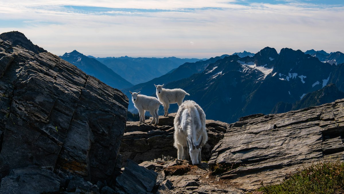
- Mountain goats, especially on Sahale Arm
Mountain goats can come close to hikers because they crave salt from sweat and urine. Don’t let them approach. Move away, and never feed them or any other wildlife. Pee well off the trail and away from rocks where goats hang out.
What to Bring
- Hiking shoes or boots with good grip
- 2–3 liters of water (or a filter for streams)
- Lunch and snacks
- A warm layer and a rain jacket, even on sunny days
- Sun hat, sunglasses, and sunscreen for the open slopes
- Bug spray in July and August
- Trekking poles for the descent
- An offline map, since there’s no cell service
- A headlamp and small first-aid kit
- Microspikes or an ice axe if there’s snow on the trail, and only if you know how to use them
Common Mistakes to Avoid
Not checking the road
The trailhead is useless if Cascade River Road is closed or washed out. Check before you leave.
Going too early in the season
Steep snow near the pass can be dangerous into July. Without snow skills, wait until the trail melts out.
Arriving late on a summer weekend
The lot fills fast. Start early, or go on a weekday.
Taking Sahale Arm too lightly
It’s more than double the climbing of Cascade Pass, with loose rock near the top. Give yourself plenty of time and daylight.
Walking on the meadows
Stay on the trail. The plants here are fragile and slow to recover.
Cascade Pass Hike FAQs
How long is the Cascade Pass hike?
It’s 3.7 miles each way, or 7.4 miles round trip, according to the Park Service.
How much elevation gain is on the Cascade Pass hike?
About 1,700 feet, from roughly 3,660 feet at the trailhead to about 5,400 feet at the pass.
Is the Cascade Pass hike hard?
The Park Service rates it moderate. It’s a steady climb on a well-graded trail with many switchbacks, but no technical sections when snow-free.
How long does it take to hike Cascade Pass?
Most people take 4 to 6 hours round trip.
Do you need a permit to hike Cascade Pass?
Not for a day hike. Overnight stays require a backcountry permit.
Is there a fee to hike Cascade Pass?
North Cascades National Park has no entrance fee, and you don’t need a permit for a day hike.
Is Cascade River Road paved?
Only the first 10 miles or so. The rest is gravel, with narrow, steep sections near the end.
Can I drive a regular car to Cascade Pass?
Many people do in good conditions, but the Park Service says the road isn’t suitable for sedans or low-clearance cars. No vehicles over 22 feet.
When does Cascade River Road open?
The upper road usually opens to the trailhead by late June, or early July after heavy snow winters.
What is the best time to hike Cascade Pass?
Late July through September. August is the most reliable month for snow-free trail and wildflowers.
Are dogs allowed on the Cascade Pass Trail?
No. Pets aren’t allowed on this trail.
Can you camp at Cascade Pass?
No. Camping isn’t allowed at the pass. With a permit, you can camp at nearby sites like Pelton Basin or Sahale Glacier Camp.
What can you see from Cascade Pass?
Johannesburg Mountain and its hanging glaciers, Cascade, Mix-up, and Sahale peaks, wildflower meadows, and Pelton Basin to the east.
How far is Sahale Arm from Cascade Pass?
From the trailhead, it’s about 5.9 miles one way to Sahale Glacier, so about 2.2 miles past Cascade Pass, with much more climbing.
Is the Cascade Pass hike worth it?
Absolutely. It’s one of the best mountain views you can reach on a moderate day hike anywhere in the U.S.
Final Thoughts
The Cascade Pass hike packs glaciers, jagged peaks, wildflower meadows, and wildlife into a moderate day. The climb is steady, the trail is well built, and the reward at the top is huge.
Plan around the season and the road, start early, bring layers, and leave time to linger at the pass. If you’ve still got energy, take a look up Sahale Arm. If not, the view from the pass is more than enough to make this one of your favorite hikes.