
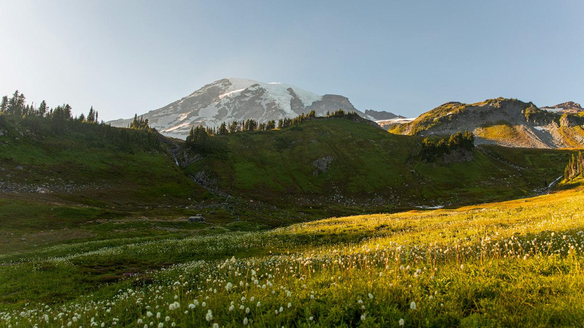
If you only do one day hike at Mount Rainier, make it the Skyline Trail. In one loop from Paradise, you walk through some of the best wildflower meadows in the country, stand eye to eye with the Nisqually Glacier, look out over a string of volcanoes from Panorama Point, and finish beside a waterfall with the mountain filling the sky behind it.
It’s not an easy stroll, though. The Skyline Trail Mount Rainier hike climbs about 1,700 feet in roughly 5.5 miles, most of it in the first two miles, and snow can cover parts of the trail well into summer. But you don’t need any climbing skills on a snow-free day, and the views start almost the minute you leave the parking lot.
This guide covers everything you need to plan it: the real distance and difficulty, which direction to hike, a step-by-step route, the High Skyline vs. lower trail question, shorter options, parking, entry rules in 2026, the best months, and what to pack.
Cover photo: a summer wildflower meadow below Mount Rainier. Photo: Emma Swoboda / Unsplash
Skyline Trail Mount Rainier: The Short Answer
The Skyline Trail is a 5.5-mile loop from Paradise, beside the Jackson Visitor Center in Mount Rainier National Park, Washington. It climbs about 1,700 feet past wildflower meadows and the Nisqually Glacier to Panorama Point, then loops back past the Stevens–Van Trump Memorial and Myrtle Falls. The park estimates about 4.5 hours. It’s moderate to strenuous, best from late July through September, and no timed-entry reservation was needed in 2026.
Skyline Trail Mount Rainier: Quick Facts
| Detail | Information |
|---|---|
| Location | Paradise, Mount Rainier National Park, Washington |
| Trailhead | Paradise Meadows / Skyline Trailhead, by the Jackson Visitor Center |
| Distance | 5.5-mile loop (GPS tracks often show up to 6.2 miles) |
| Elevation gain | About 1,450–1,900 feet (the park lists 1,700) |
| Trailhead elevation | About 5,400 feet |
| Highest point | About 6,800–7,000 feet, depending on the route |
| Difficulty | Moderate to strenuous |
| Time needed | About 4–5 hours |
| Trail type | Loop |
| Park-recommended direction | Clockwise |
| Main highlights | Paradise meadows, Glacier Vista, Panorama Point, Stevens–Van Trump Memorial, Myrtle Falls |
| Best months | Late July through September |
| Dogs | Not allowed on trails |
| Timed entry in 2026 | Not required |
Why the numbers vary: The National Park Service lists 5.5 miles, 1,700 feet of gain, and about 4.5 hours. Washington Trails Association lists 1,450 feet with a high point of 6,800 feet. Some GPS tracks that include side trips and the High Skyline measure 6.2 miles and about 1,900 feet. Plan for the bigger numbers.
How Hard Is the Skyline Trail?
The Skyline Trail is moderate to strenuous. For fit hikers it’s a very doable half-day. For people who rarely walk uphill, the steady climb at over 5,000 feet can feel tough.
There’s no technical climbing when the trail is clear of snow. The challenges are the sustained climb, the altitude, rocky footing in places, and weather that can change fast on an exposed mountainside.
| Challenge | How hard? | What it means for you |
|---|---|---|
| Distance | Moderate | About 5.5 miles, a half-day hike |
| Elevation gain | Moderate to hard | About 1,700 feet, mostly in the first 2 miles (clockwise) |
| Steepness | Hard in places | Steep paved and rocky sections on the climb to Panorama Point |
| Scrambling | Low | A well-built trail when snow-free |
| Altitude | Moderate | You’re hiking between about 5,400 and 7,000 feet |
| Snowfields | Variable to dangerous | Common into July, and one icy slope stays all year |
| Navigation | Moderate | Several junctions, all signed |
| Weather | Can be serious | Little shelter above the trees |
A quick self-test: If you can comfortably hike 5 or 6 miles with a sustained uphill section, you’re likely ready. If not, the Myrtle Falls walk or an out-and-back to Glacier Vista is a great introduction.
Where Is the Skyline Trail?
The Skyline Trail starts at Paradise, on the south side of Mount Rainier National Park in Washington. Paradise sits at about 5,400 feet on the mountain’s flank, with the Henry M. Jackson Memorial Visitor Center, the historic Paradise Inn, and a big parking area.
Most people drive in through the Nisqually Entrance near the town of Ashford, then continue about 19 miles up the road past Longmire to Paradise. From Seattle, plan on about 2.5 hours of driving.
The trail begins on the wide stone steps just behind the visitor center, carved with a famous John Muir quote about the mountain’s wildflower gardens.
Skyline Trail Map and Route
The classic clockwise loop goes: Jackson Visitor Center (John Muir steps) → Paradise meadows → Glacier Vista → Panorama Point → High Skyline Trail → Golden Gate junction → Stevens–Van Trump Memorial → Paradise Valley (Mazama Ridge) → Myrtle Falls → Paradise.
Paradise has a web of connecting trails, so you’ll pass a lot of signed junctions. Grab the free Paradise trail map at the visitor center, or look at the park’s interactive Skyline Trail map before you go and download it, because cell service is spotty and snow can hide the path in early summer.
Clockwise or Counterclockwise?
You can hike the loop either way. The Park Service describes it clockwise, and many experienced hikers prefer counterclockwise. Here’s how they compare:
| Factor | Clockwise (park-recommended) | Counterclockwise |
|---|---|---|
| The climb | Steeper and shorter, right at the start | More gradual, spread over more distance |
| Panorama Point | Reached after about 2 miles | Reached later in the hike |
| The descent | Gentler, through Paradise Valley | Steeper, down to Paradise |
| Mountain views | Big views right away | Mount Rainier in front of you for more of the climb |
| Best for | Getting the hard climbing done while your legs are fresh | Hikers who prefer an easier climb and don’t mind a steep downhill |
Our take: Go clockwise if you’d rather get the big climb over with early. Go counterclockwise if your knees handle downhills well and you want a gentler ascent. The step-by-step guide below follows the park’s clockwise route.
Skyline Trail Step by Step (Clockwise)
1. Paradise to the upper meadows
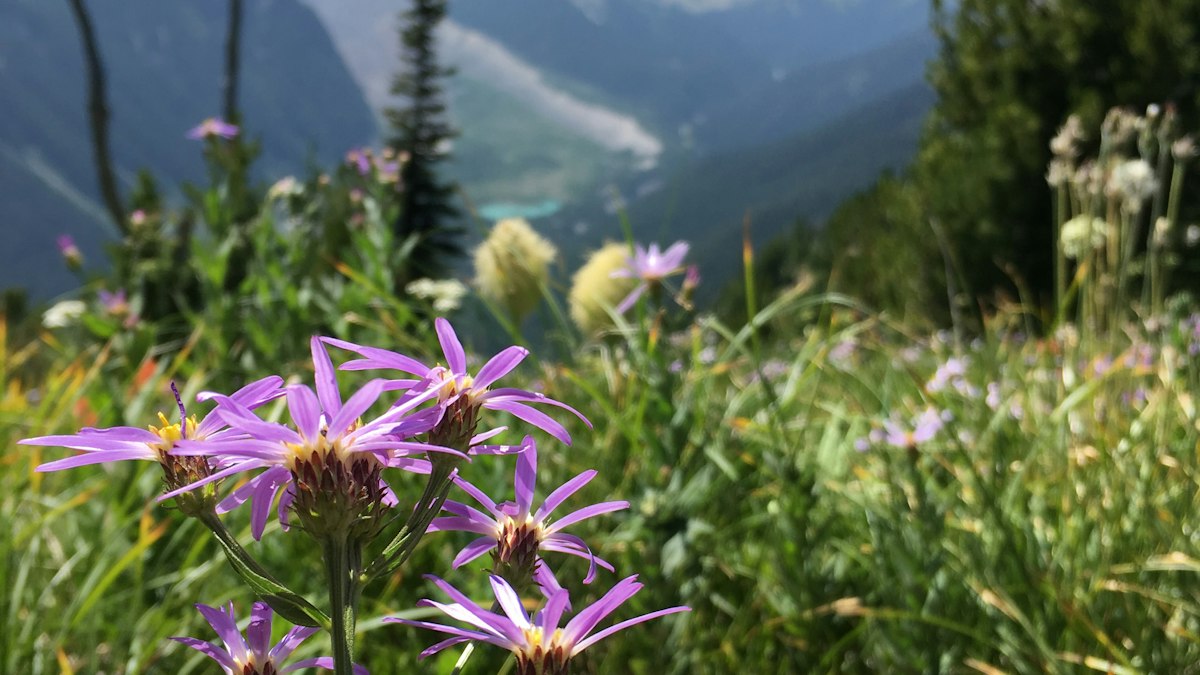
Climb the stone steps behind the visitor center and you’re immediately in the Paradise meadows. The first stretch is paved and surprisingly steep, so don’t race it. In late July and August, these slopes explode with lupine, paintbrush, asters, and avalanche lilies.
Stay on the trail. These subalpine plants have only a few snow-free weeks to grow each year, and one footprint can damage them for years.
2. Glacier Vista
As you climb, the trees thin out and the Nisqually Glacier comes into view, a huge river of cracked ice pouring off the mountain. A short spur to Glacier Vista (about 6,300 feet) adds roughly 0.2 mile and gets you a closer look. It’s also a great turnaround point if you only want a shorter hike.

3. Panorama Point
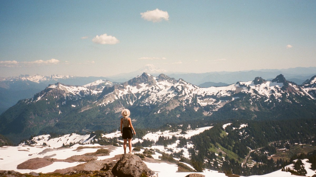
Keep climbing on rockier trail to Panorama Point, about 2 miles from Paradise. This is the high point for most hikers and the best rest stop on the loop. On a clear day, you can see the jagged Tatoosh Range right below, and in the distance Mount Adams, Mount St. Helens, and sometimes Mount Hood in Oregon.
There’s a pit toilet near Panorama Point, but it’s usually closed from about mid-October to mid-June.
This is your decision point. If you’re tired, cold, or watching dark clouds build, head back the way you came. You’ve already seen the best views.
4. Take the High Skyline Trail
Past Panorama Point, the trail splits. The Park Service recommends taking the High Skyline Trail. The lower route crosses a steep, icy snow slope that often doesn’t melt, even in late summer, and a slip there can be serious. The High Skyline climbs a little higher (to roughly 7,000 feet) and rejoins the main trail above the Golden Gate junction.
Never follow other hikers across steep snow just because they’re doing it. Check the latest trail report before you go.
5. The Golden Gate junction and Stevens–Van Trump Memorial
Next you’ll reach the Golden Gate Trail junction. Golden Gate is a shortcut that drops steeply back toward Paradise if you want to cut the loop short.
To continue on the full loop, carry on about 0.75 mile to the Stevens–Van Trump Memorial. This stone bench marks where Hazard Stevens and P.B. Van Trump camped in 1870 before making the first documented climb of Mount Rainier. It’s also the junction with the Paradise Glacier Trail.
6. Down through Paradise Valley
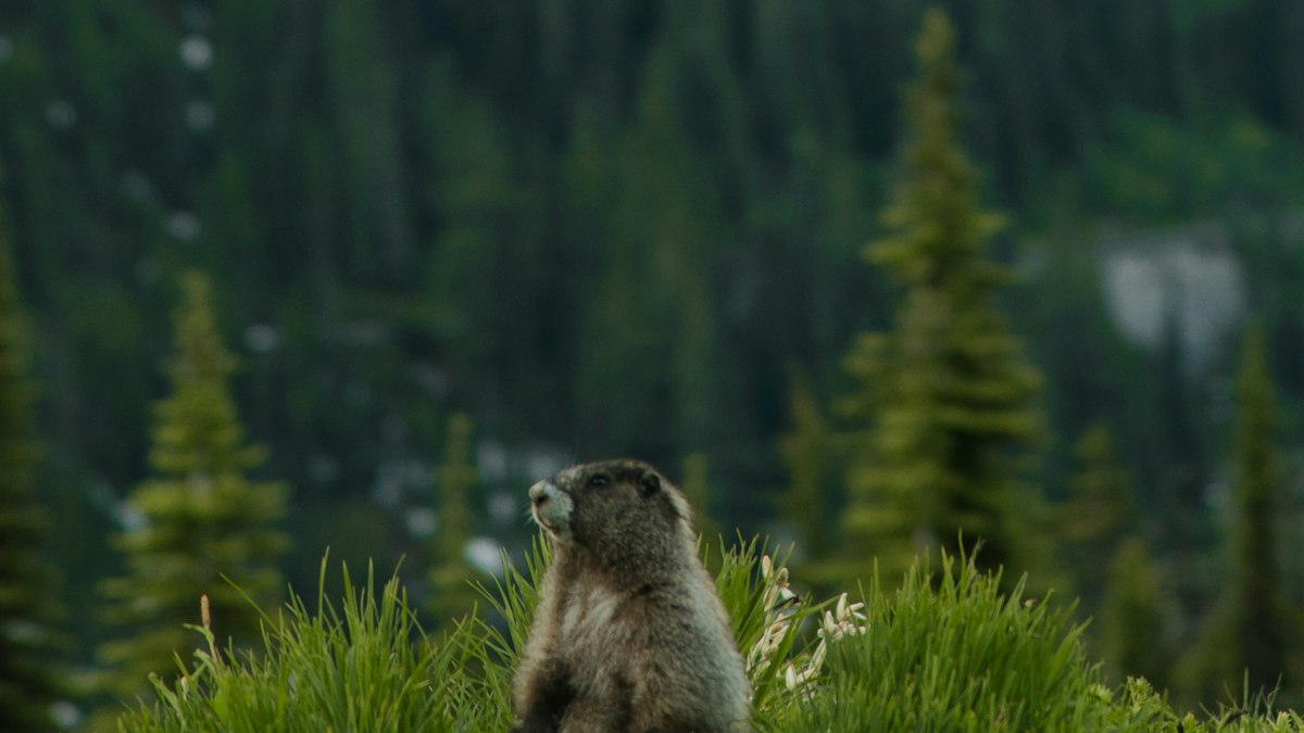
From the memorial, the trail drops into Paradise Valley, trading rock and snow for meadows, streams, and small trees. Mazama Ridge, on this side of the loop, is one of the best wildflower spots in the park. Watch for marmots sunning themselves on the rocks.
Tired legs make downhill switchbacks harder than they look, so take it steady.
7. Myrtle Falls and back to Paradise
The trail climbs gently to Myrtle Falls, where Edith Creek tumbles through a small gorge with Mount Rainier towering behind it. It’s one of the most photographed views in the park. From here, it’s an easy, paved walk back to the visitor center.
The classic view is from the bridge above the falls. A short, steep side path with steps leads down to a lower viewpoint looking up at the falls with the mountain behind. It’s popular and the gorge has steep drops, so keep kids close and stay behind the rails.

Skyline Trail Distance and Shorter Options
You don’t have to do the whole loop to see Paradise at its best.
| Option | Approx. distance | Good for |
|---|---|---|
| Full Skyline Loop (with High Skyline) | 5.5–6.2 miles | Fit hikers who want the full experience |
| Panorama Point out and back | About 3.2–4 miles round trip | The big views without the full loop |
| Glacier Vista out and back | About 2.5 miles round trip | Glacier views with less climbing |
| Golden Gate shortcut loop | Shorter than the full loop | Cutting the loop short (steep descent) |
| Myrtle Falls | About 1 mile round trip | Families, casual walkers, and partly accessible paths |
| Nisqually Vista Trail | About 1.2-mile loop | An easy walk to a Nisqually Glacier viewpoint |
| Alta Vista Trail | About 1.7 miles | A short, steep hill with wildflowers and big mountain views |
Even the short options can be icy in early summer, so check conditions first. The first part of the path toward Myrtle Falls is paved, and some wheelchair users can manage part of it with help.
Best Time to Hike the Skyline Trail
Late July through September is the sweet spot. Paradise gets enormous amounts of snow, so the trail is often snow-covered into July.
| Month | Typical conditions | Our take |
|---|---|---|
| May–June | Deep snow on most of the loop | Snowshoe or walk near Paradise only |
| July | Snow melting, wildflowers starting | Expect snowfields up high; check reports |
| Late July–mid-August | Peak wildflowers, mostly snow-free | Best time, but busiest |
| September | Fewer people, fall colors, cooler air | Excellent, but early snow is possible |
| October–April | Snow and ice; winter road rules | Winter travel only |
When do the wildflowers bloom?
Peak bloom at Paradise usually runs from late July to mid-August, but it depends on snowmelt. A big snow year pushes the flowers later. A warm spring brings them earlier.
Best time of day
Start early. Clouds often build around the mountain by midday, and the parking lots fill by mid-morning in summer. A sunrise or early-morning start also gives you the best light on Rainier and the quietest trail. Late afternoon can be lovely too, thanks to long summer daylight.
Skyline Trail Wildflowers
Paradise is famous for some of the best subalpine wildflower displays in the country. The snow melts late, so plants have only a few weeks to grow and bloom, and they all seem to do it at once. Look for:
- Avalanche lilies: white, nodding flowers that pop up right as the snow melts.
- Western pasqueflower: creamy early flowers that turn into shaggy “mop-top” seed heads later in summer.
- Subalpine lupine: the purple-blue spikes that cover whole slopes.
- Magenta and scarlet paintbrush: bright reds and pinks mixed in with the lupine.
- Pink mountain heather, asters and bistort: filling in the meadows from late July.
Photo tip: crouch low on the trail with flowers in the foreground and the mountain behind. You’ll get the shot without stepping into the meadow.
Skyline Trail in August
August is the most popular month and often the best. The upper loop is usually snow-free (apart from that icy slope below the High Skyline), the wildflowers are often still at or near peak in early August, and days are long. The catch is crowds: parking can fill by mid-morning, especially on weekends. Arrive before 7 a.m., pack sun protection for the open slopes, and still carry a warm layer for Panorama Point. Wildfire smoke can sometimes hide the views in late August.
Skyline Trail in September
September is quieter and often clearer. The flowers fade, but the meadows turn red and gold as huckleberry and mountain ash change color, and the crowds thin out after Labor Day. Mornings are cold, and the first snow can dust the upper trail any time, especially late in the month. Check the forecast and turn back at Panorama Point if conditions look wintry.
Skyline Trail Weather
Mount Rainier makes its own weather. A sunny morning at Paradise can turn into thick fog, wind and rain within an hour, and the mountain often disappears behind clouds by early afternoon. Panorama Point is usually colder and much windier than the parking lot, and snow can fall at Paradise in any month.
- Check the National Weather Service point forecast for Paradise, not Ashford or Seattle.
- Start early, when skies are most often clear.
- If clouds drop onto the trail, turn around. It’s easy to lose the route on snow in a whiteout.
Skyline Trail Conditions Right Now (Late October 2026)
Paradise is shifting into winter. Paradise Inn and Cougar Rock Campground are closed for the season, and the Jackson Visitor Center is on winter hours (Friday to Monday, then weekends and holidays once the nightly road gate schedule starts). The park’s detailed summer trail updates are finished for the year.
Expect snow and ice on the upper loop, short days and possible road closures between Longmire and Paradise. Unless you have winter skills and gear, stick to short walks near the visitor center, and check the park’s road status before driving up. In winter, carry tire chains: they’re required in the park during the snow season.
Parking, Entry, and Reservations in 2026
Timed entry
Mount Rainier National Park does not require timed-entry reservations anywhere in the park in 2026. The park announced this on February 25, 2026. Rules can change for future years, so check before you go.
Parking at Paradise
Paradise is the busiest part of the park. To get a spot:
- Arrive before 7 a.m. or after 4 p.m., as the park recommends.
- Visit on weekdays if you can. Weekends and holidays are packed.
- If Paradise is full, follow ranger directions and pick another area. Never park on meadows or block the road.
Entrance fees
- Private vehicle: $30, valid 7 days
- Motorcycle: $25, valid 7 days
- Per person (on foot or bike, 16+): $15, valid 7 days
- Mount Rainier annual pass: $55
- America the Beautiful pass is also accepted. The park doesn’t take cash.
Road access
The road from the Nisqually Entrance to Paradise is the park’s year-round route, but in winter it’s gated at Longmire overnight and vehicles must carry tire chains. Weather can close it at any time, so check the road status before you drive up.
Wildlife on the Skyline Trail
The Paradise meadows are full of life. You’re likely to see hoary marmots whistling from the rocks, plus chipmunks, ground squirrels, and deer. Mountain goats sometimes appear on higher slopes, and black bears occasionally graze the meadows in late summer.
Never feed wildlife or approach it, even animals that seem used to people. Pack out all your trash and food scraps.
Is the Skyline Trail Good for Beginners?
The full loop is a stretch for complete beginners, mainly because of the steady climb at altitude. Fit beginners with some hiking experience can usually do it in good, snow-free conditions if they take their time.
If you’re new to hiking, start with Myrtle Falls or the walk to Glacier Vista, and check out our hiking for beginners guide. Kids who are used to hiking often love the loop, especially the marmots.
What to Bring
- Sturdy hiking shoes with good grip for rocky and wet sections
- Plenty of water (at least 2 liters each) and snacks; treat any water from streams
- A rain jacket and warm layer, since clouds and wind roll in fast (see our waterproof hiking jacket guide)
- Sun protection: hat, sunglasses, and sunscreen; the snow and open slopes reflect a lot of sun
- Trekking poles for the climb and descent (see budget trekking poles for beginners)
- Offline map and a fully charged phone
- Headlamp and small first-aid kit
- Traction and snow skills if you hike in early summer
Safety Tips
- Check the trail report before you start, especially for snow on the upper loop.
- Take the High Skyline Trail past Panorama Point to avoid the permanent icy slope.
- Turn around if clouds drop in. Whiteouts make it easy to lose the trail on snow.
- Stay on the trail to protect the fragile meadows.
- Give wildlife space, and never feed it.
- No fires are allowed, and Paradise is day-use only.
Photography Tips
- Paradise meadows: wildflowers in the foreground with Rainier filling the frame.
- Glacier Vista: a telephoto lens picks out the crevasses on the Nisqually Glacier.
- Panorama Point: the Tatoosh Range with Adams, St. Helens and Hood lined up on the horizon.
- Myrtle Falls: the iconic waterfall-and-mountain shot, best in morning light.
One- and Two-Day Mount Rainier Plans
One day: Arrive at Paradise by 7 a.m., hike the Skyline Loop clockwise, have lunch at Panorama Point, and finish at Myrtle Falls by early afternoon. On the drive out, stop at Narada Falls and Christine Falls along the road.
Two days: Do the Skyline Loop on day one. On day two, take an easy morning at Reflection Lakes (famous for mirror views of the mountain), walk the short trails at Longmire, and add the Grove of the Patriarchs or the drive to Sunrise if those roads are open. If you want another big hike, our guide compares Skyline with Mount Fremont Lookout above.
Where to Stay Near the Skyline Trail
- Paradise Inn: the historic lodge right at the trailhead, open roughly May through September. Book months ahead.
- National Park Inn at Longmire: open year-round, about 30 minutes below Paradise.
- Cougar Rock Campground: between Longmire and Paradise, open in summer and reservable on Recreation.gov.
- Ashford: cabins, lodges and restaurants just outside the Nisqually Entrance, about 45 minutes from Paradise.
- Packwood: a good base for the park’s southeast corner, about an hour away when Stevens Canyon Road is open.
Exploring more of Washington? Try Colchuck Lake near Leavenworth, the Maple Pass Loop, Cascade Pass, Mount Storm King or the Hoh River Trail.
Common Mistakes to Avoid
Showing up mid-morning on a summer weekend
You may spend more time looking for parking than hiking. Go early, late, or on a weekday.
Taking the lower trail across the icy slope
The High Skyline route exists for a reason. Use it.
Hiking in June expecting summer conditions
Paradise is often still buried in snow. Wait until late July for the full loop.
Underdressing
It can be sunny and warm at the visitor center and windy and cold at Panorama Point. Bring layers.
Walking off-trail for photos
Stepping into the meadows damages plants that take years to recover, and it’s against park rules.
Skyline Trail vs. Mount Fremont Lookout
Both are classic Mount Rainier hikes, but they’re on different sides of the mountain.
| Feature | Skyline Trail | Mount Fremont Lookout |
|---|---|---|
| Park area | Paradise (south side) | Sunrise (northeast side) |
| Route | Loop | Out and back |
| Main scenery | Wildflower meadows, glaciers, waterfalls | Ridgelines and a historic fire lookout |
| Difficulty | Moderate to strenuous | Moderate |
| Seasonal access | Road open year-round; trail snow-free mid-summer | Sunrise Road open only in summer |
| Best for | A first big hike at Rainier | A second day exploring the quieter side |
If you have time for both, do Skyline first.
Skyline Trail FAQs
How long is the Skyline Trail at Mount Rainier?
The Park Service lists the loop at 5.5 miles. GPS tracks that include the High Skyline and side trips often show closer to 6.2 miles.
How much elevation gain is on the Skyline Trail?
About 1,700 feet according to the park, with estimates ranging from 1,450 to 1,900 feet depending on the exact route.
How long does the Skyline Trail take?
About 4–5 hours for most hikers, including breaks. The park estimates about 4.5 hours.
Is the Skyline Trail hard?
It’s moderate to strenuous. The steady climb at altitude is the main challenge. In snow-free conditions there’s no technical climbing.
Which direction should I hike the Skyline Trail?
The park recommends clockwise, which gets the steepest climb done early. Counterclockwise has a gentler climb but a steeper descent.
What is the High Skyline Trail?
It’s a slightly higher route past Panorama Point that avoids a steep, icy snow slope on the lower trail. The park recommends using it.
Can beginners hike the Skyline Trail?
Fit beginners can, in good conditions and at a relaxed pace. True beginners should try Myrtle Falls or Glacier Vista first.
When is the best time to hike the Skyline Trail?
Late July through September. Wildflowers usually peak from late July to mid-August.
Do you need a reservation for the Skyline Trail?
No. There was no timed-entry reservation in 2026, and no permit is needed for a day hike. You do need a park entrance pass.
Can you see glaciers from the Skyline Trail?
Yes. The Nisqually Glacier is right beside the climb, and Glacier Vista gives an especially close view.
Are dogs allowed on the Skyline Trail?
No. Pets aren’t allowed on any trails in Mount Rainier National Park, except service animals.
Is there a bathroom on the Skyline Trail?
There are restrooms at the Jackson Visitor Center and a pit toilet near Panorama Point that’s usually open only from mid-June to mid-October.
How far is Panorama Point on the Skyline Trail?
About 2 miles from Paradise on the clockwise loop, with most of the loop’s climbing on the way.
How far is Myrtle Falls from Paradise?
About half a mile each way on a mostly paved path, so roughly 1 mile round trip.
Can you hike the Skyline Trail in September?
Yes. September is quieter with fall color in the meadows, but expect cold mornings and the chance of early snow, especially late in the month.
Is the Skyline Trail open in winter?
The road to Paradise stays open in winter (weather permitting, with chains required), but the summer trail is buried under deep snow. Winter travel there needs snowshoes or skis, avalanche awareness and good navigation.
Is the Skyline Trail worth it?
Absolutely. It packs meadows, glaciers, volcano views, wildlife, and a waterfall into one half-day loop. It’s widely considered the best day hike in the park.
Final Thoughts
The Skyline Trail is Mount Rainier at its best. You don’t need to climb the mountain to feel how big it is. Just walk up from Paradise and let the glaciers, meadows, and views do the rest.
Go between late July and September, start early, take the High Skyline past Panorama Point, and pack layers. And if the full loop is too much, even a walk to Myrtle Falls is unforgettable.