
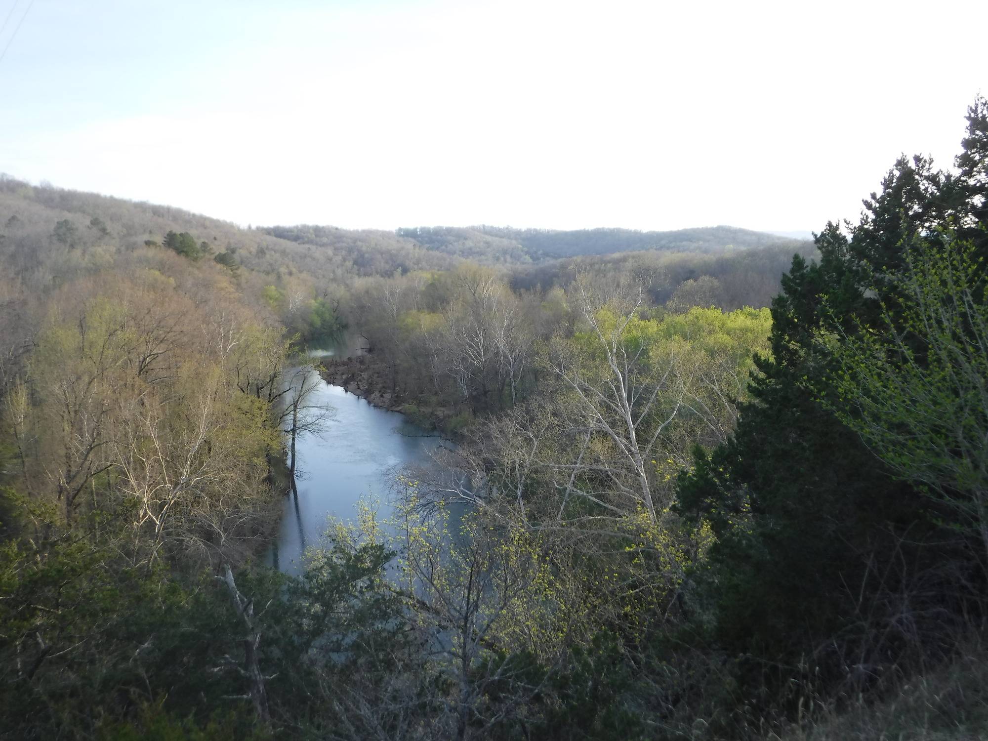
Most hikes save the hard part for the way up. The Centerpoint to Goat Trail hike in Arkansas does it the other way around. You spend the first hour or so walking downhill through quiet Ozark forest. Then a narrow path takes you out along the face of Big Bluff, where a wall of rock rises on one side and a sheer drop falls away on the other, straight down to the Buffalo River.
It’s one of the most famous views in Arkansas. It’s also one of the park’s busiest spots for rescues, mostly because people underestimate the long climb back to the car.
This guide explains how the route works (Centerpoint Trail, the Goat Trail and Big Bluff), plus directions, parking, distance and time, difficulty, a step-by-step route, ledge safety, the best seasons, kids and dogs, camping, nearby hikes and FAQs.
Cover photo: The Buffalo National River in early spring. Photo: NPS (public domain)
Centerpoint to Goat Trail: The Short Answer
The Centerpoint to Goat Trail hike starts at Centerpoint Trailhead on Highway 43, about 3 miles north of Ponca, Arkansas, in the Ponca Wilderness of Buffalo National River. Walk about 2.5 miles down Centerpoint Trail, then bear right on the Goat Trail for about half a mile to Big Bluff. It’s about 6 miles round trip and takes 4–6 hours, with roughly 1,000 feet of climbing on the way back. The park rates it strenuous. The Goat Trail runs along the edge of a 350-foot sheer cliff, so it isn’t recommended for children under 12 or anyone afraid of heights. Pets are not allowed.
Centerpoint to Goat Trail: Quick Facts
| Detail | Information |
|---|---|
| Location | Ponca Wilderness, Buffalo National River, Arkansas |
| Nearest town | Ponca, about 3 miles south |
| Trailhead | Centerpoint Trailhead, Hwy 43 at Fire Tower Road |
| Destination | Big Bluff, via the Goat Trail |
| Distance | About 6 miles round trip |
| Time | 4–6 hours |
| Climb on the way back | About 1,000 feet |
| Difficulty | Strenuous (NPS rating) |
| Cliff below the Goat Trail | About 350 feet, sheer |
| Parking | Gravel lot for 20–25 cars |
| Restroom | None at the trailhead |
| Fees and permits | No activity fee or reservation for the day hike |
| Pets | Not allowed (service animals only) |
| Kids | Not recommended under 12 |
| Open | Year-round, any time of day |
| Best seasons | Spring and fall |
Centerpoint Trail vs. Goat Trail vs. Big Bluff
People use these names as if they mean the same thing, which confuses a lot of first-timers. Here’s how they fit together:
- Centerpoint Trail is the main trail, an old wagon road that drops from Highway 43 toward the Buffalo River.
- The Goat Trail is the narrow side trail that leaves Centerpoint and runs along the face of the bluff.
- Big Bluff is the giant limestone cliff itself, rising more than 500 feet above the river. It’s often called one of the tallest bluffs in the Ozarks.
So “Centerpoint to Goat Trail” just means hiking Centerpoint Trail down to the Goat Trail, then out onto Big Bluff.
Centerpoint Trailhead Directions
Centerpoint Trailhead sits on Arkansas Highway 43, about 3 miles north of Ponca, directly across the highway from the Fire Tower Road intersection.
- From Ponca: Drive north on Highway 43 for about 3 miles. When you see Fire Tower Road on one side, the gravel trailhead lot is on the other.
- From Harrison: Drive south on Highway 43 toward Ponca. The trailhead comes before you reach Ponca, opposite Fire Tower Road.
- From Jasper: Take Highway 74 west to Ponca, then Highway 43 north for about 3 miles.
The lot is right off the paved highway, so any car can reach it. Cell service is patchy in this area, so download your directions and map before you leave town.
Parking, Fees and Facilities
- Parking: A gravel lot holds about 20–25 vehicles. On fall weekends it can fill early, so arrive by mid-morning or earlier.
- Cost: There’s no activity fee and no reservation needed for the day hike.
- Restrooms: None at the trailhead. Use facilities in Ponca or Jasper first.
- Water: None at the trailhead. Bring all you need.
- Full lot? Don’t park on the highway shoulder or block driveways. Pick another hike, or come back later.
How Long Is the Centerpoint to Goat Trail Hike?
| Section | Approximate distance |
|---|---|
| Centerpoint Trailhead to the Goat Trail junction | 2.5 miles |
| Goat Trail to Big Bluff | 0.5 mile |
| One way | About 3 miles |
| Round trip | About 6 miles |
GPS apps usually record 5–6 miles, depending on how far along the bluff you go. The park lists 4–6 hours and suggests planning a full day.
| Hiking style | Round-trip time |
|---|---|
| Fit, experienced hikers | About 3.5–4 hours |
| Average hikers | 4–5 hours |
| Slower pace with long breaks | 5–6+ hours |
| Hot or wet days | Longer |
A good rule: expect the hike out to take about twice as long as the hike in.
How Hard Is the Centerpoint to Goat Trail?
The National Park Service rates it strenuous. Some apps call it moderate because 6 miles doesn’t sound like much, but here’s why it’s harder than it looks:
- Upside-down hike: Centerpoint drops steadily toward the river (nearly 1,300 feet if you go all the way down). From Big Bluff, you climb about 1,000 feet back out when you’re already tired.
- Rough ground: The old road is rocky, rutted and steep in places.
- Exposure: The Goat Trail is a narrow ledge with no railing above a sheer drop.
- Heat and humidity: Ozark summers make the climb out exhausting.
- Remote: There’s no water, no restroom and spotty cell service.
Is it OK for beginners? Not as a first hike. If you haven’t done a steep 6-mile hike before, build up on easier trails first; our hiking for beginners guide is a good place to start. If you’re new to heights, try Lost Valley or Whitaker Point first.
Centerpoint to Goat Trail Map and Route
Centerpoint Trailhead → Centerpoint Trail (yellow “CPT” blazes) → Goat Trail junction at about 2.5 miles (bear right) → Goat Trail along the bluff → Big Bluff, then back the same way.
Centerpoint crosses several other trails, including the Chimney Rock, Sneeds Creek, Compton and Hemmed-in Hollow trails. Keep following the yellow rectangular CPT markers until the Goat Trail junction. The park’s Big Bluff hiking page includes a Centerpoint trail map. Save a copy to your phone before you go, since you probably won’t have a signal on the trail.
Centerpoint to Goat Trail: Step by Step
1. Head Down the Old Wagon Road
From the lot, Centerpoint Trail heads into an oak and hickory forest and starts dropping almost at once. It’s wide because it was once a wagon road, but it’s rocky and loose in places. Going down feels easy. Keep in mind that every step down is a step you’ll climb back up.
2. Pass the Trail Junctions
Along the way you’ll pass junctions for other Ponca Wilderness trails. Stay on the trail marked with the yellow CPT blazes. A wrong turn here can add hours.
3. Bear Right on the Goat Trail
At about 2.5 miles, veer right onto the Goat Trail. Many hikers know it by the clearing and fire ring nearby, but go by signs and your map, since landmarks change. Before you continue, take an honest look at the weather and how you feel about heights. This is the moment to decide.
4. Walk the Goat Trail Ledge
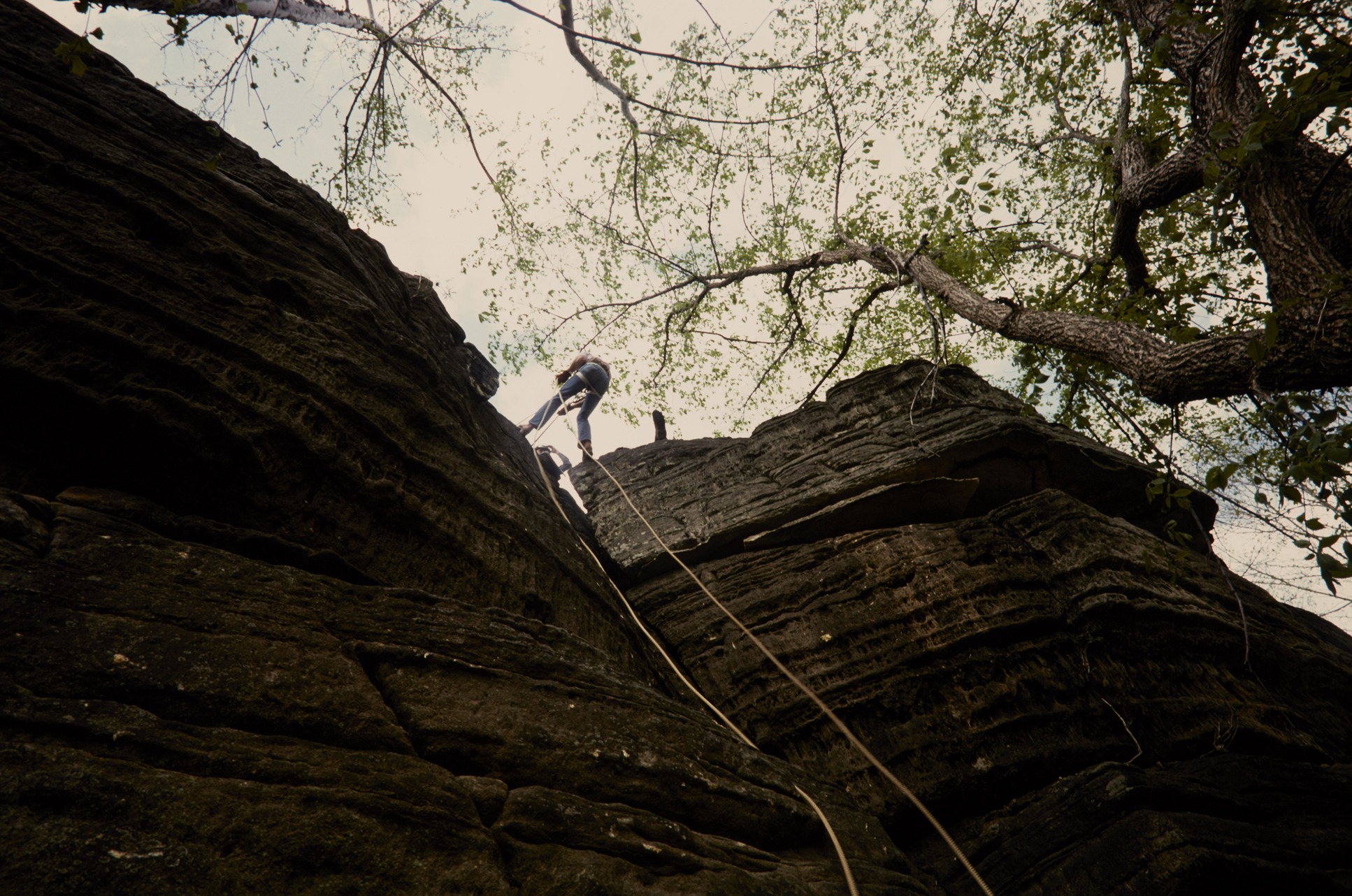
The trees thin out, and the trail swings onto the face of the bluff. Now it’s a narrow, rocky ledge, with a limestone wall towering above and a 350-foot sheer drop below. In places, there’s barely room for two people to pass. There are no railings.
- Walk slowly and stay on the inside, near the wall.
- Stop to look at the view; don’t look while walking.
- Wait at a wider spot to let people pass.

5. Enjoy Big Bluff
The ledge opens into wider rocky spots with views straight down to the green Buffalo River curling through the Ponca Wilderness. The forested Ozark hills roll away in every direction. In spring, everything is a fresh green; in late October and early November, the hills turn red, orange and gold. You’ll often spot canoes and kayaks on the river far below.
Find a safe, wide spot back from the edge for your snack break.
6. The Climb Back
Walk back along the ledge just as carefully, then turn left onto Centerpoint for the long climb, about 1,000 feet of elevation gain. Take it slow, rest often, drink and eat. Trekking poles really help here (stow them on the ledge, where they can get in the way).
Is the Goat Trail Dangerous?
Yes, it needs real respect. The park calls the Goat Trail “narrow and dangerous” and says Centerpoint and Big Bluff are among Buffalo National River’s most frequent search-and-rescue locations. Most rescues aren’t falls. They’re people worn out, dehydrated or overheated on the climb back.
Who should skip the Goat Trail:
- Children under 12 (the park’s advice)
- Anyone afraid of heights or with balance problems
- Anyone without sturdy shoes with good grip
When to skip the ledge: in rain, ice, thunderstorms or high wind. Wet limestone is slick, and lightning on an open cliff is a serious danger.
Safety tips:
- Carry at least 2 liters of water and salty snacks (more in summer).
- Start early, and bring a headlamp in case you finish after dark.
- Tell someone your plan, since you may have no signal.
- Never back up, sit on the edge or pose near the drop for photos.
- In warm months, watch for ticks, chiggers, poison ivy and snakes, including copperheads.
Can you skip the ledge? Yes. You can hike Centerpoint and turn around at the Goat Trail junction, or continue down Centerpoint toward the river instead. Either way, you’ll still have the climb back.
Best Time to Hike Centerpoint to Goat Trail
| Season | What to expect |
|---|---|
| Spring (March–May) | Fresh green forest, dogwoods and wildflowers, comfortable temperatures. Rain can make rock slick. |
| Summer (June–August) | Hot and humid; the climb out is brutal. Start at dawn or skip it. |
| Fall (October–November) | Best colors, usually late October to early November. Busiest time; leaves can hide loose rocks. |
| Winter (December–February) | Quiet, with clearer views through bare trees. Ice can make the ledge dangerous. |
Right now (late October): this is prime fall-color season in the Ponca area, with cool, pleasant hiking weather. Expect a busy lot on weekends, and arrive early. Daylight is shorter, so leave time to finish before dark.
Weather: Pick a cool, dry, clear day. Check the forecast for Ponca or Jasper, and turn back if storms build. Big Bluff is no place to be in lightning.
Kids, Dogs and Camping
- Kids: The park doesn’t recommend this hike for children under 12. For families, Lost Valley is a much better choice.
- Dogs: Pets are not allowed on any Ponca Wilderness trail, including Centerpoint and the Goat Trail. Documented service animals are allowed.
- Camping: Backcountry camping is allowed along Centerpoint and in the Ponca Wilderness, but not on Big Bluff. Follow the park’s backcountry rules and Leave No Trace.
What to Pack
- At least 2 liters of water per person (3+ in warm weather)
- Salty snacks and lunch
- Sturdy hiking shoes or boots with good grip
- Downloaded or paper trail map
- Headlamp
- Rain jacket (see our waterproof hiking jacket guide)
- Sun protection and bug repellent
- First-aid kit
- Trekking poles for the climb out
Photography Tips
- The classic shot: a hiker on the ledge with the river far below. Take it from a wide, flat spot, and never ask someone to stand near the edge.
- Light: late morning lights up the river; the bluff face glows in late afternoon (but leave time to hike out).
- Fall color: late October to early November is the photographer’s favorite time.
- From the river: paddlers floating from Steel Creek to Kyles Landing get a dramatic view looking up at Big Bluff.
Centerpoint to Goat Trail vs. Other Arkansas Hikes
| Hike | Round trip | Difficulty | Highlight |
|---|---|---|---|
| Lost Valley | About 2–2.5 miles | Easy–moderate | Waterfalls, a natural bridge and a cave; great for kids |
| Whitaker Point (Hawksbill Crag) | About 3 miles | Moderate | Arkansas’s most famous rock overlook |
| Hemmed-in Hollow (from Compton) | About 5 miles | Strenuous | A 210-foot waterfall after rain |
| Centerpoint to Goat Trail | About 6 miles | Strenuous | Big Bluff ledge above the Buffalo River |
Love a cliff-edge view? Compare this hike with Devils Bridge in Sedona or the exposed Highline Trail in Glacier National Park.
Sample Plans
One Day
- 8:00 a.m.: Park at Centerpoint Trailhead and start down.
- 9:15 a.m.: Reach the Goat Trail junction. Check the weather and how you feel.
- 9:45 a.m.: Big Bluff. Views and snacks.
- 10:30 a.m.: Start the climb back, slow and steady.
- 12:30–1:00 p.m.: Back at the car. Lunch in Jasper.
Weekend
- Day 1: Centerpoint to the Goat Trail and Big Bluff. At dusk, drive to the Boxley Valley to watch for wild elk in the fields.
- Day 2: An easier morning at Lost Valley, then a float on the river from Ponca or Steel Creek when water levels allow.
Where to Stay Near Centerpoint Trailhead
- Ponca: closest, with cabins and outfitters about 5 minutes away.
- Steel Creek Campground: an NPS campground on the river below Roark Bluff, near Ponca.
- Jasper: small town with lodging and restaurants, about 30 minutes away.
- Harrison: the most hotels and services, but a longer drive.
Book early for fall-color weekends; cabins near Ponca fill fast.
Centerpoint to Goat Trail FAQs
How long is the Centerpoint to Goat Trail hike?
About 6 miles round trip: 2.5 miles on Centerpoint and half a mile on the Goat Trail each way.
How long does it take?
The park says 4–6 hours. Plan for the climb out to take longer than the walk in.
How hard is the Centerpoint to Goat Trail?
Strenuous. You climb about 1,000 feet on the way back, and the Goat Trail is an exposed ledge.
Where does the hike start?
At Centerpoint Trailhead on Highway 43, about 3 miles north of Ponca, across from Fire Tower Road.
How do you get to the Goat Trail from Centerpoint?
Follow the yellow CPT blazes down Centerpoint for about 2.5 miles, then bear right onto the Goat Trail for about half a mile to Big Bluff.
How high is Big Bluff?
The bluff rises more than 500 feet above the Buffalo River. The Goat Trail runs along a section with a sheer drop of about 350 feet.
Is the Goat Trail dangerous?
It’s narrow with no railing above a big drop, so yes. Go slowly, stay near the wall, and skip it in bad weather.
Can kids do the Goat Trail?
The park doesn’t recommend it for children under 12.
Are dogs allowed?
No. Pets aren’t allowed on Ponca Wilderness trails; only service animals are allowed.
Do you need a permit or pay a fee?
No. There’s no activity fee or reservation for the day hike.
Is there a restroom at Centerpoint Trailhead?
No, and there’s no water either. Plan ahead in Ponca or Jasper.
Can you camp on Big Bluff?
No. Backcountry camping is allowed elsewhere along Centerpoint and in the Ponca Wilderness, but not on the bluff.
When is the best time to hike?
Spring and fall, especially late October to early November for fall color. Summer is very hot for the climb out.
Is the Centerpoint to Goat Trail Worth It?
For prepared hikers who are comfortable with heights, absolutely. Few places in the Ozarks put you so close to the edge of a cliff with a whole river valley spread out below. Just remember that the view is the halfway point, not the finish line. Start early, carry plenty of water, take the ledge slowly, and save your energy for the long climb home.