
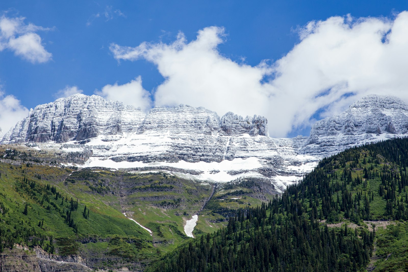
Some hikes make you climb for hours before the views show up. The Highline Trail in Glacier National Park hands them to you in the first five minutes. Starting high on the Continental Divide at Logan Pass, it follows the face of the Garden Wall for miles, with Going-to-the-Sun Road far below, wildflower meadows at your feet, mountain goats on the slopes, and jagged peaks in every direction.
It’s one of the most famous hikes in America, and it needs some planning. Right at the start there’s a narrow cliff ledge with a long drop. The full route is nearly 12 miles and ends somewhere other than where it starts. And it’s prime grizzly country.
This guide covers it all: route options and distances, the ledge, the Garden Wall and Grinnell Glacier Overlook, Granite Park Chalet, the descent to The Loop, parking and shuttle logistics, bear safety, wildflowers, the best months (including September) and current conditions.
Cover photo: mountains along Going-to-the-Sun Road, Glacier National Park. Photo: Nikolay Maslov / Unsplash
Highline Trail: The Short Answer
The Highline Trail starts at Logan Pass (6,646 ft) on Going-to-the-Sun Road in Glacier National Park, Montana. It’s 7.6 miles one way to Granite Park Chalet, and the classic point-to-point hike continues down to The Loop for 11.8 miles total, with about 2,400 feet of climbing and 4,800 feet of descent. Expect 6–9 hours. It’s usually snow-free from mid-July to September. Plan your ride back from The Loop, carry bear spray, and skip the first ledge if you’re uneasy with heights.
Highline Trail: Quick Facts
| Detail | Information |
|---|---|
| Location | Glacier National Park, Montana |
| Trailhead | Across Going-to-the-Sun Road from the Continental Divide sign at Logan Pass |
| Logan Pass to Granite Park Chalet | 7.6 miles one way |
| Logan Pass to The Loop | 11.8 miles one way (point to point) |
| Elevation (full route) | About 2,388 feet up and 4,773 feet down |
| Highest point | About 7,024 feet, below Haystack Butte |
| Difficulty | Moderate (short out-and-back) to strenuous (full route) |
| Time | 6–9 hours for the full route |
| Optional side trip | Grinnell Glacier Overlook: about 1.8 miles round trip, 900+ feet up |
| Best season | Mid-July through September |
| Hazards | Exposure, grizzlies, snowfields, storms, sun, fatigue |
| Permit | None for day hiking; park entrance pass required |
| Dogs | Not allowed |
Where Is the Highline Trail?
The trail starts at Logan Pass, the high point of Going-to-the-Sun Road, right on the Continental Divide. Logan Pass is about 32 miles from West Glacier and about 18 miles from St. Mary. The trailhead is across the road from the parking lot, just north of the big Continental Divide sign. The trail then runs north along the west face of the Garden Wall, a knife-edge ridge that forms the Divide.
Going-to-the-Sun Road’s high section is open only in summer. In 2026, the full road opened on June 22 and closed for the winter around October 19–20. If the road over Logan Pass isn’t open, you can’t reach this trailhead.

Highline Trail Distance: Route Options
| Option | Distance | Logistics | Best for |
|---|---|---|---|
| Out and back past the ledge | 1–4 miles round trip, your choice | Simple, return to Logan Pass | Views without a big day |
| Out and back to Haystack Butte saddle | About 7.2 miles round trip | Return to Logan Pass | A solid half-day with the trail’s high point |
| Logan Pass to The Loop | 11.8 miles one way | Need a ride from The Loop back to your car | The classic full Highline |
| Plus Grinnell Glacier Overlook | About 13.6 miles one way | Same as above | Strong hikers with time |
| Logan Pass to Granite Park Chalet and back | 15.2 miles round trip | Return to Logan Pass | Avoiding a car shuttle (long day) |
The official numbers for the full route are 11.8 miles, 2,388 feet up and 4,773 feet down. Most of the drop comes in the last four miles below the chalet.
Highline Trail Difficulty
A short out-and-back is moderate; the full route is strenuous. The first 7.6 miles are surprisingly gentle for a mountain trail, mostly rolling along the hillside with one real climb to the Haystack Butte saddle. What makes it hard:
- Exposure: The ledge near the start, and long open stretches with steep slopes below.
- Distance: Almost 12 miles, with no shortcut once you’re committed.
- Sun and wind: Very little shade from start to finish.
- The final descent: About 2,200 feet down to The Loop on tired legs.
- Bears and snow: Both can close sections or force you to turn around.
Beginners: a short walk past the ledge and back is fine for fit beginners comfortable with heights. The full route is better for people who have done long mountain days before. See our hiking for beginners guide to build up.
Highline Trail Map and Route
Logan Pass → the ledge (0.25–0.55 mile) → Garden Wall meadows → Haystack Butte saddle (3.6 miles) → Grinnell Glacier Overlook junction (6.9 miles) → Granite Park Trail junction / Granite Park Chalet (7.6 miles) → Loop Trail → The Loop on Going-to-the-Sun Road (11.8 miles).
All junctions are signed. Near the chalet, trails split toward Swiftcurrent Pass, the Granite Park campground and The Loop, so check signs carefully. Pick up a park map at any visitor center, download an offline map, and check the park’s trail status page the morning you hike.
Highline Trail: Step-by-Step Guide
1. The Ledge (first half mile)
About a quarter mile from the trailhead, the Highline is blasted into a cliff above Going-to-the-Sun Road. For roughly 0.3 mile, the path is mostly 6 to 8 feet wide, with a drop of 100 feet or more to the road below. A hand cable is bolted to the rock wall on the uphill side.
- Hug the wall side and hold the cable if it helps.
- Look at the trail ahead, not straight down.
- Don’t stop in the narrowest spots for photos; wait for a wider section.
- Let people pass where it’s wider, and keep poles tucked away.
- Turn around if it’s icy, very windy or snow-covered.
Most hikers find it more exciting than scary, but if heights really bother you, this may not be your trail. Hidden Lake Overlook, just across the road, is a great alternative.
2. The Garden Wall Meadows
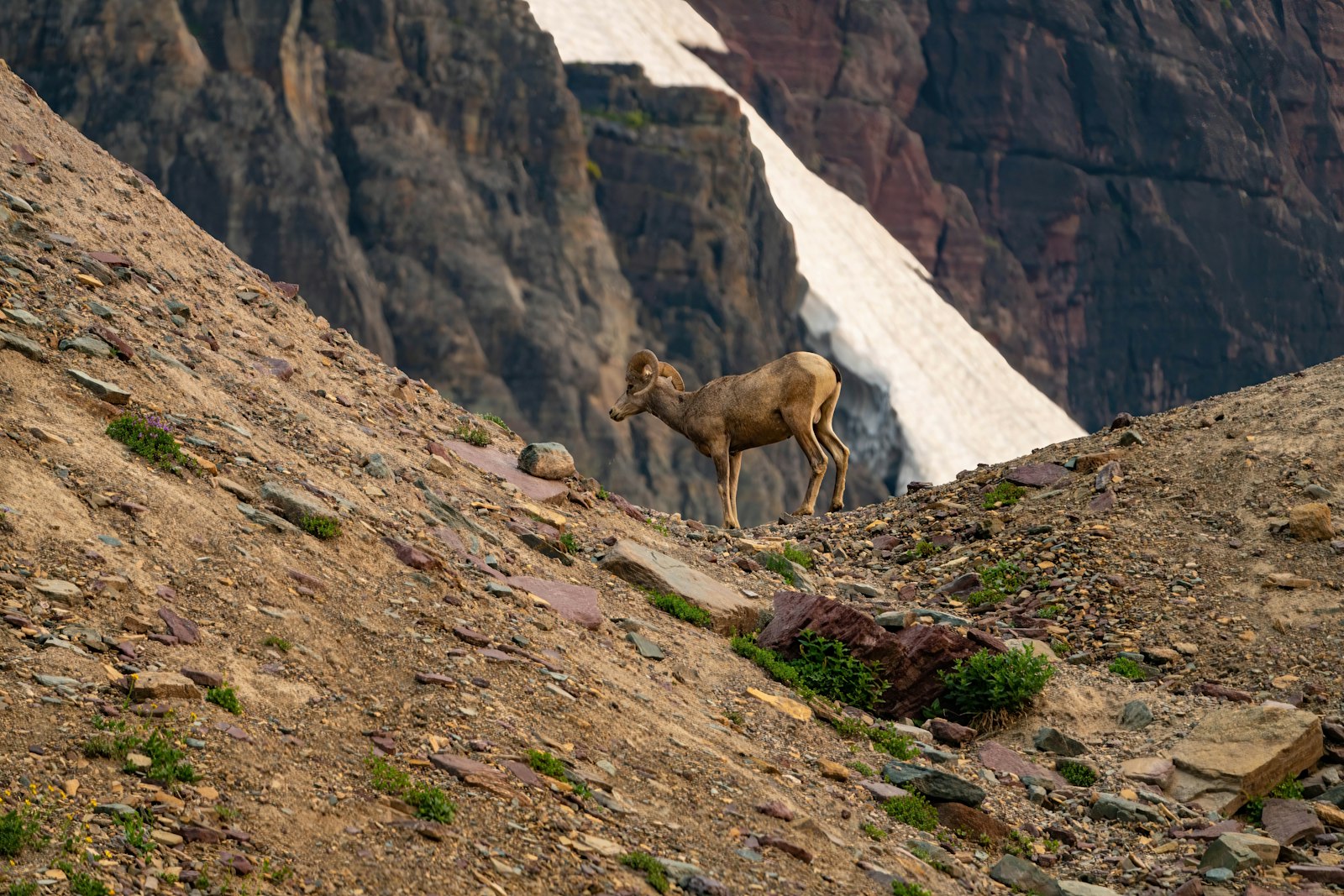
After the ledge, the trail opens onto broad slopes below the Garden Wall. The rock rises steeply above you, the valley of McDonald Creek drops away below, and on clear days you see peak after peak to the west. This is the best wildflower stretch and the most likely place to see mountain goats and bighorn sheep, sometimes right on the trail. Give them space and let them move off.
3. Haystack Butte Saddle (3.6 miles)
The only real climb on the first half: a long switchback gains about 275 feet to a saddle at roughly 7,024 feet, between Haystack Butte and the Garden Wall. It’s the high point of the Highline and a classic snack stop with great views both ways. If you’re doing an out-and-back, this makes a perfect turnaround.
4. Grinnell Glacier Overlook Junction (6.9 miles)
After more rolling trail, you reach the junction with the Garden Wall Trail. This side trip climbs more than 900 feet in under 0.9 mile up loose rock to a notch on the Continental Divide. From the top, you look straight down about 1,000 feet onto Grinnell Glacier, the Salamander Glacier and turquoise Upper Grinnell Lake. It’s one of the most dramatic views in the park, and a brutal climb after nearly 7 miles. Only go if you have the energy, the weather is stable and the side trail isn’t closed for bears.
Note: Grinnell Glacier Overlook isn’t the same as the Grinnell Glacier Trail. The trail climbs to the glacier from Many Glacier below; the overlook looks down on it from above. Read our Grinnell Glacier Trail guide for that hike.
5. Granite Park Chalet (7.6 miles)
Built in 1914 by the Great Northern Railway, Granite Park Chalet is a stone-and-timber backcountry lodge on a knoll with huge views. It’s reachable only on foot or horseback, has 12 guest rooms and no electricity, and opens roughly July to mid-September. Day hikers can rest on the porch and use the pit toilets nearby, but don’t count on buying water or food. Bring all you need, plus a filter if you’ll refill.
Want to stay overnight? Rooms sell out fast. For 2027, the chalet says it’s piloting a reservation lottery, with details to be announced.
6. Down the Loop Trail (about 4 miles)
From the chalet area, the Loop Trail drops about 2,200 feet in roughly 4 miles to The Loop, the big hairpin bend on Going-to-the-Sun Road. Much of it passes through an old burn with little shade, so it can be hot in the afternoon. The steady downhill is tough on knees; trekking poles help a lot. Watch for bears here too, especially around berry patches in August.
Logan Pass Parking and Shuttle Logistics
Because the classic route starts at Logan Pass and ends at The Loop, getting back to your car is the biggest planning puzzle.
What happened in 2026
- No vehicle reservations were required anywhere in the park.
- Three-hour parking limit at Logan Pass (235 spaces) from July 1 to early September, using a free timestamped permit. That ruled out parking there for a full Highline day.
- A ticketed express shuttle ran from July 1 from Apgar and Lake McDonald Lodge on the west side, and St. Mary and Rising Sun on the east side, to Logan Pass. Tickets were booked on Recreation.gov ($1 fee), with buses from 6 a.m. The west-side route also stopped at The Loop in the afternoon, which is how Highline hikers got back.
- On September 8, the park ended the parking limit and shuttle for the season. Parking went back to first-come, first-served until the road closed.
Simple plans that work
- Park at The Loop and shuttle up to Logan Pass in the morning, then walk back to your car. This means no worrying about the last bus.
- Two cars: leave one at The Loop and drive the other to Logan Pass (only when there’s no time limit).
- Out and back from Logan Pass: no shuttle needed, but watch any parking time limits.
The 2026 system was a pilot, so check the park’s Logan Pass and shuttle pages for 2027 rules before you plan. Don’t count on hitchhiking, and never walk along Going-to-the-Sun Road.
Entrance fees: $35 per vehicle for 7 days in summer, $70 for a Glacier annual pass, or $80 for America the Beautiful. International visitors 16 and over pay an extra $100 unless they hold an annual or America the Beautiful pass. Cards only.
Grizzly Bears on the Highline Trail
The Highline and the Granite Park area are some of the best grizzly habitat in Glacier. Bears dig for roots and squirrels in the meadows and feast on huckleberries in late summer. Sections are often posted as “bear frequenting,” and the park sometimes closes the trail or the Loop Trail when bears are active.
- Carry bear spray on your hip belt or chest strap, not in your pack, and know how to use it.
- Hike in groups and talk or call out on blind corners and in brushy areas.
- Stay at least 100 yards from bears and 25 yards from goats and sheep.
- Never leave food or packs unattended, even at the chalet.
- Obey closures, even if others don’t.
Highline Trail Wildflowers
The slopes below the Garden Wall are a wildflower garden from mid-July into August. Look for yellow glacier lilies right after snowmelt, tall white plumes of beargrass (in good years the hills are covered), red and pink paintbrush, purple asters, blue lupine and fireweed. Peak bloom usually lands in late July to early August, but it shifts each year with the snowpack. Admire them from the trail; the alpine plants are fragile.
Best Time to Hike the Highline Trail
| Month | What to expect |
|---|---|
| June | Road may still be closed; trail usually snow-covered and closed. |
| July | Trail typically opens in early to mid-July once a steep snowfield near the start is cleared. Wildflowers begin. |
| August | Most reliable month. Peak wildflowers early, huckleberries late, busy, possible wildfire smoke. |
| September | Cooler, quieter, golden colors. Early snow and closures for bear activity are possible. |
| October | Road usually closes over Logan Pass in mid- to late October. |
Highline Trail in September
September is a favorite with locals: the crowds drop after Labor Day, the hillsides turn gold and red, and cool air makes the long day easier. But days are shorter, the first snowstorms can hit, and services wind down. In 2026, Logan Pass water was shut off on September 8 and the visitor center closed after September 27. Heavy rain in early September also briefly closed the alpine road. Bring all your water, plenty of layers and a flexible plan.
Current Conditions (Late October 2026)
The alpine section of Going-to-the-Sun Road, including Logan Pass, closed to vehicles for the winter around October 19–20, 2026, so the Highline Trailhead can’t be reached by car until the road reopens next summer (usually late June or early July). Winter travel on the Highline is avalanche terrain and only for experienced mountaineers. For 2027 trips, watch the park’s road status, trail status and Logan Pass access pages from late spring.
Is the Highline Trail Dangerous?
- The ledge: Safe in good conditions, risky when icy, windy or crowded.
- Snowfields: Early-season snow on steep slopes can be deadly. Wait for the park to open the trail.
- Lightning: The trail is exposed for miles. Turn back if storms build.
- Heat and dehydration: There’s little shade and no reliable water.
- Bears: Carry spray and follow closures.
- Fatigue: The long final descent is where many slips happen.
What to Pack
- Bear spray (essential)
- 3 liters of water per person and a filter
- Lunch and lots of snacks
- Sun hat, sunglasses and sunscreen
- Wind and rain jacket (see our waterproof hiking jacket guide) and a warm layer
- Trekking poles for the Loop descent (see budget trekking poles for beginners), stowed on the ledge
- Shoes with good grip, offline map, headlamp, first-aid kit
- Shuttle tickets or a ride plan from The Loop
Photography Tips
- The ledge: shoot from the wider section just before or after it, looking back at hikers along the cliff.
- Garden Wall meadows: wildflowers in front, peaks behind; morning light is softest.
- Haystack Butte saddle: wide views back toward Logan Pass and Mount Oberlin.
- Grinnell Glacier Overlook: midday sun brings out the turquoise of Upper Grinnell Lake.
- Wildlife: a zoom lens lets you photograph goats and sheep without crowding them.
Highline Trail vs. Other Glacier Hikes
| Hike | Distance | Difficulty | Highlight |
|---|---|---|---|
| Hidden Lake Overlook | About 2.8 miles round trip | Moderate | Meadows, goats and a lake view from Logan Pass |
| Avalanche Lake | About 4.6 miles round trip | Moderate | Cedar forest and waterfalls into a lake |
| Grinnell Glacier | About 10 miles round trip (7.4 with boats) | Strenuous | Standing beside a glacier and icebergs |
| Highline to The Loop | 11.8 miles one way | Strenuous | Miles of high, open views along the Garden Wall |
Want something shorter? Try our Avalanche Lake Trail guide.
Sample Day Plan (Logan Pass to The Loop)
- 6:00–7:00 a.m.: Park at The Loop or a shuttle stop and ride up to Logan Pass (or drive up early when there’s no time limit).
- 7:30 a.m.: Cross the ledge while it’s quiet.
- 9:30 a.m.: Snack at Haystack Butte saddle.
- 11:30 a.m.: Optional climb to Grinnell Glacier Overlook.
- 1:00 p.m.: Lunch on the porch at Granite Park Chalet.
- 1:30–4:00 p.m.: Descend the Loop Trail to Going-to-the-Sun Road.
Where to Stay Near the Highline Trail
- Lake McDonald Lodge area: historic lodge and cabins on the west side, closest to The Loop.
- Apgar and West Glacier: lodging, campgrounds, food and the west-side shuttle hub.
- Rising Sun and St. Mary: east-side motor inn, campgrounds and lodges, about 30–40 minutes from Logan Pass.
- Granite Park Chalet: the ultimate stay, right on the trail; book early.
Highline Trail FAQs
How long is the Highline Trail in Glacier National Park?
7.6 miles one way from Logan Pass to Granite Park Chalet, and 11.8 miles one way to The Loop.
How hard is the Highline Trail?
A short out-and-back is moderate. The full route to The Loop is strenuous because of its length, exposure and the 2,200-foot final descent.
How scary is the Highline Trail ledge?
It’s mostly 6–8 feet wide with a hand cable, but there’s a 100-foot-plus drop to the road. Most hikers manage fine; people with a strong fear of heights may not enjoy it.
How do you get back from The Loop?
In 2026, the ticketed park shuttle stopped at The Loop in the afternoon. Many hikers park at The Loop and shuttle up to Logan Pass in the morning, or use two cars. Check 2027 shuttle details before you go.
Can you park at Logan Pass for the Highline?
In summer 2026, parking was limited to three hours from July 1 into early September, too short for the full hike. After September 8, parking was first-come, first-served with no limit.
Is Grinnell Glacier Overlook worth it?
If you have the energy, yes. It’s a steep 900-foot climb in under a mile, but the view down onto the glacier and turquoise lake is unforgettable.
When does the Highline Trail open?
Usually early to mid-July, after crews clear snow near the start, and it stays open until snow returns or the road closes in fall. Bear activity can close it temporarily.
Are there grizzly bears on the Highline Trail?
Yes, especially around Granite Park. Carry bear spray, make noise and obey any closures.
Can you buy water at Granite Park Chalet?
Don’t count on it. Bring enough water for the whole hike, plus a filter.
When are the wildflowers best on the Highline?
Usually late July to early August, with glacier lilies early and beargrass, paintbrush and asters at peak.
Is the Highline Trail open now?
Not by car. Going-to-the-Sun Road closed over Logan Pass for the winter in late October 2026 and usually reopens in late June or early July.
Is the Highline Trail Worth It?
Absolutely. Few trails anywhere give you this much scenery for this little climbing: cliffs, meadows, goats, glaciers and a historic chalet, all along the spine of the Continental Divide.
Sort out your ride from The Loop before you start, carry bear spray, check the trail status that morning, and go early. Even if you only walk a mile past the ledge and back, you’ll see why people call it the best hike in Glacier.