
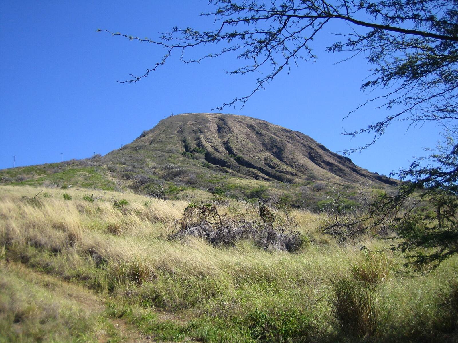
From the parking lot at Koko Head District Park, you look up and see it: a thin, straight line of old railway ties running almost vertically up the side of a giant volcanic cone. No switchbacks. No zigzags. Just up. That line is the Koko Head hike, and it’s one of the most talked-about climbs in Hawaii.
Locals call it nature’s StairMaster, and some call it the “Stairs of Doom.” It’s short, free and only half an hour from Waikiki. But 1,048 uneven steps in full sun will humble almost anyone. The reward at the top is one of the best views on Oahu: Hanauma Bay, Hawaii Kai, Diamond Head in the distance and, on a clear day, neighboring islands across the channel.
This guide covers everything first-timers ask: how hard it really is, how long it takes, the distance and elevation (and why every website gives different numbers), the scary bridge section, parking, whether you need a reservation, the best time to go, what to pack, safety, the trail’s WWII history and the best things to do nearby afterward.
Cover photo: The railway-tie “stairs” climbing Koko Crater, seen from the base of the trail. Photo: Heptazane / Wikimedia Commons, CC BY-SA 3.0
Koko Head Hike: The Short Answer
The Koko Head hike (officially the Koko Crater Tramway or Koko Crater Railway Trail) climbs 1,048 old railway ties up Koko Crater in Hawaii Kai, on Oahu’s southeast corner. It’s about 1.6 miles round trip with roughly 990 feet of climbing to a 1,208-foot summit. Most people take 30–75 minutes to go up and 1.5–2.5 hours in total. It’s strenuous, steep and has no shade. It’s free, needs no reservation, and parking is free at Koko Head District Park (open 4 a.m. to 11 p.m.). As of late October 2026, the trail is open. Go early, bring plenty of water, and use the bypass if the bridge section scares you.
Koko Head Hike at a Glance
| Detail | Information |
|---|---|
| Official name | Koko Crater Tramway (also Koko Crater Railway Trail, Koko Crater Stairs, Koko Head Stairs) |
| Location | Koko Head District Park, Hawaii Kai, southeast Oahu |
| Steps | 1,048 railway ties |
| Distance | About 1.6 miles round trip from the parking lot (the stairs alone are about 0.7 mile one way) |
| Elevation gain | Roughly 990 feet (sources range from about 850 to 1,200) |
| Summit elevation | 1,208 feet |
| Steepness | Gets close to a 50% grade near the top |
| Time | 30–75 minutes up; 1.5–2.5 hours total for most visitors |
| Difficulty | Strenuous |
| Shade | Almost none |
| Water on trail | None (fountains at the park) |
| Restrooms | At the park, not on the trail |
| Cost | Free |
| Reservation | Not required |
| Parking | Free, 423 Kaumakani St, Honolulu, HI 96825; gate open 4 a.m.–11 p.m. |
| Best time | Sunrise or early morning; sunset if you bring a headlamp |
| Drive from Waikiki | About 25–30 minutes (11 miles) |
Is the Koko Head Hike Open Right Now?
Yes. As of late October 2026, the Koko Crater Tramway is open and there’s no closure in effect. A few recent things worth knowing:
- Rescues keep happening. On October 16, 2026, Honolulu firefighters airlifted a hiker in his 20s from the top after he became dehydrated and possibly hurt his ankle while climbing alone in the early afternoon. Another hiker was flown off the summit on September 9, 2026. Heat, not falls, causes most of these calls.
- The summit bunkers are sealed. In July 2025, an 8-year-old boy was critically hurt after falling 20 to 40 feet down a shaft in one of the old military bunkers at the top. The city closed the trail for several days, sealed the openings and added warning signs. Stay out of every bunker and off every structure except the viewing platform.
- Short closures still happen for repairs, paving or helicopter work. Check the Honolulu Department of Parks and Recreation’s announcements before you go.
Koko Head or Koko Crater? Clearing Up the Name
Here’s something most guides skip. Almost everyone calls this “the Koko Head hike,” but the stairs actually climb Koko Crater, not Koko Head.
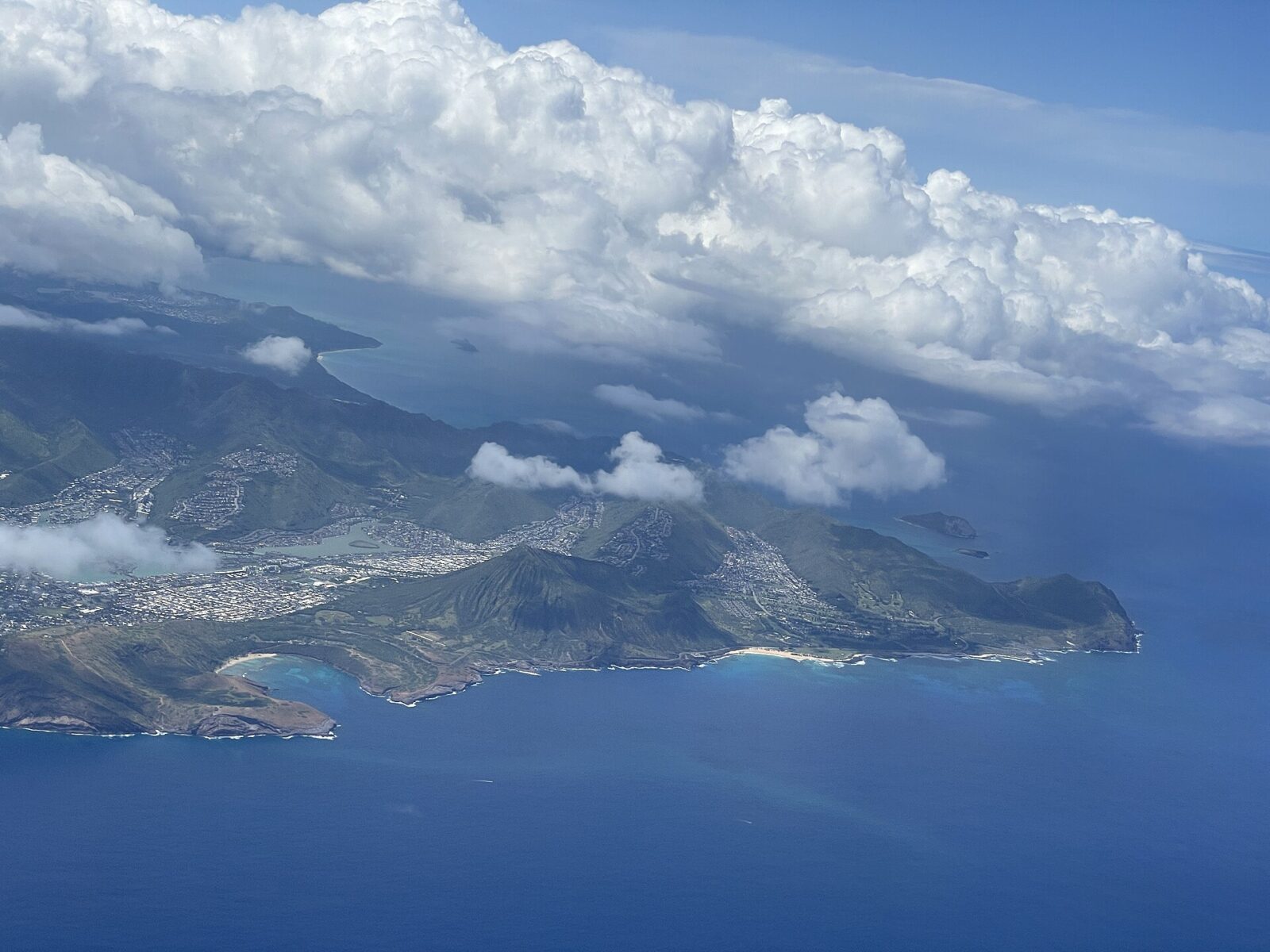
- Koko Crater is the big, ridged cone (1,208 feet) above Hawaii Kai. Its Hawaiian name is Kohelepelepe, and the summit is called Puʻu Mai. This is where the stairs are.
- Koko Head is the smaller headland (642 feet) to the south, next to Portlock. Its biggest old vent forms Hanauma Bay.
Both are tuff cones, built by explosive eruptions when magma hit water, and both belong to the youngest volcanic area on Oahu. So if you’re typing “Koko Head trail” into your map app, you’ll still end up in the right place: Koko Head District Park.
How Hard Is the Koko Head Hike?
It’s strenuous, even though it’s short. You climb close to 1,000 feet in about 0.7 miles of stairs. That’s more like a stadium workout than a walk in the woods. The difficulty comes from four things working together:
- The steps aren’t real steps. They’re railway ties, laid for a cable car, not for human legs. Some are close together, some are a big knee-high step apart. You can’t settle into a rhythm, so your legs work harder than on normal stairs.
- It never lets up. There are no flat sections to recover on. The slope starts moderate and keeps getting steeper, reaching close to 50% near the top.
- There’s no shade. The crater’s southwest face takes direct sun, and the dark ties soak up heat. By mid-morning in summer, it’s baking.
- The way down is tricky. On tired, shaky legs, stepping down big, uneven gaps is where people twist ankles.
The good news? It’s not technical. You can’t get lost, you don’t need climbing skills, and you can stop as often as you like. Regulars run it several times in a row, but that’s not you on day one, and nobody cares how long you take.
The Climb, Section by Section
| Section | Roughly | What it feels like |
|---|---|---|
| Parking lot to the first tie | 5–10 minutes | Easy paved and dirt walk past the ballfields |
| Lower stairs | Steps 1 to about 500 | Steady, moderate slope; this is where people go out too fast |
| The bridge | About halfway | A short stretch where the ground falls away under the ties; bypass on the right |
| Upper stairs | About 500 to 900 | Steeper and hotter; most breaks happen here |
| The final push | The last 100–150 steps | Nearly vertical; use your hands if it helps |
| Summit | 1,208 feet | Viewing platform, old bunkers, wind and a 360° view |
Is the Koko Head Hike Good for Beginners?
It depends on fitness, not experience. If you can climb a few flights of stairs at home without stopping, you can almost certainly reach the top if you go slowly and start early. If stairs already hurt your knees, or you get dizzy with heights, it’s a poor first hike.
A smart beginner plan: make the bridge (about halfway) your first goal. You already get great views of Hawaii Kai and the marina from there. If you still feel good, keep going. If not, turn around with no regrets. Our hiking for beginners guide covers the basics of pacing and preparing.
How Long Is the Koko Head Hike? (Distance and Miles)
Plan on about 1.6 miles (2.6 km) round trip from the parking lot. You’ll see numbers from 0.4 to 1.7 miles online, and here’s why they don’t match:
- 0.4–0.8 mile: just the railway stairs, one way.
- 1.4–1.5 miles: the stairs up and down, starting near the base.
- 1.6–1.7 miles: the full outing, including the walk from your car to the first tie and back.
Whichever number you go by, the miles aren’t the hard part. A 1.6-mile walk on flat ground takes half an hour. Here, almost all the effort is vertical.
How Long Does the Koko Head Hike Take?
Most people reach the summit in 30–75 minutes and finish the whole outing in 1.5–2.5 hours. Here’s a realistic breakdown by fitness level:
| Hiker | Time up | Time down | Total with summit stop |
|---|---|---|---|
| Very fit regulars and runners | 15–25 minutes | 10–20 minutes | About 45 minutes |
| Fit, active visitors | 30–45 minutes | 25–35 minutes | About 1.5 hours |
| Average fitness, first time | 45–75 minutes | 35–50 minutes | About 2–2.5 hours |
| Beginners or families taking many breaks | 75–90+ minutes | 45–60 minutes | 2.5–3 hours |
Don’t be surprised if the way down takes nearly as long as the way up. On the steep top section, a lot of people go down facing the stairs, like a ladder, which is slower but much safer.
Koko Head Hike Elevation: How Much Do You Really Climb?
This is the number that confuses people most, so let’s untangle it:
- Summit elevation: 1,208 feet (368 m) above sea level. That’s the height of the crater’s top, and it’s the figure you’ll see on most signs and maps.
- Elevation gain: about 990 feet. The parking lot isn’t at sea level, so you climb less than the summit height. GPS apps report anywhere from about 850 to 1,100 feet, depending on where they start counting.
To put it in perspective: close to 1,000 feet is roughly an 85- to 90-story building. That’s packed into a distance most people could jog in a few minutes on flat ground.
How Many Steps Is the Koko Head Hike?
There are 1,048 railway ties from the bottom to the top. The city itself describes it as roughly 1,050 steps. You’ll occasionally see 1,042 or “about 1,100” online, but 1,048 is the count everyone uses.
A few things about these “steps” that photos don’t show:
- The spacing changes constantly, so some steps are easy and some feel like big lunges.
- The steel rails run along both sides, and you’ll use them for balance on the steep sections.
- Many ties are newer than they look. In 2021, volunteers from the nonprofit Kokonut Koalition spent about 10 months and more than 6,000 hours rebuilding the stairs, hauling over 600,000 pounds of lumber, gravel and bolts up by hand. Before that, many ties were rotten, loose or missing. The group still maintains them.
A counting tip: the numbers people quote, like “the bridge is around step 500,” are rough. Don’t count. Look up at the next landmark instead, and the climb feels shorter.
The Bridge: The Scariest Part (and How to Skip It)
About halfway up, the ground drops away below the tracks. For a short stretch, the ties hang in the air like a ladder laid flat, with a drop of roughly 40 feet underneath. This is the section people remember.
- Fine with heights? Step from tie to tie, look at your feet, and hold the rails. Some people crawl across on hands and feet, which is completely normal.
- Not fine with heights? Take the bypass path on the right. It drops down beside the bridge and climbs back to the tracks just past it. It’s a short dirt scramble, often dusty and a little slippery, but it keeps solid ground under you.
- After rain, both the ties and the bypass get slick. Go slowly, and consider turning back if it’s been pouring.
There’s no shame in the bypass. Plenty of strong hikers use it every day.
The Koko Head Hike View: What You’ll See at the Top
When you pull yourself over the last tie, the trade winds hit you and the whole southeast corner of Oahu opens up. From the summit you can see:
- Hanauma Bay curling into the coast below, its reef showing through the water
- Hawaii Kai, Koko Marina and the Portlock peninsula
- Diamond Head and the Honolulu skyline far to the west
- The Koʻolau mountains inland, and Makapuʻu Point and the windward coast to the east
- Down inside the crater itself, the green bowl of the Koko Crater Botanical Garden
- On very clear days, Molokaʻi, and sometimes Lānaʻi and even Maui, across the channel
The best spot is the steel viewing platform at the very top. The city replaced the old, rusted radar-station grate with a safer platform in 2023. It’s small (about 71 square feet), with railings and its own short stairway, so share it and take turns for photos. Everything else up there, especially the concrete bunkers, is off-limits.
One more thing: it’s windy at the summit, sometimes very windy. Hold onto hats and phones, and stay back from the edges.
Koko Head Hike Parking and How to Get There
Where to Park
- Address: Koko Head District Park, 423 Kaumakani St, Honolulu, HI 96825 (enter from Anapālau Street).
- Cost: free.
- Hours: the park is open 4 a.m. to 11 p.m. Since December 2023, an automatic gate opens at 4 a.m., so sunrise hikers can drive straight in. It closes at 11 p.m.
- Where to walk: park in the upper lot near the baseball fields (Goeas Field), then follow the path behind the fields toward the base of the tracks. You can’t miss them.
- Facilities: restrooms and water fountains at the park. Fill up here; there’s nothing on the trail.
- Please don’t park on the residential streets outside the park. Neighbors have dealt with early-morning noise and cars for years, which is exactly why the city installed the 4 a.m. gate.
The lot can fill on weekend mornings and in summer. Arrive before 7 a.m. or come on a weekday. As always, don’t leave valuables in your car.
Getting There From Waikiki
- By car: about 11 miles and 25–30 minutes east on H-1, which becomes Kalanianaʻole Highway. In Hawaii Kai, turn left on Lunalilo Home Road, then right on Anapālau Street into the park.
- By rideshare: easy and avoids parking stress. Set the drop-off to Koko Head District Park.
- By bus: there’s no direct route from Waikiki to the trailhead. Buses serving Hawaii Kai stop along Lunalilo Home Road and near Koko Marina, roughly a 10–20 minute walk from the stairs. Check TheBus app for the current route and schedule.
Do You Need a Reservation for the Koko Head Hike?
No. There’s no reservation, no permit, no ticket and no fee. Just show up. That’s a big difference from Diamond Head, which requires advance reservations for out-of-state visitors ($5 per person plus $10 per car), and from Hanauma Bay, which also needs a booking.
Technically, the trail is open whenever the park is open. In practice, the safest window is daylight, plus the hour before sunrise if you carry a headlamp.
Best Time to Do the Koko Head Hike
Best Time of Day
| Time | Pros | Cons |
|---|---|---|
| Sunrise (start about 45–60 minutes before) | Coolest temperatures, pink skies, friendly regulars | Busiest time; you need a headlamp for the lower stairs |
| Early morning (7–9 a.m.) | Still bearable, full daylight on the steps | Heat builds fast after 9 a.m., especially in summer |
| Midday (10 a.m.–3 p.m.) | Fewest people | Hottest, most rescues happen in this window; not recommended |
| Late afternoon and sunset | Golden light, sunset over Honolulu | The face holds the afternoon heat; you’ll come down in the dark |
Our pick: start at first light. You’ll climb in the coolest air of the day and watch the sky change behind Hawaii Kai as you rest. If you go for sunset, start at least 90 minutes before the sun goes down and bring a headlamp for the descent.
Best Time of Year
- November to April: the best season. It’s a little cooler, and the slopes are greener after winter rain. Showers can make the ties slippery, so check the forecast.
- May to October: hot, dry and dusty. Very doable at sunrise, punishing at midday. Carry extra water.
- Weekdays are always quieter than weekends.
What to Bring for the Koko Head Hike
- Water: at least 1 liter per person, 2 liters in summer or after 8 a.m. Drink before you start, too.
- Shoes with grip: trail runners or sneakers with good tread. Never slippers (flip-flops).
- Sun protection: hat, sunglasses and reef-safe sunscreen (especially if you’re heading to Hanauma Bay afterward).
- A small towel: you will sweat a lot.
- Light gloves (optional): handy for gripping the rails on the steep top section and on the way down.
- Headlamp: essential for sunrise or sunset.
- A salty snack and a charged phone in a pocket or small pack. Keep both hands free.
Leave the big backpack and the trekking poles in the car; poles get in the way on the ties. If you want to film the climb, a small action camera clipped to a strap is easier than holding a phone.
10 Tips That Make the Climb Easier
- Start slower than you think you should. The lower stairs feel easy, and that’s the trap. Burn out in the first 300 steps and the rest is miserable.
- Use the “20 steps, breathe” method. Climb 20 ties, stop for a few breaths, repeat. Short, frequent breaks beat long collapses.
- Step to the side to rest. Keep the middle clear. People heading up have the right of way.
- Turn around and look. The view behind you grows with every break, and it’s great motivation.
- Use the rails. On the steepest part, hold the rails or put a hand on a higher tie.
- Put your whole foot down. Landing on just your toes on uneven ties tires your calves fast.
- Go down facing the stairs on the steep top section if you feel wobbly. It’s slower but safer.
- Don’t hike alone at midday. The October 2026 rescue was a solo hiker in the early afternoon. Bring a friend, or at least tell someone your plan.
- Know when to quit. Dizziness, a pounding headache, nausea or stopping sweating are signs of heat illness. Sit in any shade, drink and head down. If you can’t, call 911.
- Expect sore legs the next day, especially your thighs from the descent. Plan an easy beach day after.
Is the Koko Head Hike Dangerous?
It’s not dangerous if you’re prepared, but it sends a lot of people to the Honolulu Fire Department. Firefighters respond to Koko Crater many times a year, usually climbing up on foot and then lifting the hiker out with the Air 1 helicopter. Most rescues involve heat exhaustion, dehydration, feeling ill or ankle and leg injuries, very often between late morning and mid-afternoon.
- Be honest about your fitness and any heart, knee or balance problems.
- Avoid the hottest hours, and carry more water than you think you need.
- Stay out of the bunkers and off old structures at the summit. The 2025 fall happened inside one.
- Don’t follow side trails along the crater rim or down the back of the crater unless you know the route. They’re narrow, crumbly and have led to helicopter rescues.
- In an emergency, call 911, say you’re on the Koko Crater (Koko Head) Tramway, and give your rough position, such as “just above the bridge.”
Can Kids and Dogs Do the Koko Head Hike?
Kids: active older kids and teens who already hike often do fine with breaks. It’s not a good idea for small children: the gaps between ties are big for short legs, the bridge has a real drop, and there’s no shade. Keep kids close at the summit and away from every bunker. For younger families, the flat loop through the Koko Crater Botanical Garden (below) is a much better choice.
Dogs: we don’t recommend it. The ties get hot in the sun, the gaps and the bridge are hard for dogs, and there’s no water. Some visitor guides list pets as not allowed, so check the signs at the park.
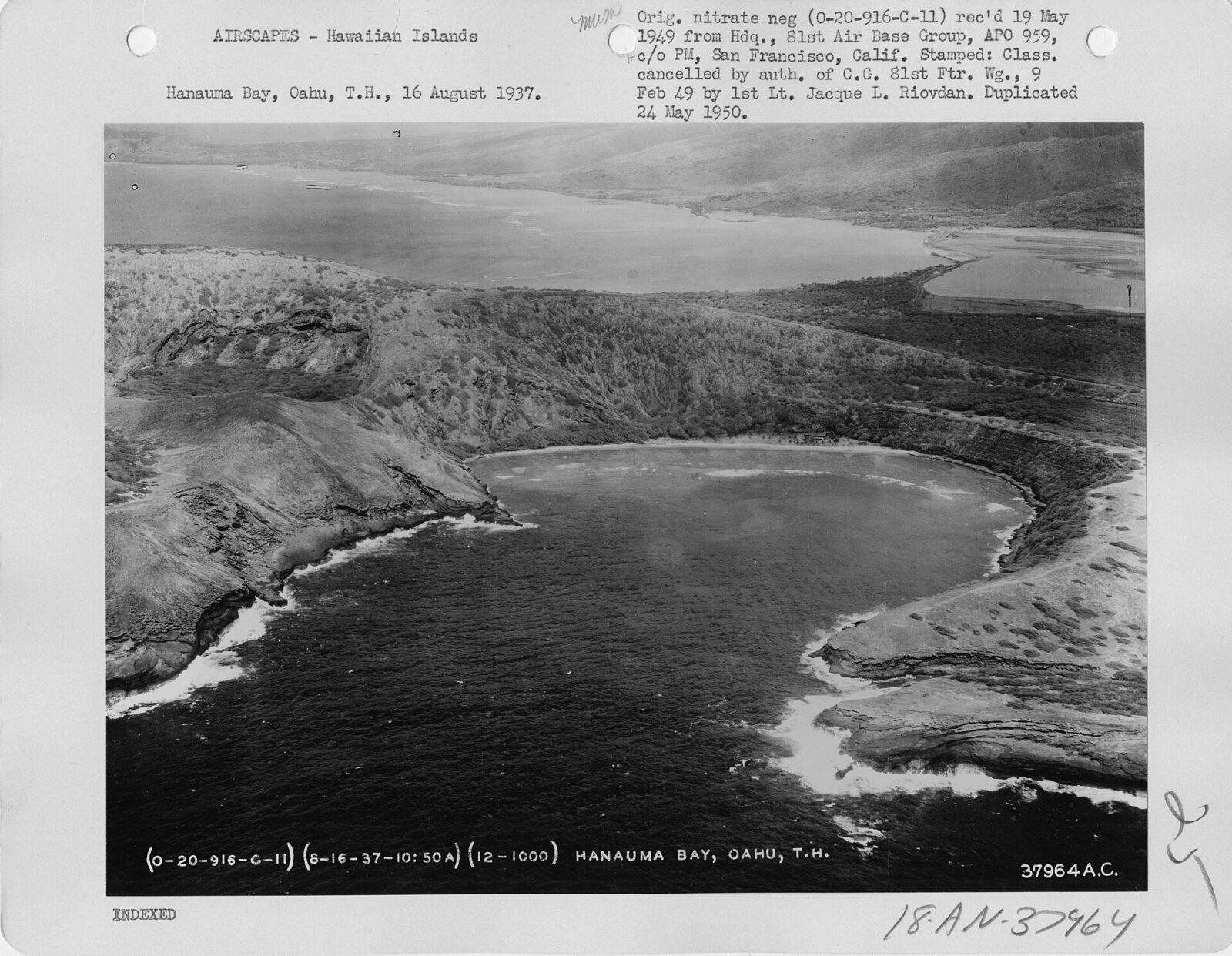
History: From WWII Tramway to Oahu’s Famous Stairs
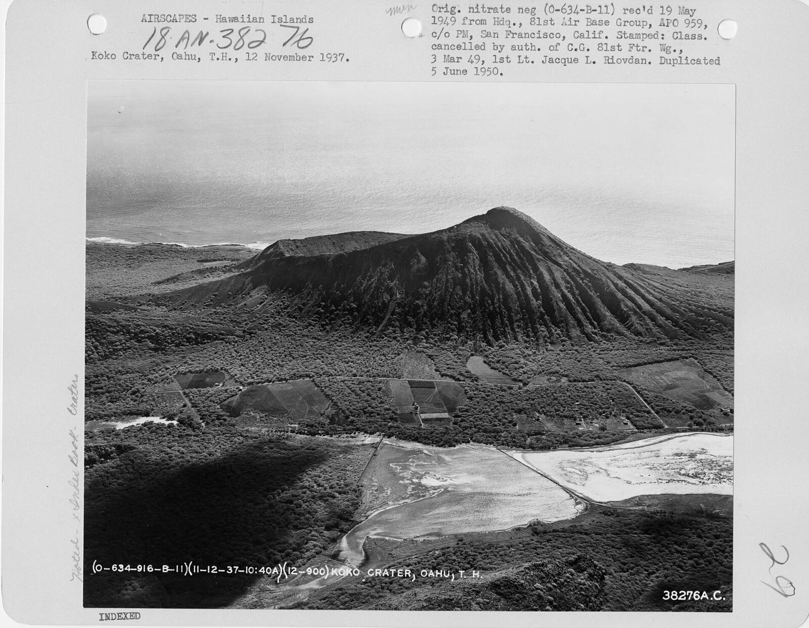
Those ties were never meant for feet. In 1942 and 1943, during World War II, the U.S. Army laid a cable tramway straight up the crater. A winch at the top hauled soldiers, equipment and supplies up to lookout and radar bunkers at the summit, a key spot for watching the skies and sea around Oahu.
After the war, the site became Koko Crater Air Force Station. The Air Force shut it down and handed the land to the City and County of Honolulu in 1966. The tram stopped, but the tracks stayed, and over the years people started climbing them for exercise and the view.
The trail’s popularity has caused headaches. Rescues climbed steadily (33 in 2012 alone), and in 2008 the city briefly posted “keep out” signs, only to take them down the same day after a public outcry. Today, the city works with the Kokonut Koalition, the volunteer group that rebuilt the stairs in 2021, to keep the trail open. At peak times, roughly a thousand people a day climb it.
Look for the old rusty winch gears near the top. They’re the last pieces of the machine that once pulled cars up this slope.
The Hawaiian Name and Legend
Long before the military arrived, Hawaiians knew this crater as Kohelepelepe. Its name comes from a moʻolelo (traditional story) about Kapo, sister of the volcano goddess Pele. When the pig demigod Kamapuaʻa pursued Pele, Kapo distracted him with a magical part of her body that she sent flying across the sea to Oahu. Where it landed, it left the imprint that became this crater, and the name describes it. “Koko” itself means “blood,” a name some say comes from an old canoe landing below the crater. Knowing the story is a nice reminder that this is a storied place, not just a workout.
Koko Head vs. Diamond Head: Which Hike Should You Do?
| Feature | Koko Head (Koko Crater Stairs) | Diamond Head |
|---|---|---|
| Distance | About 1.6 miles round trip | About 1.6 miles round trip |
| Climb | About 990 feet | About 560 feet |
| Difficulty | Strenuous | Moderate |
| Trail type | 1,048 railway ties straight up | Paved path, switchbacks, stairs and a tunnel |
| Shade | None | Very little |
| Reservation | Not needed | Required for out-of-state visitors |
| Cost | Free | $5 per person plus $10 parking (nonresidents) |
| Hours | Park open 4 a.m.–11 p.m. | 6 a.m.–6 p.m. |
| Best for | A serious workout and quieter, wider views | First-time visitors, families and history |
Short version: Koko Head is harder, free and flexible. Diamond Head is easier, more famous and needs planning. If you’re fit and only have time for one, Koko Head’s view of Hanauma Bay is hard to beat. If you’re traveling with young kids or anyone unsure about stairs, choose Diamond Head.
What to Do Near the Koko Head Hike
Koko Head sits at the start of the gorgeous Ka Iwi coast, so turn the hike into a half-day trip:
- Hanauma Bay Nature Preserve: snorkel the bay you just looked down on. Out-of-state visitors need a reservation, released two days ahead at 7 a.m. HST, and pay $25 (age 13+). The preserve is closed some days each week, so check before you go.
- Koko Crater Botanical Garden: free, open sunrise to sunset, and right inside the crater (7491 Kokonani St). An easy 2-mile loop winds past plumeria groves, cacti, baobabs and rare native wiliwili trees. Bring water; there’s only a portable toilet.
- Lānaʻi Lookout and Hālona Blowhole: quick roadside stops a few minutes east, with sea spray, lava rock and views of Molokaʻi.
- Sandy Beach: great for watching bodyboarders and flying kites, but the shore break is dangerous for swimming.
- Makapuʻu Point Lighthouse Trail: a paved, gentler hike with whale-watching in winter.
- Manoa Falls: want shade and a waterfall instead of sun and stairs? The Manoa Falls hike is an easy rainforest walk about 30 minutes away.
- Food in Hawaii Kai: Koko Marina Center has plenty of post-hike breakfast, poke and shave ice options.
Visiting Kauai too? The Kalalau Trail on the Nā Pali Coast is Hawaii’s most famous coastal hike.
Sample Half-Day Plan
- 5:45 a.m.: Leave Waikiki.
- 6:15 a.m.: Park at Koko Head District Park, use the restroom, fill your bottles.
- 6:25 a.m.: Start climbing with a headlamp; watch the sunrise from partway up or the top.
- 7:30 a.m.: Summit photos and a snack on the platform.
- 8:30 a.m.: Back at the car before the heat.
- 9:00 a.m.: Breakfast in Hawaii Kai.
- 10:00 a.m.: Snorkel Hanauma Bay (if you booked), or walk the botanical garden, then drive the Ka Iwi coast past the blowhole.
Koko Head Hike FAQs
How long is the Koko Head hike?
About 1.6 miles round trip from the parking lot. The railway stairs themselves are about 0.7 mile one way.
How many steps is the Koko Head hike?
1,048 railway ties from the bottom to the top.
How long does the Koko Head hike take?
Most people need 30–75 minutes to climb and 1.5–2.5 hours for the whole outing. Very fit hikers do it in under 45 minutes total; beginners may need up to 3 hours.
How hard is the Koko Head hike?
Strenuous. It’s a nonstop, very steep stair climb of close to 1,000 feet with uneven steps and no shade. It isn’t technical, though, so fit beginners can do it slowly.
What is the Koko Head hike elevation?
The summit is 1,208 feet above sea level. You gain about 990 feet from the parking lot.
Do you need a reservation for the Koko Head hike?
No. There’s no reservation, permit or fee.
Where do you park for the Koko Head hike?
Free parking at Koko Head District Park, 423 Kaumakani St, Honolulu. The gate is open 4 a.m. to 11 p.m. Park near the baseball fields, closest to the trail.
Is the Koko Head hike open?
Yes, as of late October 2026. It closes now and then for repairs or safety work, so check the city’s parks announcements before you go.
Can you skip the bridge?
Yes. A short bypass path on the right side goes around it and rejoins the tracks just above.
Is Koko Head harder than Diamond Head?
Yes, much harder. Both are about 1.6 miles round trip, but Koko Head climbs nearly twice as much, straight up stairs, with no shade.
Can you do the Koko Head hike at night?
Many people start before sunrise or come down after sunset with headlamps. The park is open 4 a.m. to 11 p.m. Don’t attempt it in the dark if it’s your first time and you have no light.
Are there bathrooms or water on the trail?
No. Restrooms and water fountains are only at Koko Head District Park, at the bottom.
Can you see Hanauma Bay from the top?
Yes. Hanauma Bay is one of the main views, along with Hawaii Kai, Diamond Head and, on clear days, Molokaʻi.
Is Koko Head the same as Koko Crater?
Not exactly. The stairs climb Koko Crater (1,208 feet). Koko Head is the smaller headland next to Hanauma Bay. Most people call the stairs “the Koko Head hike” anyway.
Is the Koko Head Hike Worth It?
If you’re reasonably fit and you start early, absolutely. It’s free, close to Waikiki, impossible to get lost on, and the payoff is one of the widest views on Oahu, earned in about an hour. There’s also something special about the trail’s community: the sunrise regulars, the volunteers who rebuilt every loose tie, and the strangers cheering each other through the last brutal hundred steps.
Just respect it. Go slowly, carry more water than seems reasonable, skip the bridge if it scares you, stay out of the bunkers, and remember that the top is only halfway. Getting down safely is the real finish line.
Love a steep climb with a big view? Try the Beehive Trail in Acadia, the Mount Si Trail near Seattle or Devils Bridge in Sedona next.