
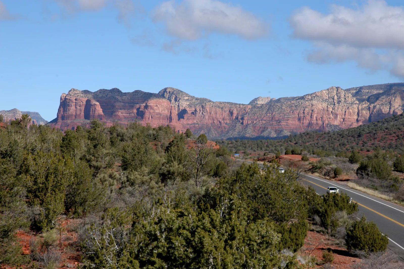
From the road, Cathedral Rock looks like a giant red sandcastle: tall spires of sandstone rising above the desert. It’s the most photographed rock in Sedona. And yes, you can climb up into it.
But here’s what surprises people. The Cathedral Rock Trail is only about a mile round trip, yet the Forest Service rates it strenuous and describes it as “more like a rock climb than a hike.” You’ll scramble up smooth slickrock, squeeze up a steep crack using your hands and feet, and finish on a saddle between the spires with a view across all of red rock country.
This guide covers everything in plain English: the real difficulty, a step-by-step look at the scramble, parking (which is tricky because of the shuttle), the Red Rock Pass, sunrise and sunset tips, safety, and easier ways to enjoy Cathedral Rock if the climb isn’t for you.

Quick answer
- Distance: about 1.1 miles round trip (Forest Service). Apps often say 1.2.
- Elevation gain: about 669 feet.
- Time: about 1.5 hours (allow 2 with photos and crowds).
- Difficulty: strenuous. Hands-on scrambling on steep slickrock.
- Trailhead: Back O’ Beyond Road, off SR-179 south of Sedona.
- Parking: small lot; Red Rock Pass or America the Beautiful pass required. The lot is closed to private cars when the Sedona Shuttle is running.
- Shuttle: free Sedona Shuttle from the North SR-179 Park & Ride, regularly Thursday to Sunday.
- Best time: spring and fall, early morning.
Cathedral Rock Trail at a Glance
| Official name | Cathedral Rock Trail #170, Coconino National Forest |
| Location | Just south of Sedona, Arizona |
| Trailhead | Back O’ Beyond Road (elevation about 4,043 ft) |
| Distance | About 1.1 miles round trip |
| Elevation gain | About 669 feet |
| Time | About 1.5 hours |
| Difficulty | Strenuous |
| Surface | Slickrock, rock ledges, a steep chute |
| End point | Saddle between two spires |
| Shade | Almost none |
| Parking pass | Red Rock Pass or America the Beautiful pass |
| Best seasons | Spring and fall |
Facts above come from the Coconino National Forest.
Where Is Cathedral Rock Trail?
Cathedral Rock is just south of central Sedona, between town and the Village of Oak Creek. The trailhead is on Back O’ Beyond Road, a short side road off State Route 179.
Directions
- From the “Y” roundabout (where SR-89A meets SR-179) in Sedona, drive south on SR-179 for about 3.5 miles.
- Turn right onto Back O’ Beyond Road.
- Drive about 0.6 miles to the trailhead parking lot on the left.
But before you drive there, read the parking section below. On many days, you can’t park at the trailhead at all.
Cathedral Rock Parking and the Sedona Shuttle
Parking is the trickiest part of this hike.
- The lot is small and fills very early, especially on weekends and in spring and fall.
- When the free Sedona Shuttle is running, the Cathedral Rock trailhead lot is closed to private vehicles. The shuttle regularly runs Thursday through Sunday, with extra days around holidays.
- When you can park there, you need a Red Rock Pass (about $5 per day) or an America the Beautiful pass displayed in your car.
- Don’t park on Back O’ Beyond Road or in nearby neighborhoods. Tickets and towing happen.
Using the shuttle
On shuttle days, drive to the North SR-179 Park & Ride and take the free shuttle to Cathedral Rock. Shuttles come frequently during operating hours, and no reservation is needed. Check sedonashuttle.com for the current schedule, and note the last return trip before you start.
| Situation | What to do |
|---|---|
| Shuttle running (usually Thu–Sun) | Park at North SR-179 Park & Ride; ride the free shuttle |
| Shuttle not running | Try the trailhead lot early with your Red Rock Pass |
| Lot full | Come back later or hike in via a longer trail like Baldwin or Templeton |
| Sunset hike | Check the last shuttle time, or come on a non-shuttle day |
How Hard Is the Cathedral Rock Trail?
The Forest Service rates it strenuous, and calls it more of a rock climb than a hike. It’s short, but:
- You gain about 669 feet in roughly half a mile.
- Much of it is on smooth, sloping sandstone (slickrock).
- There’s a steep crack, often called “the chute,” where you’ll use your hands and feet.
- There’s almost no shade.
- Coming down is harder than going up for many people.
Is it good for beginners?
Fit beginners do it every day, but it’s not a great first hike if you’ve never scrambled on rock or don’t like heights. You can always hike the first quarter mile to the big ledge, enjoy the views, and turn back.
Can kids do it?
Older, confident kids often love it with close supervision. The chute and drop-offs near the top aren’t safe for little ones.
Cathedral Rock vs. other Sedona hikes
Cathedral Rock is steeper and more hands-on than Devils Bridge and much shorter but harder than Boynton Canyon.
Cathedral Rock Trail, Step by Step
1. Trailhead to the first ledge (0 to 0.25 miles)
The trail starts climbing almost right away across red sand and rock. Look for basket cairns: rocks held in wire cages that mark the route across the sandstone. At about a quarter mile, you reach a broad ledge where the Templeton Trail crosses. Even this far, the views are great. It’s a good turnaround point if you don’t want to scramble.
2. The slickrock climb
Above the ledge, the trail heads straight up sloping bare rock. The Forest Service notes there are toeholds worn into the steeper sections. Lean into the slope, keep your weight over your feet and take small steps.
3. The chute
This is the famous part: a short, steep crack in the rock with handholds and footholds on both sides. You’ll use your hands. Go one at a time, and wait at the bottom or top if someone is coming the other way.
4. To the saddle
Above the chute, the trail continues up more sloping rock to the saddle between two of Cathedral Rock’s spires. A sign marks the end of the trail. The spires tower above you, and the view opens up across Sedona’s red rocks and the green ribbon of Oak Creek below.
An unmaintained side path continues to other saddles. It’s rougher and closer to big drops. Most people stop at the main saddle.
5. Coming down
Go back the way you came. Face the rock in the chute and lower yourself carefully. On the slickrock, keep your weight low; some people sit and scoot on the steepest bits. Take your time. Tired legs and a downhill view make slips more likely.
Does the Trail Reach the Summit?
No. The official trail ends at the saddle between the spires. The tops of the spires are technical rock climbs that need ropes and experience. The saddle view is the “summit view” most people talk about.
Sunrise or Sunset on Cathedral Rock?
Sunrise
Cooler temperatures, softer light and fewer people. You’ll want enough daylight to see the rock clearly on the way up, so many hikers start just as it gets light. On shuttle days, the shuttle won’t be running yet at sunrise, and the lot is still closed to cars during shuttle hours, so plan carefully.
Sunset
The rock glows deep red and orange. It’s beautiful, but coming down the chute in fading light is risky. Bring a headlamp, leave the saddle with plenty of light, and check the last shuttle if you’re using it.
Easier sunset spots
For the classic photo of Cathedral Rock, go to Red Rock Crossing / Crescent Moon Picnic Site on Oak Creek, where the rock reflects in the water. No scrambling needed (there’s a separate day-use fee there).
Best Time of Year
| Season | What to expect |
|---|---|
| March–May | Pleasant temperatures, busiest time |
| June–August | Hot rock, monsoon storms; go very early or skip |
| September–November | Great weather, still busy |
| December–February | Quieter, cool; skip if there’s ice or snow on the rock |
The Forest Service warns that it’s hot in summer, so plan accordingly. Never climb wet or icy slickrock.
What to Wear and Bring
- Shoes with sticky rubber soles: trail runners or approach shoes are ideal. Smooth sneakers slip.
- A small backpack so both hands are free.
- Water: at least 1 liter per person, more when warm.
- Sun protection: hat, sunglasses, sunscreen.
- Headlamp for sunrise or sunset.
- Light gloves (optional) to protect hands on rough sandstone.
- Charged phone.
Safety Tips
- Know when to turn back. If the chute looks scary going up, it’ll feel scarier coming down.
- Stay off wet or icy rock.
- Keep away from edges at the saddle.
- One at a time in the chute. Don’t crowd people above or below you.
- Heat: start early in warm months.
- Follow the basket cairns and avoid cutting new paths.
Cathedral Rock vs. Other Sedona Hikes
| Trail | Distance | Difficulty | Highlight |
|---|---|---|---|
| Cathedral Rock | 1.1 mi | Strenuous (scramble) | Saddle between spires |
| Boynton Canyon | 6 mi | Moderate | Red rock canyon and forest |
| Devils Bridge | Varies by parking | Moderate | Natural sandstone arch |
| Bell Rock Pathway | Varies | Easy | Close-up views of Bell Rock |
Frequently Asked Questions
How long is the Cathedral Rock Trail?
About 1.1 miles round trip, according to the Forest Service.
How hard is Cathedral Rock?
It’s rated strenuous because of steep slickrock and hands-on scrambling.
How long does it take?
About 1.5 hours; allow 2 with photos and waiting at the chute.
Where do I park for Cathedral Rock?
At the Back O’ Beyond trailhead lot when the shuttle isn’t running (Red Rock Pass required). On shuttle days, park at the North SR-179 Park & Ride and ride the free shuttle.
Is the Sedona Shuttle free?
Yes. No reservations needed.
Do you need a Red Rock Pass?
Yes, to park at the trailhead (or an America the Beautiful pass).
Does the trail go to the top?
No. It ends at the saddle between the spires.
Is Cathedral Rock dangerous?
It can be if you’re careless or the rock is wet. Go slowly, especially on the way down.
Is sunrise or sunset better?
Sunrise is cooler and easier for the descent. Sunset is beautiful but needs careful timing.
Can I bring my dog?
Dogs are allowed on a leash on national forest trails, but the scramble isn’t safe or fun for most dogs.
Is Cathedral Rock worth it?
Yes, if you’re comfortable scrambling. If not, Red Rock Crossing gives you the iconic view without the climb.
Final Thoughts
Cathedral Rock packs a big adventure into about a mile. Sort out parking before you go, wear grippy shoes, keep your hands free and take the chute slowly, especially on the way down. Then stand on the saddle between those famous spires and take in the best of Sedona.
More Arizona hikes: Boynton Canyon, Devils Bridge, the cave and pools on the Soldier Pass Trail, Camelback Mountain, Peralta Trail and the best winter hiking trails in the USA.
Official info: Coconino National Forest: Cathedral Rock Trail #170.