
On paper, the Clingmans Dome hike looks almost too easy. It’s half a mile. It’s paved. You drive most of the way up the mountain.
Then you start walking, and within five minutes you see people stopped on benches, hands on their hips, catching their breath. That’s because this little path goes almost straight uphill to the highest point in Great Smoky Mountains National Park.
So what is the real Clingmans Dome hike difficulty? In short: short but steep. Most people can do it if they go slowly. This guide explains exactly how hard it is, how long it takes, how to get there, when the road is open in 2026, and what else you can hike from the top.
Quick note on the name: Clingmans Dome was officially renamed Kuwohi (koo-WOH-hee) on September 18, 2024. It’s the same mountain, the same trail and the same tower. Many signs and maps now say Kuwohi, but most people still search for Clingmans Dome, so you’ll see both names here.
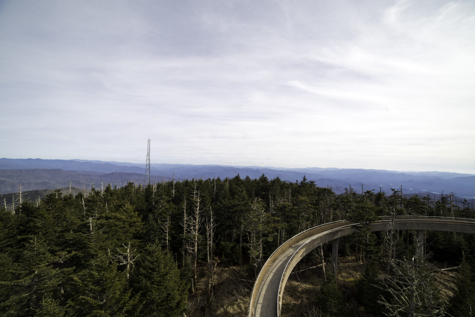
Cover photo: The ramp of the Kuwohi (Clingmans Dome) observation tower above the spruce-fir forest. Photo via Good Free Photos (public domain)
How Hard Is the Clingmans Dome Hike? The Short Answer
The Clingmans Dome (Kuwohi) hike is moderate. It’s only 1 mile round trip (0.5 mile each way) on a paved path, but it climbs about 330 feet, with an average grade of roughly 12–13%. You’re also above 6,000 feet, so you may breathe harder than usual. Most people take 20–40 minutes to walk up and 45–90 minutes in total. Benches line the path, so you can rest as often as you need. It’s not wheelchair accessible. The road to the trailhead is open April 1 to November 29 in 2026, and you need a park parking tag ($5 a day).
Clingmans Dome Hike at a Glance
| Detail | Information |
|---|---|
| Official name | Kuwohi (formerly Clingmans Dome) |
| Park | Great Smoky Mountains National Park, on the Tennessee–North Carolina line |
| Difficulty | Moderate (steep, but short and paved) |
| Distance | 0.5 mile each way, 1 mile round trip |
| Elevation gain | About 330 feet |
| Average grade | About 12–13% |
| Summit elevation | 6,643 feet (highest in the park and in Tennessee) |
| Time | 45–90 minutes total |
| Trail surface | Paved, with benches |
| Observation tower | 45 feet tall, reached by a 375-foot spiral ramp |
| Road season (2026) | April 1 – November 29 (weather permitting) |
| Parking tag | Needed if parked over 15 minutes: $5 daily, $15 weekly, $40 annual |
| Reservation | Not needed |
| Dogs | Not allowed on the trail |
| Restrooms | At the parking area |
Is the Clingmans Dome Road Open Right Now?
Yes, for now. Kuwohi Road (the 7-mile road to the parking area) is scheduled to stay open until November 29, 2026. After that, it closes to cars for the winter and reopens around April 1.
A few things to know if you’re visiting in late fall:
- The road can close early or for a day or two because of ice, snow or high winds, even inside the open season.
- It’s cold up there. By late October and November, the summit is often near freezing, windy and foggy.
- Free days: October 27 and November 11, 2026 are fee-free days, so you don’t need a parking tag on those dates.
Always check the park’s road status (on the NPS website or the park’s social media) before driving up. If Newfound Gap Road is closed, you can’t reach Kuwohi Road either.
Why Does a 1-Mile Hike Feel So Hard?
Here’s the honest answer: it’s not the distance. It’s the hill. Three things work together.
1. It’s Steep the Whole Way
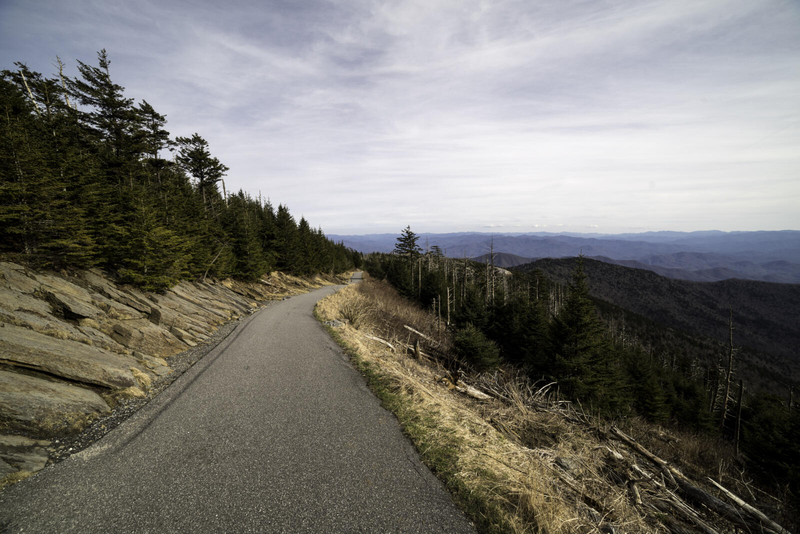
You climb about 330 feet in half a mile. That works out to an average grade of about 12–13%. For comparison, most wheelchair ramps are around 8%, and a “steep” city street is often about 10%.
There are no flat stretches to rest your legs. It just keeps going up until you reach the tower.
2. The Air Is Thinner
The parking lot sits above 6,300 feet. That’s not extremely high, but if you live near sea level, you’ll notice it. Your heart beats faster and you get out of breath sooner than you expect.
3. The Weather Can Be Rough
The summit is usually much colder, windier and wetter than Gatlinburg. Walking uphill into cold wind or drizzle makes the climb feel harder.
The fix is simple: walk slower than feels natural, and stop at the benches. Nobody is timing you.
Who Can Do the Clingmans Dome Hike?
Beginners
Yes. You don’t need hiking experience, special shoes or skills. If you can walk up a long, steep driveway or a few flights of stairs, you can most likely reach the top. Just take breaks. Our hiking for beginners guide has more simple tips on pacing.
Kids
Most school-age kids do great; many of them run up while the adults stop at every bench. Toddlers usually end up being carried for part of it. A stroller can go on the pavement, but pushing it up this slope is hard work, and you’ll need strong brakes coming down.
Older Visitors
Age isn’t the issue; health is. Plenty of people in their 70s and 80s make it with lots of rest stops. But if you have heart, lung, knee or balance problems, think carefully. The slope doesn’t let up, and the walk down can be hard on knees.
Is Clingmans Dome Wheelchair Accessible?
No, not really. The path is paved, but the park describes it as very steep, and it’s not considered accessible. The good news: on a clear day, the parking area overlook itself has big views, and there are accessible restrooms there. You can enjoy a lot of the scenery without walking the trail at all.
Clingmans Dome Hike Length and Distance
The Clingmans Dome hike is 1 mile round trip. You walk 0.5 mile up from the parking lot to the observation tower, then 0.5 mile back down the same path.
- Parking lot to tower: 0.5 mile (uphill)
- Tower ramp: an extra 375 feet of gentler spiral ramp to the top
- Tower back to parking lot: 0.5 mile (downhill)
How It Compares to Other Smoky Mountain Hikes
| Hike | Round trip | Climb | Difficulty | Surface |
|---|---|---|---|---|
| Clingmans Dome (Kuwohi) Tower | 1 mile | About 330 ft | Moderate | Paved |
| Andrews Bald (from the same lot) | 3.6 miles | About 900 ft | Moderate | Rocky trail |
| Alum Cave Bluffs | About 4.5 miles | About 1,100 ft | Moderate | Rocky trail |
| Mount LeConte via Alum Cave | About 10–11 miles | About 2,800 ft | Strenuous | Rocky trail |
| Newfound Gap to Kuwohi (Appalachian Trail) | About 15–16 miles | Large, up and down | Strenuous | Rocky trail |
Want a longer hike with more variety? The Alum Cave Trail in the Smoky Mountains starts on the same road and passes a rock arch, a big viewpoint and a giant cliff.
Clingmans Dome Hike Elevation Gain (and Summit Height)
People often mix up two numbers:
- Summit elevation: 6,643 feet. That’s how high the top of the mountain is above sea level. It’s the highest point in the park, the highest point in Tennessee, and the highest point on the entire Appalachian Trail from Georgia to Maine.
- Elevation gain: about 330 feet. That’s how much you actually climb on the trail, because the road already brings you up to about 6,300 feet.
On the way back, you lose those same 330 feet. Going down is easier on your lungs but harder on your knees. Take short steps, and be careful when the pavement is wet or has leaves on it.
How Long Does the Clingmans Dome Hike Take?
| Part of the visit | Typical time |
|---|---|
| Walking up | 20–40 minutes |
| Tower ramp and enjoying the view | 10–20 minutes |
| Walking down | 15–25 minutes |
| Total | 45–90 minutes |
- Fit hikers: can walk up in about 15 minutes.
- Families and first-timers: allow about an hour.
- If you need lots of rest stops: allow 1.5 hours and enjoy it.
Plan your whole visit at about 2.5–3 hours from Gatlinburg, because the drive up takes 45–60 minutes each way, and you’ll probably want to stop at overlooks on Kuwohi Road.
The Clingmans Dome Hike From the Parking Lot, Step by Step
Step 1: The Parking Area
Kuwohi Road ends at a big parking lot with restrooms and a wide overlook. On a clear day, the view from right next to your car is already amazing, looking out over North Carolina ridges. Use the restroom here; there isn’t one on the trail.
Step 2: Start Up the Paved Path
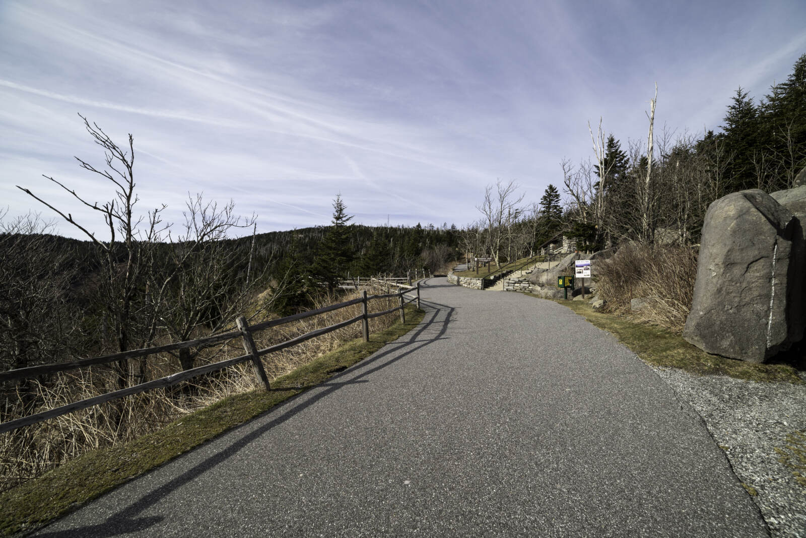
The trail starts at the upper end of the lot. You’ll feel the slope right away. Start slow, even if you feel great. People who rush the first five minutes are the ones sitting on the second bench.
Step 3: The Visitor Contact Station
Near the bottom of the trail, there’s a small visitor contact station and park store run by the park’s nonprofit partner. It’s a good place to ask a ranger questions, grab a map or buy a souvenir. Hours are seasonal.
Step 4: Through the Spruce-Fir Forest
As you climb, you walk through a forest of red spruce and Fraser fir, a type of forest found only on the very highest peaks in the South. It smells like a Christmas tree lot, and it feels more like Canada than Tennessee.
You’ll also see lots of gray, dead tree trunks. Most of the big Fraser firs were killed by a tiny invasive insect, the balsam woolly adelgid. Look closely and you’ll see young firs growing back.
Step 5: The Observation Tower
Near the top, you’ll see the tower: a round concrete platform with a long, curving ramp, a bit like something from a 1950s space movie. It was built in 1959 and is listed on the National Register of Historic Places.
The 375-foot spiral ramp takes you up 45 feet, above the treetops. It’s gentler than the trail, but it’s still uphill, so one last push.
Step 6: The View
On a clear day, you get a full 360° view of the Smokies, with ridge after ridge fading into blue. The park says you can see up to about 100 miles on the clearest days. On hazy days, it’s more like 20 miles.
And sometimes, you see nothing at all. Kuwohi is in the clouds a lot. If you reach the top in thick fog, wait 10–15 minutes. Clouds often blow through, and the view can open up for a few magical minutes.
Step 7: Walk Back Down
Head back the same way. Don’t jog down; the slope is steep enough that it’s easy to trip, especially when wet.

How to Get to Clingmans Dome From Gatlinburg
- From downtown Gatlinburg, drive south on US 441 into the park.
- Pass Sugarlands Visitor Center (buy your parking tag here if you haven’t yet).
- Continue up Newfound Gap Road about 13 miles. Just before Newfound Gap, turn right onto Kuwohi Road (old signs may still say Clingmans Dome Road).
- Drive about 7 miles to the end of the road and the parking area.
- From Gatlinburg: about 23 miles, 45–60 minutes (longer on fall weekends)
- From Cherokee, NC: about 25 miles, 45–60 minutes
- From Pigeon Forge: about 1 hour 15 minutes
Tip: there’s little or no cell service on Newfound Gap Road. Download your directions before you leave town.
Is Clingmans Dome in Tennessee or North Carolina?
Both. The summit sits right on the state line. It’s Tennessee’s highest point, but the road and parking lot are on the North Carolina side, so your map app might show a North Carolina address. It’s the same place.
Clingmans Dome Parking and Fees
There’s no entrance fee for Great Smoky Mountains National Park. But you do need a parking tag if you park anywhere in the park for more than 15 minutes, including at Clingmans Dome.
| Parking tag | Price |
|---|---|
| Daily | $5 |
| Weekly | $15 |
| Annual | $40 |
- Buy it online (print it) or at a visitor center before you drive up.
- It must be a paper tag showing your license plate. Screenshots don’t count.
- America the Beautiful national park passes don’t replace it.
- A tag doesn’t reserve a spot.
Will You Find a Parking Spot?
The lot is big, but this is one of the most visited spots in the park. On summer and fall weekends, and at sunset, it fills up and cars can back up down the road. Don’t park on the road shoulder. Instead:
- Arrive before 10 a.m., or after the sunset crowd leaves
- Visit on a weekday
- If it’s full, wait a few minutes; people come and go quickly here
Newfound Gap to Clingmans Dome: The Long Way
There’s a second way to reach the summit, and it’s a totally different hike. From Newfound Gap, you can follow the Appalachian Trail west along the high ridge all the way to Kuwohi.
- Distance: about 7.5–8 miles one way, or about 15–16 miles round trip
- Surface: rocky, rooty mountain trail with lots of ups and downs
- Time: most of a long day
- Difficulty: strenuous
| Feature | Parking lot route | Newfound Gap route (AT) |
|---|---|---|
| Distance | 1 mile round trip | About 15–16 miles round trip |
| Difficulty | Moderate | Strenuous |
| Surface | Paved | Natural, rocky trail |
| Time | 45–90 minutes | Most of a day |
| Crowds | Busy | Quiet |
| Good for beginners | Yes | No |
Many hikers do it one way with a car or shuttle waiting at the other end. In winter, when Kuwohi Road is closed to cars, the summit can only be reached on foot, by walking the closed road or the Appalachian Trail. That’s a serious winter hike, with snow, ice and very cold wind, and only for prepared, experienced hikers.
Bonus Hike: Andrews Bald From the Same Parking Lot
If the tower feels too short, try Andrews Bald. The trail (Forney Ridge Trail) starts at the far end of the same parking lot, to the left of the paved tower path.
- Distance: about 3.6 miles round trip
- Climb: about 900 feet (mostly on the way back, since you go downhill first)
- Time: about 2.5–3 hours
- Difficulty: moderate, with a rocky first section
At the end, you walk out onto a wide, grassy mountain meadow, the highest grassy bald in the park, with big views to the south. From mid-June to early July, flame azaleas and Catawba rhododendrons bloom here in orange and pink. It’s one of the prettiest picnic spots in the Smokies.
What’s the Weather Like at Clingmans Dome?
Cold, windy and often cloudy, much more than you’d expect. The summit is usually 10–20°F colder than Gatlinburg. Average daily highs up top are only around 50°F over the year, and the mountain gets about 82 inches of rain and around 84 inches of snow a year.
- A warm, sunny day in town can be foggy and chilly on top.
- Afternoon thunderstorms are common in summer. Leave the tower if you hear thunder; it’s the highest point around.
- In spring and late fall, freezing temperatures and ice are possible.
Tip: look at a webcam or the summit forecast before you drive up. The park has webcams for several high spots. If the summit is socked in, visit something lower first and try again later.
Best Time to Hike Clingmans Dome
Best Time of Year
- April–May: the road reopens around April 1. Still cold, with leftover ice possible. Fewer crowds.
- June–August: the coolest escape from summer heat. Busy, with afternoon storms. Andrews Bald blooms in late June.
- September–October: crisp, often clearer air and fall color. The high peaks change color first, usually by early to mid-October. The busiest time of year.
- November: cold and quiet; the road closes for the season at the end of the month (November 29 in 2026).
- December–March: road closed to cars. Hikers only.
Best Time of Day
- Morning: fewer people and often clearer air before afternoon clouds build.
- Sunset: stunning, but very popular. Bring a warm jacket and a headlamp for the walk down.
- Sunrise: magical and much quieter, but it means a dark, early drive up a winding road.
What to Wear and Bring
- A warm jacket, even in July. This is the most-forgotten item.
- A rain layer, since showers pop up fast (see our waterproof hiking jacket guide).
- Comfortable walking shoes with good grip. You don’t need hiking boots for the paved path.
- Water, especially on warm days.
- Sunglasses and sunscreen on clear days; the sun is strong up high.
- A headlamp if you’re staying for sunset.
- Your parking tag on the dashboard.
For Andrews Bald or the Appalachian Trail route, bring proper hiking shoes, more water, food, a map and extra layers.
Tips to Make the Climb Easier
- Go slow from the very first step. The start is where people wear themselves out.
- Use the benches. That’s what they’re there for.
- Talk while you walk. If you can’t say a sentence, slow down a little.
- Take short steps, both up and down.
- Drink some water before you start.
- Bring a layer for the windy tower.
- Give yourself time at the top for the clouds to move.
Common Mistakes to Avoid
- Thinking “paved” means “flat.” It’s paved, but it’s steep.
- Dressing for Gatlinburg weather. It’s often 10–20°F colder on top.
- Forgetting the parking tag, or planning to buy it at the top (there’s no signal).
- Driving up in winter. The road is closed to cars from early December to the end of March.
- Confusing the 1-mile tower walk with the 15-mile AT hike from Newfound Gap.
- Bringing the dog on the trail. Pets aren’t allowed on the path to the tower.
Why the Name Changed: Clingmans Dome to Kuwohi
For centuries, the Cherokee people called this mountain Kuwohi, meaning “mulberry place.” It’s a sacred place in Cherokee history and culture.
In 1859, geographer Arnold Guyot named it “Clingmans Dome” after Thomas Clingman, a North Carolina politician and explorer who measured the peak. After a request from the Eastern Band of Cherokee Indians, the U.S. Board on Geographic Names restored the name Kuwohi on September 18, 2024.
So when you see “Kuwohi Road,” “Kuwohi Trail” or “Kuwohi Observation Tower” on signs, you’re in the right place.
What to Do Near Clingmans Dome
- Newfound Gap: just down the road; stand on the Tennessee–North Carolina line with a huge view.
- Overlooks on Kuwohi Road: several pull-offs with sweeping views on the 7-mile drive.
- Alum Cave Trail: one of the best day hikes in the park, about 20 minutes away. See our Alum Cave Trail guide.
- Chimney Tops: a short, very steep hike off Newfound Gap Road.
- Oconaluftee Visitor Center: on the North Carolina side, often with elk grazing in the nearby fields.
For a full list of ideas, see our guide to the best things to do in Great Smoky Mountains National Park. If you’re continuing into North Carolina, our Asheville guide is a good next stop.
Sample Half-Day Plan From Gatlinburg
- 8:00 a.m.: Leave Gatlinburg with your parking tag, a jacket and water.
- 8:20 a.m.: Quick stop at Sugarlands Visitor Center.
- 9:00 a.m.: Stop at Newfound Gap for photos.
- 9:30 a.m.: Park at Kuwohi and walk up to the tower.
- 10:30 a.m.: Back at the car. Feeling strong? Add Andrews Bald (2.5–3 hours).
- Afternoon: Drive back toward Gatlinburg, stopping at overlooks, or continue to Cherokee.
Clingmans Dome Hike FAQs
Is the Clingmans Dome hike difficult?
It’s moderate. The path is short and paved, but it climbs about 330 feet in half a mile, so it’s steep the whole way. Most people make it by going slowly and resting.
How long is the Clingmans Dome hike?
1 mile round trip: 0.5 mile up to the tower and 0.5 mile back.
How long does the Clingmans Dome hike take?
About 45–90 minutes in total, including time on the tower.
What is the Clingmans Dome hike elevation gain?
About 330 feet from the parking lot to the summit. The summit is 6,643 feet above sea level.
Can you drive to the top of Clingmans Dome?
You can drive to the parking lot about 330 feet below the summit (April 1–November 29 in 2026). The last half mile to the tower is on foot.
Is Clingmans Dome good for beginners?
Yes. No experience is needed. Just walk at your own pace and use the benches.
Is Clingmans Dome wheelchair accessible?
No. The path is paved but too steep to be considered accessible. The parking area overlook has good views on clear days.
Do you need a reservation or ticket?
No reservation. You only need a park parking tag ($5 a day) if you park for more than 15 minutes.
When is Clingmans Dome Road open?
In 2026, Kuwohi Road is scheduled to be open April 1 through November 29, weather permitting. It closes to cars in winter.
Are dogs allowed at Clingmans Dome?
Dogs aren’t allowed on the trail to the tower. They can stay on a leash in the parking area.
How far is Newfound Gap to Clingmans Dome by trail?
About 7.5–8 miles one way on the Appalachian Trail, or 15–16 miles round trip. It’s a strenuous, full-day hike.
Is Clingmans Dome harder than Alum Cave Trail?
Clingmans Dome is steeper for its length, but much shorter. The Alum Cave hike to the bluffs is longer, rockier and more tiring overall.
Why is it now called Kuwohi?
Kuwohi is the mountain’s original Cherokee name, meaning “mulberry place.” It was officially restored on September 18, 2024.
Is the Clingmans Dome Hike Worth It?
Yes. Where else can you stand on the highest point in the Smokies, and the highest point on the whole Appalachian Trail, after a 20-minute walk? On a clear day, the view from the tower is one of the best in the eastern United States.
The Clingmans Dome hike difficulty really comes down to one steep half mile. Go slowly, bring a jacket, check the weather and the road status, and give the clouds a few minutes to clear. You’ll be glad you made the climb.