

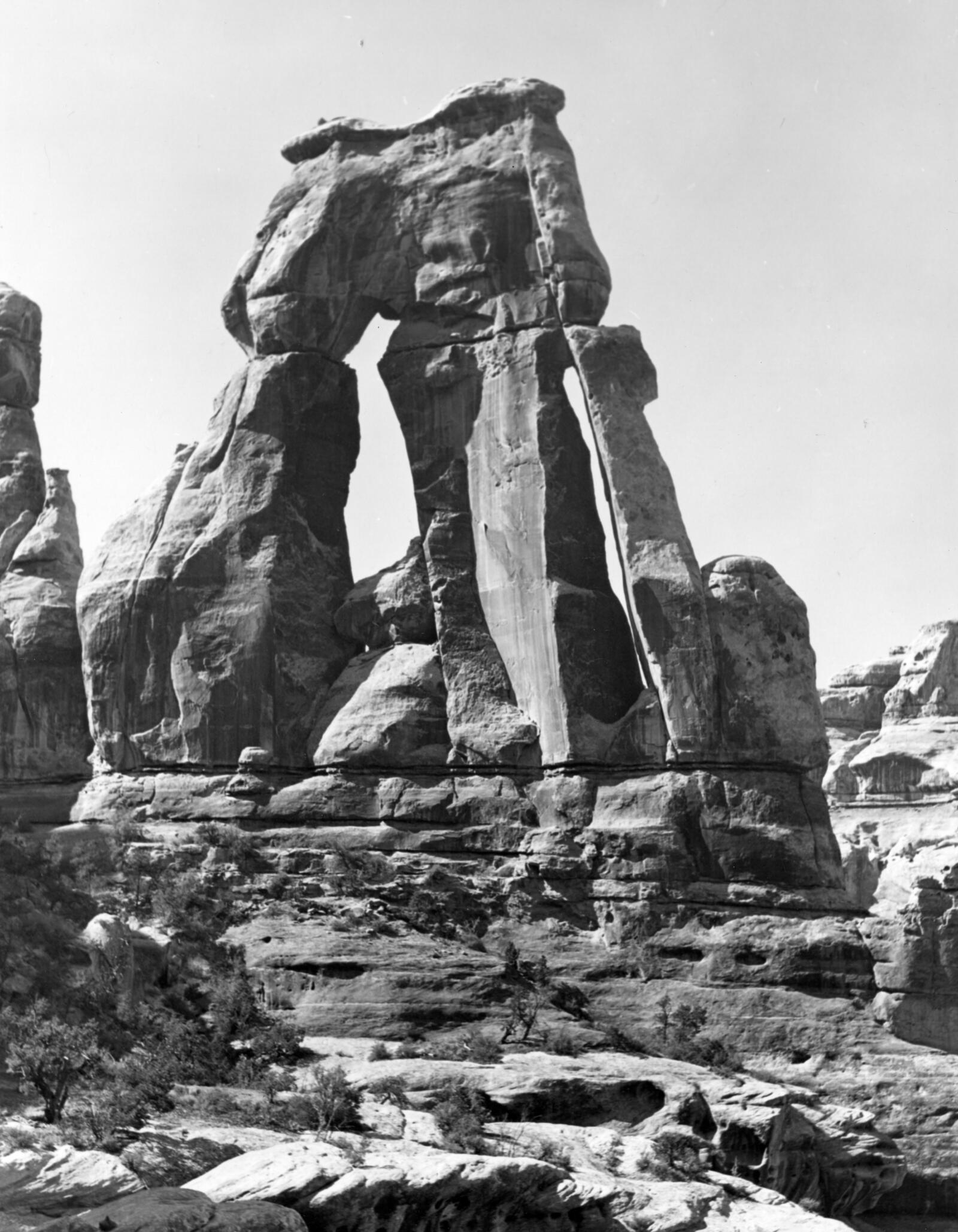
Most arches are graceful curves. Druid Arch is not. At the far end of Elephant Canyon in Canyonlands National Park, it stands like a row of giant stone slabs stacked against the sky, with two tall windows punched through it. People say it looks like Stonehenge, and that’s how it got its name.
Getting there is half the fun. The Druid Arch Trail starts at Elephant Hill in the Needles District, squeezes through cracks in the rock, crosses slickrock benches, follows a sandy canyon floor for miles past striped red-and-white spires, then climbs a ladder and a steep scramble to a ledge right beneath the arch. It’s 10.8 miles round trip and one of the best day hikes in Utah.
This guide covers everything: the map and route, parking at Elephant Hill and the access road, directions from Moab, length and real elevation gain, difficulty and the ladder, water, the best season, permits, and how to turn it into a Druid Arch and Chesler Park loop.
Cover photo: Druid Arch, Canyonlands National Park. Photo: NPS / Veronica Verdin
Hiking in November? This is one of the best months for Druid Arch: cool days, cold nights and few crowds. But days are short (sunset is around 5:10 p.m.), so be on the trail by 8 a.m. Recent storms left parts of the Elephant Hill Access Road muddy and slick in late October. The Needles Visitor Center usually closes for winter in early December and reopens in mid-February. Check the park’s road conditions page before you drive.
Druid Arch Trail: The Short Answer
The Druid Arch Trail is a strenuous 10.8-mile out-and-back hike from Elephant Hill Trailhead in the Needles District of Canyonlands National Park, about 75 miles south of Moab. It follows the Chesler Park trail for about 2 miles, then heads up sandy Elephant Canyon to Druid Arch. The last stretch is steep, with one ladder and some scrambling. Plan 5–7 hours, carry about 1 liter of water per person per hour, and go in spring or fall. Dogs aren’t allowed.
Druid Arch Trail: Quick Facts
| Detail | Information |
|---|---|
| Location | The Needles District, Canyonlands National Park, Utah |
| Trailhead | Elephant Hill Trailhead (also called Soda Spring) |
| Length | 10.8 miles round trip (NPS); GPS often reads 10.5–11.3 |
| Time | 5–7 hours (NPS) |
| Elevation | Trailhead about 5,150 ft; arch viewpoint about 5,700 ft |
| Total climbing | NPS lists 503 ft overall change, but real climbing is about 1,400–2,300 ft |
| Difficulty | Strenuous |
| Obstacles | One ladder, rock steps, scrambling near the end |
| Water | None reliable; carry 1 L per person per hour |
| Dogs | Not allowed |
| Entrance fee | $30 per vehicle (7 days) |
| Day-hike permit | Not needed |
| Best seasons | March–May and late September–November |
Where Is Druid Arch?
Druid Arch sits at the head of Elephant Canyon in the Needles District, the southeast corner of Canyonlands. The Needles is named for its forest of red-and-white striped sandstone spires. It’s a completely separate area from Island in the Sky, the district most people visit from Moab. There’s no road between the two inside the park, so make sure you’re heading to the Needles.
Directions to Elephant Hill Trailhead
| From | Route | Approx. drive to trailhead |
|---|---|---|
| Moab | US-191 south about 40 miles, then UT-211 west about 35 miles | About 1 hour 45 minutes |
| Monticello | US-191 north about 14 miles, then UT-211 west | About 1 hour 15 minutes |
- Drive UT-211 to the Needles entrance station and pay the entrance fee. On the way, stop at Newspaper Rock, a panel covered in ancient petroglyphs right beside the road.
- Continue on the main park road about 3 miles past the visitor center, then turn left toward the Needles (Squaw Flat) Campground and Elephant Hill.
- Follow the signs onto the unpaved Elephant Hill Access Road for about 3 miles to the trailhead parking area.
Fill up on gas and water before you leave Moab or Monticello. There’s no gas in the park, and there’s no cell service in the Needles. Download your maps ahead of time, and don’t trust phone GPS for directions out here.
Elephant Hill Parking and the Access Road
- The road: The Elephant Hill Access Road is a graded dirt road, narrow and winding, with blind curves. Most regular cars can drive it when it’s dry. After rain or snow it can turn slick and muddy, so check road conditions first.
- If the road is bad: The park says that if it becomes 4WD-only, hikers can start from Needles Campground Loop A instead and walk the Squaw Flat Trail to join the route. That adds a few miles.
- The lot: It’s fairly small, roughly 30 cars, with vault toilets and picnic tables. On spring and fall weekends it can fill by mid-morning.
- Don’t drive past the trailhead. Beyond the parking area, the road becomes the Elephant Hill 4WD Road, one of the toughest jeep roads in Utah. It needs a high-clearance 4WD vehicle and a day-use permit. You don’t need any of that for the hike.
Fees and Permits
| Item | Cost or rule |
|---|---|
| Private vehicle (7 days) | $30 |
| Motorcycle | $25 |
| Per person on foot or bike | $15 |
| Day hike to Druid Arch | No permit needed |
| Overnight backpacking | Backcountry permit required, at designated sites only |
| Driving the Elephant Hill 4WD Road | Day-use permit required |
An America the Beautiful pass covers the entrance fee. Canyonlands doesn’t use timed-entry reservations.
Druid Arch Trail Map and Route
| Section | Approx. miles from trailhead | What to expect |
|---|---|---|
| Climb out of the trailhead | 0–0.5 | Stone steps up between rocks onto slickrock benches |
| Junction with Squaw Flat Trail | About 1.5 | Signed; continue toward Chesler Park/Druid Arch |
| Narrow passage and descent | 1.5–2.1 | A slot between rock walls, then down into Elephant Canyon |
| Druid Arch junction | About 2.1 | Leave the Chesler Park trail and head up Elephant Canyon |
| Elephant Canyon wash | 2.1–4.2 | Deep sand, loose rock and slickrock ledges; two more signed junctions |
| Final climb | 4.2–5.4 | Steep rocky slope, a ladder and scrambling |
| Druid Arch viewpoint | About 5.4 | Ledge facing the arch; return the same way |
Pick up the free Needles map at the visitor center (when it’s open) or download the park’s Needles Trails and Roads map before you go. The route is signed at junctions and marked with cairns (small rock piles) across the slickrock. Follow the cairns; don’t make your own.
Hiking the Druid Arch Trail: Step by Step
1. Up and Over the Slickrock (0–1.5 Miles)
There’s no warm-up. The trail climbs right away, up stone steps squeezed between boulders, then rolls across open sandstone benches dotted with piñon pine and juniper. The views open up fast: rows of striped needles in every direction, with the Abajo Mountains rising far to the south. You go up and down constantly here, which is why the real climbing adds up.
2. The Narrow Passage and Elephant Canyon (1.5–2.1 Miles)
After the Squaw Flat junction, the trail slips through a narrow crack between two rock walls, a fun, shady squeeze. Then it drops down ledges into Elephant Canyon. At the bottom, a signed junction splits the trails: Chesler Park goes one way, and Druid Arch heads up the canyon.
3. Up Elephant Canyon (2.1–4.2 Miles)
Now you follow the canyon floor for about 3 miles. Much of it is deep, soft sand that makes every step harder, broken up by stretches of rock and slickrock ledges where the trail climbs out of the wash and back in. Huge spires and buttes tower overhead, and in shady corners you might find potholes of rainwater (not safe to drink without treating, and often dry).
There are two more signed junctions in the canyon. At each one, follow the signs for Druid Arch. Watch the cairns where the trail leaves the wash to go around dry waterfalls (pour-offs).

4. The Ladder and Final Scramble (Last 1–1.25 Miles)
Near the head of the canyon, you’ll catch your first side view of the arch’s big fin. The park says the last 1.25 miles are steep, with one ladder and some scrambling. The trail climbs out of the wash up a rocky slope full of loose, chunky rock. A short metal ladder helps you up one ledge, and a few spots need your hands. It’s not technical, but take your time, especially coming back down.
5. Druid Arch (5.4 Miles)
The trail tops out on a slickrock bench right in front of the arch. Up close, it’s massive: tall, flat fins of sandstone with two tall openings, standing in a rock amphitheater high above the canyon. Find some shade, eat lunch and soak it in. Behind you, the whole length of Elephant Canyon stretches back toward Elephant Hill.
Some hikers climb a short, awkward dryfall for a better angle. Only do it if you’re confident coming back down. And don’t climb on the arch itself.
6. The Way Back
You return the same way: down the scramble and ladder, back through the sand and over the slickrock. The sand feels deeper on tired legs, and the slickrock benches near the end mean more climbing. Save enough water and energy, and keep an eye on the cairns; it’s easy to wander off-route on the return.
Druid Arch Trail Length and Elevation
The National Park Service lists the hike at 10.8 miles round trip, taking 5–7 hours. Hikers’ GPS watches usually read between 10.5 and 11.3 miles.
About that “503 feet”: The park lists an overall elevation change of 503 feet. That’s just the difference between the low and high points, not the total climbing. Because the trail goes up and down all day over benches, ledges and washes, most hikers record about 1,400 to 2,300 feet of total climbing. The park itself notes the cumulative gain is much greater. Plan for that, not for 503.
How Hard Is the Druid Arch Trail?
The park rates it strenuous. It’s a long, full-day hike with a few things that make it harder than the numbers suggest:
- Deep sand in Elephant Canyon, which drains your legs fast
- Constant up and down over slickrock
- A ladder and scrambling at the end
- Sun and heat, with little shade outside the canyon
- Remoteness: no cell service and few people on weekdays
Can beginners do it? Fit beginners can, on a cool day, if they start early and carry plenty of water. But it’s not a good first desert hike. For something shorter, try the Chesler Park Viewpoint (see below). New to hiking? Start with our hiking for beginners guide.
About Druid Arch
Druid Arch is carved from Cedar Mesa Sandstone, the rock that gives the Needles its red-and-white stripes. The red bands come from iron-rich sediment washed down from ancient mountains; the white bands are old coastal sand dunes. Long ago, the ground here cracked into a grid of parallel joints. Water and frost widened those cracks into fins, and in a few fins, weak spots wore all the way through, leaving arches.
What makes Druid Arch special is its shape. Instead of one smooth curve, it’s a tall, blocky fin with stacked openings that really does look like the standing stones of Stonehenge, the ancient monument people once linked to druids.
Druid Arch and Chesler Park Loop
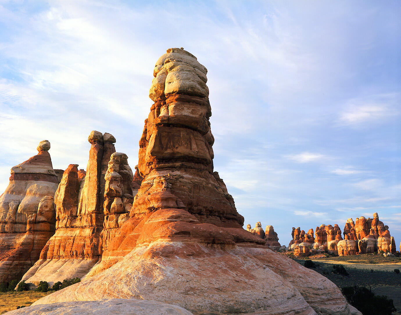
Chesler Park is a wide grassy meadow ringed by giant striped spires, and the Joint Trail beside it threads through cracks in the rock so narrow you turn sideways. Both share the first part of the route with Druid Arch, so many strong hikers combine them.
| Hike from Elephant Hill | Distance | Typical time |
|---|---|---|
| Druid Arch (out and back) | 10.8 miles | 5–7 hours |
| Chesler Park Viewpoint (out and back) | 5.8 miles | 3–4 hours |
| Chesler Park / Joint Trail Loop | 10.7 miles | 5–7 hours |
| Druid Arch + Chesler Park Loop | About 15–16 miles (route dependent) | 8–10 hours |
The first three distances come from the park. The combined hike isn’t an official route; it depends which connectors you use.
- Do it only if you’re a strong, experienced desert hiker with good map skills.
- Bring lots of water, about 8–10 liters on a warm day, by the park’s 1-liter-per-hour rule.
- Spring is best, when the days are long enough. In November, there may not be enough daylight.
- Or split it into two days: Druid Arch one day and the Chesler Park loop the next, or backpack with a permit and camp in a designated site.
Best Time to Hike Druid Arch
| Season | What to expect |
|---|---|
| Spring (March–May) | The classic season. Comfortable temperatures, long days, desert flowers. Windy days and busy weekends. |
| Summer (June–August) | Very hot, often 90–100°F+. Only for experienced desert hikers starting at dawn. Monsoon storms bring lightning and flash floods. |
| Fall (September–November) | Excellent. Cooling temperatures and golden cottonwoods. Days get short by November. |
| Winter (December–February) | Cold, quiet and beautiful. Snow and ice on the ladder and slickrock. The park recommends traction devices. Visitor center usually closed. |
Flash floods: Elephant Canyon is a drainage. If storms are forecast, especially in summer, don’t hike it. Water can rush through the wash with little warning, even if it isn’t raining where you are.
Water and What to Pack
The park recommends 1 liter of water per person, per hour. For a 5–7 hour hike, that’s 5–7 liters each. It sounds like a lot, and it is heavy, but there’s no reliable water on this trail. On cool November days you may drink less, but carry it anyway.
- Water (plus extra left in the car) and salty snacks
- Sturdy shoes with good grip for slickrock
- Gaiters to keep sand out of your shoes (see our trail running gaiters guide)
- Sun hat, sunglasses and sunscreen
- Headlamp, a must from October to March
- Printed map and offline GPS; there’s no cell service
- Warm layers for cold mornings in spring and fall
- Microspikes in winter
- First-aid kit and a whistle
- Trekking poles help in the sand; stow them for the ladder (see budget trekking poles)
Tell someone your plan and when you’ll be back. If you get hurt in Elephant Canyon, you may wait a long time for another hiker to pass.
Dogs, Kids and Park Rules
- Dogs: Not allowed on this or any other hiking trail in Canyonlands. Service animals are allowed.
- Kids: Strong, experienced older kids can do it on a cool day. For younger kids, try the short Cave Spring Trail (with small ladders) or Pothole Point instead.
- Protect the crust: Stay on the trail, slickrock or sandy washes. The dark, lumpy “biological soil crust” is alive, holds the desert together, and takes decades to recover from one footprint.
- Don’t stack cairns or move existing ones. They’re how everyone finds the way.
- Pack out everything, including toilet paper.
Camping and Where to Stay
- Needles Campground (Squaw Flat): 26 sites close to the trailhead, with flush toilets in season. Perfect for an early start; book ahead in spring and fall.
- Backcountry camping: Designated sites in and near Elephant Canyon and Chesler Park, with a backcountry permit. Great for splitting Druid Arch and Chesler Park into two days.
- Near the park: BLM campgrounds and dispersed camping along UT-211 and Indian Creek, popular with climbers.
- Towns: Monticello (about an hour away) is closest. Moab has the most hotels and food but is almost two hours from the trailhead.
A Sample Day Plan From Moab
- 6:00 a.m.: Leave Moab with full water jugs and a tank of gas.
- 7:30 a.m.: Quick stop at Newspaper Rock.
- 8:00 a.m.: Start hiking from Elephant Hill.
- 10:30–11:00 a.m.: Reach Druid Arch; long lunch break.
- 2:00–3:00 p.m.: Back at the trailhead.
- Afternoon: If you have energy, walk the short Pothole Point or Slickrock Trail, then drive back with sunset on the spires.
Common Mistakes to Avoid
- Driving to Island in the Sky. Druid Arch is in the Needles, 75+ miles away by road.
- Trusting the “503 feet.” Real climbing is three to four times that.
- Bringing too little water. Follow the 1 liter per hour rule.
- Driving past the trailhead onto the Elephant Hill 4WD Road.
- Starting late in fall or winter. It gets dark early.
- Hiking the canyon with storms forecast.
- Bringing your dog. It’s not allowed.
Druid Arch Trail FAQs
How long is the Druid Arch Trail?
10.8 miles round trip from Elephant Hill Trailhead, according to the National Park Service.
How long does it take to hike to Druid Arch?
The park estimates 5–7 hours. Allow more in heat, sand or with long breaks.
Is the Druid Arch Trail hard?
Yes, it’s rated strenuous, with deep sand, lots of up and down, a ladder and some scrambling at the end.
Where do you park for Druid Arch?
At Elephant Hill Trailhead, about 3 miles down the unpaved Elephant Hill Access Road in the Needles District.
Can a regular car reach Elephant Hill?
Usually yes, when the road is dry. After rain or snow it can be muddy or 4WD only. Check the park’s road conditions first.
Do you need a permit to hike Druid Arch?
No permit is needed for a day hike, just the park entrance fee. Overnight trips need a backcountry permit.
Is there a ladder on the Druid Arch Trail?
Yes, one ladder in the steep final section, plus some scrambling.
How much water should I bring?
The park recommends 1 liter per person, per hour, so about 5–7 liters for the hike.
Can you combine Druid Arch and Chesler Park?
Yes. Adding the Chesler Park and Joint Trail loop makes a long day of about 15–16 miles, depending on the route.
Are dogs allowed on the Druid Arch Trail?
No. Dogs aren’t allowed on hiking trails in Canyonlands.
When is the best time to hike Druid Arch?
Spring (March–May) and fall (late September–November), starting early in the morning.
Why is it called Druid Arch?
Its tall, blocky slabs look like the standing stones of Stonehenge, which people once linked to ancient druids.
Is the Druid Arch Trail Worth It?
Absolutely. It’s one of the most varied day hikes in Utah: slickrock benches, a rock slot, a long sandy canyon lined with spires, a ladder, and at the end, an arch unlike any other. And because it takes real effort to reach, you’ll often share it with only a handful of people.
Go on a cool day, start early, carry plenty of water, follow the cairns and check the road before you drive. Druid Arch has stood in its quiet canyon for a very long time. It’s worth the walk.