
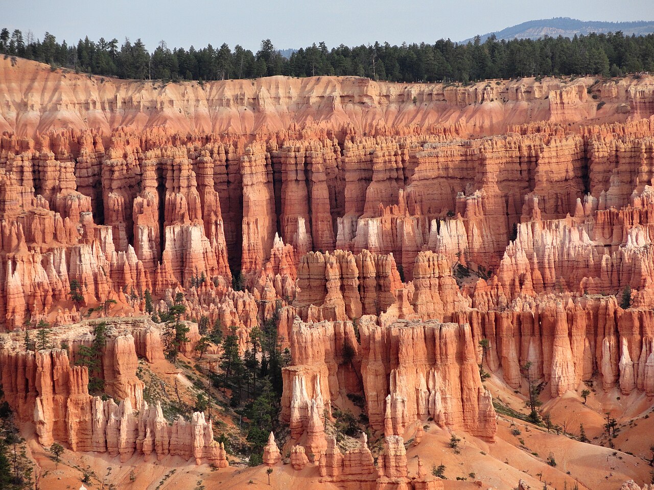
The first few minutes of the Queen’s Garden Trail almost feel too easy. You leave Sunrise Point, the path dips gently below the rim, and the whole amphitheater opens up in front of you.
Then the scale starts to shift. Fins of orange rock rise beside the trail. You duck through tunnels cut into the limestone. Hoodoos that looked like toys from the top now tower over your head. And near the bottom, a short side path leads to the formation that gave the trail its name, a hoodoo said to look like Queen Victoria herself, looking out over her garden of stone.
The Queen’s Garden Trail is the gentlest way to hike below the rim in Bryce Canyon, which makes it the best first hike for most visitors. This guide covers the route step by step, how hard it really is, parking and the shuttle, winter conditions, and why you might not want to turn around at the bottom.
Queen’s Garden Trail: Quick Answer
The Queen’s Garden Trail is a 1.8-mile out-and-back hike in Bryce Canyon National Park that starts at Sunrise Point, drops about 450 feet into Bryce Amphitheater and takes 1 to 2 hours. It’s rated moderate but is the least difficult trail from the rim into the amphitheater. It ends at a short spur to the Queen Victoria hoodoo. Most first-time visitors combine it with the Navajo Loop for a 2.9-mile loop, hiked down Queen’s Garden and up Navajo.
Queen’s Garden Trail at a Glance
| Trailhead | Sunrise Point |
| Distance | 1.8 miles (2.9 km) round trip |
| Elevation change | About 450 feet (137 m) |
| Time | 1 to 2 hours |
| Difficulty | Moderate, the easiest trail into the amphitheater |
| Steepness | About 11% on average, up to 25% in places |
| Trail type | Out-and-back (or part of a loop with Navajo) |
| Highlights | Rock tunnels, hoodoo garden, Queen Victoria |
| Best combination | Queen’s Garden + Navajo Loop, 2.9 miles |
| Shuttle stop | Yes, Sunrise Point |
| Restrooms and water | Near the General Store (seasonal); none below the rim |
| Winter | Usually open; icy, traction needed |
| Dogs | Not allowed |
| Permit | None needed beyond park entry |
In This Guide
- The route, step by step
- How hard is it?
- Trailhead, parking and the shuttle
- Queen’s Garden and Navajo Loop and how it compares to other hikes
- Hiking in every season
- Kids, beginners, dogs and accessibility
- What to bring and photo tips
- FAQs
Is the Queen’s Garden Trail Worth It?
Yes. It’s the easiest way to go from looking at Bryce’s hoodoos to actually walking among them. You don’t need to commit to a five- or eight-mile hike to get the real Bryce experience. In under two hours, you get open views across the amphitheater, tunnels through the rock, a maze of colorful spires and a trail that feels like an adventure for its size.
It also feels different from its neighbor, the Navajo Loop. Queen’s Garden is more open and spread out, with views across ridges and fins, while Navajo drops through a narrow slot. That’s exactly why the two work so well together.
The Queen’s Garden Route, Step by Step
1. Start at Sunrise Point
Before you head down, spend a few minutes at the overlook. Notice how small the hoodoos look from up here, and try to pick out a few. Once you’re below the rim, many of those same formations will rise far above you, and that shift in scale is half the fun. Use the restrooms and fill your water near the General Store, a short walk away, since there’s nothing below the rim.
2. Descend Along the Ridge
The trail starts just south of Sunrise Point and heads down at a gentle, steady grade along a ridge, with wide views across the amphitheater. This is the most relaxed stretch of any trail into the canyon, but remember: every step down is a step you’ll climb back up later.
3. Walk Into the Hoodoos
As you drop lower, the scenery becomes three-dimensional. Instead of one giant view, you start noticing individual fins, spires, little windows and walls of pink and orange rock on all sides. The colors come from iron and manganese in the limestone, and they change as the light moves across them.
4. Pass Through the Tunnels
Lower down, the trail passes through a few short tunnels cut through fins of rock. They’re only a few steps long, but they frame the hoodoos beyond like windows, and they’re one of the most photographed spots on the hike. Kids especially love them.
5. Take the Spur to Queen Victoria
Near the bottom, a signed spur leads a short way to Queen Victoria, the hoodoo that gave the trail its name. It’s said to look like the British queen, crown and all, seated as she looks over her “garden” of surrounding rock sculptures. Whether you see her right away or need to squint a little is part of the fun. Don’t skip this spur. It’s off the main trail, and plenty of hikers walk right past it.
6. Turn Around, or Keep Going
From the Queen Victoria area, you have a choice. Turn around and climb back the way you came to Sunrise Point, for 1.8 miles total. Or continue across the canyon floor to the Navajo Loop, climb out to Sunset Point and walk the rim back, for 2.9 miles total. The second option is only about a mile longer and shows you far more. Strong hikers can also branch off toward the Peekaboo Loop from the junction on the canyon floor.
How Hard Is the Queen’s Garden Trail?
The park rates it moderate, but it’s the least difficult of all the trails that descend from the rim into the amphitheater. There’s no scrambling, no ladders and no exposure to speak of. The trail is wide, averaging nearly 7 feet across.
The challenge comes from three things. First, it’s upside down: the easy downhill comes first and the 450-foot climb comes last. Second, it averages an 11% grade and hits 25% in places. Third, you’re around 8,000 feet up, where the air holds about a quarter less oxygen than at sea level. Plenty of fit people are surprised by how hard they’re breathing on the way back up.
The fix is simple: go slowly on the climb, rest whenever you need to, drink water, and don’t let faster hikers set your pace.
Trailhead, Parking and the Shuttle
The trail starts at Sunrise Point, the northernmost of the four main viewpoints in Bryce Amphitheater, near the General Store and the lodge. You don’t need to drive anywhere remote. The trailhead sits beside one of the most famous overlooks in the park.
Parking: There’s a lot at Sunrise Point, but it fills by mid-morning in busy months. Oversized vehicles aren’t allowed to park here while the shuttle is running. If you arrive early for sunrise, driving in is usually fine.
Shuttle: The free park shuttle stops at Sunrise Point. In 2026 it runs April 3 to October 18, with buses about every 15 minutes. Park at the shuttle station in Bryce Canyon City or the lot across from the visitor center and ride in. If you’re doing the full loop with Navajo, the shuttle also stops at Sunset Point, so you could even skip the final rim walk.
Fees: No trail fee or permit. You just need your park entry: $35 per private vehicle for seven days in 2026, plus a $100 per-person nonresident fee for non-U.S. residents aged 16 and older.
Queen’s Garden and Navajo Loop: The Best Hike in Bryce
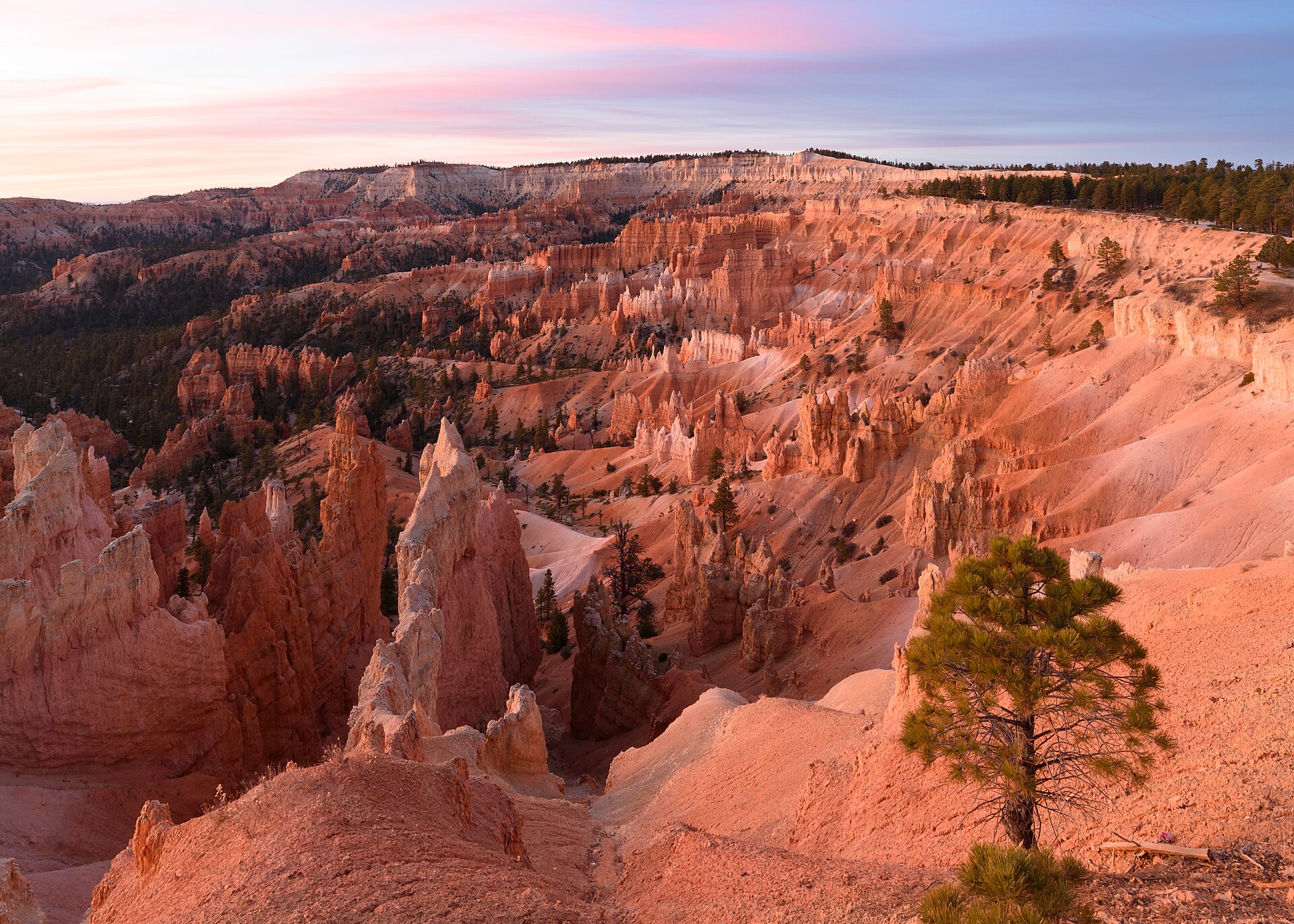
For most first-time visitors, the best plan is to combine Queen’s Garden with the Navajo Loop. The park calls this combination its most popular hike and recommends it most to first-timers, and it’s easy to see why. You get both sides of Bryce in one walk: the open hoodoo garden and tunnels of Queen’s Garden, then the steep switchbacks, Thor’s Hammer and towering walls of the Navajo Loop.
| Queen’s Garden Only | Queen’s Garden + Navajo | |
|---|---|---|
| Distance | 1.8 mi | 2.9 mi |
| Climb | 450 ft | 625 ft |
| Time | 1–2 hrs | 2–3 hrs |
| Route | Out and back from Sunrise Point | Loop: Sunrise Point → Sunset Point → rim |
| Highlights | Tunnels, Queen Victoria | Plus Wall Street or Two Bridges, Thor’s Hammer |
| Best for | Short time, young kids, first day at altitude | Most first-time visitors |
Which Direction Should You Hike It?
Go clockwise: down Queen’s Garden from Sunrise Point, up the Navajo Loop to Sunset Point, then walk the flat, paved half-mile Rim Trail back to Sunrise Point. This is the direction the park recommends.
It might sound backward to climb the steeper trail, but there’s a good reason. Going down the gentle Queen’s Garden side keeps the views in front of you and spares your knees. Climbing the steep Navajo switchbacks is harder work, but it’s much safer than descending them, since that’s where most slips happen. Gentle side down, steep side up.
In summer, you can climb out on either side of the Navajo Loop. In winter, Wall Street is closed, so use the Two Bridges side. For the full story on that half of the hike, see our Navajo Loop Trail guide.
How Queen’s Garden Compares to Other Bryce Hikes
| Trail | Distance | Climb | Difficulty | Feel |
|---|---|---|---|---|
| Queen’s Garden | 1.8 mi | 450 ft | Moderate (easiest) | Open, gentle, tunnels |
| Navajo Loop | 1.3 mi | 515 ft | Moderate | Steep, narrow, dramatic |
| Peekaboo Loop | 5.5 mi | 1,560 ft | Strenuous | Deep in the hoodoos |
| Figure-8 Combination | 6.4 mi | 1,575 ft | Strenuous | The full amphitheater |
| Fairyland Loop | 8 mi | 1,900 ft | Strenuous | Long and quiet |
Queen’s Garden vs Navajo Loop: Choose Queen’s Garden for the gentlest way down and open views. Choose Navajo for the most drama in the shortest distance. Better yet, do both.
Queen’s Garden vs Peekaboo or Fairyland: Those are half-day hikes for strong hikers. Queen’s Garden is the better introduction, especially on your first day at altitude. If you’re unsure, start here, and save the big hikes for day two. For every trail side by side, see our guide to the best hikes in Bryce Canyon National Park.
Going Further: The Figure-8
Strong hikers can stretch Queen’s Garden into Bryce’s biggest amphitheater hike. From the bottom of Queen’s Garden, add the Peekaboo Loop, then climb out on the Navajo Loop. This Figure-8 Combination covers about 6.4 miles and takes 4 to 5 hours. It’s a different commitment altogether, so only choose it if you genuinely want several hours of climbing.
Hiking Queen’s Garden in Every Season
The easiest months are May, June and September, with comfortable temperatures and dry trails. Early October can be lovely too. For crowds and the best months overall, see our guide to the best time to visit Bryce Canyon National Park.
Spring
March and April can still bring heavy snow, and shady sections below the rim hold ice long after the parking lot is dry. By May, conditions are usually much easier. Check trail conditions at the visitor center before you go, and bring traction early in the season.
Summer
Summer has the easiest access but also the biggest crowds and, in July and August, almost daily afternoon thunderstorms with frequent lightning. Hike early. You’ll get cooler air, better light, fewer people and plenty of time before the clouds build. If you hear thunder, head for a building or a hard-topped car.
Fall
September is one of the best months of all, with highs around 70°F and far fewer storms. October turns colder, with freezing nights and the occasional early snowstorm, so don’t assume dry trails just because it’s fall. For temperatures and snow by month, check Bryce Canyon weather by month.
Winter
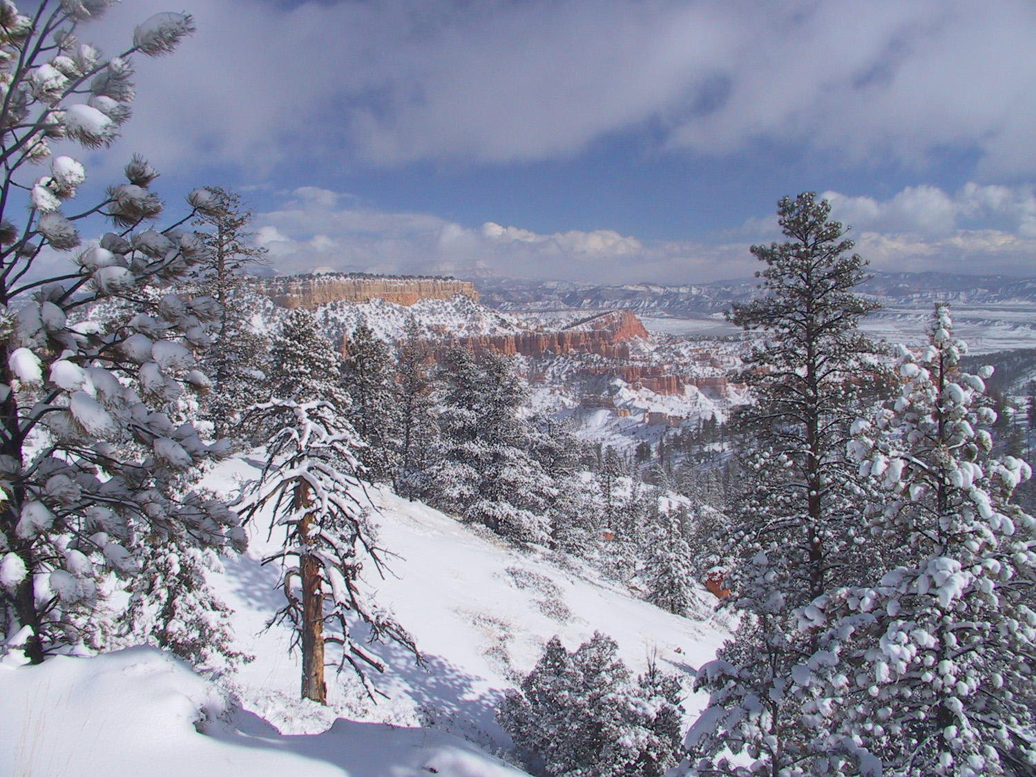
Yes, you can hike Queen’s Garden in winter. Unlike Wall Street on the Navajo Loop, it doesn’t close for the season, and it’s one of the park’s best winter hikes. Snow on the hoodoos is spectacular. But conditions change a lot: after fresh snow you may want snowshoes, and once hikers pack it down, the trail turns icy and microspikes become essential. Combine it with the Two Bridges side of the Navajo Loop for a winter loop, or simply hike out and back. Start mid-morning, when it’s warmer, and finish well before dark.
Best Time of Day: Sunrise, Then Hike
Because the trail starts at Sunrise Point, it’s perfect for a sunrise-and-hike morning. Watch the light hit the hoodoos from the rim, wait a few minutes for the crowd to thin, then head down while the low light is still giving the rocks depth and glow. You’ll be back up, or on to Navajo, before the trail gets busy.
Is Queen’s Garden Right for You?
Beginners
This is the best trail in Bryce for beginners who want to go below the rim. Most reasonably fit people can manage it with time, water, good shoes and a few rest stops on the way back up.
Kids
It’s one of the park’s top picks for families, and kids love the tunnels and spotting the Queen. Just remember that “least difficult” doesn’t mean flat. Little legs often fly downhill and then run out of steam on the climb back. Plan for breaks, bring snacks, and don’t go farther down than your kids can climb back up. For toddlers, the paved rim walk between Sunrise and Sunset Points is a safer choice. More family tips are in our guide to Bryce Canyon with kids.
Dogs
Dogs aren’t allowed on Queen’s Garden or any unpaved trail in Bryce, though service animals are permitted. Leashed pets can join you on the paved rim walk between Sunrise and Sunset Points.
Accessibility
The trail isn’t wheelchair accessible because of its steep grades and natural surface. The best accessible alternative is the paved Rim Trail from Sunrise Point to Sunset Point, about half a mile each way and nearly flat, with great views down into the area Queen’s Garden passes through. Our guide to Bryce Canyon viewpoints has more ideas for seeing the park without a steep hike.
What to Bring
- Shoes with good grip. The park says poor footwear is the number one cause of injuries and rescues in Bryce. Skip sandals and smooth sneakers.
- Water. About 1 liter per person. The park suggests roughly a liter every 1 to 2 hours of hiking.
- Sun protection. Hat, sunscreen and sunglasses for the strong high-altitude sun.
- A warm layer for sunrise starts, even in summer.
- A snack for the climb out, especially with kids.
- Microspikes or other traction from late fall to spring.
Queen’s Garden Photography Tips
- Use the trail as a leading line. The path winding down through the hoodoos makes a great natural guide into the frame.
- Frame shots through the tunnels. The rock openings make perfect natural frames for the hoodoos beyond.
- Zoom in on Queen Victoria. A longer lens or phone telephoto helps her stand out from the busy rock around her.
- Include a person. A hiker beside a hoodoo shows the scale far better than an empty shot.
- Go early. Morning shadows give the formations depth that flat midday light can’t.
Fitting Queen’s Garden Into Your Trip
One day: Sunrise at Sunrise Point, then the Queen’s Garden and Navajo Loop, then Inspiration and Bryce Points, lunch, and the Southern Scenic Drive in the afternoon. Your main hike is done while you’re fresh, and the rest of the day is easy.
Two days: Do Queen’s Garden and Navajo on day one with the amphitheater viewpoints, and save the scenic drive, Bristlecone Loop and a longer hike like Peekaboo for day two. For full hour-by-hour plans, see our Bryce Canyon itinerary.
Common Queen’s Garden Mistakes
- Thinking the easy start means an easy hike. The climb comes at the end.
- Walking past the Queen Victoria spur. It’s off the main trail, so watch for the sign.
- Starting late on a summer afternoon. That’s prime thunderstorm time.
- Underestimating the altitude, especially on your first day.
- Wearing shoes without grip on the sandy, sloping trail.
- Turning around when you have time for Navajo. The loop is only about a mile longer and much more varied.
- Rushing. It’s a short trail. Use the time to stop and look around.
Related Guides
Still putting your plans together? You might also find these useful:
Queen’s Garden Trail: FAQs
How long is the Queen’s Garden Trail?
1.8 miles (2.9 km) round trip, from Sunrise Point down to the Queen Victoria hoodoo and back.
How long does Queen’s Garden take?
Most people take 1 to 2 hours. With the Navajo Loop added, allow 2 to 3 hours.
Is Queen’s Garden hard?
It’s rated moderate, but it’s the easiest trail into Bryce Amphitheater. The main challenge is the 450-foot climb back up at around 8,000 feet of elevation.
Where does the Queen’s Garden Trail start?
At Sunrise Point in Bryce Amphitheater, near the General Store. The park shuttle stops there.
What is Queen Victoria in Bryce Canyon?
A hoodoo near the bottom of the trail that’s said to resemble Queen Victoria seated on her throne. It’s reached by a short, signed spur off the main trail.
Is Queen’s Garden or the Navajo Loop better?
Queen’s Garden is gentler with more open views. Navajo is steeper and more dramatic, with Wall Street and Thor’s Hammer. For most people, combining them is the best choice.
How long is Queen’s Garden and Navajo Loop together?
About 2.9 miles with roughly 625 feet of climbing. It takes 2 to 3 hours.
Which direction should you hike Queen’s Garden and Navajo?
Clockwise: down Queen’s Garden from Sunrise Point, up the Navajo Loop to Sunset Point, then back along the paved rim.
Can you hike Queen’s Garden in winter?
Yes. It usually stays open all year, but snow and ice mean you’ll need microspikes or snowshoes depending on conditions.
Is Queen’s Garden good for kids?
Yes, for kids who are used to walking. They’ll love the tunnels and Queen Victoria, but plan for breaks on the climb back up.
Are dogs allowed on Queen’s Garden?
No. Pets aren’t allowed on the trail, though service animals are.
The Best First Step Below the Rim
The Navajo Loop is more dramatic. Peekaboo is bigger. Fairyland is wilder. But Queen’s Garden has something the others don’t: it’s the easiest way to get down among the hoodoos, and it gives you options once you’re there.
Walk down from Sunrise Point, pass through the tunnels and pay your respects to the Queen. Then decide. Climb back the way you came for a short, satisfying 1.8-mile hike, or keep going, connect to the Navajo Loop and climb out to Sunset Point on the best-known hike in the park. Either way, it’s the perfect first step below the rim. For more ideas for your visit, see our guide to the best things to do in Bryce Canyon National Park.