
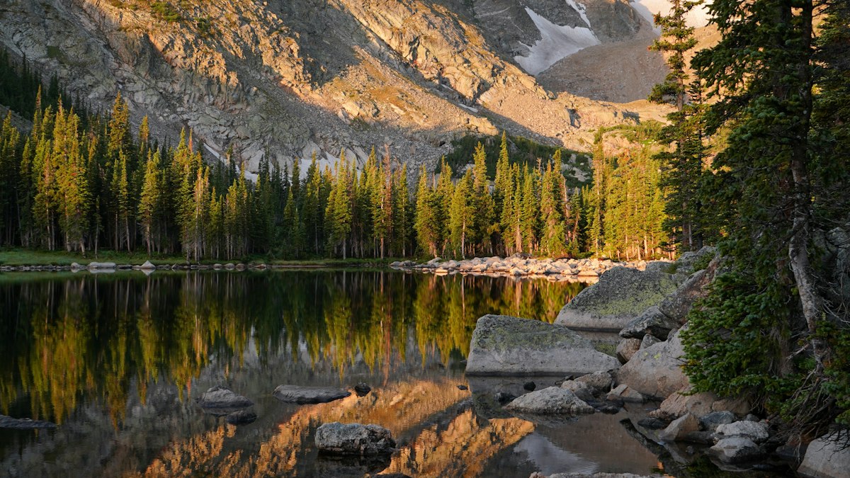
The Sky Pond hike in Colorado packs more scenery into one trail than most hikes manage in a whole trip. In about four and a half miles you pass a roaring waterfall, a big forest lake, a second waterfall you have to climb beside, a little alpine lake, and then Sky Pond itself, tucked under a wall of jagged granite spires in Rocky Mountain National Park.
There’s a catch, though. To reach the last two lakes, you scramble up wet rock next to Timberline Falls, using your hands as much as your feet. That one short section is why some people call Sky Pond the best day hike in the park, and why others turn around and happily eat lunch at the bottom.
This guide covers everything you need to plan it: the real distance (sources don’t agree), how hard it is, the waterfall scramble, parking and the shuttle, timed-entry reservations and fees, the best months to go, what to pack, and the mistakes that send hikers home early.
Cover photo: sunrise at an alpine lake in Rocky Mountain National Park. Photo: Dylan Taylor / Unsplash
Conditions update (November 2, 2026): Winter has arrived in the high country. The park’s latest trail report (October 22, 2026) says to expect snow and ice on trails above 10,000 feet and recommends traction devices, and it showed snow and ice on a footbridge near The Loch. Sky Pond sits at about 10,900 feet, so for now treat the upper trail, especially the Timberline Falls scramble, as icy and dangerous. The 2026 timed-entry season and the free shuttle ended on October 18, so you can drive up Bear Lake Road without a reservation (a park pass is still required). See current conditions.
Sky Pond Hike in Rocky Mountain National Park: The Short Answer
The Sky Pond hike is about 9 miles round trip from Glacier Gorge Trailhead in Rocky Mountain National Park, near Estes Park, Colorado. It climbs about 1,700 feet to a lake at roughly 10,900 feet and takes most people 5 to 8 hours. It’s rated hard because of the altitude and a short, steep rock scramble beside Timberline Falls. The best time to go is July through September, starting at sunrise.
Sky Pond Hike: Quick Facts
| Detail | Information |
|---|---|
| Location | Glacier Gorge / Loch Vale, Rocky Mountain National Park, Colorado |
| Nearest town | Estes Park (about 30–40 minutes’ drive to the trailhead) |
| Trailhead | Glacier Gorge Trailhead, Bear Lake Road |
| Distance | About 9 miles round trip (sources range from 8.5 to 9.8 miles) |
| Elevation gain | About 1,700–1,800 feet to Sky Pond (2,000+ feet counting all the ups and downs) |
| Trailhead elevation | About 9,240 feet |
| Sky Pond elevation | About 10,900 feet |
| Difficulty | Hard (long, high, with a hands-on scramble) |
| Time needed | 5–8 hours for most hikers |
| Trail type | Out and back |
| Crux | About 100 feet of rock scrambling beside Timberline Falls |
| Best months | July through September |
| Dogs | Not allowed |
| Entry | Park pass required; Timed Entry + Bear Lake Road reservation in peak season |
Why the distances don’t match: Different maps and GPS tracks measure this route differently. Most guides land between 8.5 and 9.8 miles round trip. Plan your day around the longer number so you’re never short on time, food, or water.
The Official National Park Service Numbers
The park’s own Bear Lake Road guide lists these one-way distances and elevation gains from Glacier Gorge Trailhead, which it puts at 9,175 feet (other park pages say 9,240 feet). They run a little shorter than many hiking apps, which is part of why numbers differ online.
| Destination | One way (NPS) | Round trip | Elevation gain (NPS) |
|---|---|---|---|
| Alberta Falls | 0.8 mile | 1.6 miles | 233 ft |
| Mills Lake | 2.7 miles | 5.4 miles | 816 ft |
| The Loch | 3.0 miles | 6.0 miles | 1,046 ft |
| Timberline Falls | 3.8 miles | 7.6 miles | 1,589 ft |
| Sky Pond | 4.2 miles | 8.4 miles | 1,726 ft |
GPS tracks from real hikers usually come out between 8.5 and 9.8 miles, depending on the exact start point, side trips and how the device records switchbacks. The trail landmarks table further down uses those real-world distances, so don’t worry if the two tables differ by a few tenths of a mile.
Where Is Sky Pond in Colorado?
Sky Pond sits at the top of Loch Vale, a glacier-carved valley in the Glacier Gorge area of Rocky Mountain National Park. It’s west of Estes Park, at the end of Bear Lake Road, and you can only reach it on foot.
The lake is boxed in by some of the most dramatic rock in the park. Taylor Peak (13,153 feet) towers at the head of the basin, Powell Peak rises to the south, and the Cathedral Spires, including The Sharkstooth (12,829 feet) and the Petit Grepon, stab up along one side. You’ll often spot rock climbers on those spires if you look closely.
Despite the name, Sky Pond is a real lake, not a puddle. It’s long, cold, deep blue, and on a still day it reflects the whole skyline.
How Hard Is the Sky Pond Hike?
Sky Pond is a hard hike. Not because of one brutal climb, but because several challenges stack up:
- Length: About 9 miles round trip is a full day for most people.
- Altitude: You start above 9,200 feet and finish near 10,900 feet. Visitors from low elevation often feel short of breath and tire faster than they expect.
- Rocky trail: Above The Loch, the path gets steeper, rougher, and crosses a boulder field.
- The Timberline Falls scramble: A short but steep climb up wet rock right next to the waterfall. You’ll use your hands.
- Route-finding: Above Lake of Glass, the trail fades and is marked by rock piles (cairns), especially in early summer.
If you’re fit, used to rocky mountain trails, and comfortable with a little exposure, it’s very doable. If you’ve never hiked at altitude or you’re nervous about heights, start with an easier hike first (see our hiking for beginners guide) or plan to turn around at The Loch or the base of Timberline Falls. Both are fantastic destinations on their own.
How Long Does the Sky Pond Hike Take?
Most hikers need 5 to 8 hours for the round trip, including breaks. Your own time depends on your fitness, how used you are to altitude, how busy the scramble is, and how long you sit by the lakes.
| Hiking pace | Approximate round-trip time |
|---|---|
| Fast, fit and acclimated | 4–5 hours |
| Steady pace with short breaks | 5–7 hours |
| Slow pace, lots of photo stops | 7–9 hours |
| Snow or ice on the route | Longer and hard to predict |
These are planning numbers, not official times. Coming down Timberline Falls often takes longer than going up, so leave plenty of time for the return.
Sky Pond Elevation Gain Explained
Glacier Gorge Trailhead sits at about 9,240 feet and Sky Pond at about 10,900 feet. That’s a net climb of roughly 1,700 feet. Some GPS apps show 2,000 feet or more, and both numbers are right in their own way:
- Net gain is the difference between the start and the lake.
- Total ascent adds up every small uphill, including the ones after short dips, so it’s always a bit higher.
At this height, 1,700 feet feels like a lot more than it would at sea level. Walk slowly, drink often, and watch for signs of altitude sickness: headache, nausea, dizziness, unusual tiredness, or feeling out of breath even when resting. If they show up, stop climbing and head down. Severe symptoms like confusion or trouble walking need urgent medical help.
Sky Pond Trail Map: Landmarks and Junctions
The trail is well signed up to Timberline Falls. Here’s what you’ll pass, with approximate distances from Glacier Gorge Trailhead:
| Landmark | Approx. distance one way | Which way to go |
|---|---|---|
| Glacier Creek Trail split | 0.25 mile | Turn left toward Alberta Falls |
| Alberta Falls | 0.8 mile | Keep going uphill |
| North Longs Peak Trail junction | 1.6 miles | Stay right toward The Loch |
| Mills Lake junction | 2.1 miles | Go straight onto the Loch Vale Trail |
| The Loch | 2.7–2.8 miles | Follow the north shore |
| Andrews Glacier junction | 3.6 miles | Stay left for Sky Pond |
| Timberline Falls | 4.0 miles | Scramble up to the right of the falls |
| Lake of Glass | 4.1 miles | Follow cairns along the right side |
| Sky Pond | 4.5 miles | You made it |
Download an offline map before you go. Cell service is close to zero along Bear Lake Road and on the trail.
Where to get a map: The National Park Service has free trail maps of the Bear Lake area on its official maps page. The state’s free Colorado Trail Explorer (COTREX) app also has the Sky Pond route, and you can save it for offline use. Above Lake of Glass, where the trail is faint, a map on your phone is the easiest way to check you’re still on track.
Sky Pond Trail Guide: Step by Step
Glacier Gorge Trailhead to Alberta Falls (0.8 mile)
The hike starts in a cool forest of pine, spruce, and aspen. Within a quarter mile you’ll reach a split. Turn left and follow the signs for Alberta Falls.
The climb is gentle here, and before long you’ll hear Glacier Creek before you see it. Alberta Falls is a 30-foot waterfall pouring through a granite slot. It’s the most popular stop on this side of the park, so expect company. Snap your photos and keep moving. The best parts of this hike are still ahead.

Alberta Falls to The Loch (about 2.8 miles)
Past the falls, the trail climbs steadily across open granite slopes with big views back down the valley. At about 1.6 miles, stay right where the North Longs Peak Trail branches off. Half a mile later you’ll hit the Mills Lake junction. Go straight to stay on the Loch Vale Trail.
A few switchbacks later, the trail levels out and you arrive at The Loch. It’s a long, beautiful lake with Thatchtop Mountain to the south and the high peaks of the Continental Divide in the distance. On calm mornings the water is glassy and the reflections are stunning.
Good to know: The Loch is a perfect turnaround point if storms are building, someone’s struggling with the altitude, or you’re hiking with kids. It’s about 5.5 miles round trip and still one of the prettiest lakes in the park.
The Loch to Timberline Falls (about 4 miles)
Follow the trail along the north shore of The Loch and into the forest beyond it. This stretch is quieter and wilder. You’ll cross small streams on log bridges and pass through meadows that fill with wildflowers in July.
At about 3.6 miles you’ll reach the Andrews Glacier junction. Stay left for Sky Pond. The right fork heads up toward Andrews Glacier and the Andrews Creek backcountry campsite.
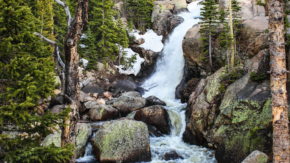
From here, the trail gets steeper and rockier, climbing through a boulder field. Then Timberline Falls comes into view: about 100 feet of white water spilling down a cliff band. This is the start of the hardest part of the hike.
The Timberline Falls Scramble
This is the part everyone talks about. To get above the falls, you climb a steep, rocky chute just to the right of the main flow. It’s roughly 100 feet of hands-and-feet scrambling. In a few spots, water runs right across the rock.
Here’s how to handle it:
- Take your time. Look for the most worn path and solid handholds. Don’t rush to keep up with others.
- Stow your trekking poles. You’ll want both hands free.
- Expect wet rock. Water flow is strongest in early summer when snow is melting. Your shoes may get wet.
- Think about the descent first. Coming down is usually harder than going up, especially when the rock is wet. If you’re not sure you can climb back down, don’t climb up.
- Never attempt it on ice or snow without proper skills and gear. Early in the season and from fall onward, this section can be glazed with ice.
Turning around here is not a failure. The view from the base of Timberline Falls, looking back down Loch Vale, is beautiful in its own right.
Timberline Falls to Lake of Glass (about 4.1 miles)
Pull yourself over the top of the scramble and suddenly you’re above the trees. Lake of Glass (also called Glass Lake) sits in a rocky bowl surrounded by bare granite and patches of snow. It’s small, very clear, and a lovely place to catch your breath.
It’s also colder and windier up here. Throw on a layer before you sit down.
Is Lake of Glass the same as Sky Pond? No. Lake of Glass is the smaller lake right above the waterfall. Sky Pond is about half a mile farther up the valley. Plenty of hikers stop here thinking they’ve arrived, because it already looks like a postcard. Keep going: the best view is still ahead.
Lake of Glass to Sky Pond (about 4.5 miles)
The final half mile follows the right (north) side of Lake of Glass, then climbs gently through rocks, tundra, and small meadows. The trail is faint in places, so watch for cairns.
Then the basin opens up and there it is. Sky Pond stretches out in front of you, Taylor Peak rises at the far end, and the Cathedral Spires rise beside the lake like a row of stone teeth. Find a flat rock out of the wind, eat your lunch, and soak it in.
Just keep one eye on the sky. You still have to get back down the waterfall and walk 4.5 miles out.
Optional Side Trip: Mills Lake
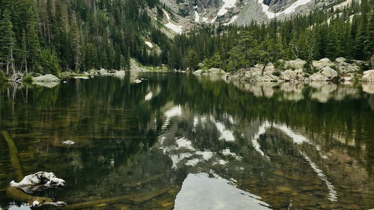
Got energy to spare? On the way back, take the Mills Lake turnoff at the junction about 2.1 miles from the trailhead. The detour adds roughly 1.4 miles and about 200 feet of climbing, and it leads to one of the most photographed lakes in the park, with Longs Peak towering above it. It’s a great option if your group skipped the scramble and still wants another lake.
How to Get to the Sky Pond Trailhead
You can’t drive to Sky Pond. It’s a backcountry lake, and the only way there is on foot from the end of Bear Lake Road. What you drive to is Glacier Gorge Trailhead.
- From downtown Estes Park, take US-36 west to the Beaver Meadows Entrance of Rocky Mountain National Park.
- Just past the entrance station, turn left onto Bear Lake Road.
- Follow Bear Lake Road past Moraine Park and the Park & Ride. Glacier Gorge Trailhead is on a sharp bend about 1 mile before the road ends at Bear Lake.
What to type into Google Maps: “Glacier Gorge Trailhead, Rocky Mountain National Park.” Don’t type “Sky Pond,” because your phone may try to send you somewhere strange. Expect the drive from Estes Park to take about 30 to 40 minutes, longer if you’re waiting at the entrance station.
Coming from Denver? Allow about 1 hour 45 minutes to 2 hours to Estes Park via Boulder and Lyons, then add the drive up Bear Lake Road.
Sky Pond Parking: How to Get a Spot
Parking is one of the trickiest parts of this hike.
Glacier Gorge Trailhead is the closest start, but the lot is small (around 50 spaces). On summer weekends it can fill before 6 a.m. If you want a spot here, arrive in the dark.
If it’s full, you have two good backups:
Option 1: Park at Bear Lake Trailhead
The big Bear Lake lot is at the very end of Bear Lake Road. A connecting trail links it to the Glacier Gorge route, adding only about 0.4–0.5 mile round trip. It fills too, but later in the morning.
Option 2: Take the Free Bear Lake Shuttle
In 2026, the free Bear Lake Shuttle ran daily from May 22 to October 18, roughly 6:30 a.m. to 7:30 p.m., with buses every 10–15 minutes. It stops at the Park & Ride on Bear Lake Road, Bierstadt Lake Trailhead, Glacier Gorge Trailhead, and Bear Lake.
Park at the Park & Ride, hop on, and the bus drops you right at the trailhead. No reservation is needed for this shuttle. A separate Hiker Shuttle from the Estes Park Visitor Center also connects to the Park & Ride, but it needs a $2 ticket booked ahead on Recreation.gov.
Check the National Park Service shuttle page for next season’s dates before you go.
Do You Need a Permit or Reservation for Sky Pond?
You don’t need a hiking permit for a day hike to Sky Pond. You do need to get into the park, and that’s where people get caught out.
Timed entry (2026 season): From May 22 to October 18, 2026, driving into the Bear Lake Road corridor between 5 a.m. and 6 p.m. required a Timed Entry + Bear Lake Road reservation. The standard timed-entry reservation (which doesn’t include Bear Lake Road) is not enough to reach Glacier Gorge.
- Reservations are booked on Recreation.gov and cost a $2 processing fee.
- Blocks of dates are released at 8 a.m. MDT on the first of the month before (for example, August dates on July 1).
- A small number of extra reservations open at 7 p.m. MDT the night before. They go fast.
- Arriving before 5 a.m. means you don’t need a reservation, and that’s also the best way to get parking.
- Riding the shuttle from the Park & Ride still requires that you’ve entered the park legally.
Entrance fees (current): A 1-day vehicle pass is $30, a 7-day vehicle pass is $35, and a 1-day per-person pass is $15. The Rocky Mountain National Park annual pass is $70, and the America the Beautiful pass is $80 for US residents. Since 2026, nonresident visitors aged 16 and over also pay a $100 surcharge unless they hold an annual or America the Beautiful pass. The park takes cards only, no cash.
Timed-entry dates and rules change every year, so always check the official NPS page before your trip.
Update for late 2026: The 2026 timed-entry season ended on October 18. Until it starts again next spring, you can drive up Bear Lake Road without a reservation (you still need a park pass). The park hasn’t announced its 2027 dates yet, so check before you plan a summer 2027 trip.
Camping: If you want to stay overnight, the only nearby backcountry site is Andrews Creek, and it requires a wilderness camping permit. Most people do Sky Pond as a day hike.
Best Time to Hike Sky Pond
July through September is the sweet spot. That’s when the trail is most likely to be free of snow and the Timberline Falls scramble is most manageable.
June and early July
Snow often lingers above The Loch well into July, and Timberline Falls runs high with snowmelt. The scramble can be wet, icy, or both. Bring traction and be ready to turn back.
Mid-July to August
Peak season. Wildflowers bloom along the trail, all the lakes are thawed, and days are long. The tradeoff is crowds and afternoon thunderstorms, which build almost daily in the Colorado high country. Aim to be at Sky Pond by late morning and back below the trees by early afternoon.
September
Many locals’ favorite month. The crowds thin after Labor Day, storms ease off, and aspens around the lower trail turn gold in mid to late September. Mornings are cold and an early snowstorm is always possible.
October to May
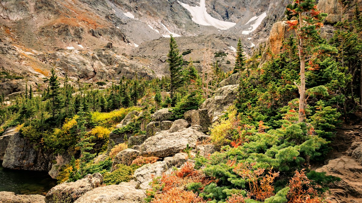
This is winter mountaineering territory. Snow covers the trail, Timberline Falls freezes solid, and parts of the route cross avalanche terrain. Bear Lake Road and its trailheads stay open, and many people snowshoe to Alberta Falls or The Loch. Going beyond that is only for experienced winter travelers with the right gear and avalanche knowledge. Timed entry and the shuttle don’t run in this season, so parking is easier.
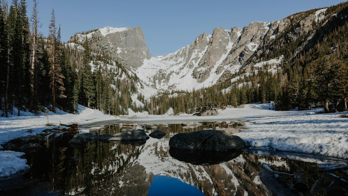
Sky Pond Hike in Winter
In winter, Sky Pond turns from a hard day hike into a serious alpine trip. Deep snow hides the trail, wind packs it into hard slopes, and Timberline Falls becomes a wall of ice. The lake itself freezes and can stay frozen into late spring.
Is it safe for most hikers? No. The upper route crosses avalanche terrain, the ice climb needs real skills, and route-finding gets hard when the trail is buried. Microspikes or snowshoes alone don’t make it safe. Only go beyond The Loch if you have winter mountaineering training, avalanche gear (beacon, probe, shovel) and know how to judge snow conditions.
A better winter plan: snowshoe or hike with traction to Alberta Falls or The Loch. You’ll get the snowy forest and frozen lake views with far less risk, and parking is easy because the shuttle and timed entry aren’t running.
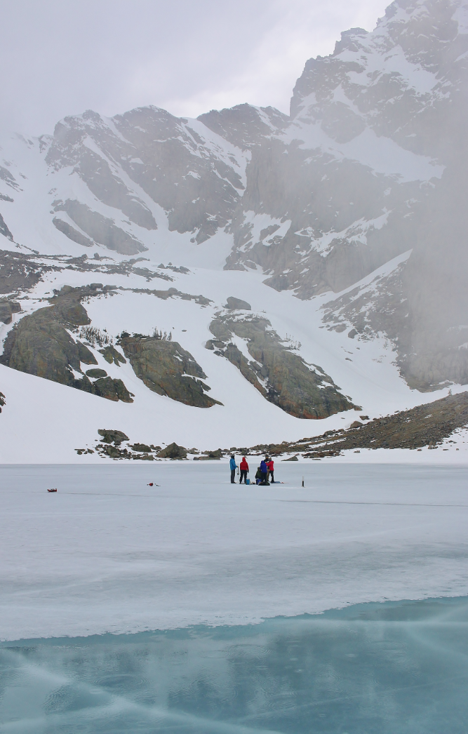
Sky Pond Trail Conditions Right Now (November 2026)
Here’s what the National Park Service’s most recent trail report (October 22, 2026) says about this part of the park:
- Above 10,000 feet: Expect snow and ice on trails. Sky Pond, Lake of Glass and Timberline Falls are all at or above that height.
- Glacier Gorge area: Be prepared for some ice and snow on the trail above the trailhead. The park suggests traction devices and hiking poles.
- The Loch: The report included a photo of snow and ice on a footbridge near The Loch.
- Timberline Falls: The report doesn’t mention it at all. That doesn’t mean it’s clear. In cold weather, the wet rock of the scramble freezes into a sheet of ice.
What this means for you: In early November, Alberta Falls and The Loch make a great snowy hike with microspikes. Going above Timberline Falls is a winter climbing trip, not a hike, and should be left to people with ice and avalanche skills.
How to check before you go:
- Read the NPS trail conditions page (it’s updated every week or two).
- Check the park’s alerts and road status for Bear Lake Road.
- Look at a mountain forecast for the Bear Lake area, not just Estes Park’s weather. It’s usually much colder and windier up high.
- In winter and spring, check the avalanche forecast from the Colorado Avalanche Information Center.
- Call the park’s Information Office at (970) 586-1206 if you’re unsure.
Is the trail “open” in winter? Usually yes. There’s no gate on the trail. But open doesn’t mean safe. The park doesn’t close the route just because it’s icy, so the decision to turn around is yours.

Best Time of Day to Start
Start early. Really early. Being on the trail by 5 or 6 a.m. solves almost every problem on this hike. You’ll grab a parking spot, have the lakes almost to yourself, catch soft morning light for photos, and be heading down before the afternoon storms roll in. Drive in before 5 a.m. during timed-entry season and you won’t need a reservation at all.
A good rule: if you haven’t reached Timberline Falls by about 11 a.m. in summer, think hard about whether to continue.
What to Pack for Sky Pond
Pack for a full day in the mountains, not a stroll to a lake.
- Sturdy shoes with grippy soles. Wet granite is slick. Trail runners or boots with good tread both work.
- 2–3 liters of water per person, plus a filter if you want to top up.
- Lunch and plenty of snacks. You’ll burn more calories at altitude than you expect.
- A rain jacket for afternoon storms (our waterproof hiking jacket guide can help you choose).
- A warm layer, hat, and gloves. It’s often cold and windy at Sky Pond, even in August.
- Sun protection. The last mile is above the trees with no shade.
- Offline map or GPS app.
- Trekking poles for the long descent, folded away for the scramble (see budget trekking poles for beginners).
- Headlamp, first-aid kit, and a whistle, in case the day runs long.
- Microspikes in June, early July, or fall, though they’re no substitute for skills on steep ice.
Want to keep your pack light? Our ultralight backpacking gear list shows where to save weight.
Is the Sky Pond Hike Dangerous? Safety Tips
It can be. Most of the trail is a normal mountain path, but five things cause most of the trouble here: slips on wet rock at Timberline Falls, altitude sickness, afternoon lightning above the trees, snow and ice early and late in the season, and tired legs on the long walk out. Plan around those and the hike is far safer.
- Watch the sky. Lightning is one of the biggest dangers above the trees. If you hear thunder, head down right away.
- Respect the altitude. Drink plenty of water, go slowly, and turn around if anyone gets a bad headache, nausea, or dizziness. Spending a night or two in Estes Park first helps a lot.
- Don’t push past your limit at the falls. Accidents happen most on the way down.
- Stay on the trail. Alpine tundra is fragile and takes years to recover from trampling.
- Pack out everything, including food scraps. Don’t feed the marmots and chipmunks, however friendly they look.
- Use the restrooms before you start. There are toilets at the trailheads but none along the trail.
- Leave the dog and the drone at home. Pets aren’t allowed on Rocky Mountain National Park trails, and drones are banned in national parks.
Common Mistakes to Avoid
Underestimating the waterfall scramble
People read “hike to a lake” and expect a walk. The climb beside Timberline Falls is short, but it’s real, and it’s harder on the way down.
Starting too late
A 10 a.m. start means you’re at Sky Pond right when thunderstorms build, and you may struggle to find parking at all.
Booking the wrong timed-entry reservation
During the peak season, only the Timed Entry + Bear Lake Road option gets you to Glacier Gorge during controlled hours.
Ignoring the altitude
Hiking near 11,000 feet the day after flying in from sea level is a recipe for a miserable day.
Forgetting layers
It can be 75°F at the trailhead and windy and 45°F at Sky Pond.
Wildlife on the Sky Pond Trail
Glacier Gorge is wild country, and you’ll probably see some of its residents. Here’s who lives here and how to act around them:
- Marmots and pikas: Look for them in the boulder fields near Timberline Falls and Sky Pond. Pikas are the little “eeep!” calls you hear from the rocks. Marmots are bold and will go after unattended packs.
- Chipmunks, squirrels and gray jays: Cute, but don’t feed them. Human food makes them sick and aggressive.
- Elk and deer: More common lower down, especially along Bear Lake Road and in Moraine Park. Keep at least 25 yards away.
- Black bears: They live in the park but are rarely seen on this trail. Never leave food unattended, and if you see one, give it space and back away calmly.
- Moose: Occasionally spotted in wet areas of the park. They’re bigger and more dangerous than they look. Give them far more room than the 25-yard (75-foot) minimum, and never get between a cow and her calf.
The Loch vs. Lake of Glass vs. Sky Pond: Where Should You Turn Around?
All three lakes are on the same trail, so you don’t have to pick one before you start. You can decide on the way up. This table helps:
| The Loch | Lake of Glass | Sky Pond | |
|---|---|---|---|
| One way from Glacier Gorge | About 3 miles | About 4.1 miles | About 4.2–4.5 miles |
| Elevation | About 10,190 ft | Just above Timberline Falls | About 10,900 ft |
| Scramble needed? | No | Yes (Timberline Falls) | Yes (Timberline Falls) |
| What it’s like | Long forest lake with big cliffs around it | Small, clear lake in a bare granite bowl | Long lake under Taylor Peak and the Cathedral Spires |
| Best for | Families, beginners, bad-weather days, winter | Hikers short on time after the scramble | Fit, experienced hikers in summer |
Our take: If anyone in your group is nervous about heights, The Loch is the sweet spot. You get a stunning lake without the risk. If you make it up the scramble, don’t stop at Lake of Glass. Sky Pond is only about 10 minutes farther, and it’s the view people come for.
A bit of trivia for the trail: “Loch” is the Scottish and Irish Gaelic word for a lake. Alberta Falls is named after Alberta Sprague, wife of Abner Sprague, one of the early settlers of the Estes Park area. And Lake of Glass is often called Glass Lake, so don’t be confused if you see both names on signs or maps.

Sky Pond vs. Emerald Lake: Which Hike Should You Do?
| Feature | Sky Pond | Emerald Lake |
|---|---|---|
| Starting point | Glacier Gorge Trailhead | Bear Lake Trailhead |
| Distance | About 9 miles round trip | About 3.6 miles round trip |
| Elevation gain | About 1,700–1,800 feet | About 650 feet |
| Difficulty | Hard | Easy to moderate |
| Scrambling | Yes, beside Timberline Falls | No |
| Time | 5–8 hours | 1.5–3 hours |
| Lakes along the way | The Loch, Lake of Glass, Sky Pond | Nymph, Dream, and Emerald Lakes |
| Best for | Fit, experienced hikers | Families and first-timers |
If you’re short on time, new to altitude, or hiking with young kids, Emerald Lake is the smarter pick (see our full Emerald Lake Trail guide). If you want a big day with real adventure, Sky Pond is the one people remember.
More Bear Lake Area Lake Hikes Compared
| Hike | Round trip | Elevation gain | Difficulty | Best for |
|---|---|---|---|---|
| Emerald Lake | 3.6 miles | About 650 feet | Easy–moderate | First-timers and families |
| Lake Haiyaha | 4.2 miles | About 745 feet | Moderate | Boulders and turquoise water |
| The Loch | About 5.5 miles | About 1,000 feet | Moderate | A big lake without the scramble |
| Sky Pond | About 9 miles | About 1,700 feet | Hard | Experienced hikers who want the full adventure |
The Loch is the best middle option: you get much of the same scenery and skip Timberline Falls completely.
Sample Sky Pond Day Plan
- 5:00–6:00 a.m.: Arrive at Glacier Gorge Trailhead (or the Park & Ride in shuttle season). Use the restroom and start walking.
- 6:30 a.m.: Quick stop at Alberta Falls.
- 8:00 a.m.: Reach The Loch. Check the sky, your energy and your group. This is your main go/no-go point.
- 9:00 a.m.: Climb Timberline Falls carefully, then pass Lake of Glass.
- 9:30–10:30 a.m.: Lunch and photos at Sky Pond.
- By 11:00 a.m.: Start heading down, before the usual afternoon storms build.
- 1:00–2:00 p.m.: Back at the trailhead. Add Mills Lake on the way out if you still have energy.
Where to Stay Near the Sky Pond Hike
Estes Park is the best base. It’s about 30–40 minutes from Glacier Gorge Trailhead and has hotels, cabins, vacation rentals, restaurants and gear shops. Stay on the west side of town, near the Beaver Meadows Entrance, to cut your early-morning drive. Spending a night or two here before the hike also helps your body get used to the altitude.
Camping: Glacier Basin Campground sits right on Bear Lake Road and is the closest to the trailhead, but it’s summer-only and books up months ahead on Recreation.gov. Moraine Park Campground is another good choice nearby. Camping near Sky Pond itself isn’t allowed; the closest backcountry site is Andrews Creek, which needs a wilderness permit.
Making a bigger Colorado trip? Add a few days in Colorado Springs with our Garden of the Gods guide, or head southwest for the Warner Point Trail at Black Canyon of the Gunnison.
Sky Pond Photography Tips
- Alberta Falls: flowing water framed by pines. Morning shade keeps the light soft.
- The Loch: mirror-like reflections on calm early mornings.
- Timberline Falls: shoot from the base. Put the camera away before you climb.
- Lake of Glass: clear water and bare granite walls.
- Sky Pond: walk a little way along the shore to line up The Sharkstooth and the Cathedral Spires with their reflection.
Bring a light camera or just your phone, and keep it zipped away on the scramble. Building clouds make dramatic photos, but they’re also your signal to start heading down.
Is the Sky Pond Hike Worth It?
Absolutely, if it matches your fitness and comfort level. Few day hikes anywhere give you two waterfalls, three lakes, and a basin of granite spires in under five miles one way.
It’s not for everyone, and that’s fine. Hiking to The Loch, or to the base of Timberline Falls, is still a beautiful day out with far less risk. The best version of this hike is the one you come home from safely.
Sky Pond Hike FAQs
How long is the Sky Pond hike in Colorado?
About 9 miles round trip from Glacier Gorge Trailhead. Different sources list anywhere from 8.5 to 9.8 miles. Starting from Bear Lake adds about half a mile.
What is the Sky Pond hike elevation gain?
About 1,700 feet of net climbing, from roughly 9,240 feet at Glacier Gorge Trailhead to about 10,900 feet at Sky Pond. GPS apps that count every small uphill often show 2,000 feet or more.
Is the Sky Pond hike near Estes Park?
Yes. The trailhead is inside Rocky Mountain National Park, about 30–40 minutes’ drive from Estes Park along Bear Lake Road.
How long does it take to hike to Sky Pond?
Most hikers need 5–8 hours round trip, including breaks. Strong, acclimated hikers can do it faster.
How difficult is the Sky Pond hike?
It’s rated hard because of the distance, the altitude near 11,000 feet, the rocky upper trail, and the scramble beside Timberline Falls.
Do you have to climb a waterfall to get to Sky Pond?
You don’t climb through the waterfall itself, but you do scramble up a steep, often wet rock chute right beside Timberline Falls. There’s no way around it on the standard route.
Can beginners hike Sky Pond?
It isn’t a good first hike. Beginners can still enjoy the trail by turning around at Alberta Falls or The Loch.
Can kids hike to Sky Pond?
Older kids who are confident on rock and used to long hikes can do it with close supervision. For younger children, The Loch is a better goal.
Do I need a reservation to hike Sky Pond?
No hiking permit is needed, but during the timed-entry season (May 22 to October 18 in 2026), you need a Timed Entry + Bear Lake Road reservation to drive into the area between 5 a.m. and 6 p.m., plus a park entrance pass.
Where do you park for Sky Pond?
At Glacier Gorge Trailhead if you arrive very early. Otherwise park at Bear Lake or take the free Bear Lake Shuttle from the Park & Ride.
Is there cell service on the Sky Pond trail?
Almost none. Download your map and tell someone your plans before you go.
Can you drive to Sky Pond?
No. The closest you can drive is Glacier Gorge Trailhead on Bear Lake Road. From there it’s about 4.2 to 4.5 miles one way on foot.
What are the Sky Pond trail conditions in November?
Wintry. The park’s October 22, 2026 report warned of snow and ice above 10,000 feet and recommended traction devices. Timberline Falls is usually icy by now, so most hikers should turn around at The Loch.
How much does it cost to hike Sky Pond?
The hike itself is free, but you need a park pass: $30 for a 1-day vehicle pass or $35 for 7 days. In peak season, add the $2 timed-entry booking fee.
Is Sky Pond wheelchair or stroller accessible?
No. The trail is rocky and steep, and the waterfall scramble needs hands and feet. For an accessible lake view nearby, try the paved section around Bear Lake.
Can you camp at Sky Pond?
No. Camping is only allowed at designated wilderness campsites with a permit from Recreation.gov. The closest one is Andrews Creek.
Is Lake of Glass the same as Sky Pond?
No. Lake of Glass (also called Glass Lake) is the small lake right above Timberline Falls. Sky Pond is about a half mile past it.
Are dogs allowed on the Sky Pond trail?
No. Pets aren’t allowed on any trails in Rocky Mountain National Park.
Can you swim in Sky Pond?
It’s not recommended. The water stays dangerously cold all year, and the shoreline is fragile alpine terrain.
Can you hike Sky Pond in winter?
Only if you have winter mountaineering experience. Timberline Falls freezes, and parts of the route cross avalanche terrain. Snowshoeing to The Loch is a safer winter option.
What is the best month to hike Sky Pond?
August and September usually offer the best mix of snow-free trail and stable conditions. September is quieter, while August has more wildflowers.
Final Thoughts
Sky Pond is the kind of hike that stays with you. The early start, the waterfalls, the scramble with your heart pounding, and that first look at the spires reflected in the lake all add up to one of the best days you can have in Rocky Mountain National Park.
Go early, book the right reservation, pack layers, and treat Timberline Falls with respect. And remember: the lake will still be there next summer if today isn’t the day.
Related Guides
- Hiking for Beginners: A Complete Guide to Your First Hike
- Best Waterproof Hiking Jacket
- Best Budget Trekking Poles for Beginners
- Ultralight Backpacking Gear List
- Garden of the Gods, Colorado Springs
- Emerald Lake Trail, Rocky Mountain National Park
- Ice Lake Basin Trail near Silverton, Hanging Lake Trail, Colorado
- Colchuck Lake Trail, Washington
- US National Park Guides
- More Hiking Guides