

The first thing everyone notices about Colchuck Lake is the color. On a sunny day, the water glows a bright turquoise that hardly looks real, and right behind it, the giant granite wall of Dragontail Peak shoots straight up into the sky.
The Colchuck Lake Trail near Leavenworth, Washington, is one of the most popular hikes in the state, and the gateway to the famous Enchantments. But you earn that view. The trail climbs about 2,300 feet in four miles, crosses a rocky boulder field, and finishes with a steep, rooty staircase of switchbacks.
This guide covers everything: distance, difficulty, directions and the rough forest road, parking, the permits you actually need, a step-by-step trail guide, the boulder field, Aasgard Pass, the best season (including larch season), weather, what to pack and where to stay.
Cover photo: Colchuck Lake from the Colchuck Lake Trail. Photo: Noah Heaps / Unsplash
Colchuck Lake Trail: The Short Answer
The Colchuck Lake Trail is an 8-mile round-trip hike (some GPS tracks show closer to 9) from Stuart Lake Trailhead, about 12 miles from Leavenworth, Washington. It gains about 2,280 feet to a turquoise lake at 5,580 feet below Dragontail Peak. It’s moderate to hard, with a boulder field and a steep final mile, and takes most people 5–8 hours. Day hikers need a free self-issued wilderness permit and a Northwest Forest Pass; camping requires an Enchantments permit from May 15 to October 31. Dogs aren’t allowed.
Colchuck Lake Trail: Quick Facts
| Detail | Information |
|---|---|
| Location | Alpine Lakes Wilderness, Okanogan-Wenatchee National Forest, near Leavenworth, WA |
| Trailhead | Stuart Lake Trailhead, end of Forest Road 7601 |
| Trails | Stuart Lake Trail #1599, then Colchuck Lake Trail #1599A |
| Distance | About 8 miles round trip (up to 9 with lakeshore walking) |
| Elevation gain | About 2,280 feet |
| Trailhead elevation | 3,400 feet |
| Lake elevation | 5,580 feet |
| Difficulty | Moderate to hard |
| Time needed | 5–8 hours |
| Best months | July through early October |
| Day-use permit | Free, self-issued at the trailhead |
| Parking pass | Northwest Forest Pass ($5/day, $30/year) or America the Beautiful |
| Camping | Enchantments overnight permit required May 15–October 31 |
| Dogs | Not allowed anywhere in the Enchantment Permit Area |
| Toilet | Vault toilet at the trailhead |
Where Is Colchuck Lake?
Colchuck Lake sits high in the central Cascades, southwest of Leavenworth, inside the Alpine Lakes Wilderness. It’s tucked right below Dragontail Peak and Colchuck Peak, at the base of Aasgard Pass, the steep shortcut up into the Enchantments’ Core Zone. You can only reach it on foot.
Directions to the Colchuck Lake Trailhead
- From US-2 at the west end of Leavenworth, turn onto Icicle Creek Road.
- Drive 8.4 miles, then turn left onto Forest Road 7601 (Eightmile Road).
- Follow FR 7601 for 3.7 miles, past Eightmile Trailhead, to the Stuart Lake Trailhead at the end.
Plan on 35–45 minutes from town. FR 7601 is unpaved, steep in places and gets badly washboarded and potholed as the summer goes on. The Forest Service recommends high clearance, and 4WD if you have it. Many people make it in regular cars when the road is in decent shape; just drive slowly.
Road season: FR 7601 closes to vehicles every winter, usually from about November to May. The Forest Service has also closed it in spring for maintenance in some years. Check Okanogan-Wenatchee National Forest alerts before you drive up.
Colchuck Lake Parking
The Stuart Lake Trailhead lot holds only about 20–30 cars, and it’s shared by Colchuck, Stuart Lake and Enchantments hikers. On summer and larch-season weekends, it can be full before sunrise.
- Overflow parking: When the lot is full, you can park only on the right side of FR 7601 between Eightmile Lake and the trailhead. That can mean an extra walk of a mile or more.
- Pass: Display a Northwest Forest Pass ($5 a day or $30 a year, also available by Scan & Pay at the trailhead) or an America the Beautiful pass.
- No camping along the road: Dispersed camping isn’t allowed between FR 7601 and Icicle Creek.
- Best bet: Arrive by 6 a.m. on weekends, or hike on a weekday.
Colchuck Lake Permits: What You Actually Need
This confuses a lot of people, because Colchuck sits inside the famous Enchantment Permit Area.
| Your plan | What you need |
|---|---|
| Day hike | Free self-issued day-use wilderness permit (fill it out at the trailhead) + parking pass |
| Overnight, May 15–Oct 31 | Enchantments overnight permit for the Colchuck Zone (advance lottery, later reservations, or the daily lottery on Recreation.gov) + parking pass |
| Overnight, Nov 1–May 14 | Self-issued wilderness permit (but the road is usually closed) |
Good news for day hikers: you don’t need to win the Enchantments lottery. Just fill out the free permit at the trailhead kiosk and carry your copy.
For campers: overnight permits are limited and in high demand. The main lottery happens in late winter on Recreation.gov, and a daily lottery releases a small number of next-day permits through the Recreation.gov app. Don’t hike in with a tent hoping for the best; rangers do check.
How Long Is the Colchuck Lake Trail?
The Washington Trails Association lists the hike at 8 miles round trip with 2,280 feet of gain. Other measurements land closer to 9 miles and about 2,340 feet, usually because they include walking along the lakeshore or count every small dip.
| Landmark | Approx. distance from trailhead |
|---|---|
| First log bridge over Mountaineer Creek | 1.5 miles |
| Stuart Lake / Colchuck Lake junction | 2.25 miles |
| Second bridge and boulder field | About 2.5 miles |
| Colchuck Lake (first viewpoint) | About 4 miles |
| Far end of the lake (base of Aasgard Pass) | About 4.7 miles |
Colchuck Lake Trail Difficulty
WTA rates Colchuck Lake moderate/hard, and most casual hikers will find it hard. The first 1.5 miles are gentle. After that, the trail gets steeper and rockier, and the last mile and a half to the lake is a real climb over roots, rock steps and granite slabs.
- Elevation gain: About 2,300 feet, mostly in the second half.
- The boulder field: A short stretch of hopping between large rocks.
- The final ascent: Steep, rocky switchbacks that slow almost everyone down.
- The descent: Going back down the same rocky steps is tough on knees.
Is it OK for beginners? Fit beginners can do it on a dry summer day, but it isn’t a great first mountain hike. If you’re new, try an easier Leavenworth trail first, or read our hiking for beginners guide.
How Long Does the Colchuck Lake Hike Take?
| Hiking pace | Approximate round-trip time |
|---|---|
| Strong, experienced hikers | 4–5 hours |
| Steady pace with a lunch break | 5–7 hours |
| Slower pace, lots of photos | 7–9 hours |
| Snow or ice on the trail | Much longer |
Colchuck Lake Trail Guide: Step by Step
1. Stuart Lake Trailhead to the First Bridge (1.5 miles)
Fill out your day-use permit at the kiosk, use the vault toilet, and head up the Stuart Lake Trail. The first stretch is a gentle, shady climb through big evergreens beside Mountaineer Creek. It’s the easiest part of the day, so enjoy it. At 1.5 miles, a log bridge crosses the creek.
2. To the Colchuck Junction (2.25 miles)
After the bridge, the trail gets steeper and rockier. About 0.75 mile later, you reach a signed junction. Stuart Lake is straight ahead; turn left for Colchuck Lake onto Trail #1599A. Double-check the sign. Plenty of people miss this turn.
3. The Second Bridge and the Boulder Field
Soon after the junction, a second log bridge crosses a narrow, churning section of Mountaineer Creek. Just beyond it, the trail crosses a slope of large boulders (talus). You’ll step from rock to rock, sometimes using your hands for balance.
- Take short, deliberate steps and test wobbly rocks.
- Follow the most worn route and the cairns; don’t invent shortcuts.
- Be extra careful when the rocks are wet, icy or snowy.
- Strap trekking poles to your pack if they get in the way.
4. The Final Climb
Now comes the hard part. The trail switchbacks steeply up through forest, over roots, rock steps and granite slabs. Peeks of granite peaks appear through the trees. This last mile and a half feels long, so take breaks and drink water. Near the top, look for a nice viewpoint of the valley behind you.
5. Arriving at Colchuck Lake
The trail tops out on a broad granite slab overlooking the lake, and the view is worth every step. In sunlight the water is a bright aquamarine; in shade, a deep blue. Dragontail Peak towers across the lake, with Aasgard Pass to its left and Colchuck Peak and the remains of the Colchuck Glacier to the right.
The color comes from fine rock dust, ground up by glaciers and carried into the lake, which reflects sunlight in brilliant blue-green.

6. Exploring the Lakeshore
If you have energy, a rough route follows the west shore for about two-thirds of a mile toward the far end of the lake. At a large tarn, stay on the rocky route to the left. Near the base of Aasgard Pass, golden larches take over in fall. It’s quieter here and the views of Dragontail are even more dramatic. Just remember this adds distance and rocky footing to your day.
Should You Go Up Aasgard Pass?
From the far end of the lake, a route climbs roughly 2,000 feet in about a mile up loose rock to Aasgard Pass, the entrance to the Enchantments’ Core Zone. It’s one of the steepest “trails” in Washington. The Forest Service says it’s not advised for hikers who aren’t prepared and equipped for steep snow travel, and there’s often snow on it well into summer.
For day hikers, Colchuck Lake should be the turnaround point. Aasgard is for well-prepared hikers doing the full Enchantments traverse.
Best Time to Hike Colchuck Lake
| Month | What to expect |
|---|---|
| May–June | Road may still be closed; snow on the upper trail and boulder field. Traction and snow skills needed. |
| July | Mostly snow-free by mid-July; creeks running high; mosquitoes near the lake. Busy. |
| August | Most reliable conditions and brightest water. Warm climb; possible wildfire smoke. |
| Mid-September–early October | Larch season: golden larches near the far end of the lake. Stunning, cold mornings, very busy weekends. |
| Late October | Snow and ice likely near the lake; short days. The road usually closes in November. |
| November–April | Road closed; winter mountaineering only. |
Right now (late October 2026): larch season is ending, and early snow and ice are likely on the upper trail and boulder field. If FR 7601 is still open, bring microspikes, warm layers and a headlamp, and check recent trip reports before you go.
Colchuck Lake Weather
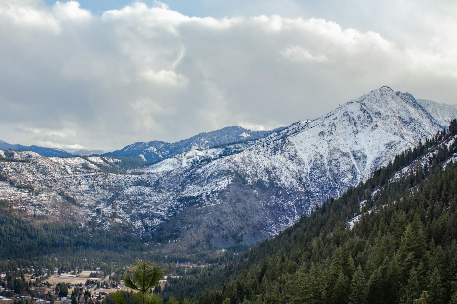
The lake sits more than 4,000 feet above Leavenworth, so it’s often 15–20°F colder, and much windier, than town. Summer afternoons on the climb can be hot, while the lake stays chilly. Rain makes the roots and boulders slick, and thunderstorms can roll in on summer afternoons. Check the National Weather Service point forecast for the lake itself, not just Leavenworth, and pack a warm layer even in August.
Rules to Know: Dogs, Drones, Fires and Goats
- No dogs on any trail in the Enchantment Permit Area, including Stuart Lake and Colchuck Lake trails, even on a leash.
- No drones in designated wilderness.
- No campfires in the Enchantments; use a stove if you’re camping.
- No horses or pack stock on the Colchuck Lake Trail.
- Mountain goats: They’re common around the lake and crave salt from sweat and urine. Keep at least 50 yards away, never feed them, and pee on rocks well away from the trail and water.
- Use the toilets at camp areas, or pack out human waste; the soil here is thin and fragile.
Camping at Colchuck Lake
Established campsites line the lakeshore, and camping here is magical, with sunrise lighting up Dragontail. But from May 15 to October 31, you must have an Enchantments overnight permit for the Colchuck Zone. Camp only in established sites, follow the group size limits on your permit, and store food so goats and rodents can’t reach it.
No permit? Developed campgrounds along Icicle Creek Road, such as Eightmile, Bridge Creek and Johnny Creek, are a good base for an early start (most are seasonal and reservable).
Colchuck Lake vs. Stuart Lake
| Feature | Colchuck Lake | Stuart Lake |
|---|---|---|
| Trailhead | Stuart Lake Trailhead | Stuart Lake Trailhead |
| Distance | About 8 miles round trip | About 9 miles round trip |
| Climb | About 2,280 feet, steep finish | Less climbing, more gradual |
| Difficulty | Moderate/hard | Moderate |
| Highlight | Turquoise water under Dragontail | Big lake below Mount Stuart, meadows |
| Crowds | Very busy | Quieter |
Stuart Lake is a nice option if you want a longer but gentler walk from the same trailhead.
Can Kids Hike Colchuck Lake?
Older kids who already handle long, steep hikes can do it, and the turquoise water is a great reward. For young kids or first-timers, the boulder field, steep finish and 8-mile round trip are too much. Turn around early if anyone is struggling; the creek and first bridge make a nice shorter goal.
What to Pack for the Colchuck Lake Trail
- Hiking boots or trail shoes with good grip for boulders and slabs
- 2–3 liters of water and a filter (refill from the creek)
- Lunch and plenty of snacks
- Warm layer and rain jacket (see our waterproof hiking jacket guide)
- Sun hat, sunglasses and sunscreen: the granite reflects strong sun
- Trekking poles for the descent (see budget trekking poles for beginners)
- Bug spray in July
- Microspikes in June and from October on
- Offline map, headlamp, first-aid kit, permit and parking pass
Photography Tips
- First viewpoint slab: the classic wide shot of the lake with Dragontail Peak behind.
- Midday: the water looks its most turquoise when the sun is high.
- Morning: calm water and reflections, though the peaks shade parts of the lake early.
- Larch season: walk to the far end of the lake for golden larches against blue water and granite.
Sample Day Plan
- 5:15 a.m.: Leave Leavenworth.
- 6:00 a.m.: Park, display your pass, fill out the day-use permit, start hiking.
- 6:45 a.m.: First bridge. Short snack break.
- 7:15 a.m.: Turn left at the junction, cross the second bridge and the boulder field.
- 8:00–9:00 a.m.: Steep final climb.
- 9:00–11:00 a.m.: Lake time: viewpoint slab, lunch, maybe the lakeshore walk.
- 11:00 a.m.–1:30 p.m.: Hike out, then a celebratory meal in Leavenworth.
Where to Stay Near Colchuck Lake
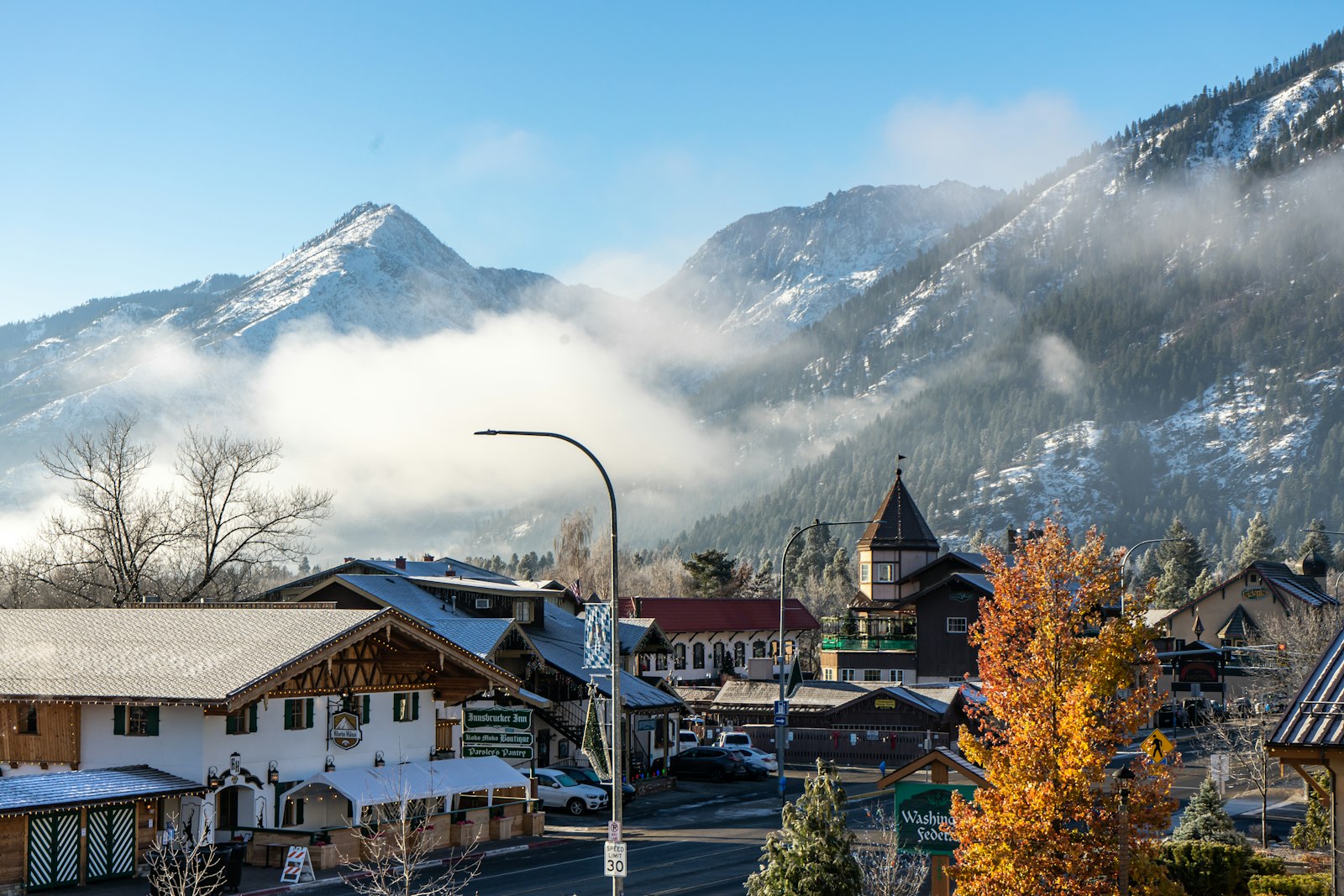
- Leavenworth: the Bavarian-style village has hotels, inns, cabins, restaurants and gear shops, about 40 minutes from the trailhead.
- Icicle Creek area: cabins and vacation rentals along Icicle Road cut your morning drive.
- Icicle Creek campgrounds: the closest beds to the trailhead, in season.
- Wenatchee and Cashmere: more and cheaper options, 30–40 minutes east of Leavenworth.
Leavenworth gets very busy during larch season and its October festivals, so book early.
More Washington Hikes
Love alpine lakes and big views? Try the Maple Pass Loop or Cascade Pass in the North Cascades, the Skyline Trail at Mount Rainier, or Mount Storm King on the Olympic Peninsula.
Colchuck Lake Trail FAQs
How long is the Colchuck Lake Trail?
About 8 miles round trip from Stuart Lake Trailhead, or up to 9 miles if you explore the lakeshore.
How hard is the Colchuck Lake hike?
Moderate to hard. It gains about 2,280 feet, crosses a boulder field and ends with a steep, rocky climb.
How long does it take to hike to Colchuck Lake?
Most people need 5–8 hours round trip, including time at the lake.
Do you need a permit to day hike Colchuck Lake?
Yes, but it’s free and easy: fill out a self-issued day-use permit at the trailhead. You also need a Northwest Forest Pass or America the Beautiful pass to park. No lottery needed.
Can you camp at Colchuck Lake?
Yes, but from May 15 to October 31 you need an Enchantments overnight permit for the Colchuck Zone through Recreation.gov.
Is the boulder field on the Colchuck Lake Trail hard?
It’s short but takes care. You step between large rocks, sometimes using your hands. It’s much trickier when wet or icy.
Can you drive to the Colchuck Lake trailhead in a regular car?
Often, yes, but FR 7601 is rough and washboarded. The Forest Service recommends high clearance and prefers 4WD. Drive slowly.
When is the road to Colchuck Lake open?
FR 7601 usually closes for winter from about November to May. Check forest alerts before you go.
Are dogs allowed at Colchuck Lake?
No. Dogs are banned on all trails in the Enchantment Permit Area, even on a leash.
Can you swim in Colchuck Lake?
Some people take a very quick dip in August, but the water is snowmelt-cold all year. Cold-water shock is a real risk, and help is hours away.
When do the larches turn gold at Colchuck Lake?
Usually from mid- or late September into early October, depending on the year. The best larches are at the far end of the lake toward Aasgard Pass.
Is the Colchuck Lake Trail Worth It?
Absolutely. Few day hikes anywhere end at water this color, under granite walls this big. It’s one of the best day hikes in Washington.
Just plan it right: start early to get parking, fill out your free permit, take the boulder field and final climb slowly, carry layers, and leave Aasgard Pass for another, better-prepared day. When you reach that granite slab and see the lake for the first time, you’ll know why everyone makes the climb.