
It’s the hike Phoenix locals use as their outdoor stair machine. Just over a mile up, about 1,200 feet of climbing, rock steps the whole way, and a summit where the entire Valley of the Sun spreads out around you.
The Piestewa Peak Summit Trail is one of the most popular hikes in Arizona, and the City of Phoenix rates it extremely difficult. It’s short, but it’s relentless. There’s barely a flat step from bottom to top.
This guide explains everything in simple words: distance, how steep it really is, the stairs, how long it takes, parking and hours, heat closures, the no-dogs rule, what you’ll see from the top and how to stay safe.

Quick answer
- Distance: 1.2 miles one way, about 2.4 miles round trip (City of Phoenix).
- Elevation gain: about 1,200 feet.
- Summit: about 2,608 feet.
- Time: 1.5–3 hours round trip for most people.
- Difficulty: extremely difficult (official city rating).
- Start: 302 (Mesquite) Trailhead, 2701 E. Piestewa Peak Dr., then a short link via the Freedom Trail.
- Hours: trailhead 5 a.m.–7 p.m.; trails 5 a.m.–11 p.m.
- Cost: free.
- Dogs: not allowed on the Summit Trail.
- Heat: closed 8 a.m.–5 p.m. on Extreme Heat Warning days.
Piestewa Peak Summit Trail at a Glance
| Location | Phoenix Mountains Preserve, Phoenix, Arizona |
| Trail | Piestewa Peak Summit Trail (often called Trail 300) |
| Distance | 1.2 miles one way (about 2.4 round trip) |
| Elevation gain | About 1,200 feet |
| Summit elevation | About 2,608 feet |
| Difficulty | Extremely difficult |
| Surface | Rock steps, switchbacks, gravel, rock |
| Trailhead | 302 (Mesquite) Trailhead, 2701 E. Piestewa Peak Dr. |
| Facilities | Water, parking and restrooms at the base |
| Fee | None |
| Dogs | Not allowed on the Summit Trail |
| Best season | November to March |
Facts above come from the City of Phoenix.
Where Is Piestewa Peak?
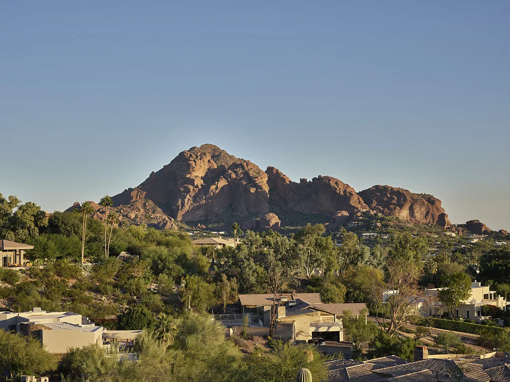
Piestewa Peak rises in the Phoenix Mountains Preserve, in the middle of the city, north of downtown and the Biltmore area. It’s one of the most recognizable peaks in the city, and you can see it from all over the valley.
Why is it called Piestewa Peak?
The mountain was renamed in 2003 to honor Lori Ann Piestewa, a U.S. Army soldier from Tuba City, Arizona, and a member of the Hopi Tribe. She was killed in the Iraq War in 2003 and is believed to be the first Native American woman to die in combat while serving in the U.S. military.
How to Get There and Where to Park
- Address: 302 (Mesquite) Trailhead, 2701 E. Piestewa Peak Drive, Phoenix, AZ.
- From SR-51 (Piestewa Freeway), take the Glendale/Lincoln exit, head east on Lincoln Drive, and turn north onto Piestewa Peak Drive. Follow it into the park.
- The City of Phoenix says to start at the 302 Trailhead and take the Piestewa Peak Freedom Trail to connect to the Summit Trail.
- There are several parking lots along Piestewa Peak Drive. On winter mornings and weekends, they fill fast. Arrive early or try a weekday.
- Parking is free.
Hours
- Trailhead (parking) hours: 5 a.m. to 7 p.m.
- Trail hours: 5 a.m. to 11 p.m.
The city sometimes extends summer parking hours. Check the city website before you go.
How Hard Is the Piestewa Peak Summit Trail?
The City of Phoenix rates it extremely difficult. Here’s why:
- It’s steep the whole way: about 1,200 feet up in 1.2 miles.
- Rock stairs: many “modified steps” made of rock, of all different heights.
- Loose gravel in places.
- No shade.
- The last stretch near the top is rockier and you may use your hands for balance.
Is it good for beginners?
It’s not ideal as a first hike, but fit beginners do it all the time. Go slowly, take breaks, and turn around whenever you need to. Even halfway up, the views are great. Our hiking for beginners guide can help you build up to it.
Piestewa Peak vs. Camelback Mountain
Both are rated extremely difficult. Camelback’s Echo Canyon Trail has more scrambling, handrails and boulders. Piestewa Peak is more of a nonstop staircase with less scrambling. Many locals find Piestewa a little easier and Camelback a little scarier.
What to Expect, Step by Step
1. The start
From the 302 Trailhead, follow the signs and the short Freedom Trail connector to the Summit Trail. Right away, the trail starts climbing.
2. The lower switchbacks
The trail zigzags up the mountainside on rock steps and gravel. You’ll pass saguaros, creosote bushes and palo verde trees. Find a steady pace you can keep. This hike rewards slow and steady.
3. The stairs
Most of the hike feels like climbing an uneven staircase. Some steps are small, some are knee-high. Use your legs, not your back, and keep breathing.
4. The saddle
Partway up, you reach a saddle with views to the north. It’s a popular rest stop and a fine turnaround if you’re done.
5. The final climb
The last part is the steepest and rockiest. You’ll step up big rocks and might use your hands. Watch your footing and give way to others in narrow spots.
6. The summit
At about 2,608 feet, the top is a rocky perch with a 360-degree view: downtown Phoenix, Camelback Mountain, the Biltmore, Scottsdale, and on clear days, the Superstition and McDowell Mountains in the distance.
7. The descent
Going down is hard on the knees, and loose gravel on rock steps can be slippery. Take short steps and don’t rush.
How Many Stairs Are There?
There’s no official step count. The trail has a lot of constructed rock steps mixed with natural rock and gravel. Rather than counting, plan for a steady, steep climb from start to finish.
How Long Does It Take?
| Hiker | Up | Down | Total |
|---|---|---|---|
| Very fit locals | 30–40 min | 20–30 min | About 1 hour |
| Regular hikers | 45–75 min | 30–60 min | 1.5–2 hours |
| Beginners | 75–90+ min | 45–75 min | 2–3 hours |
Best Time to Hike
| Season | What to expect |
|---|---|
| November–March | Best weather; busy on weekends |
| April and October | Warm; go at sunrise |
| May–September | Dangerous heat; very early only, or skip |
Heat closures
Under Phoenix’s Trail Heat Safety Program, the Piestewa Peak trails close from 8 a.m. to 5 p.m. on days the National Weather Service issues an Extreme Heat Warning. Check the city’s heat safety page in summer.
Sunrise and night hikes
Sunrise is a favorite time: cool air and pink light over the city. Because trail hours run until 11 p.m., some people also hike at night with headlamps. Remember that parking closes earlier (7 p.m.), and the rocky steps are much harder in the dark.
Rules to Know
- No dogs on the Summit Trail, year-round. Phoenix also bans dogs on all city trails when it’s 100°F or hotter.
- Stay on the trail. Cutting switchbacks damages the mountain and causes falls.
- No fee.
What to Bring
- Water: at least 1 liter per person in winter, more if warm. There’s water at the base, none on the trail.
- Shoes with good grip.
- Hat, sunglasses, sunscreen.
- Headlamp for sunrise or evening hikes.
- Phone in a secure pocket or shoulder strap holder.
Safety Tips
- Pace yourself. It’s a marathon of stairs, not a sprint.
- Heat is the biggest danger. Turn back if you feel dizzy, sick or overheated.
- Turn around when half your water is gone.
- Watch footing on gravel-covered rock, especially going down.
- Be courteous: let faster hikers pass at wide spots.
Piestewa Peak vs. Other Phoenix Hikes
| Trail | Distance (round trip) | Difficulty | Highlight |
|---|---|---|---|
| Piestewa Peak Summit | About 2.4 mi | Extremely difficult | 360° city view |
| Camelback Echo Canyon | About 2.3 mi | Extremely difficult | Scrambling, handrails |
| Piestewa Peak Freedom Trail | 3.7 mi loop | Difficult | Circles the mountain |
| Piestewa Peak Nature Trail | 1.4 mi | Moderate | Easier desert walk |
| Pinnacle Peak (Scottsdale) | About 4 mi | Moderate | Smooth trail, desert views |
Frequently Asked Questions
How long is the Piestewa Peak Summit Trail?
1.2 miles one way, or about 2.4 miles round trip.
How hard is it?
The City of Phoenix rates it extremely difficult because of the steep, nonstop climb on rock steps.
How long does it take?
Most people take 1.5–3 hours round trip.
What’s the elevation gain?
About 1,200 feet, to a summit of about 2,608 feet.
Where do you park?
At the 302 (Mesquite) Trailhead, 2701 E. Piestewa Peak Drive, or other lots along Piestewa Peak Drive. Parking is free.
Are dogs allowed?
No, not on the Summit Trail.
What are the hours?
Trailhead parking 5 a.m.–7 p.m.; trails 5 a.m.–11 p.m.
Is it closed in summer?
It closes 8 a.m.–5 p.m. on Extreme Heat Warning days.
Is Piestewa harder than Camelback?
Both are very hard. Camelback has more scrambling; Piestewa is more of a steady staircase.
How many steps are there?
There’s no official count. Expect steps most of the way.
Is it worth it?
Yes. It’s one of the best workouts and best city views in Phoenix.
Final Thoughts
Piestewa Peak is short, steep and honest: you earn every step, and the summit pays you back with one of the best views in Phoenix. Come early in the cool months, bring water, leave the dog at home and take the descent slowly.
More Phoenix-area hikes: Camelback Mountain, Pinnacle Peak, Tom’s Thumb, Wind Cave Trail and the best winter hiking trails in the USA.
Official info: City of Phoenix: Piestewa Peak trails.