

Some hikes make you work for hours before you see anything special. The Avalanche Lake Trail in Glacier National Park is different. Within minutes you’re walking under giant cedars that have stood for centuries. Then you’re staring down into a narrow gorge full of rushing turquoise water. And about two miles later, the forest opens up to a mountain lake ringed by cliffs, with long, thin waterfalls pouring down from the snowfields above.
It’s one of the most popular hikes in Glacier, and one of the best moderate hikes in Montana. But there are a few things to know first: parking is tight, the park’s 2026 shuttle didn’t stop here, the road changes with the seasons, and this is grizzly country.
This guide covers it all: distance, difficulty, elevation gain, how long it takes, the trailhead, a step-by-step trail guide, parking, 2026 access rules, when the trail is open, bear safety, hiking with kids, what to pack, and where to stay.
Cover photo: Avalanche Lake, Glacier National Park. Photo: Robert Schrader / Pexels
Avalanche Lake Trail: The Short Answer
The Avalanche Lake Trail in Glacier National Park, Montana, is 2.3 miles one way (about 4.6 miles round trip) with 741 feet of elevation gain. It starts from the Trail of the Cedars at Avalanche Picnic Area on Going-to-the-Sun Road, about 5.5 miles east of Lake McDonald Lodge. It’s a moderate hike that takes most people 3 to 4 hours (the park suggests allowing 3 to 6). Go early, because parking fills fast, and carry bear spray.
Avalanche Lake Trail: Quick Facts
| Detail | Information |
|---|---|
| Location | West side of Glacier National Park, Montana |
| Trailhead | Avalanche Picnic Area / Trail of the Cedars, Going-to-the-Sun Road |
| Distance | 2.3 miles one way, about 4.6 miles round trip |
| Elevation gain | 741 feet |
| Trailhead elevation | About 3,400 feet |
| Lake elevation | 3,905 feet |
| Difficulty | Moderate |
| Time needed | 3–4 hours for most hikers (allow up to 6 with long breaks) |
| Trail type | Out and back |
| Highlights | Old-growth cedars, Avalanche Gorge, waterfalls, Avalanche Lake |
| Best months | Late June through September |
| Restrooms | At the picnic area, plus a vault toilet near the lake |
| Dogs | Not allowed on trails |
| Permit | No hiking permit; park entrance pass required |
Where Is the Avalanche Lake Trailhead?
Avalanche Lake is on the west side of Glacier National Park. To get there, enter through the West Glacier entrance, drive past Apgar and along the shore of Lake McDonald on Going-to-the-Sun Road, and continue about 5.5 miles past Lake McDonald Lodge. You’ll reach the Avalanche area, which has a picnic area, a seasonal campground, and the trailhead for the Trail of the Cedars.
The Avalanche Lake Trail branches off the Trail of the Cedars loop, just past the footbridge over Avalanche Gorge. In your map app, search for “Avalanche Picnic Area” or “Trail of the Cedars,” not “Avalanche Lake.” You can’t drive to the lake; the last two miles are on foot only.
| From | Approximate drive to the trailhead |
|---|---|
| West Glacier entrance | About 30 minutes |
| Apgar Village | About 25 minutes |
| Lake McDonald Lodge | About 10 minutes |
| Whitefish | About 1 hour |
| Kalispell / Glacier Park International Airport | About 1 hour |
How Long Is the Avalanche Lake Trail?
The National Park Service lists the Avalanche Lake Trail at 2.3 miles one way, so about 4.6 miles round trip. Many hikers end up walking 5 to 6 miles, because they add the rest of the Trail of the Cedars loop or walk along the lakeshore to get closer to the waterfalls.
| Route | Approximate distance |
|---|---|
| Trail of the Cedars loop only | About 1 mile |
| Trailhead to Avalanche Lake and back | About 4.6 miles |
| Plus the full Trail of the Cedars loop | About 5 miles |
| Plus walking to the head of the lake | About 6 miles |
Avalanche Lake Trail Difficulty: Is It Hard?
The Avalanche Lake Trail is moderate. There’s no scrambling or exposure, and the trail is wide and easy to follow. What makes it work is the steady climb: most of the 741 feet comes in the first mile and a half after the gorge, on a trail with roots, rocks and a few muddy patches. After that it levels out, and the last stretch to the lake is close to flat.
The good news is that it’s at a much lower elevation than many famous mountain hikes. At about 3,400 to 3,900 feet, altitude isn’t really a problem here, and the forest gives plenty of shade on hot days.
Is it good for beginners? Yes, if you’re comfortable walking around five miles with some uphill. Take breaks, drink water, and remember the return is mostly downhill. If you’re unsure, walk the Trail of the Cedars loop first and decide from there. Our hiking for beginners guide has more tips.
How Long Does the Avalanche Lake Trail Take?
| Hiking style | Approximate time |
|---|---|
| Fast, experienced hikers | 2–2.5 hours |
| Average pace with a break at the lake | 3–4 hours |
| Families or lots of photo stops | 4–6 hours |
| Snow, ice or mud | Longer and hard to predict |
For a relaxed first visit, plan on about four hours. Most people want at least half an hour at the lake.
Avalanche Lake Trail Guide: Step by Step
1. Trail of the Cedars
The hike starts on the Trail of the Cedars, a short, flat loop through one of the few old-growth cedar and hemlock forests in Glacier. Some of the western red cedars are around 100 feet tall and estimated to be more than 500 years old. Ferns and moss cover everything, and the air is noticeably cooler and damper than out on the road. It feels more like the Pacific Northwest than the Rockies.
The loop is paved, with a raised boardwalk on one side, and it’s one of the few wheelchair-accessible trails in the park. Either direction works. Heading along the boardwalk side is the classic choice, and it brings you to the Avalanche Gorge footbridge at about the halfway point.

2. Avalanche Gorge
From the footbridge, you look down on Avalanche Creek, which has carved a narrow, twisting slot through red and green rock. The water is a striking blue-green. Just past the bridge, the Avalanche Lake Trail splits off. About a tenth of a mile up it, you get an even better view of the gorge from above.
Stay on the trail and behind the barriers here. The rocks along the gorge are polished smooth and slippery, the water is fast and icy, and people have died after falling in. The views from the trail are more than enough for photos.
3. The Climb Through the Forest
This is the workout part. The trail climbs steadily through thick forest of cedar, hemlock and spruce, with Avalanche Creek tumbling over little cascades on your left. Expect roots, rocks and a few wet spots. Watch for open areas where old avalanches have swept the slope clear of trees. They give you the first glimpses of the peaks ahead, and they explain the lake’s name.
Make noise on this stretch, especially where the creek is loud and you can’t see far ahead. It’s prime bear habitat.

4. Arriving at Avalanche Lake
After about two miles, the climbing eases and the trail rolls gently to the foot of the lake. Then the trees open up, and there it is: a long, clear lake inside a huge bowl of cliffs, with Bearhat Mountain on one side and the pointed Little Matterhorn rising at the far end.
The waterfalls are the star. Meltwater from Sperry Glacier, hidden out of sight above the cliffs, pours over the headwall in several long ribbons, including Monument Falls. They’re biggest in June and July, when the snow is melting fast.
What Is Avalanche Lake Like?
- Size: About 0.6 mile long and up to about 63 feet deep, at 3,905 feet above sea level.
- Color: Turquoise, green or deep blue depending on the light and the amount of glacial silt in the water.
- Shoreline: The foot of the lake has a gravel beach covered in big piles of bleached driftwood, perfect for sitting and for photos. It isn’t a developed swimming beach.
- Can you walk around it? Not all the way. A trail continues about 0.7 mile along the west shore to the head of the lake, closer to the waterfalls and usually much quieter. There’s no loop; come back the same way.
- Can you swim? Some brave people wade in, but the water is snowmelt-cold all summer. A quick dip from the gravel beach is the most anyone should try.
- Fishing: Unusually for a lake its size, it has native westslope cutthroat trout. Check the park’s fishing rules before you cast.

Avalanche Lake Trail Map and Navigation
The route is simple: Avalanche Picnic Area → Trail of the Cedars → Avalanche Gorge footbridge → Avalanche Lake Trail → Avalanche Lake, then back the same way. There’s only one junction that matters, just past the gorge footbridge, and it’s well signed.
Pick up a free park map at the entrance station or Apgar Visitor Center, and download an offline map before you go. Cell service is weak to nonexistent along Going-to-the-Sun Road. In snow, the trail can be hard to see, so don’t just follow other people’s tracks.
Where to Park for the Avalanche Lake Trail
Parking is the hardest part of this hike in summer. The Avalanche area serves both the Trail of the Cedars and Avalanche Lake, and the lots near the picnic area and along the road fill quickly.
- Arrive before 8 a.m. or after about 4 p.m. in July and August for the best chance of a spot. Long summer evenings make a late-afternoon hike very doable.
- Park only in marked spaces. Don’t block the road, campground sites or the picnic area loop. Rangers ticket and tow, because blocked roads stop emergency vehicles.
- If it’s full, have a backup plan, like a stop at Lake McDonald, McDonald Falls or Apgar, and come back later.
Can you take a shuttle? Not in 2026. The park replaced its old free shuttle with a new ticketed express shuttle (from July 1, $1 booking fee per ticket on Recreation.gov) running from Apgar and Lake McDonald Lodge up to Logan Pass. It did not stop at Avalanche or the Trail of the Cedars. Shuttle plans can change each year, so check before a 2027 trip.
Do You Need a Reservation or Permit?
No hiking permit is needed for a day hike to Avalanche Lake. In 2026, Glacier also dropped its vehicle reservation system, so no vehicle reservation was required anywhere in the park, including Going-to-the-Sun Road. You only needed an entrance pass. The park can still temporarily stop cars at busy areas when they hit capacity.
Entrance fees: A 7-day private vehicle pass is $35 in summer. The Glacier annual pass is $70 and the America the Beautiful pass is $80 for US residents. Since 2026, international visitors aged 16 and over pay an extra $100 per person unless they hold an annual or America the Beautiful pass. Entrance stations don’t take cash.
Rules for 2027 haven’t been announced, so check the park’s website before you plan.
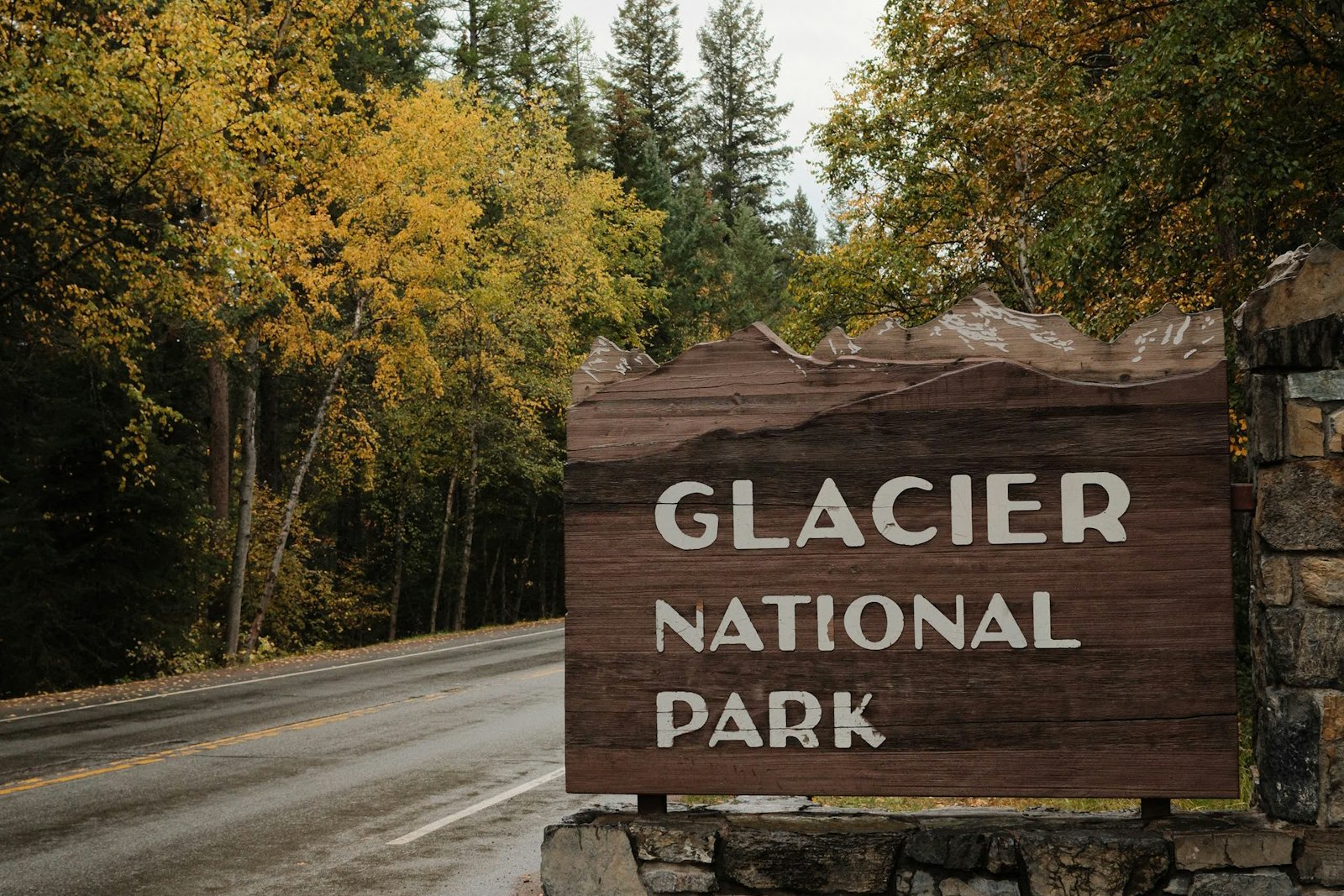
Is the Avalanche Lake Trail Open?
The trail itself doesn’t have an official opening date. Whether you can hike it depends mostly on whether you can drive to Avalanche, and on snow.
- Summer (late June to September): Open, busy, and usually snow-free. In 2026 the full Going-to-the-Sun Road opened on June 22. The lower road to Avalanche usually opens earlier than the alpine section.
- October: The alpine section of Going-to-the-Sun Road closes for the season. In 2026 it closed around October 19–20, between Avalanche Creek and Jackson Glacier Overlook. Avalanche sits at the western edge of that closure, so check the park’s road status page to confirm you can still drive there.
- Winter: The road is gated near Lake McDonald Lodge. Avalanche Picnic Area is about 5.3 miles beyond the winter parking area, so reaching the trail means a long ski, snowshoe or winter walk up the unplowed road before you even start the hike.
Before you go, check the park’s road status and trail status reports. An open road doesn’t mean the trail is free of snow, fallen trees or a temporary bear closure.
Best Time to Hike the Avalanche Lake Trail
| Month | What to expect |
|---|---|
| May–early June | Roaring creek and waterfalls, but snow and mud possible on the trail; road access can be limited. |
| Late June–July | Waterfalls at their best, lush forest, long days. Very busy. |
| August | Reliable, snow-free trail. Busy, and wildfire smoke is possible. |
| September | Cooler, quieter, lovely light. Smaller waterfalls; frost later in the month. |
| October | Snow and ice possible, short days, road closures starting. |
| November–April | Winter access only, from the Lake McDonald Lodge gate. |
Best time of day: early morning for parking, calm water and fewer people, or late afternoon on long summer days when the morning crowds have left.
Is the Avalanche Lake Trail Dangerous?
It’s a moderate, well-used trail, but it’s still wild country. These are the main risks:
- Bears: Both grizzly and black bears live here. Carry bear spray where you can grab it fast (not buried in your pack), know how to use it, hike in a group, and make noise. Never approach a bear for a photo, and keep food with you at the lake.
- Avalanche Gorge: Slippery rock and fast, cold water. Stay behind barriers.
- Weather: Rain and cold can roll in quickly, even in July. Bring a rain jacket and a warm layer.
- Falling trees: Big storms can bring down trees and branches in this dense forest. Avoid hiking in high winds.
- Snow and ice: Early and late in the season, parts of the trail can be icy. In winter, the slopes above the lake are real avalanche terrain.
Hiking Avalanche Lake With Kids
This is one of Glacier’s best family hikes. There’s always something to look at, from giant trees to the gorge to little waterfalls, and the driftwood beach at the end is a great reward. Many school-age kids manage the full hike; younger ones may need a carrier for parts of the climb.
- Strollers: They work on the Trail of the Cedars loop but not on the Avalanche Lake Trail, which is rooty and rocky.
- Keep kids close at the gorge and on the climb, where bears could be nearby.
- Pack snacks, water and a warm layer. It’s cool by the lake even on hot days.
- If little legs give out, turn around. The Trail of the Cedars alone is a lovely outing.
What to Pack for the Avalanche Lake Trail
- Bear spray in a holster or hip belt, and know how to use it
- Shoes with good grip for roots and wet rock
- 1–2 liters of water per person
- Lunch or snacks for the lake (keep them with you at all times)
- Rain jacket (see our waterproof hiking jacket guide) and a warm layer
- Bug spray: mosquitoes can be bad near the lake in early summer
- Sunscreen and sunglasses for the open lakeshore
- Offline map, charged phone, small first-aid kit and a headlamp
- Trekking poles if you like them for descents (see budget trekking poles for beginners)
Photography Tips
- Trail of the Cedars: soft, even light on cloudy days is perfect for the giant trunks and ferns.
- Avalanche Gorge: shoot from the footbridge or the viewpoint just up the trail. Early morning or late afternoon avoids harsh, patchy sunlight.
- Avalanche Lake: use the driftwood as foreground, with the waterfalls and Little Matterhorn behind. Calm mornings give the best reflections.
- Head of the lake: walk the shoreline trail for closer views of the falls and fewer people in your shot.
Never climb onto wet logs, slick rocks or past barriers for a photo.
Avalanche Lake vs. Other Glacier Hikes
| Hike | Round trip | Difficulty | Best for |
|---|---|---|---|
| Trail of the Cedars | About 1 mile (loop) | Easy, accessible | Old-growth forest, all abilities |
| Avalanche Lake | About 4.6 miles | Moderate | Waterfalls and a mountain lake |
| Hidden Lake Overlook | About 2.8 miles | Moderate | Alpine meadows and mountain goats (from Logan Pass) |
| St. Mary & Virginia Falls | About 3 miles | Easy–moderate | Two waterfalls on the east side |
| Grinnell Glacier | About 10–11 miles (shorter with boat rides) | Strenuous | A glacier and turquoise lakes |
Avalanche Lake gives you the most reward for the least effort on Glacier’s west side. Ready for a bigger day? Read our Grinnell Glacier hike difficulty guide.
Half-Day Plan
- 7:00 a.m.: Leave Apgar or West Glacier; coffee stop optional.
- 7:30 a.m.: Park at Avalanche and walk the boardwalk side of the Trail of the Cedars.
- 7:45 a.m.: Avalanche Gorge from the footbridge, then start up the Avalanche Lake Trail.
- 9:00 a.m.: Reach the lake. Snack on the driftwood beach, then walk toward the head of the lake.
- 10:00 a.m.: Head back down.
- 11:00 a.m.: Finish the other half of the Trail of the Cedars loop, then lunch at Lake McDonald Lodge or a picnic at Avalanche.
Where to Stay Near the Avalanche Lake Trail
- Avalanche Campground: right at the trailhead, open in summer. You can’t beat it for an early start, but sites go fast, so book ahead.
- Lake McDonald Lodge area: historic lodge, cabins and motel rooms about 10 minutes away.
- Apgar Village: at the foot of Lake McDonald, with lodging, a big campground, food and the visitor center.
- West Glacier: just outside the entrance, with cabins, motels, rafting outfitters and restaurants.
- Whitefish, Columbia Falls and Kalispell: the most choice and lower prices, but about an hour’s drive.
In-park lodging and campgrounds for July and August often sell out months ahead. Book early and check cancellation policies.
Avalanche Lake Trail FAQs
How long is the Avalanche Lake Trail?
2.3 miles one way, or about 4.6 miles round trip, according to the National Park Service. Adding the full Trail of the Cedars loop or the lakeshore path brings it to 5–6 miles.
How hard is the Avalanche Lake Trail?
Moderate. It climbs 741 feet, mostly in the first mile and a half after the gorge, on a rooty, rocky forest trail. There’s no scrambling.
How long does it take to hike to Avalanche Lake?
Most hikers need 3–4 hours round trip with a break at the lake. The park suggests allowing 3–6 hours.
Where is the Avalanche Lake trailhead?
At Avalanche Picnic Area on Going-to-the-Sun Road, about 5.5 miles east of Lake McDonald Lodge. The trail starts from the Trail of the Cedars loop.
Where do you park for Avalanche Lake?
In the marked lots and pullouts in the Avalanche area. They fill early in summer, so arrive before 8 a.m. or after about 4 p.m.
Does the Glacier shuttle stop at Avalanche Lake?
Not in 2026. The new ticketed shuttle ran between Apgar, Lake McDonald Lodge and Logan Pass without stopping at Avalanche or the Trail of the Cedars.
Do you need a reservation to hike Avalanche Lake?
No hiking permit is needed, and in 2026 Glacier didn’t require vehicle reservations. You just need a park entrance pass.
Is the Avalanche Lake Trail open now?
It depends on road access and snow. The alpine section of Going-to-the-Sun Road closed for winter in late October 2026, starting at Avalanche Creek. In winter, the road is gated near Lake McDonald Lodge, about 5.3 miles before Avalanche. Check the park’s road and trail status before you go.
Is the Avalanche Lake Trail good for kids?
Yes. It’s one of Glacier’s most popular family hikes. Kids should be comfortable walking about five miles with some uphill.
Is the Trail of the Cedars wheelchair accessible?
Yes. The Trail of the Cedars loop is paved with boardwalk sections and is accessible. The Avalanche Lake Trail beyond it is not.
Are there bears on the Avalanche Lake Trail?
Yes. Both grizzlies and black bears live in the area. Carry bear spray, make noise, hike in a group and never leave food unattended.
Can you bring a dog to Avalanche Lake?
No. Pets aren’t allowed on trails in Glacier National Park.
Is the Avalanche Lake Trail Worth It?
Absolutely. In under five miles you get ancient cedars, a glowing blue gorge, a quiet forest climb and a lake surrounded by waterfalls. For many visitors, it’s the highlight of Glacier’s west side.
Start early (or late), carry bear spray, wear shoes with good grip, and check road and trail status before you leave. Then take your time at the lake. It’s the kind of place you won’t want to rush away from.