
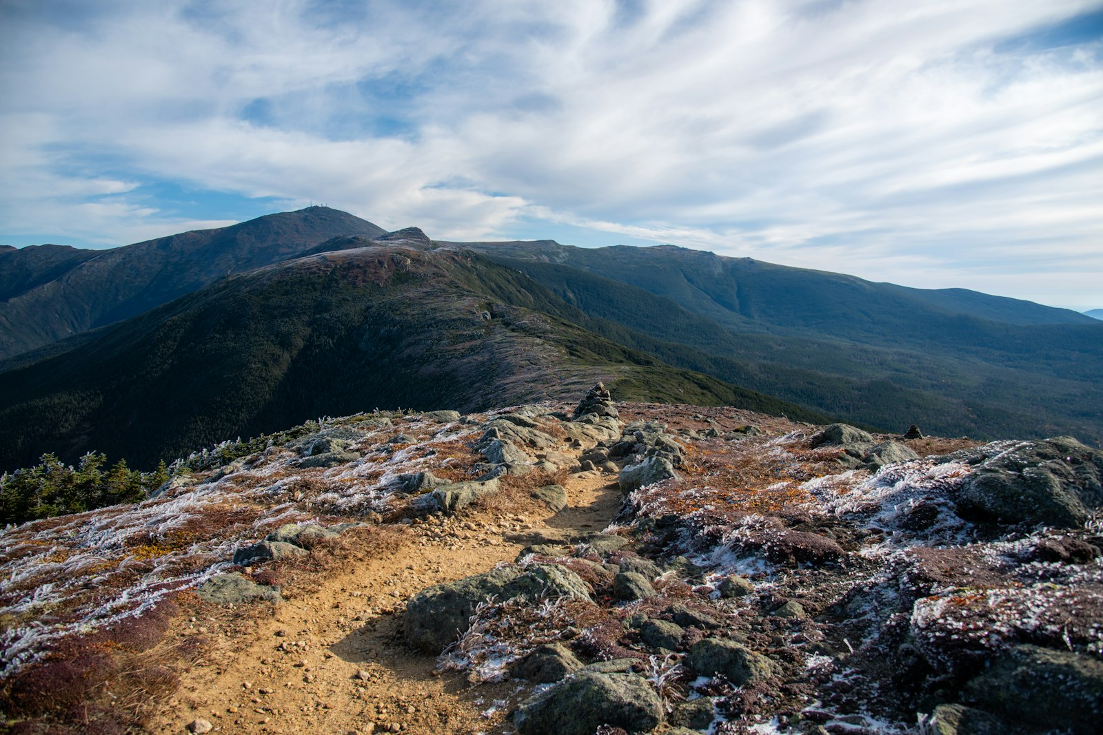
Most mountain hikes give you one big view at the top. The Franconia Ridge Loop Trail in New Hampshire gives you nearly two miles of it. After climbing past waterfalls through the forest, you pop out above the trees onto a narrow, rocky ridge and walk along the sky over three peaks: Little Haystack, Mount Lincoln and Mount Lafayette. Valleys drop away on both sides, and on a clear day the White Mountains roll out in every direction.
It’s often called the best day hike in New England. It’s also one of the toughest: about 8 miles, around 4,000 feet of climbing, rough rocky trail, and an exposed ridge where the weather can turn dangerous in minutes.
This guide covers it all: the route and map (including the 2026 Falling Waters Trail reroute), distance and difficulty, a step-by-step trail guide, parking and the hiker shuttle, ridge weather, Greenleaf Hut, camping rules, winter hiking and what to pack.
Cover photo: an above-treeline ridge trail in the White Mountains. Photo: Laura Bicknell / Unsplash
Franconia Ridge Loop: The Short Answer
The Franconia Ridge Loop is a just-over-8-mile loop in Franconia Notch State Park, New Hampshire, with about 4,000 feet of elevation gain. Most people climb the Falling Waters Trail past three waterfalls, cross the exposed Franconia Ridge over Little Haystack (4,780 ft), Mount Lincoln (5,089 ft) and Mount Lafayette (5,249 ft), then descend past Greenleaf Hut on the Old Bridle Path. It’s extremely challenging and takes 6–10 hours. Start early, check the higher-summits forecast, and use the new 2026 Falling Waters route.
Franconia Ridge Loop: Quick Facts
| Detail | Information |
|---|---|
| Location | Franconia Notch State Park, White Mountains, New Hampshire |
| Trailhead | Falling Waters / Old Bridle Path Trailhead, off I-93 |
| Distance | Just over 8 miles (GPS tracks range from about 8.2 to 8.9 miles) |
| Elevation gain | About 4,000 feet |
| Trailhead elevation | About 1,780 feet |
| Highest point | Mount Lafayette, 5,249 feet |
| Other summits | Little Haystack (4,780 ft) and Mount Lincoln (5,089 ft) |
| Difficulty | Extremely challenging |
| Time needed | 6–10 hours |
| Trails used | Falling Waters, Franconia Ridge (Appalachian Trail), Greenleaf, Old Bridle Path |
| Above treeline | About 1.7 miles along the ridge |
| Best months | Late June through early October |
| Permit / fee | No hiking permit; trailhead parking is free |
| Dogs | Allowed, but the rock scrambles are hard on them |
Where Is the Franconia Ridge Loop?
Franconia Ridge rises on the east side of Franconia Notch, a narrow mountain pass in the White Mountains of northern New Hampshire. Interstate 93 runs right through the notch, and the trailhead sits beside the highway inside Franconia Notch State Park. The nearest towns are Lincoln (about 15 minutes south) and Franconia (about 15 minutes north). From Boston, plan on roughly 2.5 hours of driving.
Franconia Ridge Loop Trail Map and Route
The classic loop links four trails. Most hikers go up Falling Waters and down Old Bridle Path, because climbing past the waterfalls is safer than coming down the steep, wet ledges.
| Section | From → To | Approx. distance | What it’s like |
|---|---|---|---|
| Falling Waters Trail | Trailhead → Little Haystack | About 3.2–3.4 miles | Waterfalls, then a long, steep climb |
| Franconia Ridge Trail | Little Haystack → Lincoln → Lafayette | About 1.7 miles | Exposed ridge walk, rolling ups and downs |
| Greenleaf Trail | Lafayette → Greenleaf Hut | About 1.1 miles | Steep, rocky descent |
| Old Bridle Path | Greenleaf Hut → Trailhead | About 2.9 miles | Steep at first, then gradual, with great ridge views |
2026 Update: Falling Waters Trail Has Moved
As of September 22, 2026, New Hampshire State Parks says the Falling Waters Trail has a significant new route around Cloudland Falls. The White Mountain National Forest project behind it relocates roughly a mile of trail to a more sustainable line and adds a short spur trail to the falls. Older downloaded maps and GPS tracks won’t show the change.
- Follow the new signs and blazes, not an old track on your phone.
- Stay off closed sections of the old trail; they’re being restored.
- Get the state park’s relocation map (the new route is shown in red) before your hike.
Mobile service is patchy in the notch, so download your map before you leave town. The AMC White Mountain Guide maps are also excellent for this area.
Franconia Ridge Loop Difficulty: How Hard Is It?
The state park rates this hike “extremely challenging,” and it earns it. There’s no technical climbing, but the trails here are classic White Mountains: steep, rocky, rooty and relentless. A few things make it especially tough:
- The climb: About 4,000 feet in a little over 8 miles, most of it in the last two miles of Falling Waters.
- Rough footing: Big rock steps, slabs and roots almost the whole way, often wet.
- Exposure: The ridge has no shelter from wind, cold, rain or lightning.
- The descent: Coming down from Lafayette to the hut, and then the steep upper Old Bridle Path, punishes tired knees.
Can beginners do it? It’s not a good first mountain hike. Build up on shorter White Mountains trails first, like Lonesome Lake across the highway. If you’re new to hiking, start with our hiking for beginners guide.
How Long Does the Franconia Ridge Loop Take?
| Hiking pace | Approximate time |
|---|---|
| Fast, experienced hikers | 5–6 hours |
| Steady pace with breaks | 7–9 hours |
| Slower pace, lots of photos | 9–11 hours |
| Wet, icy or windy conditions | Much longer |
Leave plenty of daylight for the descent. In October, the sun sets before 6 p.m.
Franconia Ridge Loop: Step-by-Step Trail Guide
1. Falling Waters Trail and the Waterfalls
From the trailhead, the Falling Waters Trail and Old Bridle Path share the first short stretch, then split. Turn right onto Falling Waters. The trail follows Dry Brook up a narrow ravine, crossing it several times on rocks. In the first mile or so you pass three waterfalls: Stairs Falls, a set of stair-like ledges; Swiftwater Falls, which pours in from the side; and tall, lacy Cloudland Falls, the biggest of the three.
The brook crossings can be easy rock-hops or knee-deep and dangerous after heavy rain. If the water is high, consider doing the loop in reverse or waiting for another day. This is also where the new 2026 route begins, so follow the signs carefully.
2. The Long Climb to Little Haystack
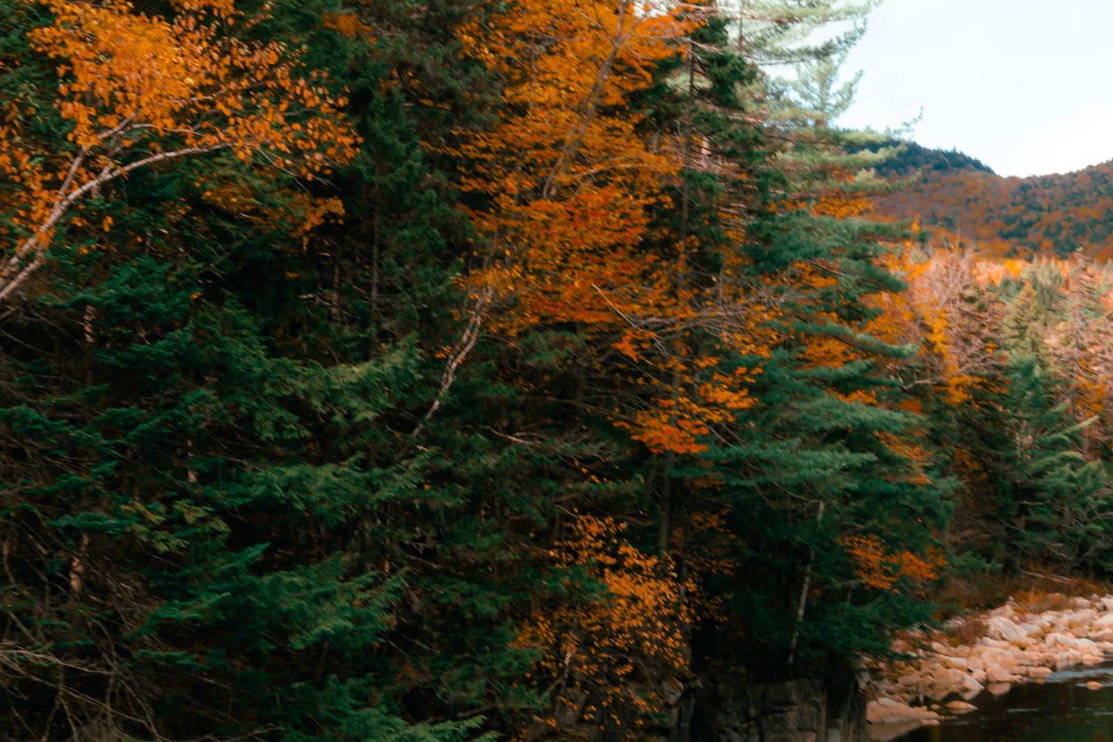
Past the falls, the trail leaves the brook and starts switchbacking steeply up the mountainside. This is the grind of the day: about two miles of steady, rocky climbing through birch and spruce. Near the top, a short side path leads to Shining Rock, a huge sloping slab with views back across the notch. Enjoy it from the base; the slab itself is often wet and slippery.
The trees shrink to knee-high, wind-twisted spruce, and then you step out onto the bare rock of Little Haystack Mountain (4,780 ft). Suddenly the whole ridge is ahead of you.
Decision point: This is your last easy bailout before the exposed ridge. If it’s windy, foggy, freezing or thunder is in the forecast, turn around here and go back down Falling Waters.
3. The Franconia Ridge Walk
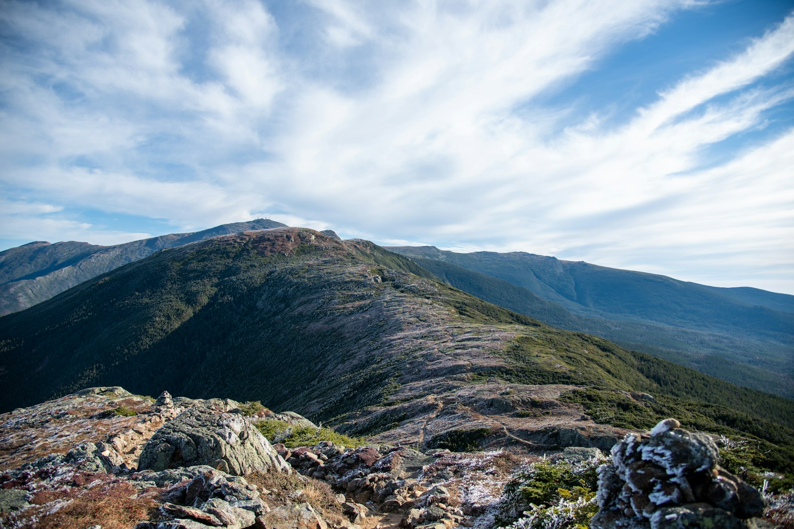
This is why people come. The Franconia Ridge Trail, part of the Appalachian Trail, follows the narrow spine north for about 1.7 miles. It climbs gently over Mount Lincoln (5,089 ft), dips through a saddle, then rises to Mount Lafayette (5,249 ft), the highest point of the loop. You’ll often walk between low rock walls built to keep feet on the trail and off the plants.
The views are huge: Franconia Notch and Cannon Mountain to the west, the wild Pemigewasset Wilderness to the east, and on clear days, Mount Washington on the horizon.
Protect the alpine plants. The tiny flowers and mosses up here are rare in New England and take decades to recover from a single footprint. Stay on the rocks and inside the scree walls.
4. Mount Lafayette Down to Greenleaf Hut
From Lafayette’s summit, turn left (west) onto the Greenleaf Trail. It drops about 1,000 feet in a bit over a mile over loose rock and big steps, with the hut visible below the whole way. Take your time; tired legs and rolling rocks are a bad mix.
Greenleaf Hut (4,220 ft) is an Appalachian Mountain Club hut beside the little Eagle Lakes. When it’s open, day hikers can usually stop in for water, restrooms and baked goods for sale. It’s a perfect break before the final descent.
5. Old Bridle Path
The last 2.9 miles follow the Old Bridle Path. The upper part crosses a series of steep rocky bumps that hikers nickname “the Agonies” (they’re worse going up). Look back from the open ledges for some of the best views of the day: the whole ridge you just walked, lined up along the skyline. Below that, the trail eases into a long, gentler forest walk back to the trailhead.
Franconia Ridge Loop Parking and Hiker Shuttle
Parking is free, but on summer and fall weekends the lots fill very early, often before 7 a.m. during peak foliage.
- Old Bridle Path / Falling Waters lot (northbound I-93): The trailhead lot itself, right at the start of the loop.
- Lafayette Place lots (southbound I-93): Two small lots on the other side of the highway. Walk through the pedestrian tunnel under I-93 to the trailhead. Hikers can’t park in the campground itself.
- Cannon Mountain Aerial Tramway lot (Exit 34B): Overflow parking when the trailhead lots are full.
Never park on I-93. Parking along the highway is illegal at any time, and cars get ticketed and towed. Never try to cross the interstate on foot; use the tunnel.
Hiker shuttle: In 2026, a shuttle ran on Saturdays, Sundays and holidays from May 23 to October 18, 8 a.m. to 7 p.m. It costs $5 per person round trip (keep your ticket for the ride back), takes cash or card, and lets well-behaved dogs ride free. It connects the overflow parking with the trailhead area. The 2026 season is over; check the state park’s hiker parking page for 2027 dates.
Franconia Ridge Weather: What to Know
The White Mountains are famous for fast, brutal weather changes, and Franconia Ridge takes it straight on. It can be 70°F and calm in the parking lot while the ridge is in cloud, near freezing, with 50 mph winds. Fog can drop visibility to a few yards, and in summer, afternoon thunderstorms make the open ridge a dangerous place to be.
- Check the Mount Washington Observatory’s Higher Summits Forecast the night before and the morning of your hike. It’s built for exactly these peaks. A Lincoln or Franconia town forecast is not enough.
- Skip the ridge if the forecast calls for thunderstorms, winds over about 40 mph, freezing rain, or summits in the clouds all day.
- Always carry a warm layer, hat, gloves and a rain shell, even in July.
Current Trail Conditions (Late October 2026)
- New route: The Falling Waters reroute near Cloudland Falls has been in effect since September 22.
- Services closed: Greenleaf Hut’s full-service season ended on October 17, the hiker shuttle ended October 18, and Lafayette Place Campground is closed for the season.
- Early winter up high: By late October, the ridge often has rime ice, snow and freezing wind while the lower trail is just wet. Carry microspikes and full winter layers, and be ready to turn around.
Before you go, check recent trip reports on New England Trail Conditions, the state park’s hiking page and the AMC’s trail updates, and pay attention to the date of each report.
Best Time to Hike Franconia Ridge
| Month | What to expect |
|---|---|
| May–early June | Mud season and lingering ice up high; black flies. Not ideal. |
| Late June–July | Long days, alpine flowers, full waterfalls. Watch for afternoon storms. |
| August | Most reliable conditions. Busy on weekends. |
| September | Cool, clear days and fewer bugs. One of the best months. |
| Late September–mid-October | Peak fall foliage in the valleys below. Stunning, but the most crowded time and colder on top. |
| Late October–April | Winter conditions on the ridge. Experienced winter hikers only. |
Best day of the week: a weekday with a clear, calm higher-summits forecast. Start by 7 a.m. at the latest.

Franconia Ridge in Winter
In winter, the ridge turns into a serious alpine route. Expect hard ice, deep drifts, whiteouts and wind chills far below zero. Experienced winter hikers do the loop on calm, clear days with crampons or heavy-duty microspikes, snowshoes, full winter clothing, goggles and solid navigation skills. Many choose to go up and back down Old Bridle Path instead of descending the icy Falling Waters ledges.
Greenleaf Hut is closed in winter and isn’t an emergency shelter. If you don’t have winter mountain experience, pick a lower, sheltered hike instead.

Greenleaf Hut
- Where: 4,220 feet, below Mount Lafayette, 2.9 miles up the Old Bridle Path.
- Beds: 48 bunks in shared bunkrooms. Full-service stays include dinner and breakfast.
- 2027 season: self-service from May 7 to May 30, and full service from June 3 to October 16, 2027.
- Booking: Reserve through the Appalachian Mountain Club. Summer and foliage weekends sell out early.
Staying at the hut is a great way to split the loop into two days and catch sunset and sunrise on the ridge.
Franconia Ridge Camping: Rules and Options
You can’t camp on the ridge. White Mountain National Forest rules ban camping above treeline (where trees are under about 8 feet tall) except in winter on deep snow, and the state park doesn’t allow backcountry camping along this loop. These rules protect the fragile alpine zone.
- Lafayette Place Campground: Right across I-93 from the trailhead, open in the warmer months with reservable sites through NH State Parks. Book early for summer and foliage season.
- Greenleaf Hut: The only overnight option on the loop itself.
- Backpacking: Designated sites such as Liberty Springs and Garfield Ridge on the Appalachian Trail work for longer trips beyond the loop. Check current Forest Service rules first.
What to Pack for the Franconia Ridge Loop
- Sturdy boots or trail shoes with excellent grip for wet rock
- 2–3 liters of water and a filter (refill at streams on the lower trails)
- Lunch and plenty of snacks
- Waterproof jacket (see our waterproof hiking jacket guide) and a wind layer
- Warm fleece or puffy, hat and gloves, even in summer
- Trekking poles for the descents (see budget trekking poles for beginners)
- Map, compass and offline GPS with the 2026 route
- Headlamp, first-aid kit, whistle and an emergency blanket or bivy
- Microspikes from October to May
Tip: Consider buying a New Hampshire Hike Safe card. It supports the state’s search-and-rescue teams and can protect you from being billed for a rescue.
Franconia Ridge With Kids and Dogs
Kids: Strong older kids who already hike big mountains can manage it on a perfect-weather day. For most families, it’s too long and steep. Lonesome Lake, right across the highway, gives kids a mountain lake with a view of the ridge for a fraction of the effort.
Dogs: Dogs are allowed, but the tall rock steps on Falling Waters and the Greenleaf descent are hard on them. Keep them leashed on the ridge to protect the alpine plants and other hikers.
Photography Tips
- Cloudland Falls: soft, cloudy light is best for the waterfall.
- Little Haystack: the classic shot of the ridge trail snaking north toward Lincoln and Lafayette.
- Mount Lincoln: look back south for the knife-edge ridge and Mounts Liberty and Flume.
- Old Bridle Path ledges: the full ridge lined up on the skyline, glowing in afternoon light.
Sample Day Plan
- 6:30 a.m.: Park at the trailhead and check the higher-summits forecast one last time.
- 7:00–8:00 a.m.: Waterfalls on the Falling Waters Trail.
- 8:00–10:30 a.m.: The long climb to Little Haystack. Make your go/no-go call at the top.
- 10:30 a.m.–12:00 p.m.: Ridge walk over Mount Lincoln to Mount Lafayette.
- 12:00–1:00 p.m.: Descend to Greenleaf Hut for lunch and a rest.
- 1:00–3:00 p.m.: Old Bridle Path back to the car.
Where to Stay Near Franconia Ridge
- Lincoln: the biggest base, with hotels, condos, restaurants and gear shops, about 15 minutes south.
- Woodstock: just south of Lincoln, with motels, cabins and a brewpub.
- Franconia and Sugar Hill: quieter inns and B&Bs with mountain views, about 15 minutes north.
- Lafayette Place Campground: the closest of all, in season.
Book early for foliage weekends; rooms around the notch sell out months ahead.
How Franconia Ridge Compares
Franconia Ridge is a step up from popular “hard” hikes like Acadia’s Beehive Trail, which is short but steep. It’s closer in effort to big western day hikes such as Grinnell Glacier or Sky Pond, with more climbing packed into fewer miles and much rougher footing.
Franconia Ridge Loop FAQs
How long is the Franconia Ridge Loop?
Just over 8 miles. Depending on the GPS track, you’ll see anywhere from about 8.2 to 8.9 miles.
How hard is the Franconia Ridge Loop?
The state park rates it extremely challenging: about 4,000 feet of climbing on steep, rocky trail, plus an exposed ridge.
How long does the Franconia Ridge Loop take?
Most hikers need 6–10 hours, including breaks.
Which direction should I hike Franconia Ridge?
Most people go up Falling Waters and down Old Bridle Path. Climbing the wet waterfall ledges is safer than descending them, and you get ridge views on the way down.
Where is the Franconia Ridge trailhead?
At the Falling Waters / Old Bridle Path Trailhead on the northbound side of I-93 in Franconia Notch State Park.
Where do you park for Franconia Ridge?
At the trailhead lot (northbound), the Lafayette Place lots (southbound, via the tunnel), or the Cannon Tramway overflow lot. Parking is free, but never park on I-93.
What changed on the Falling Waters Trail in 2026?
Since September 22, 2026, the trail follows a significant new route around Cloudland Falls. Use the updated state park map and follow the new signs.
Where should I check the Franconia Ridge weather?
The Mount Washington Observatory’s Higher Summits Forecast. Town forecasts don’t reflect conditions on the ridge.
Can you camp on Franconia Ridge?
No. Camping above treeline is banned except on deep winter snow. Stay at Greenleaf Hut or Lafayette Place Campground instead.
Is Greenleaf Hut open now?
No. Its 2026 full-service season ended October 17. It reopens for self-service on May 7, 2027.
Can you hike Franconia Ridge in winter?
Only with winter mountaineering gear, skills and a calm, clear forecast. For most hikers, it’s too dangerous from late fall to spring.
Is Franconia Ridge part of the Appalachian Trail?
Yes. The ridge section between Little Haystack and Mount Lafayette is part of the Appalachian Trail.
Is the Franconia Ridge Loop Worth It?
Absolutely. Waterfalls, a long above-treeline ridge, three summits over 4,700 feet and a mountain hut, all in one day hike. There’s nothing else quite like it in the eastern United States.
Just give it the respect it deserves. Pick a day with a good higher-summits forecast, start early, follow the new 2026 route, pack warm layers, and turn around at Little Haystack if the weather isn’t right. The ridge will be there next time.