
Trail update (checked October 22, 2026): The Park Service lists the Echo Canyon Loop as open year-round, and its alerts page (updated October 21) shows no trail or road closures. Two things to know right now: winter weather can bring snow and ice from November, and trails can stay icy for days after a storm. The park also has a rabies warning for southeast Arizona, so don’t go near, feed or touch wild animals.
Picture a forest where the trees have been swapped for stone. Rock columns taller than a house stand shoulder to shoulder. Giant boulders sit on tiny bases, looking like a strong wind could tip them over. Narrow cracks open into little rooms of rock. That’s the Echo Canyon Loop Trail in Chiricahua National Monument, and it’s one of the best short hikes in Arizona.
The Chiricahua Apache called this place the “Land of Standing-Up Rocks.” Today most people call it the Wonderland of Rocks. The Echo Canyon Loop is the easiest way to walk right through the middle of it.
The loop is about 3.3 miles with roughly 560 feet of elevation change. Most people take 2 to 4 hours, mostly because they keep stopping for photos.
This guide covers the route and map, which way to hike, the Grottoes, difficulty, parking, the best time to go, what to bring, kids, dogs, nearby trails and where to stay.
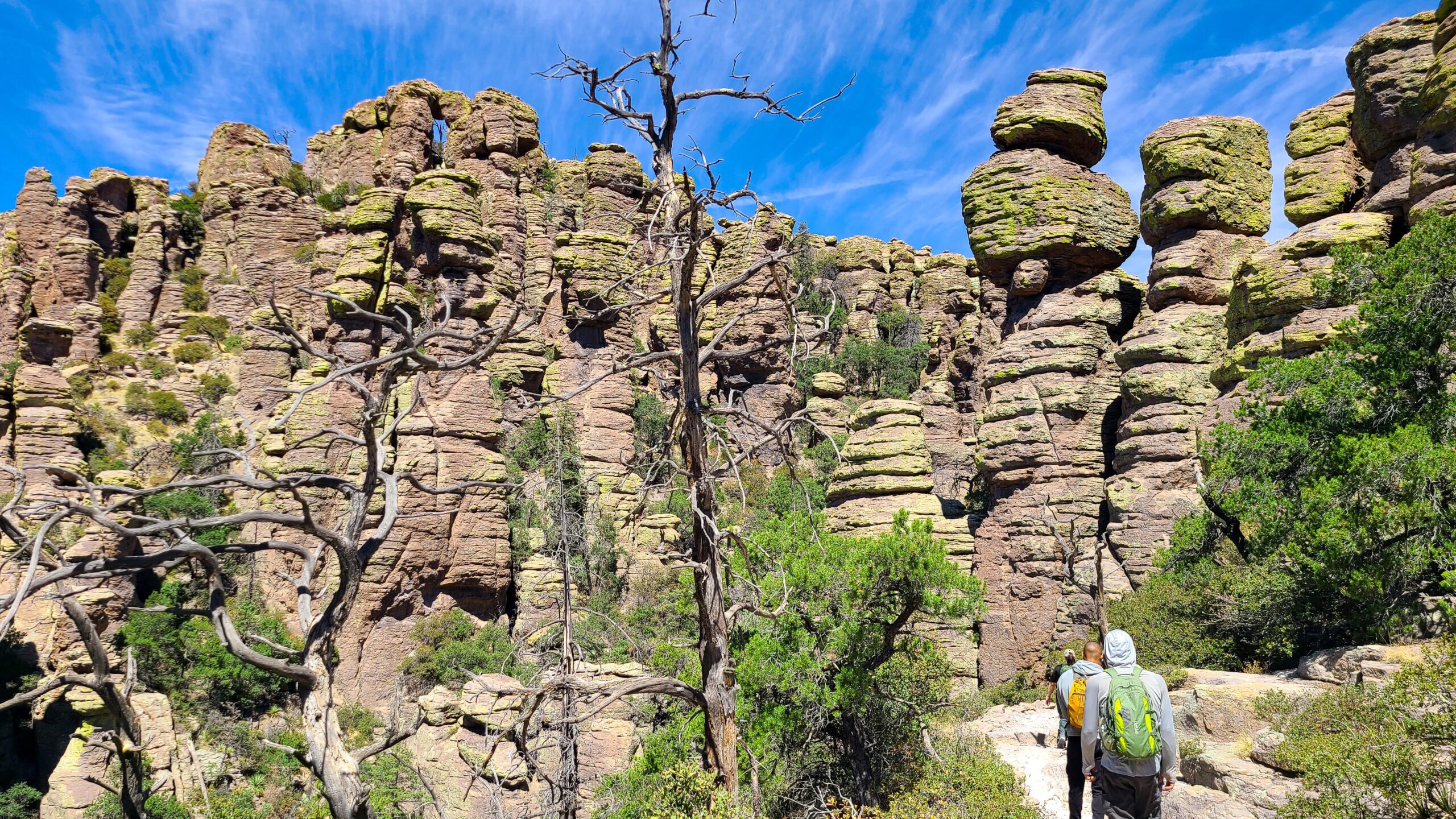
Cover photo: Hikers on the Echo Canyon Trail below rows of stone pillars. Photo: NPS
Echo Canyon Loop Trail: Quick Facts
| Detail | Information |
|---|---|
| Location | Chiricahua National Monument, southeastern Arizona |
| Nearest town | Willcox, Arizona (about 36 miles) |
| Distance | 3.3 to 3.4 miles loop |
| Elevation change | About 560 feet |
| Difficulty | Moderate |
| Time needed | 2 to 4 hours |
| Route | Echo Canyon + Hailstone + Ed Riggs trails |
| Best direction | Counterclockwise (start down Echo Canyon) |
| Trailhead | Echo Canyon parking area, near the top of Bonita Canyon Drive |
| Parking | About 19 spaces, no spaces for large vehicles |
| Facilities | Pit toilets. No drinking water |
| Entrance fee | None. Chiricahua is free |
| Permit | Not needed for day hikes |
| Dogs | Not allowed |
| Best seasons | Spring and fall |
The park’s 2026 hiking guide says 3.3 miles, while its trail page says 3.4 miles. They’re the same loop, just measured a little differently.
Where Is the Echo Canyon Loop Trail?
The trail is in Chiricahua National Monument, in the Chiricahua Mountains of southeastern Arizona. It’s about two hours east of Tucson and close to the New Mexico border.
This isn’t the cactus-and-sand Arizona many people picture. Chiricahua is a “sky island,” a mountain range rising out of the desert. Up high, you’ll walk through oak, juniper and pine trees, with cool air and big views.
How to get there
| Driving from | Distance (about) | Time (about) |
|---|---|---|
| Willcox, AZ | 36 miles | 45 minutes |
| Tucson, AZ | 120 miles | 2 hours |
| Phoenix, AZ | 235 miles | 3.5 hours |
| Bisbee, AZ | 90 miles | 1.75 hours |
From Interstate 10 at Willcox, take AZ-186 southeast to AZ-181, then into the monument. Inside, follow Bonita Canyon Drive up the mountain. The Echo Canyon parking area is near the top, just before Massai Point.
Vehicles over 24 feet and trailers aren’t allowed on the upper part of the scenic drive. If you’re in an RV, park at the visitor center area and ask about other options.
Cell signal is poor in the monument. Save a map before you go.
Not to be confused with Camelback Mountain
There’s also an Echo Canyon Trail on Camelback Mountain in Phoenix. That’s a short, very steep summit climb in the city. It’s a completely different hike, about 200 miles away. This guide is about the Chiricahua loop.
Echo Canyon Loop Trail Map and Route
Here’s the thing that confuses a lot of people: the “Echo Canyon Loop” isn’t one trail. It’s three trails joined in a triangle.
| Section | What it’s like | Elevation |
|---|---|---|
| 1. Echo Canyon Trail | Downhill through rock pillars and the Grottoes | Drops about 400 feet |
| 2. Hailstone Trail | Fairly flat, open and sunny, with big views | Mostly level |
| 3. Ed Riggs Trail | Uphill through trees back to the parking area | Climbs about 400 feet |
The trail is well signed, but several junctions lead off toward much longer hikes, like Heart of Rocks and the Big Loop. Download the free Chiricahua hiking guide and map from the Park Service website before your trip, or pick one up at the visitor center.
Which direction should you hike?
The Park Service recommends counterclockwise: go down the Echo Canyon Trail first, cross on the Hailstone Trail, then climb back up the Ed Riggs Trail.
Why this way? You get the best rock scenery while you’re fresh, and you walk down the rockiest section instead of up it. The climb at the end is in the trees, which gives you some shade.
What You’ll See on the Echo Canyon Loop
1. Echo Canyon Trail: walking among giants
From the parking area, follow the signs for the Echo Canyon Trail and the Grottoes. Within minutes, you’re surrounded by towering rock columns.
Some look like stacked pancakes. Others look like giant mushrooms or chess pieces. Bright yellow-green lichen grows on many of the rocks, which makes them glow in the morning light.
The trail drops about 400 feet through this section. It’s rocky, with uneven steps, so take your time.

2. The Grottoes: a maze of stone
About half a mile from the parking area, you’ll reach the Grottoes. This is the part kids (and most adults) remember. Huge boulders lean against each other to form little caves, tunnels and narrow hallways you can walk through.
Slow down here. Some openings are easy to miss if you’re just watching your feet. Duck into the shaded rooms and look up at the slivers of sky between the rocks.
Short on time? Hike to the Grottoes and back. The Park Service lists this as about a 1.2-mile round trip, and it gives you some of the best scenery on the whole loop.
3. Echo Park: into the trees
Past the Grottoes, the trail keeps dropping into Echo Park, a quieter, wooded area at the bottom of the canyon. You’ll still see rock towers, but there are more pines, oaks and shady spots.
Watch for the junction with the Hailstone Trail. For the counterclockwise loop, turn onto Hailstone instead of heading farther downhill toward other trails.
4. Hailstone Trail: the big view
The Hailstone Trail is short and fairly level. It runs across an open, south-facing slope, so it’s sunny and warm. You’ll see desert plants here like yucca, agave and prickly pear.
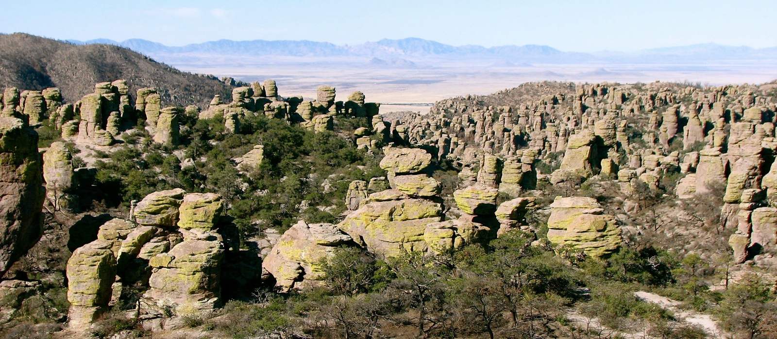
The views are the best on the loop. Look back across the canyon and you’ll see hundreds of rock pinnacles packed together, the Wonderland of Rocks at its finest.
The trail gets its name from tiny round bumps in the rock that look like hailstones. They formed in the hot volcanic ash millions of years ago.
5. Ed Riggs Trail: the climb home
The last section climbs about 400 feet back to the parking area. It’s a steady uphill through trees and rock, with some steps and loose stones. After the sunny Hailstone Trail, the shade feels good.
At the top, follow the signs to Echo Canyon parking. The trail is named for Ed Riggs, a local rancher who helped build trails here and pushed for the area to be protected.
How Did These Rocks Form?
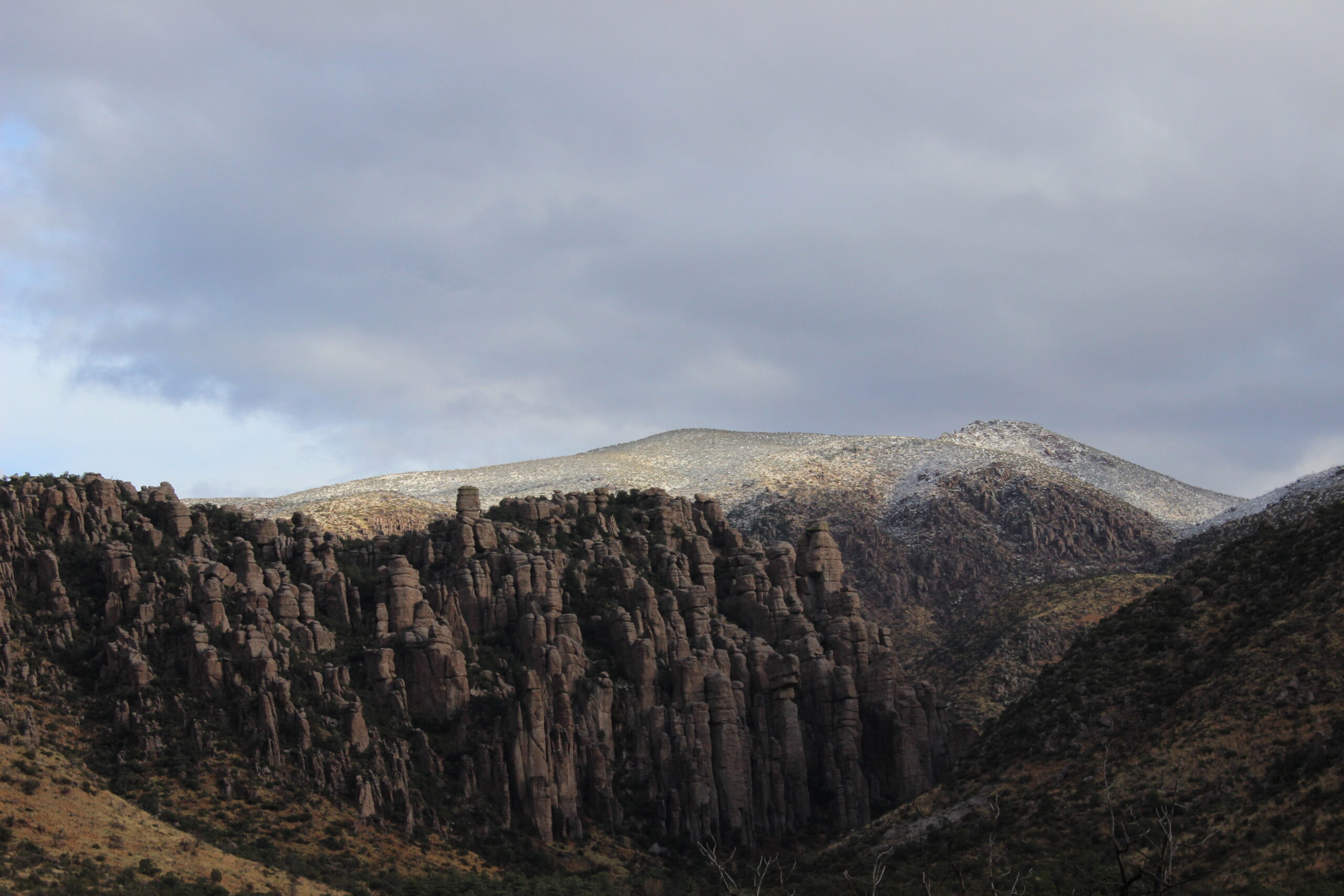
About 27 million years ago, a huge volcano nearby, called the Turkey Creek Caldera, erupted. The Park Service says the blast was far bigger than the 1980 Mount St. Helens eruption. It buried the area in thick layers of hot ash.
The ash welded together into a rock called rhyolite tuff. As it cooled, it cracked into long vertical lines. Over millions of years, water, ice and wind worked into those cracks, wearing the rock into towers, columns and balanced boulders.
What are hoodoos?
A hoodoo is a tall, skinny rock spire shaped by erosion. Many have a wider, harder cap on top. Chiricahua is special because it has so many of them packed so close together.
You’ll also see balanced rocks, where a big boulder sits on a much smaller base. They look shaky, but they’ve been there for thousands of years. Please don’t climb on them. Climbing is not allowed, and the rock can break.

How Hard Is the Echo Canyon Loop?
The Park Service rates it moderate to moderately difficult. It’s short, but it’s not a stroll.
- Rocky ground the whole way, with loose stones, roots and steps
- Steep in places, with grades up to about 25%
- Sloping trail in some spots, where the path tilts to the side
- Drop-offs near some rock formations, which can bother people who are afraid of heights
- Not suitable for wheelchairs or strollers
Is it good for beginners?
Yes, if you can comfortably walk 3 to 4 miles on uneven ground. There’s no scrambling or climbing. Good shoes and a slow pace are all you need. If you’re new to hiking, our hiking for beginners guide has simple tips to get ready.
Is it good for kids?
Most kids love it. The Grottoes feel like a natural playground, and the strange rocks keep them curious. Keep little ones close near drop-offs and in the narrow spots. For young children, the out-and-back walk to the Grottoes is a great choice.
Best Time to Hike Echo Canyon Loop
The trail is open all year, but some months are much nicer than others.
| Season | What it’s like | Our take |
|---|---|---|
| Spring (March–May) | Mild and sunny, sometimes windy. Busiest time, especially March | Excellent. Go early for parking |
| Summer (June–Sept) | Warm days. Monsoon storms with lightning, mid-June to September | OK in the morning. Off the trail before afternoon storms |
| Fall (Oct–Nov) | Cool, clear and dry. Fewer people | Excellent. Our favorite season |
| Winter (Dec–Feb) | Cold mornings. Snow and ice possible, especially January to March | Good on dry days. Check for ice |
Our pick: October or early November, or a weekday in April.
Best time of day
Start in the morning. It’s cooler, the light on the rocks is beautiful, and you’re more likely to get a parking spot. In summer, morning is the only sensible time, because storms usually build in the afternoon.
If you hike later in the day, bring a headlamp. The sun drops behind the ridges early, and it gets dark fast between the rocks.
Parking and Facilities
The Echo Canyon parking area is near the top of Bonita Canyon Drive.
- Spaces: about 19, none for large vehicles
- When it fills: spring weekends, March (the busiest month), holiday weekends and busy winter weekends
- Toilets: pit toilets at the trailhead
- Water: none. Fill up at the visitor center before you drive up
If the lot is full, try the Massai Point parking area just up the road and connect to the loop by trail. Don’t park along the road where it isn’t allowed.
Hiker shuttle
During busy times, the park may run a hiker shuttle once a day. When it runs, it leaves at 9:00 a.m. from Faraway Ranch (9:10 a.m. from the campground) and drops hikers at Massai Point or Echo Canyon so they can hike back down. It depends on staff and weather, so check the park calendar or call the visitor center (520-824-3560) before counting on it.
What to Bring
| Item | Why |
|---|---|
| Hiking shoes with good grip | Rocky, uneven trail with steps |
| 1 to 2 liters of water | No water at the trailhead |
| Hat and sunscreen | The Hailstone section is sunny and open |
| Snacks | You’ll be out 2 to 4 hours |
| Light jacket | The mountains are cooler and windier than the valley |
| Trekking poles (optional) | Help on the rocky downhill |
| Offline map | Little or no cell signal |
| Headlamp | If you start later in the day |
| Camera | You’ll want it at every turn |
Safety Tips
- Watch your step. Most falls happen on loose rock going downhill.
- Stay back from edges near the rock formations.
- Don’t climb the rocks. It’s not allowed, and the rock can be fragile.
- Leave before storms. Lightning is a real danger on open slopes in summer.
- Watch for ice in winter, especially in shady spots.
- Keep away from wildlife. You may see coatis, deer and Mexican jays. Enjoy them from a distance, and remember the rabies warning.
- Tell someone your plan. Help can take a while to arrive out here.
Rules: Dogs, Permits and Fees
- Entrance fee: none. Chiricahua National Monument is free to enter.
- Permit: not needed for day hiking.
- Dogs: not allowed on the upper trails through the rocks, including this loop. Service animals are the exception.
- Fires: not allowed on the trails.
- Drones: not allowed in national park sites without a permit.
Other Hikes in Chiricahua National Monument
| Trail | Distance | Difficulty | Highlights |
|---|---|---|---|
| Echo Canyon to the Grottoes | About 1.2 miles round trip | Easy to moderate | The best rock passages, in less time |
| Massai Point Nature Trail | About 0.5 mile | Easy | Short walk with big overlooks and signs about the geology |
| Sugarloaf Mountain | About 1.8 miles round trip | Moderate | Summit fire lookout at about 7,310 feet |
| Heart of Rocks (from Echo Canyon) | About 7.4 miles round trip | Hard | Famous Big Balanced Rock and Punch and Judy |
| Big Loop | 8.5 to 12 miles | Very hard | A full day through the best of the park |
Massai Point
Just up the road from Echo Canyon, Massai Point has one of the best views in the park. Walk the short nature trail and look out over the rock pinnacles and the valleys beyond. It’s a perfect stop before or after your hike.
Sugarloaf Mountain
A short, steady climb to a stone fire lookout with views in every direction. It’s a great second hike if you have energy left.
Heart of Rocks
This is where you’ll find the park’s most famous formations, including Big Balanced Rock. It’s a much longer day, so start early and bring plenty of water.
Love strange rocks? Utah’s Devils Garden Trail in Arches has giant stone arches, and the places to visit near Hanksville include the hoodoos of Goblin Valley. Closer to Phoenix, Devils Bridge in Sedona is Arizona’s most famous red rock arch hike.
Sample Itineraries
One day in Chiricahua
| Time | What to do |
|---|---|
| 8:00 AM | Stop at the visitor center for water and a map |
| 8:30 AM | Drive Bonita Canyon Drive to Echo Canyon |
| 9:00 AM | Start the Echo Canyon Loop counterclockwise |
| 9:30 AM | Explore the Grottoes |
| 11:30 AM–12:30 PM | Finish the loop |
| 12:30 PM | Picnic lunch |
| 1:30 PM | Massai Point overlook and nature trail |
| Afternoon | Sugarloaf Mountain or a visit to historic Faraway Ranch |
Two days in Chiricahua
- Day 1: Echo Canyon Loop, Massai Point and the scenic drive viewpoints.
- Day 2: Heart of Rocks or Sugarloaf Mountain, depending on your energy. Strong hikers can try the Big Loop.
Where to Stay
- Bonita Canyon Campground: inside the monument, with about two dozen sites, water and restrooms, but no showers or hookups. Reserve on Recreation.gov, and check the vehicle-size limits.
- Willcox: the closest town with hotels, restaurants and gas, about 45 minutes away.
- Bisbee or Tombstone: farther away, but fun bases if you’re making a southeast Arizona road trip.
Echo Canyon Loop Trail FAQs
How long is the Echo Canyon Loop Trail?
About 3.3 to 3.4 miles, with about 560 feet of elevation change.
How long does it take?
Most people take 2 to 4 hours, depending on pace and photo stops.
Which direction should I hike the Echo Canyon Loop?
Counterclockwise. Go down the Echo Canyon Trail first, cross on Hailstone, and climb back up the Ed Riggs Trail.
How hard is the Echo Canyon Loop?
It’s moderate. It’s short, but rocky and steep in places, with some drop-offs.
How far is it to the Grottoes?
About half a mile from the Echo Canyon parking area. An out-and-back to the Grottoes is about 1.2 miles.
Where can I get an Echo Canyon Loop Trail map?
Download the free Chiricahua hiking guide from the Park Service website, or pick one up at the visitor center.
Is there a fee to hike Echo Canyon?
No. Chiricahua National Monument has no entrance fee, and no permit is needed for day hikes.
Are dogs allowed on the Echo Canyon Loop?
No. Pets aren’t allowed on the upper trails through the rocks.
Is the Echo Canyon Loop good for kids?
Yes, for kids who can walk 3 miles on rocky ground. Younger kids will enjoy a shorter walk to the Grottoes.
Is the Echo Canyon Loop open year-round?
Yes, but snow and ice can make it slippery in winter, and summer storms bring lightning.
Is this the same as the Echo Canyon Trail on Camelback Mountain?
No. Camelback’s Echo Canyon Trail is a steep summit climb in Phoenix. This loop is in Chiricahua National Monument in southeastern Arizona.
Is the Echo Canyon Loop worth it?
Yes. In just over 3 miles, you get towering rock pillars, balanced boulders, stone tunnels and wide views. It’s one of the most unusual short hikes in the Southwest.
Final Thoughts
The Echo Canyon Loop shows you the Wonderland of Rocks up close, without a long, hard day. Go counterclockwise, start in the morning, take your time in the Grottoes, and bring more water than you think you need.
If you enjoy hikes with strange geology, try the steaming basin on the Bumpass Hell Trail, or go underground at Lehman Caves in Nevada.