

The Guadalupe Peak hike takes you to the roof of Texas. At 8,751 feet, this is the highest point in the state, and from the top you look down on the giant cliff of El Capitan, the white salt flats, and miles of Chihuahuan Desert. It feels nothing like the Texas most people picture.
You have to earn that view, though. The trail is 8.4 miles round trip with about 3,000 feet of climbing, and the Park Service rates it very strenuous. The first stretch is a steep staircase of switchbacks, the summit is often battered by wind, and there’s no water anywhere on the trail.
The good news: in normal dry conditions you don’t need any climbing skills or gear. You need fit legs, an early start, plenty of water, and good shoes. This guide covers everything you need to plan the hike: difficulty, the route step by step, time, parking, fees, weather by season, water, safety, and easier hikes nearby if you decide the peak isn’t for you.
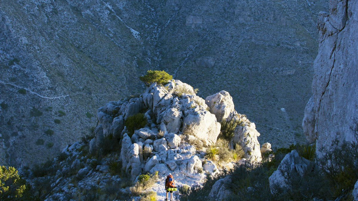
Cover photo: looking out from high on Guadalupe Peak over the cliffs and the desert. Photo: Benoit Lamarche / Unsplash
Guadalupe Peak Hike: Quick Facts
| Detail | Information |
|---|---|
| Location | Guadalupe Mountains National Park, West Texas |
| Summit elevation | 8,751 feet (highest point in Texas) |
| Distance | 8.4 miles round trip |
| Elevation gain | About 3,000 feet |
| Difficulty | Very strenuous (Park Service rating) |
| Time needed | 6–8 hours for most hikers |
| Trail type | Out and back |
| Trailhead | Pine Springs Trailhead |
| Starting elevation | About a mile above sea level |
| Climbing gear | Not needed in normal, dry conditions |
| Water on the trail | None, so carry it all |
| Shade | Very little |
| Dogs | Not allowed on trails |
| Reservation | None needed for a day hike |
| Entrance fee | $10 per person (16 and older), valid 7 days |
| Best seasons | Spring and fall |
Distances and elevation come from the National Park Service. If you have to park at the visitor center overflow lot, add about a mile to the round trip.
Is the Guadalupe Peak Trail Open?
The trail is open year-round, and when we checked in October 2026, the park had no closures or alerts posted for it. Conditions can change quickly here, though. Wildfire danger, storms, ice, and high winds have all led to closures in past years. Check the park’s alerts and the forecast right before your trip.
Where Is Guadalupe Peak?
Guadalupe Peak is in Guadalupe Mountains National Park in far West Texas, right next to the New Mexico state line. It’s one of the least visited national parks in the country, so the trails feel wild even on busy days.
- From El Paso, Texas: about 110 miles east, roughly a 2-hour drive on US-62/180
- From Carlsbad, New Mexico: about 55 miles southwest, roughly an hour’s drive
- From Carlsbad Caverns National Park: about 40 minutes, so many people visit both on the same trip
The hike starts at Pine Springs, the main area of the park, with the visitor center, campground, and trailhead.
Good to know before you go:
- No gas, food, or stores in the park. Fill your tank and buy snacks in El Paso, Carlsbad, Whites City, or Van Horn.
- The park runs on Mountain Time, even though much of Texas is on Central Time. Check your clock if you’re planning a sunrise start.
- Cell service is spotty. Download your map before you arrive.
How Hard Is the Guadalupe Peak Hike?
The Guadalupe Peak hike is very strenuous. You climb about 3,000 feet in 4.2 miles, then walk the same rocky miles back down. It isn’t technical (no ropes, ladders, or scrambling), but it’s a long, steady leg-burner.
Here’s what makes it hard:
- The steep start. The first 1.5 miles are the steepest part of the hike, with tight switchbacks and rocky steps.
- The altitude. You start about a mile up and finish above 8,700 feet. If you live near sea level, you’ll likely feel more out of breath than usual.
- The wind. Gusts over 40 mph aren’t unusual, especially in winter and spring. The summit is often at least 10°F colder and 10 mph windier than the trailhead.
- The sun. There’s very little shade, especially low on the mountain.
- The descent. Coming down 3,000 feet on loose rock is hard on knees and ankles, and it’s when tired hikers trip.
| Section | Difficulty | What to expect |
|---|---|---|
| First 1.5 miles | Very hard | Steep switchbacks and rocky steps |
| Middle section | Moderate to hard | Easier grade, shaded forest, rocky footing |
| False summit area | Moderate | A rise near mile 3 that isn’t the top |
| Final climb | Hard | Steeper switchbacks to the summit |
| Summit | Moderate | Rocky top with drop-offs and strong wind |
| Return trip | Hard | Long, rocky downhill on tired legs |
The biggest mistake is judging this hike by its mileage. Eight miles on flat ground is a long walk. Eight miles with 3,000 feet up and down over loose rock is a full mountain day.
Guadalupe Peak Trail Step by Step
1. Start at Pine Springs Trailhead
Stop at the Pine Springs Visitor Center first if it’s open. You can pay your entrance fee, check the weather and wind forecast, use the restrooms, and fill your water bottles.
The trailhead is about half a mile from the visitor center, at the end of the road past the campground. Several trails start here, so follow the signs for Guadalupe Peak Trail.
Soon after you start, you’ll see a junction with the horse trail. It’s less steep but adds about a mile each way. Most hikers stay on the main hiker trail, which is the shortest route to the top.

2. Climb the steep first 1.5 miles
This is the toughest part of the way up. The trail climbs straight up the mountainside in tight switchbacks over rock and stone steps. You gain elevation fast, and the desert view gets bigger with every turn.
Go slower than you think you need to. Hikers who charge up this section often run out of steam halfway to the top. Take short breaks, drink water, and don’t cut the switchbacks. Shortcuts wear away the slope and damage the trail.

3. Walk through the mountain forest
After about 1.5 miles, the trail eases off. It curves past a cliff and onto the north-facing side of the mountain, and suddenly you’re in a small forest of pinyon pine, southwestern white pine, and Douglas fir. Going from desert scrub to cool pine woods in an hour is one of the best surprises of this hike.
The shade is a nice break, but you’re only about halfway through the climb.
4. Pass the false summit and campsite
At nearly 3 miles, you’ll reach a high point that looks like the top. It isn’t. The real summit is a little over a mile farther.
Past this point is the Guadalupe Peak backcountry campsite, used by backpackers with a permit. Then the trail dips slightly and crosses a wooden bridge over a gap in the rock, a fun spot for photos.
Take care here. Parts of the trail are narrow (2 to 6 feet wide) with drop-offs, and wind can be strong on exposed corners. If the wind is pushing you off balance, turn around. It’s not worth the risk.

5. Make the final push to the summit
The last stretch gets steeper again, with rocky switchbacks up to the top. Horse hitching posts near the end tell you you’re close.
At the summit you’ll find a shiny stainless-steel pyramid. American Airlines put it there in 1958 to honor the Butterfield Overland Mail, a stagecoach route that once passed below the mountain. There’s also a summit register, a metal box with a logbook where you can sign your name.
6. Enjoy the view from the top of Texas
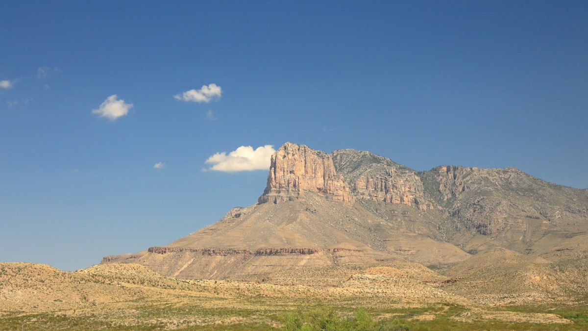
On a clear day, the view is huge. El Capitan, the giant cliff you saw from the highway, is right below you to the south. Beyond it are the white salt flats and the desert stretching toward the horizon.
Rest, eat, and take photos, but keep these in mind:
- Stay back from the edges, especially in gusty wind.
- Bring a warm layer. It’s often much colder up here than at the trailhead.
- Leave if storms build. The summit is the highest, most exposed point around, and lightning is a real danger.
7. Head back down carefully
You return the same way. Many people say the descent is harder than the climb: 4.2 miles downhill on loose rock, on legs that are already tired.
Trekking poles help a lot here. Take your time on the steep section near the bottom, and watch your footing. That’s when most slips happen.
How Long Does the Guadalupe Peak Hike Take?
The Park Service says most hikers take 6 to 8 hours round trip.
| Hiker type | Typical round-trip time |
|---|---|
| Very fit, fast hikers | 4–5 hours |
| Regular hikers | 6–8 hours |
| Slower hikers or groups with lots of breaks | 8–10 hours |
A typical day looks like 3–4 hours up, 30 minutes at the top, and 2–3 hours down.
Start early. Aim to be on the trail by sunrise, or around 7–8 a.m. at the latest. Set a turnaround time, for example 1 p.m. If you haven’t reached the top by then, head down anyway. Some hikers start in the dark for sunrise at the summit. If you do, bring a headlamp.
Best Time to Hike Guadalupe Peak
| Season | Typical conditions | Our take |
|---|---|---|
| Spring (March–May) | Mild temps, wildflowers, very windy | Great, but watch the wind forecast |
| Summer (June–August) | Hot, little shade, afternoon thunderstorms | Start at dawn and be off the summit by early afternoon |
| Fall (September–November) | Cooler, calmer, colorful leaves in nearby canyons | The best season, but parking fills on weekends |
| Winter (December–February) | Cold, wind over 40 mph possible, snow and ice | Only for experienced hikers with the right gear |
Best months: October, November, March, and April usually offer the best mix of comfortable temperatures and daylight.
Wind is the deciding factor. A perfect temperature means nothing if the summit is getting 60 mph gusts. Check the forecast for the summit area, not just the town. When high winds are forecast, pick a sheltered hike like Devil’s Hall instead.
Guadalupe Peak Parking
The hike starts at the Pine Springs Trailhead parking area, past the campground.
- The lot is small, and it’s shared with other popular trails, including Devil’s Hall.
- It fills early on weekends, especially in spring and fall.
- When it’s full, the park’s overflow parking is at the Pine Springs Visitor Center. That adds about half a mile each way.
- Only park in marked spaces. Don’t park along the road or in campsites.
Tip: On fall weekends, try to arrive before 8 a.m. Weekdays are much quieter.
Entrance Fees and Permits
You don’t need a reservation or hiking permit for a day hike, but you do need an entrance pass:
- Standard pass: $10 per person aged 16 and older, valid for 7 days
- Kids under 16: free
- Guadalupe Mountains annual pass: $35
- America the Beautiful pass: covers your entry
Pay with a card at the Pine Springs Visitor Center (open 8 a.m. to 4 p.m.), or use the self-pay station at the trailhead. You fill out a fee envelope, put the stub on your dashboard, and drop the envelope in the box.
Want to camp on the mountain? Overnight stays at the Guadalupe Peak backcountry campsite need a wilderness permit from the park. Car campers can stay at Pine Springs Campground near the trailhead. Book ahead in busy seasons.
How Much Water Should You Carry?
There’s no water on the trail. Carry everything you’ll need.
The Park Service recommends at least one gallon (about 4 liters) per person per day, and more in hot weather. Many hikers bring 3–4 liters for this hike alone.
Two simple rules:
- The half-water rule: When you’ve drunk half your water, turn around, even if you haven’t reached the top.
- Salty snacks help. If you’re sweating a lot, eat salty food along with your water.
Fill up at the visitor center before you start, and leave extra water in your car for the drive out.
What to Bring
- Hiking shoes or boots with good grip (the rocks are loose)
- 3–4 liters of water per person, or more in summer
- Lunch and salty snacks
- Sun hat, sunglasses, and sunscreen
- A windproof jacket and warm layer, even on hot days
- Trekking poles for the steep descent
- An offline map on your phone
- A headlamp in case you finish late or start early
- A small first-aid kit
- A trash bag to pack out everything you bring in
There are no toilets on the trail. Use the restrooms at the trailhead before you start. If you have to go on the trail, follow the park’s human-waste rules, which in some wilderness areas require packing out toilet paper and solid waste.
Can Beginners Hike Guadalupe Peak?
Not as a first hike. Complete beginners usually find the length, the climbing, the altitude, and the long descent too much for one day.
Fit beginners who already do regular hikes or hill walks can often finish it, as long as they start early, go slowly, and carry enough water. A good test: if you can comfortably hike 5–6 miles with a steep climb and a loaded daypack, you’re probably ready.
If you’re newer to hiking, start with easier trails first, like the Pinery Trail or Smith Spring in the same park, and read our hiking for beginners guide.
Kids: Strong, experienced young hikers do reach the top, but it’s a very long day. Make sure they have enough water and snacks, and be ready to turn back.
Is Guadalupe Peak Scary?
For most people, no. There are no ladders, chains, or real scrambling. The trail is a well-built path the whole way.
That said, a few spots near the top are narrow with steep drop-offs beside the trail, including near the wooden bridge and on the summit itself. If you’re very afraid of heights, those spots may feel uncomfortable. Wind makes the exposure feel much worse, so on a gusty day, use good judgment.
Safety Tips
- Watch the wind. If it’s knocking you off balance, turn around.
- Get off the summit before storms. In summer, afternoon thunderstorms are common. Be heading down by early afternoon.
- Don’t run out of water. Heat exhaustion and dehydration are the most common problems here.
- Look out for rattlesnakes in warm months, especially on rocks and in brush near the trail.
- Tell someone your plan. Cell coverage is unreliable.
- Watch your step on the way down. Most falls happen on the descent when people are tired.
Other Hikes in Guadalupe Mountains National Park
Not up for the peak, or the wind is too strong? These trails are worth your time too.
| Hike | Difficulty | Highlight |
|---|---|---|
| Guadalupe Peak | Very strenuous | Highest point in Texas |
| Devil’s Hall | Moderate | Rock-hopping up a canyon to a natural “hallway” of stone |
| McKittrick Canyon | Easy to strenuous, depending on how far you go | Fall colors, a historic cabin, and the Grotto |
| Smith Spring | Moderate | A shaded spring in the desert |
| Pinery Trail | Easy | Short paved walk to old stagecoach station ruins |
| El Capitan Trail | Moderate to strenuous | Long walk around the base of El Capitan |
Devil’s Hall starts at the same trailhead and is the best choice for a windy day, since it stays down in a canyon. McKittrick Canyon is famous for its red and gold maple leaves in late October and early November.
Heading on to Big Bend? The Lost Mine Trail is a great first hike there, about four hours south.
Common Mistakes to Avoid
Starting too late
Late starts mean hiking in the hottest part of the day, getting caught in afternoon storms, or coming down in the dark.
Going too fast on the first climb
The first 1.5 miles can wipe you out if you push too hard. Find a steady pace you could keep up all day.
Ignoring the wind forecast
Strong wind is the most common reason people turn back. Check the forecast and have a backup hike ready.
Bringing too little water
There’s none on the trail. Bring more than you think you need.
Saving no energy for the descent
The summit is only halfway. Leave enough in the tank, and enough daylight, for the 4.2 miles back down.
Guadalupe Peak Hike FAQs
How long is the Guadalupe Peak hike?
It’s 8.4 miles round trip from Pine Springs Trailhead. That’s 4.2 miles each way.
How hard is the Guadalupe Peak hike?
The Park Service rates it very strenuous. You climb about 3,000 feet over 4.2 miles on rocky ground, at high elevation, often in strong wind.
How long does it take to hike Guadalupe Peak?
Most hikers take 6 to 8 hours round trip. Fast hikers can do it in 4 to 5.
How tall is Guadalupe Peak?
It’s 8,751 feet above sea level, the highest natural point in Texas.
Do you need a permit to hike Guadalupe Peak?
No permit or reservation is needed for a day hike. You only need a park entrance pass. Camping at the backcountry site on the mountain requires a wilderness permit.
How much does it cost to hike Guadalupe Peak?
The entrance fee is $10 per person aged 16 or older, valid for 7 days. Kids under 16 get in free.
Can beginners hike Guadalupe Peak?
It isn’t a good first hike. Fit beginners with some hiking experience can usually finish it if they start early and take plenty of water.
What is the best month to hike Guadalupe Peak?
October and November, followed by March and April, usually offer the most comfortable conditions. Always check the wind forecast.
How much water do you need for Guadalupe Peak?
At least one gallon (about 4 liters) per person per day, and more in hot weather. There’s no water on the trail.
Are dogs allowed on the Guadalupe Peak Trail?
No. Pets aren’t allowed on trails in Guadalupe Mountains National Park. Only trained service animals are allowed.
Is there a bathroom on the Guadalupe Peak Trail?
No. There are restrooms at the trailhead and the visitor center, but none on the trail.
What is on top of Guadalupe Peak?
A stainless-steel pyramid placed by American Airlines in 1958, plus a summit register you can sign.
Can you see El Capitan from Guadalupe Peak?
Yes. El Capitan sits just south of the summit, and you look down on it from the top.
Is the Guadalupe Peak hike worth it?
Yes, if you’re prepared. Standing on the highest point in Texas, looking down on El Capitan and the desert, is one of the best views in the state.
Final Thoughts
The Guadalupe Peak hike is tough but very doable for prepared hikers. It isn’t technical. It’s a long, steady climb that tests your legs, your water planning, and your patience with the wind.
Start early, carry more water than you think you need, check the wind forecast, and save energy for the way down. Do that, and you’ll stand on top of Texas with one of the biggest views in the country.