
If you’ve driven Interstate 10 between Phoenix and Tucson, you’ve seen it: a sharp, jagged peak shooting up out of the flat desert. That’s Picacho Peak. And the trail to its summit is one of the most exciting hikes in Arizona.
The Picacho Peak Hunter Trail is short on paper, just 1.6 miles one way. But it’s packed with action: steep switchbacks, a saddle where the trail drops down the other side of the mountain, and then a series of steel cables bolted into the rock that you hold onto as you climb exposed rock faces to the top.
This guide explains everything in simple words: how hard it really is, what the cables are like, why the elevation gain is more than it looks, gloves, parking, the best season, safety tips and easier trails if the summit isn’t for you.
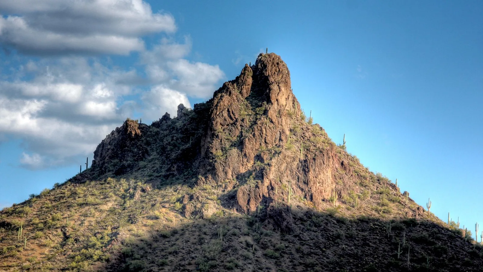
Quick answer
- Distance: 1.6 miles one way (park map), about 3.2–3.3 miles round trip. Some older guides say up to 4 miles.
- Summit: 3,374 feet.
- Total climbing: about 2,000 feet once you count the drop after the saddle and the climb back.
- Time: about 3–5 hours round trip.
- Difficulty: difficult. Steep rock, exposure and steel cables.
- Gloves: recommended by the park for the cables.
- Trailhead: Barrett Loop, Picacho Peak State Park, I-10 Exit 219.
- Dogs: leashed dogs allowed only to the saddle.
- Best season: November to March.
Hunter Trail at a Glance
| Location | Picacho Peak State Park, Arizona (between Phoenix and Tucson) |
| Trailhead | Barrett Loop, north side of the peak |
| Distance | 1.6 miles one way (about 3.2 miles round trip) |
| Summit elevation | 3,374 feet |
| Total elevation gain | Roughly 2,000 feet round trip |
| Difficulty | Difficult (official) |
| Time | 3–5 hours |
| Route type | Out and back |
| Special features | Steel cables, wooden steps, exposed rock |
| Water on trail | None. Park suggests 2–4 liters per person. |
| Dogs | Leashed, to the saddle only |
| Trail hours | Trails close sunset to sunrise |
| Fee | State park day-use fee per vehicle |
Trail details come from Arizona State Parks. Distances differ between apps and older guides.
Where Is Picacho Peak?
Picacho Peak State Park is right beside I-10 in southern Arizona, about 70 miles southeast of Phoenix and about 40 miles northwest of Tucson. The peak is a famous landmark. Spanish explorers on the 1775 Anza expedition used it as a guide, and the park is also home to the site of the Battle of Picacho Pass, a small 1862 Civil War skirmish.
How to get there
- Take I-10 to Exit 219 (Picacho Peak Road).
- Follow signs to the state park entrance and pay the day-use fee.
- Drive to Barrett Loop. The Hunter Trailhead is there.
All roads are paved, so any car works. Check the park’s hours before an early start, since trails close from sunset to sunrise.
Parking
Park at the Hunter Trail parking area on Barrett Loop. On spring weekends, especially during wildflower season, it can fill up, so arrive early. The park has restrooms, picnic areas, a visitor center and a campground.
Why the Hunter Trail Is Harder Than the Numbers Say
1.6 miles to the top sounds easy. Here’s the catch:
- You climb to a saddle (a low point on the ridge).
- Then the trail goes DOWN the other side, losing roughly 300 feet with cables and wooden steps.
- Then you climb again, steeply, using cables, to the summit.
- On the way back, you have to climb back up to the saddle before you can go down.
That’s why total climbing ends up around 2,000 feet, even though the summit is only about 1,370 feet above the trailhead. Your arms work hard too, because you’ll pull on the cables.
What to Expect on the Hunter Trail
1. Switchbacks to the saddle
The trail starts at Barrett Loop and climbs through saguaros, palo verde and brittlebush. It gets steep quickly, with rocky switchbacks and some loose footing. As you climb, I-10 and the flat desert spread out below you.
After roughly three-quarters of a mile, you reach the saddle. There’s a bench and a big view to the south. This is your decision point. If you’re already tired or nervous about heights, this is a great place to stop. It’s a solid hike on its own, and it’s as far as dogs are allowed.
2. Down the back side
From the saddle, the trail drops down the south side of the mountain. This section uses cables and wooden steps. It surprises a lot of people, since you’re going down when you expected to keep climbing. Take it slow.
The trail then runs fairly flat for a bit and reaches the junction with the Sunset Vista Trail.
3. The cable sections
Now comes the famous part. The trail climbs steep rock faces where steel cables are anchored into the mountain. In some spots you’ll hold the cable with both hands and walk your feet up the rock. In others, the cable is just there for balance on a narrow ledge.
- Some sections are nearly vertical for short stretches.
- There’s real exposure: steep drops nearby.
- Gloves make a big difference. The cables can be rough and hot from the sun.
- Only one or two people fit on some cable stretches at a time. Wait your turn at safe spots.
4. The summit
After the last cables and a final scramble, you’re on top at 3,374 feet. The view is huge: endless desert in every direction, distant mountain ranges, the farm fields and I-10 like a toy road far below. Find a safe spot away from the edges, eat a snack and take it all in.
5. The return
Go back the way you came: down the cables, climb back up to the saddle, then down the switchbacks. Going down the cables is often scarier than going up. Face the rock, keep the cable in your hands, and move one step at a time.
The Picacho Peak Cables: What You Need to Know
Do you need climbing gear?
No ropes or harnesses are needed for the standard route. The cables are fixed in place. But you do need good grip strength, balance and comfort with heights.
Should you wear gloves?
Yes. Arizona State Parks recommends gloves for the cable sections. Simple work gloves or grippy fitness gloves are fine. They protect your hands and give better grip, especially when the cables are hot.
Are the cables safe?
The cables help a lot, but they don’t remove the risk. A slip on steep rock can still mean a serious fall. Don’t hike in rain (the rock gets slick), strong wind or extreme heat.
Can you skip the cables?
Not if you want the summit. If you don’t want to use the cables, the saddle is a great turnaround.
How Hard Is the Hunter Trail?
The park rates it difficult, and most hikers agree. It combines steep climbing, loose rock, exposure, upper-body work and a second climb on the way back.
Is it scary?
It can be, if you don’t like heights. The cable sections are steep and exposed. Many people feel nervous but manage fine by taking it slow. If you have a strong fear of heights, enjoy the hike to the saddle instead.
Is it good for beginners?
Not for most beginners. It’s better for hikers who’ve done steep trails and some scrambling before. Fit beginners can hike to the saddle and decide there.
Can kids do it?
Older, experienced kids with close adult supervision sometimes do the summit, but the cables and exposure aren’t suitable for young children. The Calloway Trail or Children’s Cave Trail are better family options.
Hunter Trail vs. Sunset Vista Trail
There are two ways to the summit, and they meet before the final cable sections.
| Hunter Trail | Sunset Vista Trail | |
|---|---|---|
| Distance (park map) | 1.6 mi one way | 3.1 mi one way |
| Start | Barrett Loop (north side) | Western parking lot (south side) |
| Difficulty | Difficult the whole way | Moderate for about 2 miles, then challenging cables |
| Saddle descent | Yes | No |
| Cables | Yes | Yes (shared upper section) |
| Dogs | To the saddle only | To the cables only |
Hunter is shorter and steeper. Sunset Vista is longer and gentler at first, with the same tough cable finish. Some people go up one and down the other, but the trailheads are in different spots, so you’d need a ride or a long walk back to your car.
Best Time to Hike Picacho Peak
| Season | Conditions | Verdict |
|---|---|---|
| November–February | Cool, sunny days | Best time |
| March–early April | Warm, wildflowers in good rain years (Mexican gold poppies), busy | Great, start early |
| Late April–October | Hot to extremely hot, cables and rock heat up | Avoid |
Picacho Peak is famous for spring wildflowers in wet years, when the slopes can turn gold with poppies. Blooms vary a lot from year to year.
The park says to avoid the summit trails in extreme heat. Some years the park changes hours or access in summer, so check the official park website before you go.
What to Bring
- Water: 2–4 liters per person, as the park recommends. There’s no water on the trail.
- Gloves for the cables.
- Hiking shoes with sticky rubber for smooth rock.
- A small backpack so your hands are free. Nothing dangling.
- Sun protection: hat, sunglasses, sunscreen.
- Snacks for a half-day hike.
- Charged phone and an offline map.
- First aid kit.
Check out our backpack phone holders to keep your phone handy but secure on the cables.
Safety Tips
- Use the saddle as a check-in point. Be honest about your energy and comfort.
- Wait your turn on cable sections. Don’t crowd or pass on exposed rock.
- Face the rock when going down steep cable sections.
- Skip it in rain, wind or heat.
- Save energy for the climb back to the saddle on the return.
- Finish before sunset. Trails close at dark.
- Watch for rattlesnakes on warm days.
Easier Trails at Picacho Peak State Park
| Trail | Distance | Difficulty | What it offers |
|---|---|---|---|
| Calloway Trail | 0.5 mi one way, ~300 ft gain | Moderate | Stone steps to a desert overlook |
| Nature Trail | 0.5 mi loop | Easy | Signs about desert plants |
| Children’s Cave Trail | 0.2 mi one way | Easy | Short walk to a small rock alcove |
| Memorial Loop | 0.1 mi loop | Easy, wheelchair accessible | Signs about the Battle of Picacho Pass |
All of these allow leashed dogs.
Suggested Half-Day Plan
- Sunrise: enter the park and drive to Barrett Loop.
- First hour: climb to the saddle. Check how you feel.
- Next hour: descend the back side and climb the cables to the summit.
- Summit: rest, eat and take photos.
- Return: down the cables, back up to the saddle, down to the car.
- After: picnic in the park, then drive on to Tucson for Sabino Canyon or to Phoenix for Camelback Mountain.
Frequently Asked Questions
How long is the Picacho Peak Hunter Trail?
1.6 miles one way on the park map, or about 3.2 miles round trip. Some older guides list up to 4 miles round trip.
How hard is the Hunter Trail?
It’s rated difficult. Expect steep switchbacks, exposure, steel cables and a second climb on the way back.
How long does it take?
About 3 to 5 hours round trip, depending on fitness and how busy the cables are.
Do you need gloves for Picacho Peak?
Gloves are recommended by Arizona State Parks for the cable sections.
What is the elevation gain?
The summit is about 1,370 feet above the trailhead, but total climbing is around 2,000 feet because the trail drops after the saddle and climbs again.
Can dogs go on the Hunter Trail?
Leashed dogs are allowed only as far as the saddle.
Do you need climbing gear?
No. The cables are fixed in place. You just need to be comfortable using them.
Where is the Hunter Trailhead?
At Barrett Loop inside Picacho Peak State Park, off I-10 Exit 219.
Can you hike Picacho Peak in summer?
It’s strongly discouraged. Extreme heat makes the rock and cables dangerously hot.
Is Picacho Peak worth it?
Yes, for prepared hikers who are okay with heights. The cables make it one of the most fun hikes in Arizona.
Which is easier, Hunter or Sunset Vista?
Sunset Vista is longer but gentler for the first 2 miles. Both end with the same tough cable climb.
Final Thoughts
The Picacho Peak Hunter Trail is short, steep and a real adventure. The saddle descent, the steel cables and the summit view over the endless desert make it feel bigger than its 1.6 miles.
Go in the cool months, wear gloves, bring plenty of water, wait your turn on the cables, and remember that the saddle is a perfectly good finish line if the cables aren’t for you today.
More Arizona hikes: Peralta Trail in the Superstition Mountains, Camelback Mountain Echo Canyon Trail, Sabino Canyon hiking trails, Siphon Draw to the Flatiron and the best winter hiking trails in the USA.
Official info: Picacho Peak State Park trails (Arizona State Parks).