
Tucson is hot, dry desert. So the first time you hear running water in Sabino Canyon, it feels a little unreal.
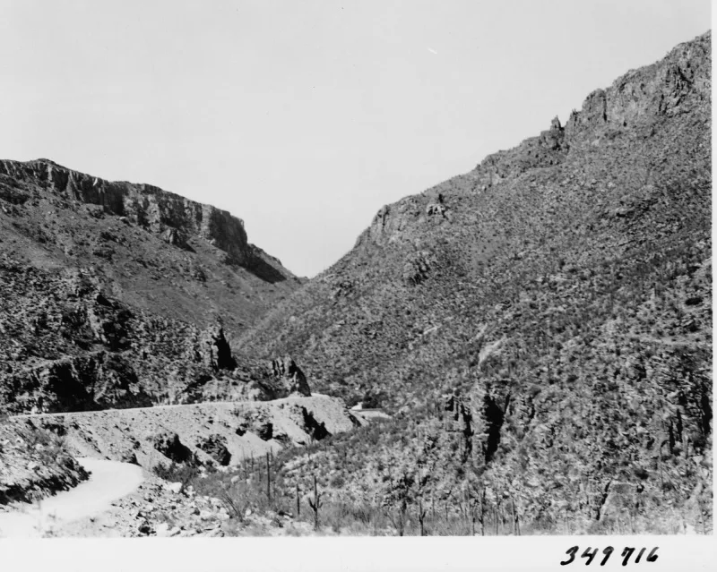
Just at the edge of the city, a creek tumbles out of the Santa Catalina Mountains through a canyon lined with giant saguaros, cottonwoods and rocky cliffs. There’s a paved road you can walk or ride a shuttle on, trails that climb high above the canyon, and one of Arizona’s most loved waterfall hikes: Seven Falls.
This guide covers the best Sabino Canyon hiking trails, from easy strolls to tough climbs. You’ll find real distances, which trail fits you, how the shuttle works, current fees, the best time to go (especially for waterfalls), map tips and the safety advice that matters in the desert.
Quick answer
- Best overall hike: Seven Falls via Bear Canyon, about 8–8.5 miles round trip on foot (shorter with the shuttle).
- Best views: Phoneline Trail, about 4–5 miles one way above the canyon, then ride the shuttle back.
- Easiest: walk any part of the paved Sabino Canyon Road.
- Toughest short climb: Blackett’s Ridge, about 6 miles round trip.
- Fee: $8 per vehicle per day (Forest Service). Shuttle tickets are extra.
- Address: 5700 N. Sabino Canyon Road, Tucson, AZ 85750.
- Dogs: not allowed in Sabino Canyon Recreation Area.
- Best time: November to April. For flowing waterfalls, mid-February to April.
Best Sabino Canyon Hiking Trails at a Glance
| Trail | Distance | Difficulty | Best for |
|---|---|---|---|
| Seven Falls via Bear Canyon | About 8–8.5 mi round trip from visitor center | Moderate–strenuous | Waterfalls and swimming holes |
| Phoneline Trail | About 4–5.25 mi one way (shuttle back) | Moderate | Big views over the canyon |
| Sabino Canyon Road | Up to about 7.5 mi round trip (any length) | Easy–moderate | Families, creek views |
| Blackett’s Ridge | About 6 mi round trip | Strenuous | Workout with a panoramic view |
| Sabino Dam area | Short walk | Easy | Water and picnics |
| Esperero Trail | Long, varies | Strenuous | Experienced hikers seeking solitude |
Distances depend on where you start and whether you use the shuttle. Treat them as close estimates.
Where Is Sabino Canyon?
Sabino Canyon is on the northeast edge of Tucson, in the foothills of the Santa Catalina Mountains. It’s part of the Coronado National Forest and managed by the U.S. Forest Service.
Visitor Center: 5700 N. Sabino Canyon Road, Tucson, AZ 85750. Phone: (520) 749-8700.
From central Tucson, take Tanque Verde Road east to Sabino Canyon Road, turn left, and drive about 4 miles north to the entrance. Expect a 25–40 minute drive depending on where you start.
The recreation area itself is open all the time, but the visitor center, bookstore and shuttles run roughly 8:00 a.m. to 4:30 p.m.
Sabino Canyon Fees, Parking and Shuttle
Fees (from the Forest Service)
| Day pass | $8 per vehicle |
| Weekly pass | $10 per vehicle |
| Coronado annual forest pass | $40 |
| America the Beautiful (Interagency) pass | Accepted |
Display your pass on the driver’s side of the dashboard. Fees can change, so double-check before you go.
The shuttle
Private cars have been banned in the canyon since 1978. Instead, open-air shuttles run up two roads:
- Sabino Canyon shuttle: about a 1-hour round trip with nine stops and narration. Listed at $15 adults, $8 kids under 12, and $8 for one-way rides.
- Bear Canyon shuttle: a short ride with three stops toward the Bear Canyon trailhead. Listed at $8 adults, $5 kids under 12.
Tickets and times are sold through the shuttle operator (sabinocanyoncrawler.com). The last shuttles leave in the late afternoon, so plan long hikes around that.
Parking tips
The lot by the visitor center fills on nice weekends and holidays. Arrive early. Restrooms near the visitor center are closed overnight (5 p.m. to 8 a.m.), and there’s drinking water at the visitor center but very little elsewhere.
1. Seven Falls Trail via Bear Canyon
Want every detail? Read our full Seven Falls Trail Tucson guide.
This is the hike most people come for. The Bear Canyon Trail follows a creek into the mountains, crossing it again and again, and ends at Seven Falls, a series of waterfalls and pools tumbling down a rocky cliff.
Distance and difficulty
- On foot from the visitor center: about 8–8.5 miles round trip, with roughly 1,000 feet of climbing (Visit Arizona).
- With the Bear Canyon shuttle: the shuttle skips the paved walk to the trailhead and shortens the hike by a few miles.
- Difficulty: moderate to strenuous because of the length, rocky trail and creek crossings.
What you’ll see
The first part follows the creek through saguaros, mesquite and cottonwoods. The trail crosses Bear Creek several times (Visit Arizona counts seven crossings). In dry times you can hop rocks. When water is flowing, expect wet feet; the water can be cold and sometimes thigh-high.
After the crossings, the trail climbs along the canyon wall with views of the falls ahead. The last bit drops to the base of the falls, where there’s a big pool. On warm spring days, people swim.
When does Seven Falls flow?
- Best: mid-February through April, when snowmelt from Mount Lemmon feeds the falls.
- Sometimes: July and August after monsoon rains (but it’s very hot, and flash floods are a real danger).
- Rest of the year: flow drops, and the falls can dry up.
Tips for Seven Falls
- Bring at least 3 liters of water. There’s little shade after the creek.
- Wear shoes you don’t mind getting wet, or bring sandals for crossings.
- Trekking poles help with balance in the creek.
- Never cross fast or rising water. Turn back.
- Check the last shuttle time if you plan to ride back.
2. Phoneline Trail
If you want views, this is the one. Instead of staying in the canyon bottom, the Phoneline Trail climbs onto the south wall of Sabino Canyon and runs hundreds of feet above the road and creek. You look down on the whole canyon, with the Catalinas rising above.
Distance and difficulty
- About 4 to 5.25 miles one way, depending on where you measure from (HikeArizona lists 4.05 miles for the trail itself; Arizona Highways gives about 5.25 miles from the visitor center to Shuttle Stop 9).
- About 950 feet of net climbing, with extra ups and downs.
- Rated moderate.
How to hike it
The most popular way: start at the visitor center, follow the Bear Canyon Trail and roads to the Phoneline sign, climb to the trail, then follow it up canyon. At the end, switchback down to Shuttle Stop 9 and ride the shuttle back (one-way tickets are sold on board if there’s space). That way you only hike one direction.
Along the way you’ll pass the junction for Blackett’s Ridge, and short spurs that drop to the road if you want to cut it short. Parts of the trail sit above steep drops, with cable railing in one spot.
3. Sabino Canyon Road
The easiest way to enjoy Sabino Canyon. The paved road runs about 3.7–3.8 miles up the canyon, crossing the creek on low stone bridges, with saguaros and cliffs all around. No cars allowed (just the shuttle), so it’s peaceful.
- Walk as far as you like and turn around.
- Ride up, walk down: take the shuttle to the top (Stop 9) and walk back downhill. This is a favorite with families.
- Accessible: the Forest Service lists the paved road up Sabino and Bear Canyons as wheelchair accessible, though it has hills.
Bikes are allowed on the road only after 5 p.m.
4. Blackett’s Ridge Trail
Blackett’s Ridge is the leg-burner. It branches off the Phoneline Trail and climbs steeply up a narrow ridge between Sabino and Bear Canyons. The last part is a constant uphill grind.
- Distance: about 6 miles round trip from the visitor center.
- Difficulty: strenuous. Steep, rocky, little shade.
- Reward: sweeping views into both canyons, across Tucson and up to the higher Catalinas.
Start early, bring plenty of water, and save energy for the steep, loose descent.
5. Short Walks and Sabino Dam
Not up for a big hike? There are easy, short options near the start of the canyon, including the Sabino Dam area, where water often pools behind an old dam. It’s a nice spot for a picnic and photos. Check the map at the visitor center for short loops and nature walks.
6. Esperero Trail (For Experienced Hikers)
The Esperero Trail heads up into the rugged Pusch Ridge Wilderness above the canyon. It’s long, steep and rough, and much quieter than the main trails. It’s a good pick for strong, experienced hikers with a full day and solid navigation skills. Pick a turnaround time before you start.
Which Sabino Canyon Trail Is Right for You?
| If you want… | Choose |
|---|---|
| An easy family outing | Shuttle up Sabino Canyon Road, walk down |
| Waterfalls and swimming | Seven Falls (Feb–April) |
| The best views without a huge climb | Phoneline Trail, shuttle back |
| A hard workout | Blackett’s Ridge |
| A quick taste | Sabino Dam area or the first mile of the road |
| Solitude | Esperero Trail |
Sabino Canyon Hiking Trails Map
Sabino Canyon has many junctions, and some trails continue deep into the wilderness. A map helps even on short hikes.
- Official map: the Forest Service offers a Sabino Canyon map on its recreation area page, and paper maps are sold at the visitor center bookstore.
- Download before you go: save an offline map on your phone. Cell service gets spotty up canyon.
- Know your shuttle stops: the Sabino Canyon shuttle has nine stops; Stop 9 is at the top of the road and the end point for Phoneline hikers.
Best Time to Hike Sabino Canyon
| Season | What to expect |
|---|---|
| November–January | Cool, sunny days. Great hiking. Creek may be low. |
| February–April | Best overall. Snowmelt fills the creek and Seven Falls. Wildflowers in good years. Busy. |
| May–June | Very hot and dry. Hike only at dawn. |
| July–September | Monsoon storms, flash floods, extreme heat. Risky. |
| October | Cooling off. Start early. |
Rules to Know
- No pets in Sabino Canyon Recreation Area (service animals are allowed).
- No glass containers and no camping.
- Bikes only after 5 p.m. on the road.
- A Forest Service order covering the Bear Canyon area (in effect through January 2028) also bans alcohol, camping, glass containers and bikes, skateboards and other wheeled vehicles in the order area, plus taking plants or animals.
- Stay on trails to protect desert plants.
What to Bring
- Water: a liter per hour is a good rule in warm weather; at least 3 liters for Seven Falls.
- Hiking shoes with grip, plus sandals or water shoes for Seven Falls crossings.
- Sun protection: hat, sunglasses, sunscreen.
- Snacks and lunch.
- Light layer for cool winter mornings.
- Trekking poles for creek crossings and steep descents. See our best hiking poles.
- Cash or card for shuttle tickets.
- First aid kit with tweezers for cactus spines.
Safety Tips
- Flash floods: storms in the mountains can raise the creek fast, even under blue sky. Never cross rising or fast water.
- Heat: Tucson summers are dangerous. Hike at dawn or not at all in summer.
- Wildlife: watch for rattlesnakes and Gila monsters. Give them space.
- Don’t get stranded: know the last shuttle time if you’re counting on a ride.
- Tell someone your plan for longer hikes.
One-Day and Two-Day Plans
One day
- Morning: arrive early, buy a shuttle ticket, and hike Seven Falls (Feb–April) or Phoneline with a shuttle ride back.
- Afternoon: picnic near the visitor center, then relax.
Two days
- Day 1: shuttle up Sabino Canyon Road, walk down, and check out Sabino Dam.
- Day 2: pick one big hike: Seven Falls for water, Blackett’s Ridge for a challenge.
Frequently Asked Questions
What are the best Sabino Canyon hiking trails?
Seven Falls via Bear Canyon, the Phoneline Trail, Sabino Canyon Road and Blackett’s Ridge are the most popular. Pick based on your fitness and whether you want water, views or an easy walk.
How long is the Seven Falls hike?
About 8–8.5 miles round trip from the visitor center. The Bear Canyon shuttle shortens it by a few miles.
When is Seven Falls flowing?
Best from mid-February to April, from Mount Lemmon snowmelt. Sometimes after summer monsoon rains.
How much does it cost to visit Sabino Canyon?
$8 per vehicle per day (or $10 per week). America the Beautiful passes are accepted. Shuttle tickets cost extra.
Can you drive into Sabino Canyon?
No. Private vehicles have been banned on the canyon road since 1978. Walk or take the shuttle.
Are dogs allowed in Sabino Canyon?
No. Pets aren’t allowed in the recreation area. Service animals are permitted.
What’s the easiest hike in Sabino Canyon?
Walking part of Sabino Canyon Road, or riding the shuttle up and walking down.
Is there a Sabino Canyon trail map?
Yes, on the Forest Service website and at the visitor center bookstore. Download one before you go.
Can you swim in Sabino Canyon?
Many people swim in the pools at Seven Falls and along the creek when water is flowing. Never swim during high or fast water.
What is the best month to hike Sabino Canyon?
March is hard to beat: flowing water, wildflowers and pleasant temperatures. November through April is good overall.
Is Sabino Canyon worth visiting?
Yes. It’s one of the best outdoor spots in Tucson, with trails for every level and rare desert water.
Final Thoughts
Sabino Canyon gives you a little of everything: easy walks on a car-free road, big views from the Phoneline Trail, a tough climb up Blackett’s Ridge and a real waterfall at Seven Falls. Few places in the Sonoran Desert pack in so much variety so close to a city.
Come between November and April, start early, check the shuttle times, bring plenty of water, and stay out of the creek when it’s rising.
More Arizona hikes: Picacho Peak Hunter Trail (on the way to Phoenix), Camelback Mountain Echo Canyon Trail, Peralta Trail, Echo Canyon Loop in Chiricahua and the best winter hiking trails in the USA.
Official info: Sabino Canyon Recreation Area (USDA Forest Service).