
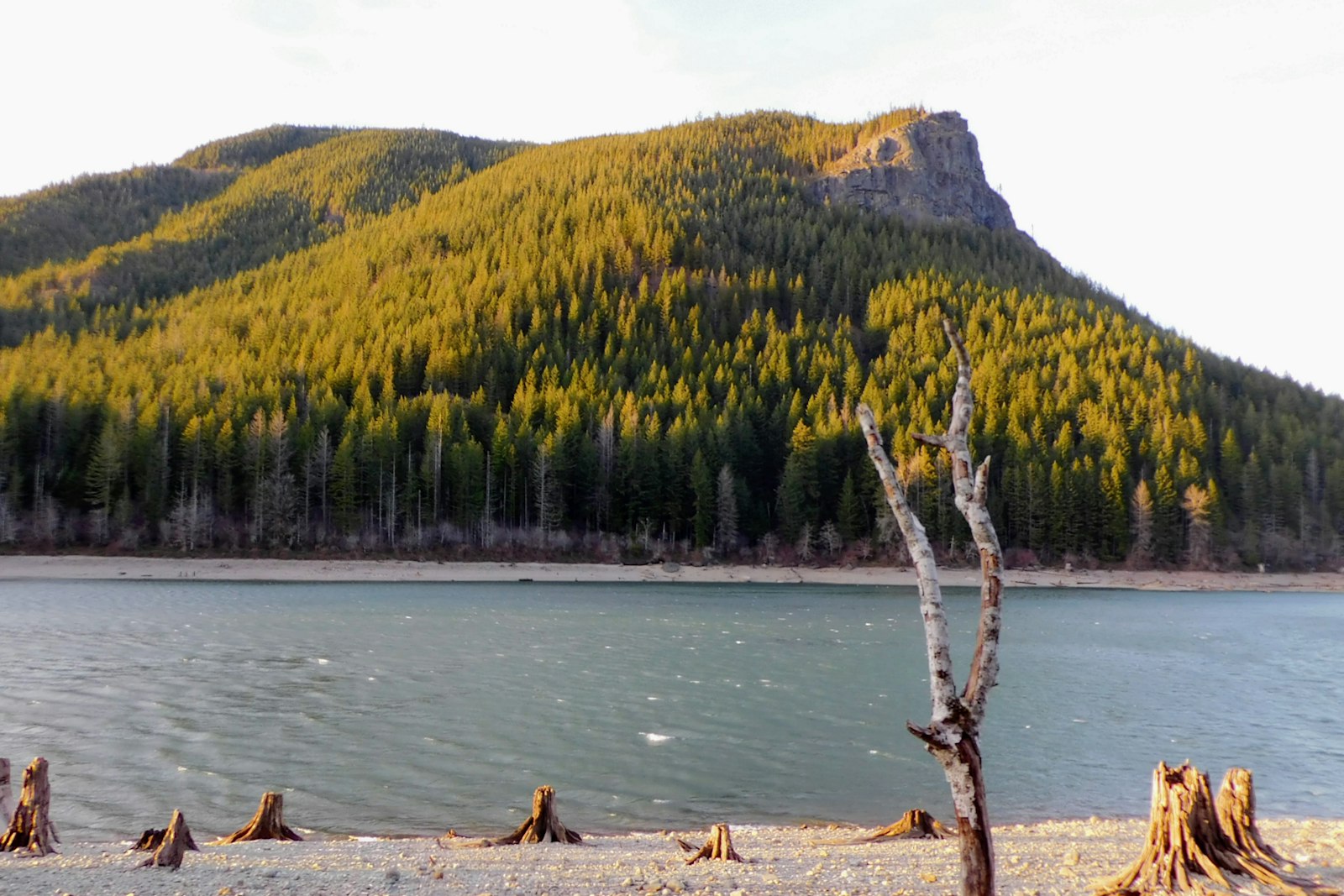
Ask anyone in Seattle for a quick hike with a big view, and Rattlesnake Ledge comes up almost every time. Under an hour from the city, you park beside a calm lake, climb two miles of shady forest switchbacks, and step out onto a bare rock ledge more than 1,000 feet above the water. Rattlesnake Lake lies straight below you, with forested ridges and Mount Si stretching across the valley.
It’s a great half-day hike, but it’s also a real climb, it gets very busy, and the ledge is a sheer cliff with no railings.
This guide covers the distance, climb and hiking time, directions and free parking, the trail step by step, the Middle and Upper Ledges, the views, weather by season, cliff safety, dogs and kids, nearby hikes and the best time to go.
Cover photo: Rattlesnake Lake, where the hike begins. Photo: Peter Robbins / Unsplash
Rattlesnake Ledge Trail: The Short Answer
Rattlesnake Ledge Trail starts at Rattlesnake Lake near North Bend, Washington, about 35 miles east of Seattle. It’s 4 miles round trip with 1,160 feet of climbing to a rocky viewpoint at about 2,078 feet. Most people take 2–3 hours. It’s moderate, parking is free, no pass is needed, and leashed dogs are allowed. The ledge is an unfenced cliff, so stay well back from the edge, especially when it’s wet or icy.
Rattlesnake Ledge Trail: Quick Facts
| Detail | Information |
|---|---|
| Location | Rattlesnake Lake, near North Bend, Washington |
| Distance from Seattle | About 35 miles (45–75 minutes’ drive) |
| Trail type | Out and back |
| Distance | 4 miles round trip (about 2 miles each way) |
| Elevation gain | 1,160 feet |
| Lake elevation | About 911 feet |
| Ledge elevation | About 2,078 feet |
| Difficulty | Moderate |
| Time | 2–3 hours |
| Parking | Free |
| Pass needed | None at the Rattlesnake Lake lot |
| Dogs | Allowed on leash |
| Hours | Dawn to dusk |
| Restrooms | Portable toilets at the trailhead |
| Main hazard | Unfenced cliff edge at the top |
Where Is Rattlesnake Ledge?
Rattlesnake Ledge sits on the east end of Rattlesnake Mountain, just south of Interstate 90 near North Bend in the Snoqualmie Valley. The trail starts at the Rattlesnake Lake Recreation Area, which is owned and managed by Seattle Public Utilities as a buffer for the protected Cedar River Watershed, the source of much of Seattle’s drinking water.
Is it in a national park? No. It isn’t part of Mount Rainier or North Cascades National Park, so you don’t need a park pass.
A bit of history: The lake didn’t always look like this. A small town called Moncton stood near its north end until 1915, when water seeping from the newly built reservoir at Chester Morse Lake raised the water table and flooded it. On very low-water days, old stumps still poke out of the lake.
Directions to Rattlesnake Ledge From Seattle
- Drive east from Seattle on I-90.
- Take Exit 32 for 436th Avenue SE.
- Turn right. The road becomes Cedar Falls Road SE.
- Drive about 3–4 miles to the Rattlesnake Lake parking lot on the right.
Watch out for old directions. Some maps and older guides send you via 208th Avenue SE near Hobart. That road no longer reaches the trailhead. Always use Exit 32 off I-90.
Trailhead coordinates: about 47.4345, -121.7684.
Rattlesnake Ledge Parking: Is It Free?
Yes, parking is free, and you don’t need a Discover Pass or Northwest Forest Pass at the Rattlesnake Lake lot. There’s a main lot beside the lake and a smaller overflow lot closer to the trail. Both are open from dawn to dusk.
- Why the confusion about passes? Some nearby trailheads, like the Cedar Falls access for the Palouse to Cascades State Park Trail, are state lands that need a Discover Pass. Make sure you’re in the Rattlesnake Lake lot.
- Does it fill up? Yes, often by mid-morning on sunny weekends. Arrive before 8 a.m. or come in the late afternoon (leaving enough daylight to get down).
- Road parking: Only park in marked spots. Don’t block gates or the road; illegally parked cars can be ticketed or towed.
How Long Is the Rattlesnake Ledge Hike?
The hike is 4 miles round trip: about 1.9 miles up to a signed junction, then about 100 yards to the ledge, and back the same way. Most of the 1,160 feet of climbing happens on steady switchbacks.
| Hiking style | Round-trip time |
|---|---|
| Fast, fit hikers | About 1.5–2 hours |
| Average pace with a break at the top | 2–3 hours |
| Beginners or families | 3–4 hours |
| Adding Middle and Upper Ledge | Add about 30–45 minutes |
| Wet, icy or snowy days | Longer; go slowly |
Going up usually takes about 1 to 1.5 hours; coming down is quicker but harder on your knees. Trekking poles help on the descent.
Rattlesnake Ledge Trail Difficulty
It’s moderate. The trail is wide, well built and easy to follow, but you climb almost the whole way up. You’ll deal with:
- Steady uphill switchbacks for nearly 2 miles
- Rocks, roots and some built steps
- Mud in the rainy months and ice in winter
- A steep, exposed rock ledge at the top
Is it good for beginners? Yes, for active beginners. It’s one of the most popular “first real hikes” around Seattle. Take your time, rest at the wider bends, and bring water. If you’re new to hiking, our hiking for beginners guide covers the basics.
Is it harder than it looks? For many people, yes. The lake looks close, but the climb doesn’t let up, and the last switchbacks feel the longest.
Rattlesnake Ledge Trail Map and Route
The route is simple: Rattlesnake Lake parking → walk around the north end of the lake → trailhead kiosk → forest switchbacks → signed junction (about 1.9 miles) → Lower Ledge, then back the same way. From the junction, the trail keeps climbing to the Middle and Upper Ledges and, much farther, along the whole Rattlesnake Mountain ridge.
Seattle Public Utilities publishes a free Rattlesnake Lake Recreation Area map, and Green Trails map 205S (Rattlesnake Mountain) covers the whole ridge. Download a map to your phone before you go, since signal can be patchy.
Rattlesnake Ledge Trail: Step by Step
1. Start at Rattlesnake Lake
From the parking lot, walk a short way around the north end of the lake to the trailhead on its northwest side. You’ll find portable toilets and an information kiosk there. Look up: that bare rock face high above the water is where you’re headed.
2. Climb the Forest Switchbacks
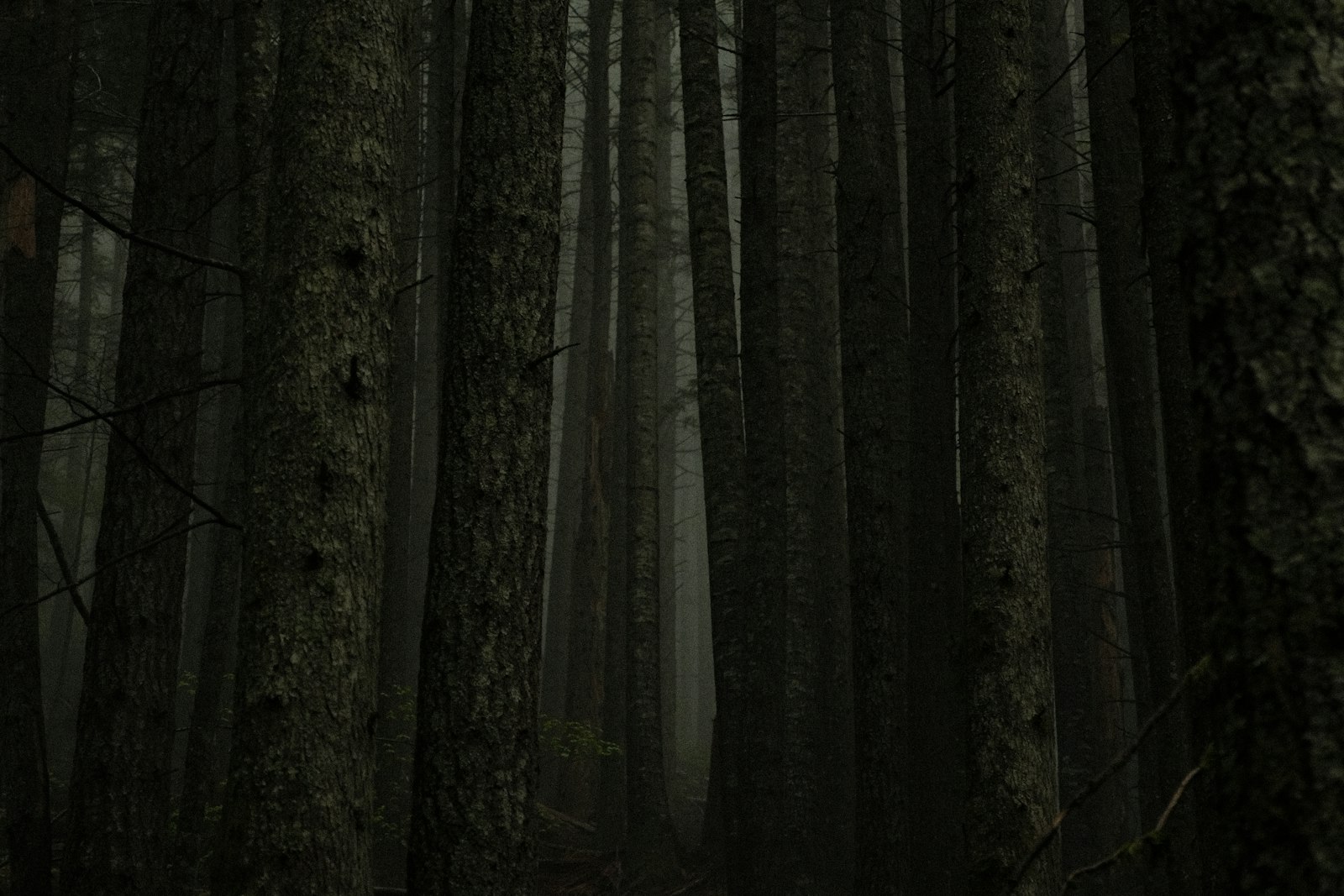
Almost right away, the trail starts zigzagging up the hillside through tall Douglas fir, western hemlock and cedar, with ferns, moss and big-leaf maples. Switchbacks keep the slope manageable, but it’s a steady workout. Sections of the trail were upgraded in 2020 and 2021 by Seattle Public Utilities and local trail groups, so the tread is in good shape.
The forest keeps you shaded most of the way, which makes this a good summer hike. There aren’t many views until the top, so settle into a steady pace and step aside to let faster hikers pass.
3. Reach the Junction
At about 1.9 miles you’ll hit a signed junction. The Lower Ledge is about 100 yards to the right (the ledge itself isn’t always signed; just follow the crowd and the light through the trees).
4. Step Out Onto the Ledge
The trees open onto a wide, rocky outcrop. Rattlesnake Lake sits far below, framed by forest. Take a minute to find a safe, flat spot back from the edge before you start taking photos.
5. Head Back Down
Return the way you came. Watch your footing on roots, loose gravel and wet rock. Most slips happen on the way down when legs are tired.
What Can You See From Rattlesnake Ledge?
- Rattlesnake Lake right below you
- Mount Si and Little Si across the valley to the north
- Mount Washington and the Cascade foothills to the east
- The Cedar River Watershed and, on clear days, Chester Morse Lake to the south
Low clouds often fill the valley, turning the view into a sea of mist with treetops poking through. That can be just as beautiful as a clear day.

Lower vs. Middle vs. Upper Ledge
Most people stop at the first viewpoint, but there are three ledges.
| Viewpoint | Extra distance | What it’s like |
|---|---|---|
| Lower Ledge | The standard 4-mile hike | The classic lake view; busiest |
| Middle Ledge | About 0.2 miles past Lower Ledge | Quieter, wider views to the northwest |
| Upper Ledge | About 0.2 miles past Middle Ledge | Fewest people, big views up the valley |
| All three ledges | About 4.8 miles round trip | About 1,500 feet of climbing in total |
If Lower Ledge is crowded, Middle and Upper Ledge are well worth the extra 15–20 minutes of climbing. All three are exposed cliff tops, so the same safety rules apply.
Want a longer day? The trail continues along the ridge to East Peak (about 2.4 miles beyond the junction) and eventually reaches Snoqualmie Point Park, roughly 11 miles from Rattlesnake Lake. That’s a full-day, one-way trip that needs a car shuttle.
Is Rattlesnake Ledge Dangerous?
The forest trail is safe in normal conditions. The danger is the ledge itself: a big rock top with sheer drops of several hundred feet and no railings. There have been fatal falls here, including a 2012 accident and a 2018 fall when a teenage hiker slipped on ice near the edge. Neither had anything to do with a hard trail; both happened at the top.
- Stay several big steps back from the edge.
- Don’t climb out onto points or step backward while taking photos.
- Skip the ledge when it’s icy, snowy or very wet; the rock gets slick.
- Hold children’s hands and keep dogs on a short leash at the top.
- Never run, jump or horse around near the drop.
Rattlesnake Ledge Weather by Season
| Season | What to expect |
|---|---|
| Spring (March–May) | Green forest, some mud; ice and snow can linger into April |
| Summer (June–August) | Driest and busiest. Shady climb, hot sun on the ledge; start early in heat waves |
| Fall (September–November) | Golden maples and cooler air; rain returns by October with muddy patches |
| Winter (December–February) | Rain, snow and ice possible. Microspikes help; the ledge can be very dangerous |
The weather at Rattlesnake Lake is often wetter and cooler than in Seattle, and the ledge can be in cloud even on a sunny city day. Check a North Bend forecast, not just Seattle’s.
Rattlesnake Ledge in Late October
In late October, expect cool temperatures, colorful leaves and wet, muddy patches after rain. Expect slippery roots and rock, and bring a rain jacket. Check recent trip reports before you go, as conditions change fast once the first frosts arrive.
Wildfire Smoke
In late summer, smoke from fires elsewhere in the Northwest can blur the view and make climbing uncomfortable. Check the air quality forecast before you go, and skip the hike on heavy-smoke days if you have breathing problems. Closures for nearby fires are rare but possible. Campfires and camping are not allowed anywhere in the recreation area.
Best Time to Hike Rattlesnake Ledge
- Best months: June through early October for dry trails and clear views.
- Quietest: weekday mornings.
- Sunrise: lovely light and fewer people, but the area opens at dawn, so you won’t be on the ledge for the very first light.
- Sunset: beautiful, but the recreation area closes at dusk and you’d be hiking down in the dark. A late-afternoon hike with plenty of daylight is the safer choice.
Rattlesnake Ledge With Kids and Dogs
Kids: Active school-age kids usually manage the hike well. The trail is wide, and spotting the lake far below is a big reward. The risk is the ledge: if your child is too young to reliably follow “stay back,” turn around just before the top or stay right beside them. A picnic by the lake afterward makes a nice finish.
Dogs: Dogs are welcome on a leash. Bring water for them (there’s none on the trail), pack out waste, and keep them on a short leash at the cliff.
What to Pack
- Shoes with good grip (roots and rock get slippery)
- At least 1 liter of water per person; there’s no water on the trail
- Snacks
- Rain jacket and warm layer (see our waterproof hiking jacket guide)
- Sun hat and sunscreen for the open ledge
- Downloaded map and a charged phone
- Headlamp, in case you’re slower than planned
- Microspikes in winter and early spring
Photography Tips
- From the lakeshore: shoot the ledge reflected in calm water before you start.
- On the ledge: you don’t need the edge for a great shot. A few steps back still frames the whole lake.
- Misty days: clouds in the valley make moody shots; foggy forest switchbacks are photogenic too.
- Fewer people: go early on a weekday, or use Middle and Upper Ledge.
Rattlesnake Ledge vs. Other Hikes Near Seattle
| Hike | Round trip | Climb | Difficulty | Best for |
|---|---|---|---|---|
| Twin Falls | About 2.6 miles | About 500 feet | Easy–moderate | Waterfalls and young kids |
| Rattlesnake Ledge | 4 miles | 1,160 feet | Moderate | A big lake view on a short hike |
| Little Si | About 3.7 miles | About 1,300 feet | Moderate | Rocky summit and mossy forest |
| Mount Si | About 8 miles | About 3,150 feet | Strenuous | A serious training hike |
Ready for bigger Washington hikes? Try Colchuck Lake near Leavenworth, the Skyline Trail at Mount Rainier, Maple Pass Loop in the North Cascades or Mount Storm King in Olympic National Park.
Sample Half-Day Plan
- 7:00 a.m.: Leave Seattle.
- 7:45 a.m.: Park at Rattlesnake Lake and start up the trail.
- 9:00 a.m.: Reach Lower Ledge; continue to Middle and Upper Ledge if you have energy.
- 10:30 a.m.: Back at the lake. Walk the shore or relax on the grass.
- Lunch: Head into North Bend, or stop at Snoqualmie Falls on the way home.
Making a weekend of it? Pair Rattlesnake Ledge with Little Si or Twin Falls the next day, and see Snoqualmie Falls in between.
Where to Stay Near Rattlesnake Ledge
- North Bend: closest town (about 10 minutes), with motels, cafes and restaurants.
- Snoqualmie: a good base for Snoqualmie Falls and nearby hikes.
- Issaquah: more hotel choices, about 25 minutes away.
- Seattle: an easy day trip if you’re seeing the city too.
Rattlesnake Ledge Trail FAQs
How long is the Rattlesnake Ledge Trail?
4 miles round trip, about 2 miles each way, with 1,160 feet of climbing.
How long does it take to hike Rattlesnake Ledge?
Most people take 2–3 hours round trip. Beginners and families may need 3–4 hours.
Is Rattlesnake Ledge hard?
It’s moderate. The trail is well built, but it climbs steadily for almost 2 miles.
Is parking free at Rattlesnake Ledge?
Yes. Parking at the Rattlesnake Lake lot is free.
Do you need a Discover Pass for Rattlesnake Ledge?
No, not at the Rattlesnake Lake lot. Some nearby state park trailheads do need one.
Are dogs allowed on Rattlesnake Ledge?
Yes, on a leash. Keep them close at the cliff.
Is Rattlesnake Ledge good for kids?
Yes for active kids, but stay right beside them at the ledge, which has no railings.
Has anyone died at Rattlesnake Ledge?
Yes. There have been fatal falls from the ledge, including in 2012 and 2018. Stay back from the edge, especially when it’s icy.
Is Rattlesnake Ledge open year-round?
Yes, from dawn to dusk, though winter can bring ice and snow.
Can you hike Rattlesnake Ledge in winter?
Yes, with microspikes and caution. Avoid the ledge itself when it’s icy.
How far is Upper Rattlesnake Ledge?
About 0.4 miles past Lower Ledge, making the round trip about 4.8 miles with roughly 1,500 feet of climbing.
Are there restrooms at Rattlesnake Ledge?
Yes, portable toilets at the trailhead area. There are none on the trail.
Can you camp or have a fire at Rattlesnake Lake?
No. Camping and fires are not allowed in the recreation area.
Is Rattlesnake Ledge Worth It?
Yes. Few hikes this close to Seattle give you so much view for so little time: a shady forest climb, free parking and a lake spread out below your feet. Go early, pick a dry day, wear shoes with good grip, and enjoy the view from a few steps back. The ledge doesn’t need you on the edge to be amazing.