
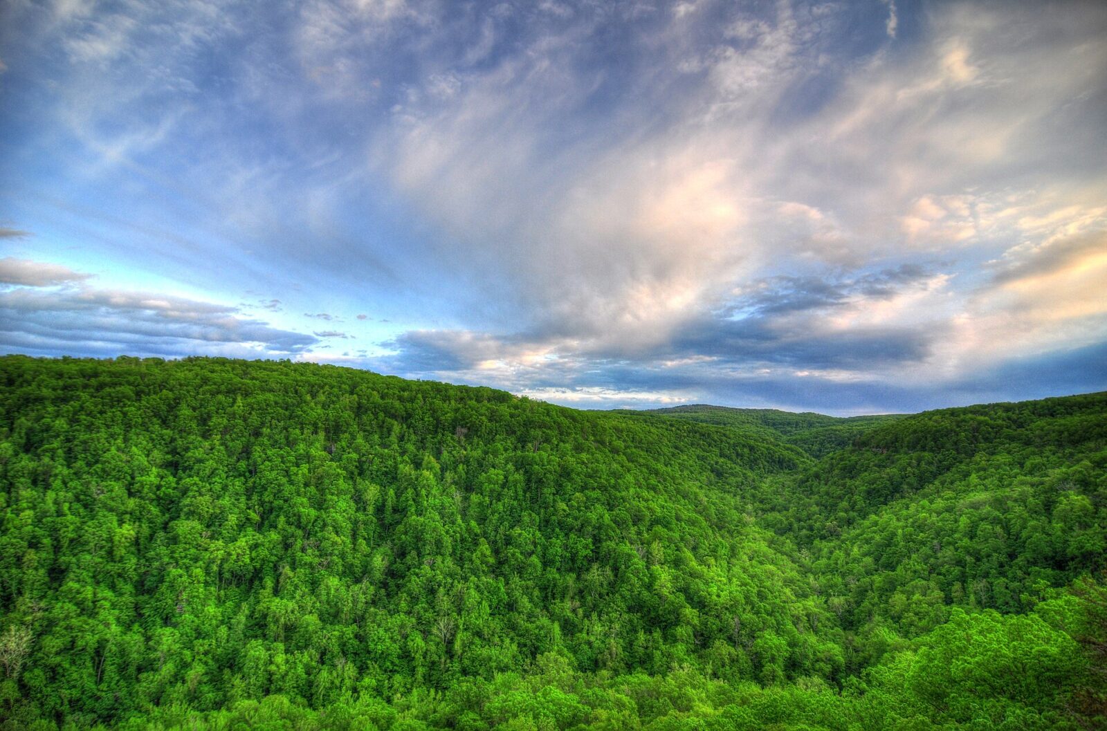
You’ve probably seen the photo before, even if you didn’t know where it was taken. A flat slab of sandstone juts out from a forested cliff like a hawk’s beak, with nothing under it but air and a sea of Ozark hills rolling away to the horizon.
That’s Hawksbill Crag, also called Whitaker Point, and it’s probably the most photographed spot in Arkansas. The good news: you don’t need to be a serious hiker to see it. The Hawksbill Crag Whitaker Point Trail is only about 3 miles round trip.
The catch? The drive to the trailhead is on a steep gravel road, the hike back is uphill, and the crag itself has no railings and a long, deadly drop. This guide covers everything in simple words: distance, directions, coordinates, the route step by step, sunrise and fall color tips, camping and how to stay safe.
Cover photo: Hawksbill Crag (Whitaker Point), Arkansas. Photo via Wikimedia Commons (free license; see file page for author)
Hawksbill Crag Whitaker Point Trail: The Short Answer
The Hawksbill Crag Whitaker Point Trail is a 2.7–3 mile out-and-back hike in the Upper Buffalo Wilderness of the Ozark National Forest, near Ponca and Boxley in northwest Arkansas. The trailhead is about 6 miles up gravel Cave Mountain Road from Highway 21 (coordinates 35.8984, -93.4580). Most people need 2–3 hours. The hike goes downhill first and uphill on the way back, and it’s rated easy to moderate. There’s no fee or permit, no restroom and no water. The crag is an unfenced sandstone ledge, and people have died falling from it, so stay well back from the edge.
Hawksbill Crag at a Glance
| Detail | Information |
|---|---|
| Other names | Whitaker Point, Whitaker Point Trail |
| Location | Upper Buffalo Wilderness, Ozark National Forest, Newton County, Arkansas |
| Nearest towns | Boxley, Ponca, Kingston, Jasper |
| Distance | About 2.7–3 miles round trip (1.4–1.5 miles each way) |
| Time | 2–3 hours with photo stops |
| Route type | Out-and-back (with an optional loop near the bluff) |
| Elevation change | Roughly 400 feet, downhill going in, uphill coming back |
| Difficulty | Easy to moderate |
| Trailhead road | Cave Mountain Road (County Road 5), about 6 miles of steep gravel |
| Fees and permits | None for day hiking |
| Open | 24 hours, year-round |
| Restroom and water | None at the trailhead |
| Dogs | Allowed on a leash |
| Best for | Sunrise, sunset, fall color and photography |
| Main dangers | Unfenced cliff edges, slick rock, rough road after rain |
Are Hawksbill Crag and Whitaker Point the Same Place?
Yes. Hawksbill Crag is the name of the rock itself, because its pointed shape looks like a hawk’s bill. Whitaker Point is the name of the point of land and the trail, taken from nearby Whitaker Creek. Maps, apps and signs use both names, sometimes together. It’s one hike, not two.
Where Is Hawksbill Crag in Arkansas?
Hawksbill Crag is in the Upper Buffalo Wilderness, a roadless area of about 12,000 acres inside the Ozark National Forest. Congress protected it as wilderness in 1974. It sits at the very top of the Buffalo River watershed, a few miles upstream from Boxley Valley and Ponca.
One thing that surprises people: the trail is not part of Buffalo National River, the national park next door. It’s run by the U.S. Forest Service. That’s why the rules differ a little: for example, dogs are allowed here on a leash, but not on many nearby park trails.
The trail to the crag is also the only official trail in the whole Upper Buffalo Wilderness. The Forest Service describes it as “developed but unmarked,” so don’t expect blazes or signposts along the way.
Can You See the Buffalo River From Hawksbill Crag?
Not really. The crag looks out over the forested valley of Whitaker Creek, which flows into the upper Buffalo. You’ll see a huge sweep of wild Ozark hills, but not the river itself. If a river view is what you want, the Centerpoint to Goat Trail hike to Big Bluff looks straight down on the Buffalo River.
Hawksbill Crag Whitaker Point Map and Coordinates
| Point | GPS coordinates | Use it for |
|---|---|---|
| Trailhead / parking (Forest Service) | 35.8984, -93.4580 | Driving directions |
| Hawksbill Crag overlook (approximate) | 35.8913, -93.4404 | Checking your map on the trail |
Important: put the trailhead coordinates into your GPS, not the crag. Some phone apps try to route you straight to the overlook on old roads that don’t go there.
The route in order: Trailhead on Cave Mountain Road → downhill through forest → small stream crossing (about 1 mile; Haley Falls just off-trail to the right) → trail splits: right branch along the bluff edge, left branch higher in the woods → bluff-top views → Hawksbill Crag (about 1.4–1.5 miles) → back the same way.
Cell service is weak or missing on Cave Mountain Road and the trail. Download an offline map (AllTrails, Gaia or onX) before you leave Jasper, Harrison or Fayetteville.
How to Get to the Hawksbill Crag Trailhead
Honestly, the drive is often harder than the hike. Here’s the simple version.
- Get to Boxley Valley. From Ponca, take Highway 43 south to where it meets Highway 21, then follow Highway 21 south through Boxley Valley.
- Turn onto Cave Mountain Road. Just before Highway 21 crosses the Buffalo River bridge, turn right (west) onto Cave Mountain Road, also called County Road 5. The sign is small and sometimes missing.
- Climb about 6 miles of gravel. The road goes steeply uphill right away, with sharp turns, loose rock and ruts.
- Pass Cave Mountain Church and cemetery. The trailhead is a little over half a mile past them.
- Park at the “Wilderness Access” lot. The trail starts across the road from the parking area.
Driving Times to the Trailhead
| From | Approximate drive |
|---|---|
| Boxley Valley (Highway 21) | 20–30 minutes (the 6 gravel miles are slow) |
| Ponca | 35–45 minutes |
| Jasper | About 1 hour |
| Harrison | About 1 hour 15 minutes |
| Fayetteville / Bentonville | About 1 hour 45 minutes – 2 hours |
Do You Need 4WD for Cave Mountain Road?
Usually not in dry weather, but high clearance helps. Lots of people make it in ordinary cars by driving slowly and picking their line around the ruts. Local tourism offices still suggest a truck or 4WD, because conditions change a lot.
- Dry weather: most cars are OK if driven slowly.
- After heavy rain: the steep first mile can be slick and washed out. Low cars may struggle.
- Ice or snow: skip it unless you have 4WD and experience.
- Rental cars: check your agreement; many don’t cover damage on unpaved roads.
Parking at the Trailhead
The lot is small. On sunny fall weekends it fills early, and cars line the road. If you park on the shoulder, pull fully off so trucks and rescue vehicles can get by. There’s no fee, no restroom and no drinking water, so stop in Boxley, Ponca or Jasper first.
Hawksbill Crag Trail Distance and Difficulty
How Long Is the Hike?
You’ll see numbers from 2.7 to 3 miles round trip. AllTrails lists about 2.7 miles. Tourism guides usually round up to 3. GPS watches often show a bit more because people wander between viewpoints on the bluff. For planning, use 3 miles.
How Long Does It Take?
| Part of the hike | Typical time |
|---|---|
| Trailhead to Hawksbill Crag (mostly downhill) | 35–60 minutes |
| Time at the crag and bluff | 20–45 minutes |
| Back to the car (mostly uphill) | 45–70 minutes |
| Total | About 2–3 hours |
How Hard Is It?
Easy to moderate. Some guides call it easy, others moderate, and both are fair. Here’s why it can feel harder than “3 miles” suggests:
- Upside-down hike: you walk downhill to the crag, so the climb comes at the end when you’re tired.
- Roots and rocks: the path is dirt, roots and loose stones, and leaves hide them in fall.
- Mud: after rain, the low spots near the stream get sloppy.
- Heights: the last half mile runs near the bluff edge, which can make some people nervous.
Is It Good for Beginners and Kids?
Yes for most fit beginners in dry weather; just take the climb back slowly. If you’re new to hiking, our hiking for beginners guide covers the basics.
Kids can do the walking easily, but the crag is the problem. There are no railings and the drop is well over 100 feet. Keep small children within arm’s reach (or holding hands) near the bluff, and think twice with toddlers who like to run.
Hiking Hawksbill Crag Whitaker Point Trail: Step by Step
1. Start Across the Road From the Lot
The trail leaves from the opposite side of Cave Mountain Road. There’s usually a wilderness sign and a register box. Signing in takes ten seconds and helps rescuers if something goes wrong.
2. Walk Down Through the Forest
The first stretch heads gently downhill through oak and hickory woods. In spring, you’ll find wildflowers and bright new leaves; in fall, a crunchy carpet of red and gold. The path is wide and easy to follow, though there are no trail markers.
3. Cross the Stream (and Look for Haley Falls)
At about the 1-mile mark, the trail dips to cross a small stream. When there’s water flowing (mainly winter and spring, or after rain), look to the right over the bluff for Haley Falls, a seasonal waterfall. It’s named after a six-year-old girl who got separated from her group in this area and was found safe here after two nights in the woods. In dry months, especially late summer and October, it’s often just a damp rock.
4. Choose Your Path at the Fork
After the stream, the trail splits. The right branch follows the bluff edge, with big views nearly the whole way. The left branch stays higher and farther from the drop. A nice option: go out along the bluff and come back on the higher path. If you’re nervous about heights or have kids with you, take the left branch both ways.
5. Walk the Bluff Top
For about the last half mile, the trees open up on your right and you get your first views over the Upper Buffalo Wilderness: ridge after ridge of forest with no roads or houses in sight. There are plenty of rocky spots to rest along here. Stay on the main path. Little side trails often lead straight to the edge.
6. Reach Hawksbill Crag
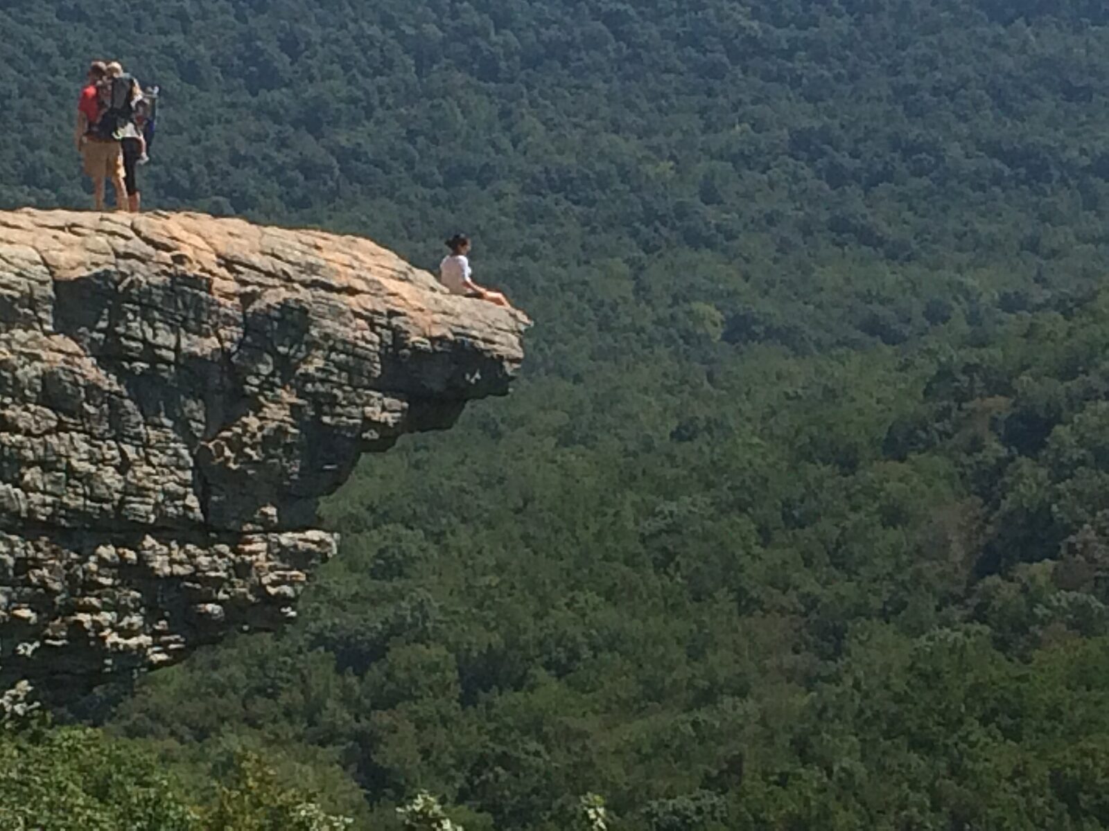
Then you round a corner and there it is: the crag sticking out from the bluff, exactly like the photos. The best view of its shape is from the bluff beside it, not from standing on it. From the side, you see the full “beak” with the valley behind it.
7. Head Back (Save Some Energy)
Return the way you came, or take the upper path at the fork. Remember that it’s uphill now. Drink some water and eat a snack before you start, and give yourself enough daylight. The forest gets dark quickly after sunset.
Is Hawksbill Crag Safe? What You Need to Know
The trail is safe. The crag is where people get hurt. It’s an open ledge with no railings, and the drop below it is well over 100 feet. People have died here. In 2016 a University of Arkansas student died after falling from the bluff, and in 2019 a 20-year-old college student on a class trip fell about 100 feet while moving into position for a photo.
That’s not meant to scare you off. Thousands of people visit safely every year. It’s just a reminder that the famous “standing on the edge” photos make it look safer than it is.
Simple Safety Rules
- Never walk backward near the edge while framing a photo.
- Stay off the crag when it’s wet, icy, windy or dark. Sandstone gets slick fast.
- Don’t jump, run or do poses like headstands or dangling your feet.
- Keep kids and dogs close, with dogs on a short leash.
- Remember that the edge is loose. Bluff edges can crumble; stay a body length back.
- Tell someone your plan, as there’s little cell service.
- Call 911 in an emergency if you can find a signal; Newton County handles rescues here.
Other Things to Watch For
- Black bears: the Forest Service has posted alerts about increased bear activity in the forest. Keep food packed away, and never feed wildlife.
- Fire danger: in fall 2026, fire danger has been rated very high. Check burn bans before lighting any campfire or stove.
- Ticks, chiggers and copperheads in warm months; wear repellent and watch where you put your hands.
- Getting lost after dark: the trail has no blazes. Carry a headlamp.
Hawksbill Crag Sunrise: Is It Worth Going Early?
For many photographers, yes. On cool mornings, fog often fills the valleys below the crag, and the first light turns the hills gold and pink. It’s also quieter than midday.
How to Plan a Sunrise Hike
- Work backward: plan to be at the crag 20–30 minutes before sunrise, start hiking an hour before that, and leave town early enough to drive Cave Mountain Road slowly in the dark.
- Stay close: sleep in Ponca, Boxley, Jasper or a nearby campground so the morning drive is short.
- Bring two lights: a headlamp and a backup (your phone doesn’t count).
- Take the upper path in the dark, not the bluff-edge path.
- Set up well back from the edge and wait for real daylight before walking near the crag.
- Dress warm: mornings on the bluff are chilly even in spring and fall.
Sunrise vs. Sunset
| Sunrise | Sunset |
|---|---|
| Fewer people | Busier, especially on weekends |
| Chance of valley fog | Warm evening light on the hills |
| Hike in during the dark | Hike out (uphill) in the dark |
| Drive the gravel road at night going in | Drive the gravel road at night going out |
Hawksbill Crag Photos: Best Shots and Tips
- The classic side view: shoot from the bluff just before the crag, so the whole “beak” and the valley are in the frame. This is the famous angle.
- A person for scale: a friend standing safely in the middle of the crag (not at the tip) shows how big it is. Use a timer or a friend rather than walking backward with a phone.
- Wide valley shots: use a wide lens or your phone’s 0.5x mode on foggy mornings.
- Trail details: mossy boulders, Haley Falls in spring and colorful leaves make good shots on the way.
- Drones: not allowed. Drones count as motorized equipment, which is banned in federal wilderness areas.
Hawksbill Crag in Fall: When to See Peak Color
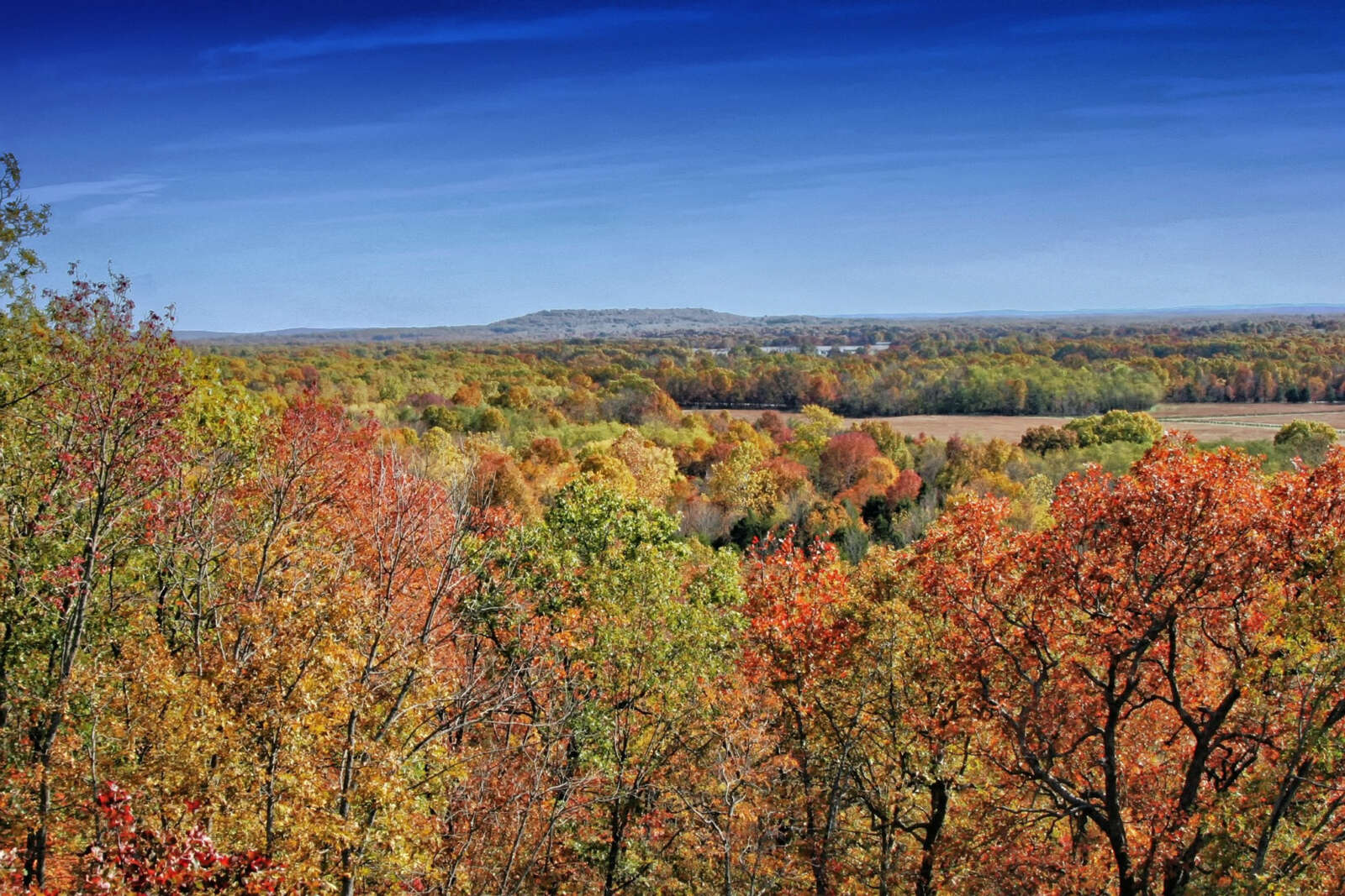
Fall is the crag’s most famous season. The oaks, maples and hickories in the valley turn red, orange and gold, and the gray sandstone stands out beautifully against them.
- Peak color: usually the last week of October into early November. A warm, dry fall can push it later or make colors duller.
- Crowds: peak weekends are very busy. Go on a weekday or at sunrise.
- Footing: fallen leaves hide roots and rocks, and they’re slippery on the sandstone.
- Layers: mornings can be near freezing, while afternoons can feel warm on the climb out.
- Waterfalls: fall is usually dry in the Ozarks, so Haley Falls may not be running.
Right now (late October 2026): it’s prime fall-color time in the Boxley and Ponca area. Expect a busy lot on weekends, and note that the Forest Service has rated wildfire danger very high, so be careful with any flame.
Best Time of Year to Visit
| Season | What you’ll get | Watch out for |
|---|---|---|
| Spring (March–May) | Wildflowers, dogwoods, flowing Haley Falls, green hills | Mud, storms, a slick road after rain |
| Summer (June–August) | Lush shade on the trail, long days | Heat, humidity, ticks and chiggers, hazy views |
| Fall (October–November) | Peak color, cool air, foggy sunrises | Crowds and full parking |
| Winter (December–February) | Quiet trail, clear views through bare trees, icicles | Ice on the crag and road; short days |
Best time of day: sunrise for fog and quiet, or a weekday morning for easy parking. Midday in summer is the least pleasant.
Hawksbill Crag Reviews: What Hikers Say
Hawksbill Crag is one of the highest-rated hikes in Arkansas. On AllTrails, the Whitaker Point Trail has nearly 6,000 reviews and a rating close to 5 stars. Reading through reviews, the same points keep coming up:
- “Worth every minute”: the view is the clear winner.
- “The road was the hardest part”: many surprised by the steep gravel climb.
- “Easy going, harder coming back”: the uphill return catches people out.
- “Go early”: weekends and fall afternoons are crowded at the crag.
- “Scary edges”: people who don’t like heights enjoy it more from the bluff beside the crag.
Hawksbill Crag Camping: Where to Stay Overnight
Camping near the crag is a great way to catch sunrise. There’s no developed campground at the trailhead, but you have a few options.
Primitive Camping in the Upper Buffalo Wilderness
Primitive (backcountry) camping is generally allowed in the wilderness with no fee or permit. Follow Leave No Trace rules, camp well back from the trail, water and the bluff edge, and never camp on the crag. Check current fire restrictions and burn bans first; in fall 2026, fire danger has been very high. There’s no reliable water, so carry all you need.
Campgrounds Nearby
- Steel Creek Campground (Buffalo National River): a beautiful spot on the river beneath Roark Bluff, near Ponca, with tent and horse sites. Book ahead on Recreation.gov in fall.
- Kyles Landing Campground: more remote, reached by a very steep, rough road, so it’s best with high clearance.
- Private campgrounds and cabins: around Ponca, Boxley and Jasper, including outfitters with cabins and RV sites.
Lodging
For a roof over your head, look at cabins in Ponca and Boxley (closest), small inns in Jasper, or chain hotels in Harrison. Fall weekends book up weeks ahead.
What to Bring
- Shoes with good grip: hiking boots or trail runners, not flip-flops.
- Water: at least 1 liter per person, 2 in summer.
- Snacks to enjoy at the crag.
- Offline map and a charged phone (a small power bank helps).
- Headlamp for sunrise, sunset or short winter days.
- Layers and a light rain jacket (see our waterproof hiking jacket guide).
- Bug spray and tick check in warm months.
- Small first-aid kit and a trash bag to pack out everything.
Common Mistakes to Avoid
- Navigating to the crag instead of the trailhead.
- Driving Cave Mountain Road fast or in a low car after heavy rain.
- Forgetting the climb back and running out of water or daylight.
- Arriving at noon on a fall Saturday and finding no parking.
- Taking risky edge photos.
- Expecting a Buffalo River view. The crag overlooks Whitaker Creek valley.
Simple Plans for Your Visit
Easy Half Day
Drive in mid-morning on a weekday, hike to the crag at an easy pace, eat a snack on the bluff, and be back at your car in about 2.5 hours. In the afternoon, drive through Boxley Valley.
Sunrise Photo Trip
Stay in Ponca or Boxley. Leave about two hours before sunrise, hike in by headlamp on the upper path, and set up back from the edge. After sunrise, take the bluff path back while the light is still soft.
Full Day in the Buffalo River Area
- Morning: Hawksbill Crag.
- Midday: lunch in Jasper or Ponca.
- Afternoon: Lost Valley Trail (easy, about 2.3 miles) for waterfalls and a cave.
- Evening: watch for wild elk in the Boxley Valley fields at dusk.
Have a second day and strong legs? Add the Centerpoint to Goat Trail hike to Big Bluff, a harder 6-mile trip with a cliff-edge view straight down to the Buffalo River.
Nearby Hikes and Sights
| Place | Round trip | Difficulty | Why go |
|---|---|---|---|
| Hawksbill Crag (Whitaker Point) | About 3 miles | Easy–moderate | Arkansas’s most famous overlook |
| Lost Valley Trail | About 2.3 miles | Easy | Waterfalls, a natural bridge and Eden Falls Cave; great for kids |
| Centerpoint to Goat Trail (Big Bluff) | About 6 miles | Strenuous | Narrow ledge high above the Buffalo River |
| Hemmed-In Hollow | About 5 miles | Strenuous | A tall waterfall after rain |
| Boxley Valley | Drive | Easy | Wild elk, historic barns and fall color |
Love famous rock viewpoints? Also see Devils Bridge Trail in Sedona.
Hawksbill Crag Whitaker Point Trail FAQs
How long is the Hawksbill Crag Whitaker Point Trail?
About 2.7–3 miles round trip. Plan on 2–3 hours, including time at the crag.
Are Hawksbill Crag and Whitaker Point the same?
Yes. Hawksbill Crag is the rock, and Whitaker Point is the name of the point and trail. It’s the same hike.
How hard is the hike?
Easy to moderate. It goes downhill to the crag and uphill back, on rocky, rooty dirt trail.
Where is Hawksbill Crag?
In the Upper Buffalo Wilderness of the Ozark National Forest, near Boxley and Ponca in Newton County, northwest Arkansas.
What are the Hawksbill Crag trailhead coordinates?
About 35.8984, -93.4580, on Cave Mountain Road. Navigate to the trailhead, not to the crag.
Do you need 4WD to get to Hawksbill Crag?
Not usually in dry weather, but Cave Mountain Road is steep, rutted gravel. High clearance is safer, and 4WD helps after rain or in ice.
Is there a fee or permit?
No. Day hiking is free, and the trailhead is open 24 hours.
Are dogs allowed at Hawksbill Crag?
Yes, on a leash. Keep them on a short leash near the bluff.
Has anyone died at Hawksbill Crag?
Yes. There have been fatal falls, including in 2016 and 2019. The crag has no railings, so stay well back from the edge.
Is Hawksbill Crag good for sunrise?
Yes, it’s one of the best sunrise spots in Arkansas, often with fog in the valleys. Hike in by headlamp and stay off the edge until it’s light.
When is peak fall color?
Usually late October to early November, depending on the weather that year.
Can you camp at Hawksbill Crag?
Not on the crag. Primitive camping is generally allowed in the surrounding wilderness, and there are campgrounds like Steel Creek nearby.
Is there a restroom at the trailhead?
No, and there’s no drinking water either. Plan ahead in Boxley, Ponca or Jasper.
Is the Hawksbill Crag Whitaker Point Trail Worth It?
Without a doubt. Very few short hikes give you a view this famous for this little effort. In about an hour and a half of walking, you go from a gravel road to one of the most recognizable spots in the American South.
Drive the road slowly, go early, save energy for the climb back, and enjoy the crag from a safe spot. Do that, and the Hawksbill Crag Whitaker Point Trail will easily be one of the best memories of your Arkansas trip.
Official Information
- Ozark-St. Francis National Forest: Whitaker Point (Hawksbill Crag) Trailhead
- Upper Buffalo Wilderness Area
- Big Piney Ranger District (Jasper): (870) 446-5122