
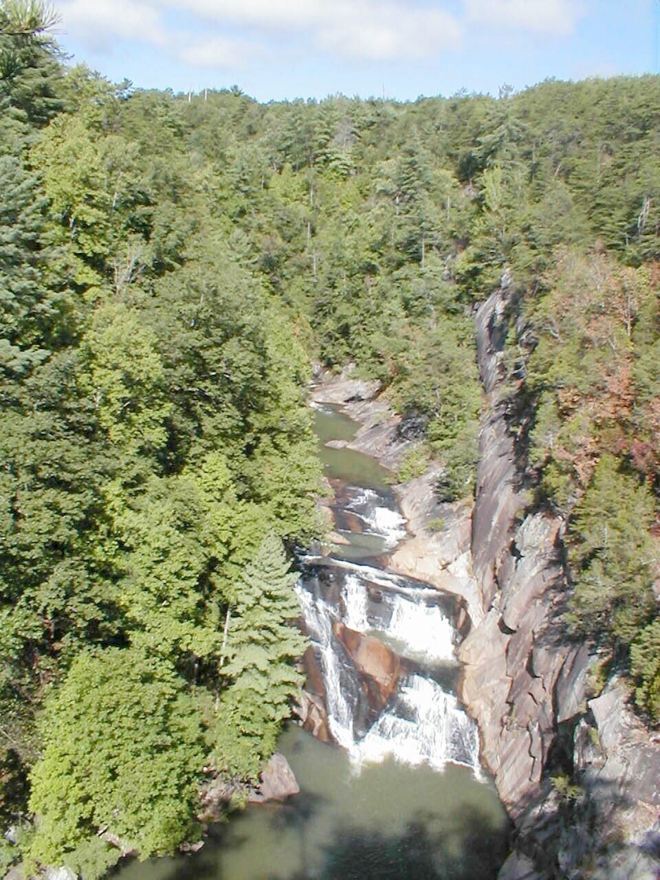
Standing at the first overlook behind the visitor center, it’s hard to believe you’re in Georgia. The ground just drops away. Nearly 1,000 feet below, the Tallulah River squeezes between walls of gray rock, tumbling over one waterfall after another. People have called it the “Grand Canyon of the South” and the “Niagara of the South” for more than 150 years.
The Tallulah Gorge hiking trails let you see it from every angle: from easy rim paths with railings, from a swaying suspension bridge 80 feet above the river, and, if you get a permit, from the boulders of the gorge floor itself.
But the trails are very different from each other. One is a gentle stroll; another is more than 1,000 metal stairs. This guide explains each route in plain words, plus permits, the waterfalls, the fall 2026 closure dates, parking, maps, kids and dogs, and simple plans for your visit.
Cover photo: Tallulah Gorge, Georgia. Photo via Wikimedia Commons (free license; see file page for author)
Tallulah Gorge Hiking Trails: The Short Answer
Tallulah Gorge State Park in Tallulah Falls, Georgia, has about 20 miles of trails around a 2-mile-long, nearly 1,000-foot-deep gorge. The best first hike is the North and South Rim Trails (about 3 miles round trip together, easy to moderate, with overlooks of the waterfalls). The Hurricane Falls Trail adds the 80-foot-high suspension bridge but involves more than 1,000 metal stairs out and back; no permit is needed. Only the Gorge Floor Trail needs a free permit, given out in person at the Interpretive Center, limited to 100 people a day. Parking costs $10 (Georgia ParkPass). The gorge floor and south staircase close on water release days, including weekends in late October and November 2026.
Tallulah Gorge Trails at a Glance
| Trail | Distance | Difficulty | Permit? | Dogs? | Highlight |
|---|---|---|---|---|---|
| North Rim Trail | About 0.75 mile one way | Easy–moderate | No | Yes, leashed | Overlooks, L’Eau d’Or Falls, Wallenda tower |
| South Rim Trail | About 0.75 mile one way | Moderate | No | Yes, leashed | Tempesta and Hurricane Falls views |
| Hurricane Falls Trail (loop) | About 2 miles | Strenuous (stairs) | No | No | Suspension bridge, base of Hurricane Falls |
| Gorge Floor Trail | About 2–3 miles, varies | Very strenuous | Yes (free, daily limit) | No | Boulder-hopping, Sliding Rock, Bridal Veil Falls |
| Bill and Dustie MacKay Trail (old Shortline) | About 1.7–3 miles | Easy, paved | No | Yes, leashed | Flat old rail line, bikes and strollers |
| Stoneplace Trail | About 10 miles round trip | Moderate–strenuous | Yes (free) | Check with park | Long forest hike to Tugalo Lake |
| High Bluff Loop | Adds about 5 miles to Stoneplace | Strenuous | Yes (free) | Check with park | Quiet backcountry |
Distances are approximate. Apps like AllTrails record slightly different numbers depending on which overlooks you visit.
Fall 2026 Closures: Check Before You Go
Georgia Power releases extra water from Tallulah Dam on certain weekends each spring and fall. On those days, the river roars, kayakers come from all over, and the waterfalls look incredible from the rim. But for safety, the gorge floor and the south staircase close, and no gorge floor permits are issued.
| Fall 2026 dates when the gorge floor and south staircase are closed |
|---|
| October 31 and November 1 |
| November 7 and 8 |
| November 14 and 15 |
| November 21 and 22 |
- Still open on those days: the North and South Rim overlooks (great for watching the high water) and other rim trails.
- Terrora Day Use Area beach: closed for construction in 2026, so there’s no swimming or kayaking on the lake there until it reopens.
- Hot days: when the heat index reaches “extreme caution,” the park can close the staircases from noon.
- Storms and high water can close the gorge floor with little notice.
Dates can change, so check the official Tallulah Gorge State Park page or call the park at 706-754-7981 before driving up.
Which Tallulah Gorge Trail Should You Hike?
| If you want… | Choose |
|---|---|
| The best views with the least effort | North Rim Trail |
| To see all the main waterfalls from above | North + South Rim Trails |
| The suspension bridge | Hurricane Falls Trail |
| A real adventure, scrambling over rocks | Gorge Floor Trail (permit) |
| A flat walk with a stroller or bike | Bill and Dustie MacKay Trail |
| A long, quiet forest hike | Stoneplace Trail (permit) |
| To bring your dog | Rim trails or the paved trail |
The Best Tallulah Gorge Hiking Trails, One by One
1. North Rim Trail: Best for First-Time Visitors
Start here. The North Rim Trail begins right behind the Jane Hurt Yarn Interpretive Center and runs about three-quarters of a mile along the edge of the gorge, with numbered overlooks along the way. Most have railings.
- What you’ll see: L’Eau d’Or Falls and Hawthorne Pool, the deep walls of the upper gorge, and Tallulah Falls Dam, finished in 1913.
- History stop: the old steel tower used by Karl Wallenda for his famous 1970 tightrope walk (more on that below).
- The path: dirt and gravel with roots, short climbs and some steps. It’s easy for most people.
- Time: 30–60 minutes out and back.
Best for: first-timers, families, photographers, and anyone who doesn’t want to do the stairs.

2. South Rim Trail: Best for Waterfall Views
The South Rim Trail is on the other side of the gorge, also about three-quarters of a mile. You reach it by crossing the suspension bridge (the stairs) or by walking across the road bridge over Tallulah Falls Dam on US 441.
- What you’ll see: Tempesta Falls and Hurricane Falls from above, plus long views down the gorge. Overlook 7 is a favorite for Hurricane Falls.
- The path: a bit hillier than the North Rim, with uneven ground.
- Time: 45–75 minutes.
Tip: AllTrails’ popular “North and South Rim Loop” links both rims into one walk of about 3 miles, often using the suspension bridge in the middle. It’s one of the most-reviewed hikes in Georgia.
3. Hurricane Falls Trail: The Suspension Bridge
This is the hike everyone talks about. Metal staircases zigzag down the gorge wall to a suspension bridge hanging about 80 feet above the river. It wobbles a little as people walk across it, and the view straight down to the rapids is unforgettable.
From the bridge, more stairs drop to a platform at the base of Hurricane Falls, the tallest falls in the gorge at nearly 100 feet. Then you climb all the way back out.
- Distance: about 2 miles round trip including the rims.
- Stairs: about 310 from the rim down to the bridge, and more than 1,000 in total if you go down to the falls platform and back out. The number most often quoted for the full staircase is 1,099.
- Time: 1.5–2.5 hours for most people.
- Permit: not needed.
- Dogs: not allowed on the stairs.
How hard are the stairs, really?
Going down is fine. Coming up is like climbing a 40- or 50-story building, in the heat, with open metal steps. There are landings and benches where you can rest, so you can take as long as you need. If you can climb several flights of stairs without stopping, you’ll be fine. If stairs hurt your knees or lungs, enjoy the bridge view from the rim overlooks instead.
Smart move: go down only as far as the bridge (about 310 steps), cross it, and climb up the other side to the South Rim. You still get the best views with fewer stairs.
4. Gorge Floor Trail: For Experienced Hikers With a Permit
This is the wild one. Below the falls platform, there’s no real path, just giant boulders, slick rock, river crossings and steep scrambles. The most popular route follows the river down to Sliding Rock and Bridal Veil Falls, a natural water slide where permit holders can swim in summer.
- Distance: about 2–3 miles depending on route, but it feels much longer.
- Difficulty: very strenuous. You’ll use your hands to climb.
- Time: 2–4 hours.
- Not for: beginners, young kids, dogs, or anyone in sandals.

5. Bill and Dustie MacKay Trail: The Easy Paved Walk
Formerly called the Shortline Trail, this paved path follows the old Tallulah Falls Railway line, which once brought crowds of tourists from Atlanta to the falls. It’s flat, smooth and great for strollers, wheelchairs, bikes and leashed dogs. You won’t get big gorge views, but it’s a relaxing walk through the woods.
6. Stoneplace Trail and High Bluff Loop: The Long Hikes
Want to escape the crowds? Stoneplace Trail is about 10 miles round trip on an old red-dirt roadbed down to Tugalo Lake. Add the High Bluff Loop for about 15 miles total. Both need a free permit from the Interpretive Center. They’re shared with mountain bikers, and part of the route crosses a wildlife management area, so wear bright orange in hunting season.
Tallulah Gorge Permits: Simple Explanation
| Activity | Permit needed? |
|---|---|
| North and South Rim Trails | No |
| Hurricane Falls stairs and suspension bridge | No |
| Bill and Dustie MacKay paved trail | No |
| Gorge Floor Trail (including Sliding Rock) | Yes, free, limited to 100 per day |
| Stoneplace Trail and High Bluff Loop | Yes, free |
| Rock climbing | Yes |
How to Get a Gorge Floor Permit
- Arrive early. Permits are handed out in person at the Jane Hurt Yarn Interpretive Center starting at 8 a.m., first come, first served. You can’t reserve them online.
- Bring everyone in your group. Each hiker needs a permit.
- Wear proper shoes. Rangers check footwear. Flip-flops and Crocs aren’t allowed.
- Listen to the short safety talk and carry your permit.
- Know the cutoff. Permits stop being issued in the early-to-mid afternoon, and on busy fall weekends all 100 can be gone by mid-morning.
No permits are issued on water release days or when the river is too high.
Tallulah Gorge Waterfalls: All Six Explained
The Tallulah River drops about 500 feet in just one mile through the gorge, over six main waterfalls. From upstream to downstream:
| Waterfall | Best way to see it |
|---|---|
| L’Eau d’Or Falls | North Rim overlooks, above Hawthorne Pool |
| Tempesta Falls | South Rim overlooks |
| Hurricane Falls (tallest, nearly 100 ft) | Suspension bridge and the platform at its base |
| Oceana Falls | Downstream view from the bridge and South Rim |
| Bridal Veil Falls (Sliding Rock) | Gorge floor only, with a permit |
| Lodore Falls | Distant views; lower gorge |
When do the falls look best? After a few days of rain, in spring, or on water release weekends. In a dry late summer, normal flow can be thin because the dam holds most of the water back.
A Little History That Makes the Hike Better
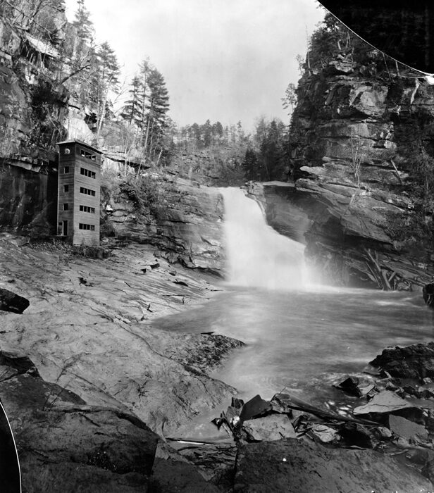
- A Victorian tourist hot spot: in the late 1800s, a railroad brought visitors from Atlanta, and the town of Tallulah Falls had hotels lined along the rim. On busy Sundays, up to 2,000 people came to hear the falls roar.
- The dam (1913): Georgia Railway and Power built Tallulah Falls Dam to make electricity for Atlanta. Most of the water was diverted, the falls went quiet, and tourism faded.
- Karl Wallenda (1970): on July 18, 1970, the 65-year-old high-wire artist walked a tightrope across the gorge, about 700 feet above the river, stopping twice to do headstands. His towers still stand on the rims.
- The state park (1993): Georgia Power and the state opened Tallulah Gorge State Park, about 2,689 acres, and started the scheduled water releases that bring the falls back to life a few weekends a year.
Tallulah Gorge Trail Map, Directions and Parking
Where to Start
Start at the Jane Hurt Yarn Interpretive Center, 338 Jane Hurt Yarn Drive, Tallulah Falls, GA 30573. It has restrooms, a gift shop, exhibits, paper trail maps and the permit desk. The North Rim Trail and the stairs both start right behind it.
Getting There
| From | Approximate drive |
|---|---|
| Atlanta | About 1 hour 45 minutes – 2 hours (I-85 or GA 400, then US 441 north) |
| Clayton, GA | About 15 minutes |
| Helen, GA | About 40 minutes |
| Greenville, SC | About 1 hour 30 minutes |
| Asheville, NC | About 2 hours |
Hours, Fees and Parking
- Park hours: 8 a.m. to dark, every day.
- Parking: $10 per vehicle per day (Georgia ParkPass). An annual ParkPass covers all Georgia state parks.
- Trail fees: none beyond parking.
- Busy times: fall weekends and summer Saturdays. The main lot can fill, and the park sometimes limits entry, so arrive by 9 a.m.
Trail Map
The official Tallulah Gorge trail map (a free PDF from Georgia State Parks) shows the numbered overlooks, the staircases, the suspension bridge and the gorge floor route. Grab a paper copy at the Interpretive Center or download it before you go, as cell signal is patchy in the gorge.
Simple route in order: Interpretive Center → North Rim overlooks → top of the stairs → down to the suspension bridge → (optional) down to the Hurricane Falls platform → back to the bridge → up the south stairs → South Rim overlooks → walk back over the dam on US 441 or return the same way.
Best Time to Hike Tallulah Gorge
| Season | What it’s like | Watch for |
|---|---|---|
| Spring (March–May) | Strong waterfalls, wildflowers, mountain laurel; April release weekends | Rain, slick rock, gorge floor closures |
| Summer (June–August) | Green and lush; Sliding Rock swimming with a permit | Heat and humidity on the stairs; afternoon staircase limits |
| Fall (October–November) | Peak color in late October to early November; release weekends | Crowds, full parking, gorge floor closed on release days |
| Winter (December–February) | Quiet, clear views through bare trees | Ice on the metal stairs, short days |
Right now (late October 2026): fall color is near its peak around Tallulah Falls. Water release weekends begin October 31, which is perfect for big waterfall views from the rim, but plan around them if you want the gorge floor.
Hiking Tallulah Gorge With Kids and Dogs
- Little kids: the North Rim Trail and the paved MacKay Trail are ideal. Hold hands near the overlooks.
- Older kids: most active 8- to 12-year-olds love the suspension bridge. Just plan breaks on the climb back.
- Strollers and wheelchairs: not possible on the stairs. Some rim overlooks and the paved trail work.
- Dogs: welcome on leash on the rim trails and paved trail, but not on the Hurricane Falls stairs or the gorge floor. The metal grate steps hurt paws anyway.
Safety Tips
- Stay behind railings and on marked trails. The gorge walls are sheer.
- Never swim outside Sliding Rock, and only with a gorge floor permit. River levels can rise suddenly when the dam releases water.
- Carry water, especially for the stairs in summer.
- Wear shoes with good grip; the metal stairs and rocks get slippery when wet.
- Know your limits before heading down. Every step down is a step back up.
What to Bring
- Hiking shoes or sneakers with grip (required for the gorge floor)
- 1–2 liters of water per person
- Snacks
- Light layers and a rain jacket
- Sunscreen and bug spray
- Swimsuit and a dry bag if you have a gorge floor permit in summer
- Your phone with the trail map saved
Simple Tallulah Gorge Itineraries
Quick Visit (1–2 Hours)
Interpretive Center exhibits, then the North Rim Trail to the last overlook and back. You’ll see the gorge, L’Eau d’Or Falls and the Wallenda tower with almost no climbing.
Half Day (3–4 Hours)
North Rim overlooks, down the stairs to the suspension bridge, a side trip to the Hurricane Falls platform if your legs are happy, then up to the South Rim overlooks and back. This is the classic Tallulah Gorge day.
Full Day
Be at the Interpretive Center before 8 a.m. for a gorge floor permit. Hike the gorge floor to Sliding Rock in the morning, eat lunch in Tallulah Falls or Clayton, then walk the rims in the afternoon light. No permit? Spend the afternoon on the paved MacKay Trail or drive 25 minutes to nearby waterfalls such as Panther Creek or Minnehaha Falls.
Where to Stay Near Tallulah Gorge
- Tallulah Gorge State Park campground: tent, trailer and RV sites near Tallulah Falls Lake, plus a few walk-in sites. Book through Georgia State Parks.
- Clayton and Lakemont: cabins, inns and restaurants 10–20 minutes away.
- Helen: the Bavarian-style town is about 40 minutes away and has plenty of hotels.
Common Mistakes to Avoid
- Arriving at 11 a.m. hoping for a gorge floor permit on a fall Saturday.
- Planning the gorge floor on a water release weekend.
- Bringing a dog and then finding out it can’t go on the stairs.
- Doing the stairs at 2 p.m. in July with one small water bottle.
- Wearing flip-flops on wet metal steps.
Like waterfalls and gorges? Compare this with our guides to Linville Falls in North Carolina and the Alum Cave Trail in the Smoky Mountains.
Tallulah Gorge Hiking Trails FAQs
What is the best hike at Tallulah Gorge?
For most people, the North and South Rim Trails connected by the Hurricane Falls suspension bridge, about 2–3 miles in total. For an easy option, just do the North Rim.
How many stairs are at Tallulah Gorge?
About 310 steps from the rim to the suspension bridge, and more than 1,000 (often quoted as 1,099) for the full staircase down to the Hurricane Falls platform and back out.
Do you need a permit to hike Tallulah Gorge?
Only for the gorge floor, Stoneplace and High Bluff trails, and rock climbing. The rim trails, stairs and suspension bridge need no permit.
How do I get a gorge floor permit?
In person at the Interpretive Center from 8 a.m., first come, first served. They’re free, limited to 100 per day and can’t be reserved.
How high is the Tallulah Gorge suspension bridge?
About 80 feet above the river.
How long does it take to hike Tallulah Gorge?
The rim trails take 1–2 hours, the Hurricane Falls stairs 1.5–2.5 hours, and the gorge floor 2–4 hours.
Are dogs allowed at Tallulah Gorge?
Yes, on a leash on the rim trails and paved trail. Not on the stairs, suspension bridge route or gorge floor.
How much does it cost to visit?
$10 per vehicle per day for the Georgia ParkPass. Permits are free.
Is the gorge floor open during water releases?
No. In fall 2026, the gorge floor and south staircase close on October 31, November 1, 7, 8, 14, 15, 21 and 22.
Can beginners hike Tallulah Gorge?
Yes. The rim trails are fine for beginners. The stairs need decent fitness, and the gorge floor is for experienced hikers only. Our hiking for beginners guide can help you prepare.
How deep is Tallulah Gorge?
Nearly 1,000 feet deep and about 2 miles long.
Can you swim at Tallulah Gorge?
Only at Sliding Rock with a gorge floor permit, when conditions allow. The Terrora beach is closed for construction in 2026.
Are the Tallulah Gorge Hiking Trails Worth It?
Absolutely. Few places in the eastern U.S. pack this much drama into such short trails. In one morning, you can peer into a 1,000-foot canyon, cross a bouncing bridge above the rapids and stand at the foot of a roaring waterfall.
Pick the trail that fits your legs, check the release calendar, get there early and save some energy for the climb back. The Tallulah Gorge hiking trails will reward you either way.
Official Information
- Tallulah Gorge State Park (Georgia State Parks)
- Official Tallulah Gorge trail map (PDF)
- Park phone: 706-754-7981