

When the first real cold snap hits, a lot of people put their hiking boots away until spring. That’s a mistake.
Winter is the best time of year for some of the most beautiful trails in America. Death Valley, Joshua Tree, Big Bend and the Arizona desert are far too hot for hiking in summer, but from November to March they’re comfortable, quiet and full of soft, golden light. And if you love snow, places like Bryce Canyon, Grand Teton and Sequoia turn into something out of a fairy tale, with red rock towers dusted in white and giant trees standing in deep, silent snow.
This guide covers the 28 best winter hiking trails in the USA. We’ve split them into easy groups: warm desert hikes with no snow, red rock trails with a dusting of snow, snowy mountain hikes and snowshoe routes, and a few mild picks in the East, Florida and Hawaii. For every trail you’ll get the distance, how hard it is, the best winter months, and the things that actually trip people up in winter, like road closures, timed-entry reservations, icy steps and tire chains.
At the end you’ll also find a month-by-month guide, a simple packing list, an easy guide to microspikes vs. snowshoes, and honest safety tips.
Quick answer: What are the best winter hiking trails in the USA?
- Best warm winter hike: Golden Canyon to Red Cathedral, Death Valley (California)
- Best easy family hike: Hidden Valley and Barker Dam, Joshua Tree (California)
- Best near Las Vegas: Fire Wave (Valley of Fire) and Calico Tanks (Red Rock Canyon)
- Best near Phoenix: Peralta Trail to Fremont Saddle
- Best in Texas: Santa Elena Canyon, Big Bend
- Best snow and red rock: Queen’s Garden and Navajo Loop, Bryce Canyon (Utah)
- Best snowshoe hike: Taggart Lake, Grand Teton (Wyoming)
- Best snowy forest walk: General Sherman Tree and Big Trees Trail, Sequoia (California)
- Best winter hiking event: the annual Hocking Hills Winter Hike in Ohio (January 16, 2027)
Best Winter Hiking Trails at a Glance
| # | Trail | State | Distance (round trip) | Difficulty | Winter type |
|---|---|---|---|---|---|
| 1 | Golden Canyon to Red Cathedral | California | 3 mi | Moderate | Warm desert |
| 2 | Mosaic Canyon | California | Up to 4 mi | Moderate | Warm desert |
| 3 | Mesquite Flat Sand Dunes | California | About 2 mi | Easy to moderate | Warm desert |
| 4 | Natural Bridge | California | 1 mi | Easy | Warm desert |
| 5 | Hidden Valley, Barker Dam & Ryan Mountain | California | 1–3 mi | Easy to strenuous | Cool desert |
| 6 | Borrego Palm Canyon | California | About 3 mi | Easy to moderate | Warm desert |
| 7 | Fire Wave | Nevada | 1.5 mi | Easy | Warm desert |
| 8 | Calico Tanks | Nevada | 2.5 mi | Moderate | Cool desert |
| 9 | Peralta Trail to Fremont Saddle | Arizona | About 4.5 mi | Moderate | Warm desert |
| 10 | Camelback Mountain (Echo Canyon) | Arizona | About 2.3 mi | Very hard | Warm desert |
| 11 | Seven Falls (Sabino Canyon) | Arizona | 8.4 mi (less with shuttle) | Moderate | Warm desert |
| 12 | Picacho Peak (Hunter Trail) | Arizona | About 3.2 mi | Hard | Warm desert |
| 13 | Devils Bridge | Arizona | Varies by parking | Moderate | Mild red rock |
| 14 | Santa Elena Canyon | Texas | 1.6 mi | Easy to moderate | Warm desert |
| 15 | Lost Mine Trail | Texas | 4.8 mi | Moderate | Cool mountains |
| 16 | Devil’s Hall | Texas | 4.2 mi | Moderate to hard | Cool desert canyon |
| 17 | Queen’s Garden & Navajo Loop | Utah | About 3 mi | Moderate | Snowy red rock |
| 18 | Riverside Walk & Pa’rus Trail | Utah | 2.2–3.5 mi | Easy | Cold canyon |
| 19 | Delicate Arch | Utah | 3 mi | Moderate | Icy red rock |
| 20 | Emerald Lake | Colorado | About 3.6 mi | Moderate in snow | Snowy mountains |
| 21 | Taggart Lake | Wyoming | About 3 mi | Moderate in snow | Snowshoe |
| 22 | General Sherman Tree & Big Trees Trail | California | Under 1.5 mi each | Easy | Snowy forest |
| 23 | Lower Yosemite Fall & Mirror Lake | California | 1–2 mi (5 mi loop) | Easy | Snowy valley |
| 24 | Paradise snowshoe routes | Washington | Varies | Moderate | Deep snow |
| 25 | Old Man’s Cave to Ash Cave | Ohio | 6 mi one way | Moderate | Frozen waterfalls |
| 26 | Starved Rock canyons | Illinois | Varies | Easy to moderate | Frozen waterfalls |
| 27 | Anhinga Trail | Florida | 0.8 mi | Easy | Warm wetland |
| 28 | Manoa Falls & Koko Head | Hawaii | Short but varied | Easy to very hard | Tropical |
Distances come from park agencies wherever they publish them. Apps and blogs often show slightly different numbers, so treat every distance as “about.”
Jump to: Warm desert hikes · Snowy red rock · Snowy mountain hikes · East, Florida & Hawaii · Month by month · What to pack · Microspikes vs. snowshoes · Safety · FAQ
How We Picked These Winter Trails
A good summer hike isn’t always a good winter hike. A trail can be perfect in July and dangerous, closed or impossible to reach in January. So every trail on this list had to pass four simple tests:
- Winter makes it better, not worse. Cooler air, fewer crowds, snow on red rock, or frozen waterfalls.
- You can actually get there. The road or trailhead stays open in winter (sometimes with tire chains).
- The risk is manageable for a normal, prepared hiker. We left out avalanche-prone summits and winter mountaineering routes.
- There’s a mix. Short family walks, all-day desert climbs, and real snowshoe outings.
We checked each trail’s distance and winter rules against the National Park Service, state park and Forest Service websites, and noted the closures and reservations that catch people out. Conditions change fast in winter, so always check the official page the week you go.
Warm Desert vs. Snowy Winter Hiking: Which Is Right for You?
| Warm desert hiking | Snowy winter hiking | |
|---|---|---|
| Where | Southern California, Nevada, Arizona, West Texas | Utah high country, the Rockies, the Sierra, the Cascades |
| Typical day | Cold morning, sunny 50s–70s°F afternoon | Below freezing, snow on the trail |
| Biggest risks | Running out of water, getting lost, flash floods, cold nights | Ice, falls, cold, short days, avalanche terrain |
| Must-have gear | Water, sun hat, layers, map | Traction or snowshoes, warm layers, waterproof boots |
| Best for | Escaping winter, long hikes, families | Snow lovers, photographers, quiet trails |
Neither one is automatically “safer.” A sunny desert trail can still be dangerous if you run out of water or wander off route, and a short snowy trail can be hard when it’s covered in ice.
Best Warm Winter Hikes in the Desert Southwest
These are the trails to pick if you want to escape the cold. Most of them are far too hot to enjoy in summer, which is exactly why winter is their best season.
1. Golden Canyon to Red Cathedral — Death Valley, California
Distance: About 3 miles round trip to Red Cathedral
Difficulty: Moderate
Time: 1.5–2.5 hours
Trailhead: Golden Canyon parking area on Badwater Road, about 2 miles south of Highway 190
Best months: November to March
Golden Canyon is the hike that makes people fall in love with Death Valley. You walk up a wide wash between crumpled hills of yellow and gold rock, and the walls slowly close in around you. Near the end, a short, rougher section climbs to Red Cathedral, a towering wall of deep red cliffs that glows in the afternoon light.
Most people turn around at Red Cathedral. Stronger hikers can link Golden Canyon with Gower Gulch or Zabriskie Point for a longer loop through the badlands. See our full Golden Canyon Trail Death Valley guide for every route.
Winter tip: Even on a cool day, the sun in Death Valley is strong and there’s no shade. Carry more water than you think you need, and start early on weekends. The parking lot fills fast in peak season.
Good for: First-time visitors, photographers, anyone who wants big scenery on a short hike.
2. Mosaic Canyon — Death Valley, California
Distance: Up to 4 miles round trip (the best narrows are in the first half mile)
Difficulty: Moderate, with some rock scrambling
Time: 1–3 hours
Trailhead: End of the gravel Mosaic Canyon Road near Stovepipe Wells
Best months: November to March
Within a few minutes of leaving the car, Mosaic Canyon squeezes into a narrow slot of smooth, polished marble. Run your hand along the walls and they feel like glass. The canyon gets its name from the “mosaic” rock along the way, made of broken pieces of stone cemented back together. Our Mosaic Canyon Trail guide explains how to get past the boulder jam and dryfall.
You can turn around after the first narrows for a short, easy outing, or keep going up the wider canyon to a dry waterfall that blocks the way.
Winter tip: The polished rock is slippery, especially going down. Wear shoes with good grip. Never enter a narrow canyon if rain is in the forecast, as flash floods can happen even when it’s dry where you’re standing.
Good for: Kids who like scrambling (with help), and anyone who wants a slot-canyon feel without technical climbing.
3. Mesquite Flat Sand Dunes — Death Valley, California
Distance: About 2 miles round trip to the highest dune (there’s no set trail)
Difficulty: Easy to moderate (walking in sand is tiring)
Time: 1–2 hours
Trailhead: Dunes parking area on Highway 190, near Stovepipe Wells
Best months: November to March, at sunrise or sunset
The Mesquite Flat Dunes look exactly like the desert you picture in movies, with smooth ripples, sharp ridges and long shadows. The highest dune is only about 100 feet tall, but the dune field is wide, and once you’re a mile in, you’ll have whole slopes of untouched sand to yourself. Read our Mesquite Flat Sand Dunes hike guide for sunrise, photo and safety tips.
There’s no trail here. You just walk out and pick a direction. Most people aim for the tallest dune, which you can see from the parking area.
Winter tip: Go at sunrise. The light is soft, the wind is usually calm, and the sand is cool. Note where you parked, because every dune looks the same on the way back. Avoid windy days, when blowing sand stings your skin and eyes.
Good for: Photography, families, and a fun “first desert hike.”
4. Natural Bridge Canyon — Death Valley, California
Distance: 1 mile round trip
Difficulty: Easy (rocky, gentle uphill)
Time: About 45 minutes
Trailhead: Natural Bridge parking area, up a short gravel road off Badwater Road, 13.5 miles south of Highway 190
Best months: November to March
This short walk follows a rocky wash into a canyon where a massive stone bridge spans the path overhead. It’s one of the easiest ways to see how water shaped Death Valley. Past the bridge, the canyon continues a short way to a dry waterfall where the trail ends.
Winter tip: The gravel road is usually fine for regular cars when dry, but it can be washboarded and rough. Combine this hike with Badwater Basin and Artists Drive for an easy half day.
Good for: Families, short visits, and anyone who wants an easy win.
5. Hidden Valley, Barker Dam and Ryan Mountain — Joshua Tree, California
Distance: Hidden Valley 1-mile loop · Barker Dam 1.1-mile loop · Ryan Mountain 3 miles round trip
Difficulty: Easy (Hidden Valley, Barker Dam) to strenuous (Ryan Mountain)
Time: 30 minutes to 2.5 hours each
Best months: November to April

Joshua Tree is a favorite winter escape for people in Southern California. Daytime highs are often in the 50s and 60s°F, and the giant boulder piles and spiky Joshua trees look amazing in low winter light.
- Hidden Valley loops through a valley almost completely closed in by huge rocks. It’s the best first hike in the park.
- Barker Dam leads to an old ranch dam that can hold a small pond after a wet winter, plus a rock art site.
- Ryan Mountain climbs about 1,050 feet on rocky steps to one of the best views in the park. It’s short but steep.
Winter tip: Nights often drop below freezing, and the summit of Ryan Mountain can be windy and cold even when the parking lot feels warm. Bring a warm layer. For 15 more trails, see our guide to the best hikes in Joshua Tree National Park.
6. Borrego Palm Canyon — Anza-Borrego Desert State Park, California
Distance: About 3 miles round trip
Difficulty: Easy to moderate (rocky in places)
Time: 1.5–2.5 hours
Trailhead: West end of Borrego Palm Canyon Campground, near Borrego Springs
Best months: December to March (wildflowers can bloom in late winter after a wet year)
This is the most popular trail in California’s largest state park, and it’s easy to see why. The path follows a rocky canyon toward a hidden oasis of native California fan palms, one of the largest palm groves in the state. A small creek often runs through it in winter.
The canyon is also one of the best places in the area to spot desert bighorn sheep, the “borregos” the park is named after. Bring binoculars and scan the rocky slopes.
Winter tip: There’s a day-use fee, and dogs aren’t allowed on the trail. Give bighorn sheep plenty of space, as they rely on this water source.
Good for: Wildlife lovers and anyone visiting the San Diego area in winter.
7. Fire Wave — Valley of Fire State Park, Nevada
Distance: About 1.5 miles round trip
Difficulty: Easy
Time: About 1 hour
Trailhead: Fire Wave parking area on White Domes Road
Open: October 1 to mid-May (closed in summer for heat)
The Fire Wave is a dome of sandstone striped with swirling bands of red, pink and cream, like a frozen wave of color. It’s about an hour from the Las Vegas Strip, and it’s one of the most photographed spots in Nevada.
The trail crosses sand and open slickrock, so watch for the trail markers when you’re on the rock.
Two important closures:
- The Fire Wave and several other popular trails are closed every summer. In 2026 the closure began on May 15 and ran through the end of September.
- Nevada State Parks says the whole park closes for maintenance from December 1 to December 14 each year. Plan your December trip for later in the month.
Winter tip: Go in the late afternoon. The stripes look brightest in the warm light just before sunset. Add White Domes and the Seven Wonders Loop for a longer outing.
8. Calico Tanks — Red Rock Canyon, Nevada
Distance: About 2.5 miles round trip
Difficulty: Moderate (some scrambling up sandstone)
Time: 1.5–2.5 hours
Trailhead: Sandstone Quarry, on the Scenic Drive
Best months: November to April
Just 30 minutes from the Las Vegas Strip, Calico Tanks climbs through a canyon of red and orange sandstone to a natural rock basin (the “tank”) that can hold rainwater in winter. A short scramble beyond it leads to a view all the way to the Las Vegas skyline.
Reservation needed: From October 1 to May 31, you need a timed-entry reservation to drive the Scenic Drive between 8 a.m. and 5 p.m. Book on Recreation.gov, and book early for weekends.
Winter tip: Shady parts of the canyon can stay icy after a cold night. Sticky-soled shoes help on the sandstone.
9. Peralta Trail to Fremont Saddle — Superstition Mountains, Arizona
Distance: About 4.5 miles round trip
Elevation gain: About 1,400 feet
Difficulty: Moderate
Time: 3–4 hours
Trailhead: Peralta Trailhead, east of Phoenix (Tonto National Forest)
Best months: November to March

The Peralta Trail climbs steadily up a rocky canyon full of strange rock towers and hoodoos. Then, at Fremont Saddle, the view opens up and you’re suddenly face to face with Weaver’s Needle, a huge spire of rock that’s tied to the legend of the Lost Dutchman’s gold mine.
It’s a real workout, but the trail is easy to follow, and the payoff at the saddle is one of the best views in Arizona.
Winter tip: This trail is very busy on winter weekends. Arrive early to get a parking spot. The last stretch of dirt road to the trailhead can be rough after rain.
Want more Superstitions? The steeper Siphon Draw Trail to the Flatiron is a great winter challenge too.
10. Camelback Mountain via Echo Canyon — Phoenix, Arizona
Distance: About 2.3 miles round trip (the City of Phoenix lists 1.14 miles each way)
Elevation gain: About 1,400 feet
Difficulty: Rated “extremely difficult” by the city
Time: 2–3 hours
Hours: Sunrise to sunset
Best months: November to March
Camelback is Phoenix’s most famous hike, and it’s short but brutal. You climb steep, rocky slopes, grab metal handrails, and scramble up boulders to the 2,700-foot summit. From the top, the whole Valley of the Sun spreads out below you.
Winter is the only comfortable time to do it. Even then, take it seriously: rescues happen here every year.
Winter tip: Parking at Echo Canyon is small and fills fast, so arrive at sunrise on a weekday or use a rideshare. Dogs are not allowed. Skip it if the rock is wet after rain. If you want something gentler nearby, the Desert Botanical Garden has easy, flat desert trails.
11. Seven Falls via Bear Canyon — Sabino Canyon, Tucson, Arizona
Distance: About 8.4 miles round trip from the visitor center (shorter if you ride the Bear Canyon shuttle)
Elevation gain: About 1,400 feet
Difficulty: Moderate
Time: 4–5 hours (2–3 with the shuttle)
Trailhead: Sabino Canyon Recreation Area visitor center
Best months: December to March, especially after rain
Seven Falls is a series of waterfalls and pools stepping down a rocky cliff in the foothills of the Santa Catalina Mountains. In winter, after rain or snow higher up, water pours over every step. In a dry year, it may be just a trickle.
The trail follows Bear Canyon and crosses the creek about seven times before reaching the falls. The Bear Canyon shuttle saves you a few miles of flat walking each way. Shuttle tickets cost extra and aren’t included in the recreation area fee.
Winter tip: After heavy rain, the creek crossings can be deep and fast. If the water looks dangerous, turn back. Bring shoes you don’t mind getting wet. Dogs aren’t allowed.
12. Picacho Peak via the Hunter Trail — Arizona
Distance: 1.6 miles each way (about 3.2 miles round trip)
Elevation gain: About 1,400 feet
Difficulty: Hard (steep, with steel cables)
Time: 3–4 hours
Trailhead: Barrett Loop, Picacho Peak State Park (off I-10 between Phoenix and Tucson)
Best months: November to March
Picacho Peak is the odd-shaped mountain you see from I-10, and climbing it feels like a mini adventure. The Hunter Trail climbs to a saddle, then drops down the other side before steel cables help you up steep rock sections to the summit.
In late winter, after a wet year, the slopes around the park can turn gold with wildflowers.
Winter tip: Bring gloves for the cables. Arizona State Parks only allows leashed dogs as far as the saddle. This one is a bad idea if you’re nervous about heights.
13. Devils Bridge — Sedona, Arizona
Distance: Depends on where you park (much shorter with a high-clearance vehicle)
Difficulty: Moderate, with a steep final climb
Best months: November to March (snow is possible but usually melts fast)

Devils Bridge is the largest natural sandstone arch in the Sedona area, and you can walk out on top of it. Sedona sits higher than Phoenix, so winter days are cool and crisp, and a dusting of snow on the red rocks is one of the prettiest sights in Arizona.
Winter tip: After snow, the rock stairs near the top can be icy. Wait for the sun to melt them, or skip the bridge walk. See our full Devils Bridge Trail guide for parking and route options.
14. Santa Elena Canyon Trail — Big Bend, Texas
Distance: About 1.7 miles round trip
Difficulty: Easy to moderate (a creek crossing and some paved steps)
Time: About 1–1.5 hours
Trailhead: End of Ross Maxwell Scenic Drive
Best months: November to March

Santa Elena Canyon is one of the most dramatic places in Texas. The Rio Grande cuts straight through a wall of limestone about 1,500 feet high, with the United States on one side and Mexico on the other. The trail takes you right inside the mouth of the canyon, along the river, until the walls meet the water and the path simply ends.
To get started, you first have to cross Terlingua Creek. Most of the time it’s dry, muddy or ankle-deep. After heavy rain, it can be impossible to cross.
Winter tip: Wear old shoes for the mud. If the creek is deep and fast, don’t try it. The drive along Ross Maxwell Scenic Drive is half the fun, so stop at the viewpoints on the way.
15. Lost Mine Trail — Big Bend, Texas
Distance: About 4.8 miles round trip
Difficulty: Moderate
Time: 3–4 hours
Trailhead: Lost Mine Trailhead, on the road into the Chisos Basin
Best months: November to March

If Santa Elena shows you the low desert, the Lost Mine Trail shows you Big Bend’s mountains. It climbs through juniper, oak and pine to a rocky ridge with huge views over Juniper Canyon and down toward Mexico.
Winter tip: The Chisos Mountains are much higher than the desert floor, so it can be freezing up here even when the river is warm. Ice is possible on shady switchbacks after a cold front. For more, see our Lost Mine Trail guide. Want a bigger day? Try Emory Peak, the highest point in the park.
16. Devil’s Hall — Guadalupe Mountains, Texas
Distance: 4.2 miles round trip
Difficulty: Moderate to hard (rocky wash, boulder hopping)
Time: 2.5–4 hours
Trailhead: Pine Springs Trailhead
Best months: November to March (on calm days)
Devil’s Hall starts as a normal trail, then drops into a rocky wash where you pick your own way over boulders. Near the end you reach the Hiker’s Staircase, a set of natural stone “steps” made of thin rock layers. Just beyond is Devil’s Hall itself, a narrow hallway of rock with walls around 100 feet high.
Winter tip: The Guadalupe Mountains are famous for strong winter winds, so check the forecast. The park advises avoiding this trail when it’s wet because of flash flood risk. Fit hikers can pair it with our guides to Guadalupe Peak (the highest point in Texas) or McKittrick Canyon.
Best Winter Hikes With Snow on Red Rock (Utah)
Southern Utah in winter is magic. Snow sits on red and orange rock, the crowds disappear, and hotel prices drop. The catch: trails can be icy, so traction devices are a must.
17. Queen’s Garden and Navajo Loop — Bryce Canyon, Utah
Distance: About 3 miles round trip (combination loop)
Elevation change: About 600 feet
Difficulty: Moderate
Time: 2–3 hours
Trailhead: Sunrise Point (to finish at Sunset Point)
Best months: December to March for snow
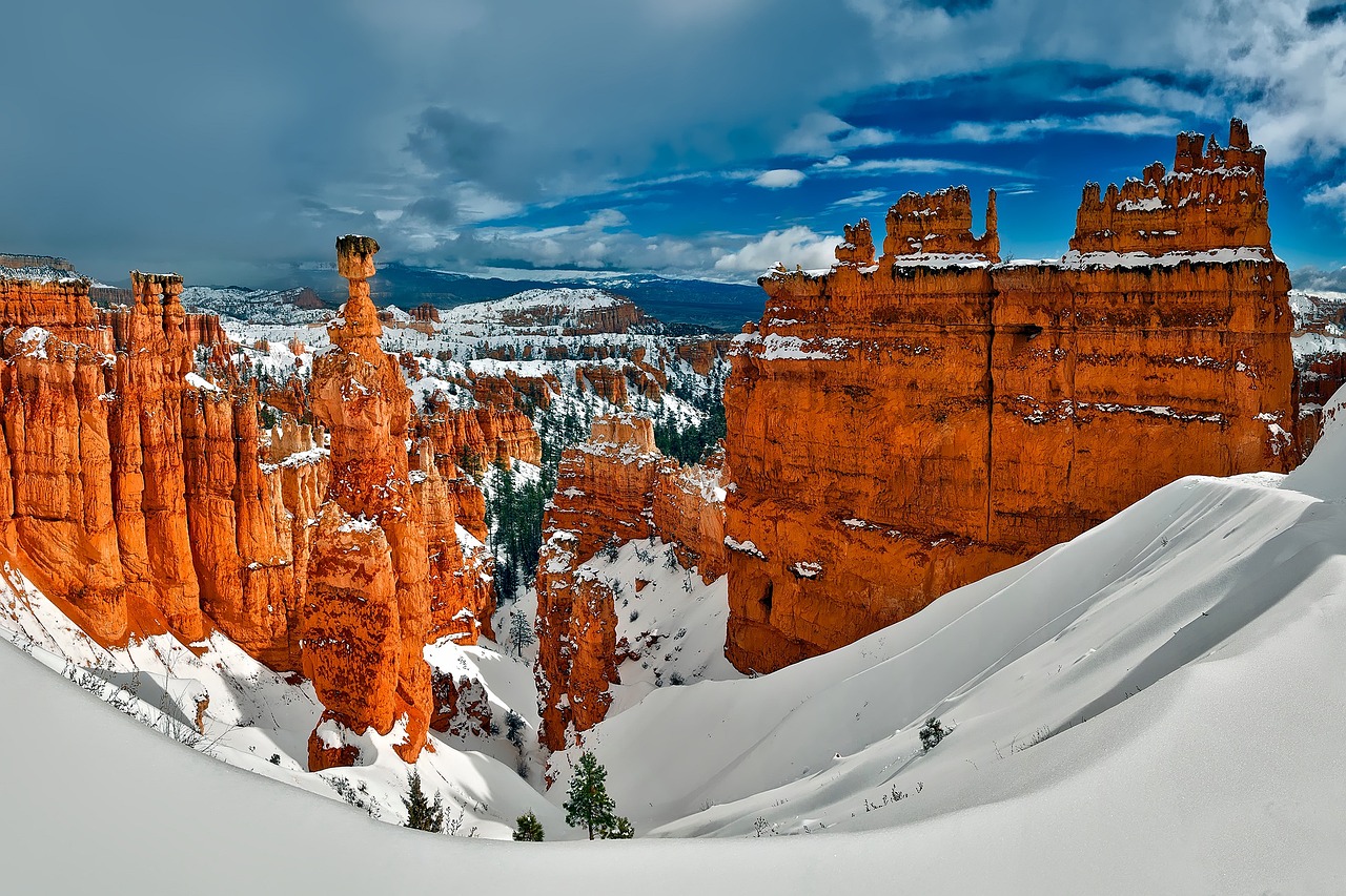
If you only do one snowy hike in America, make it this one. You walk down from the rim among hundreds of orange rock spires called hoodoos, each one topped with fresh snow. At the bottom you wander through quiet pine forest before climbing back up a set of steep switchbacks.
Important winter rules:
- The Wall Street side of the Navajo Loop closes every winter because of falling rock. Use the Two Bridges side, which stays open.
- The park says traction devices are strongly recommended in winter, and shoes not made for hiking are the top cause of rescues and injuries here.
- The NPS suggests going clockwise in winter: down Queen’s Garden from Sunrise Point, up the Navajo Loop to Sunset Point.
Winter tip: Bryce sits at around 8,000 to 9,000 feet, so it’s much colder than Zion. Mornings well below freezing are normal. Plan your trip with our guides to things to do in Bryce Canyon and Bryce Canyon with kids.
18. Riverside Walk and Pa’rus Trail — Zion, Utah
Distance: Riverside Walk about 2.2 miles round trip · Pa’rus Trail about 3.5 miles round trip
Difficulty: Easy
Time: 1–2 hours each
Best months: December to February for quiet trails
Zion is lower and milder than Bryce, and in winter you can have its most famous canyon almost to yourself. The Riverside Walk follows the Virgin River to the start of The Narrows, with tall walls, hanging gardens and icicles on the cliffs. The paved Pa’rus Trail follows the river near the visitor center and is one of the few Zion trails where dogs and bikes are allowed.
The big winter bonus: driving. Most of the year, Zion Canyon Scenic Drive is shuttle-only. In recent winters, private cars were allowed on the Scenic Drive when the shuttle wasn’t running, usually for a few weeks in early December and again from early January until the shuttle restarted in March. The shuttle has also run over the Christmas holidays. Check the NPS shuttle page for exact 2026–27 dates.
Winter tip: The upper parts of trails like Angels Landing and Observation Point can be icy and dangerous in winter. Hiking The Narrows in winter needs a drysuit and serious cold-water gear. For easier options, see our guide to the Emerald Pools and the best time to visit Zion.
19. Delicate Arch — Arches, Utah
Distance: 3 miles round trip
Difficulty: Moderate (steady climb on bare rock)
Time: 2–3 hours
Best months: November to March
Utah’s most famous arch is far less crowded in winter, and a little snow on the red rock makes photos even better. The hike climbs steadily over open slickrock, then follows a narrow ledge around a cliff to a sudden view of the arch.
Winter tip: After snow, the slickrock and the final ledge can be icy. Microspikes make a big difference. Sunset is beautiful, but bring a headlamp for the walk down because winter days are short. Read our honest guide to how hard Delicate Arch really is, and for a longer outing, see the Devils Garden Trail.
Best Snowy Winter Hikes and Snowshoe Trails
These trails are for people who want snow. You’ll need warm layers and, depending on conditions, microspikes or snowshoes. All of them are suitable for prepared beginners when you stay on the main routes.
20. Emerald Lake Trail — Rocky Mountain National Park, Colorado
Distance: About 3.6 miles round trip
Difficulty: Moderate in snow
Time: 2–3 hours
Trailhead: Bear Lake
Best months: December to March

In summer this is one of the busiest trails in Colorado. In winter it’s a peaceful snowshoe or microspike walk past three frozen lakes: Nymph Lake, Dream Lake and finally Emerald Lake, tucked right under the cliffs of Hallett Peak.
Winter tip: Wind can be fierce, especially at Dream Lake and Emerald Lake. Bring a windproof shell, goggles or sunglasses, and warm gloves. The slopes above Emerald Lake are avalanche terrain, so stay on the main route and check the Colorado avalanche forecast. Never walk out onto the ice unless you’re sure it’s safe. Details in our Emerald Lake Trail guide.
21. Taggart Lake — Grand Teton, Wyoming
Distance: About 3 miles round trip
Difficulty: Moderate in snow
Time: 2–3 hours on snowshoes
Trailhead: Taggart Lake Trailhead, about 3 miles northwest of Moose
Best months: January to March
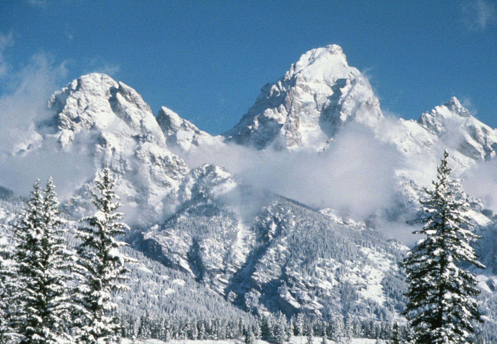
Taggart Lake is the classic winter outing in Grand Teton. The trail crosses open, snowy flats and a little forest to a lake right at the foot of the Tetons. On a clear day, with the peaks covered in white, it’s one of the most beautiful winter views in the West.
Why it works in winter: The Teton Park Road closes to cars from November 1 to April 30 between the Taggart Lake Trailhead and Signal Mountain Lodge, but the Taggart Lake parking area stays open. The closed road is groomed for skiing and snowshoeing, so you can also walk or snowshoe along it with the mountains beside you.
Winter tip: Rent snowshoes in Jackson. In past winters, the park has also offered ranger-led snowshoe walks from this trailhead, so check the park’s winter page for this season’s schedule. Read more in our guides to things to do in Grand Teton and where to stay near Grand Teton.
22. General Sherman Tree and Big Trees Trail — Sequoia, California
Distance: General Sherman: short walk from the winter parking area · Big Trees Trail: a level loop under 1 mile around Round Meadow (about 1.3 miles from the Giant Forest Museum)
Difficulty: Easy
Time: 30–60 minutes each
Best months: December to March

Standing next to the General Sherman Tree, the largest tree on Earth by volume, is amazing any time of year. Doing it with snow on the ground and almost nobody around is unforgettable. The nearby Big Trees Trail circles a snowy meadow ringed by giant sequoias, and in summer it’s a boardwalk and paved path.
Important winter rules:
- Tire chains or cables are often required on park roads from fall through spring. Carry them.
- In winter, General Sherman parking moves to a small accessible lot close to the tree, and spaces are very limited.
- The Generals Highway between Lodgepole and Grant Grove often closes for snow from about early January to mid-March.
Winter tip: The General Sherman path is one of the few trails where snow is cleared, but it can still be very icy, so traction devices help a lot. More ideas in our list of the best hikes in Sequoia National Park.
23. Lower Yosemite Fall and Mirror Lake — Yosemite, California
Distance: Lower Yosemite Fall 1-mile loop · Mirror Lake 2 miles round trip (5-mile loop around the lake)
Difficulty: Easy
Time: 30 minutes to 2 hours
Best months: December to March
Yosemite Valley stays open all winter, and its easy valley walks are lovely after a snowfall. The Lower Yosemite Fall loop is open year-round and leads to the base of the final drop of North America’s tallest waterfall. On cold mornings you may see ice building up around the falls.
The flat walk to Mirror Lake is best in winter and spring, when the lake fills with water and reflects Half Dome and Mount Watkins. By late summer, it’s usually just a meadow.
Winter tip: Valley paths can be snowy and icy. Higher roads like Glacier Point Road and Tioga Road close in winter, so most winter hiking happens on the valley floor. See all our picks in the best hikes in Yosemite.
24. Paradise Snowshoe Routes — Mount Rainier, Washington
Distance: Varies (ranger-led walks have covered about 1.5 miles in 2 hours)
Difficulty: Moderate
Best months: Late December to March
Paradise is one of the snowiest places in the country, and in winter it’s buried under many feet of snow. Snowshoeing out from the Jackson Visitor Center, with Mount Rainier towering above you, feels like being in the Alps.
Important winter rules:
- Every vehicle must carry tire chains from November 1 to May 1, even 4WD and AWD.
- The road from Longmire to Paradise opens each day only when it’s safe and closes nightly. Uphill traffic usually stops around 4 p.m.
- Never walk, ski or snowshoe on the Paradise road, even when it’s closed, because snowplows work on it.
Winter tip: In past winters, rangers have led free weekend snowshoe walks from Paradise. Check the park’s winter page before you go, and check the avalanche forecast if you plan to go beyond the easy areas. Read our Skyline Trail guide to see what this area looks like in summer.
Best Winter Hikes in the East, Florida and Hawaii
25. Old Man’s Cave to Ash Cave — Hocking Hills, Ohio
Distance: About 6 miles one way
Difficulty: Moderate (stairs, icy rock)
Time: 3–5 hours
Best months: January and February for frozen waterfalls

In a cold snap, the waterfalls and sandstone gorges of Hocking Hills turn into columns and curtains of ice. The classic route links Old Man’s Cave, Cedar Falls and Ash Cave, a huge horseshoe-shaped rock shelter.
Don’t miss: The Annual Hocking Hills Winter Hike follows this 6-mile route every January. The next one is Saturday, January 16, 2027, with starts between 9 and 11 a.m. It’s free, and a shuttle bus takes hikers back from Ash Cave to Old Man’s Cave.
Winter tip: The stone stairs get very slippery. Microspikes are a smart idea. See our list of the best hikes in Hocking Hills.
26. Starved Rock Canyons — Illinois
Distance: Varies (short walks to several canyons)
Difficulty: Easy to moderate
Best months: January and February
About 90 minutes from Chicago, Starved Rock has sandstone canyons where seasonal waterfalls freeze into tall ice falls during a long cold spell. It’s one of the best winter walks in the Midwest.
Winter tip: Trails and stairs can be very icy, and some areas can close for safety or repairs. Check our Starved Rock hiking guide for the latest closures before you go.
27. Anhinga Trail — Everglades, Florida
Distance: About 0.8 miles round trip
Difficulty: Easy (paved path and boardwalk)
Time: 30 minutes to 1 hour (longer if you love wildlife)
Trailhead: Royal Palm area
Best months: December to April (dry season)
Want to hike in a T-shirt in January? The Everglades is your place. Winter is the dry season, when water levels drop and animals crowd around the deep pools along this short boardwalk. You can expect alligators, turtles, herons and the anhinga bird drying its wings in the sun.
Winter tip: Mosquitoes are far fewer in the dry season, but bring repellent anyway. Go early in the morning for the most wildlife and fewer people.
28. Manoa Falls and Koko Head — Oahu, Hawaii
Manoa Falls: Short rainforest walk to a tall waterfall · Easy to moderate (muddy)
Koko Head: 1,048 old railway-tie steps straight up a volcanic crater · Very hard
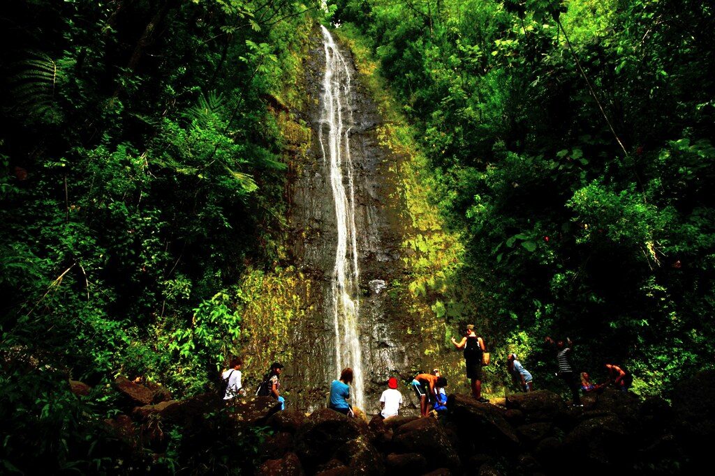
For the ultimate escape from winter, Oahu has trails right next to Honolulu. Manoa Falls is a jungle walk under giant trees to a tall, thin waterfall. Koko Head is a lung-busting climb up a straight line of old railway ties to huge ocean views.
Winter tip: Winter is Hawaii’s wetter season, so Manoa can be very muddy and the falls are often fuller. Start Koko Head early before the sun gets strong. Read our Manoa Falls guide and Koko Head guide.
Bonus: More Great Winter Hikes
- Garden of the Gods, Colorado: paved, mostly flat paths among red rock fins with snowy Pikes Peak behind. One of the easiest winter walks in the Rockies.
- Echo Canyon Loop, Chiricahua (Arizona): open year-round through a forest of rock pinnacles, with snow and ice possible from November.
- Lighthouse Trail, Palo Duro Canyon (Texas): a mostly flat canyon hike that’s far more pleasant in winter than in the summer heat.
- Siphon Draw to the Flatiron (Arizona): a steep, rocky winter challenge east of Phoenix.
- Guadalupe Peak (Texas): the highest point in Texas, best on a calm winter day.
Best Easy Winter Hikes for Beginners and Families
New to hiking, or hiking with kids? These are short, well-marked and low-risk when you check conditions first:
- Natural Bridge, Death Valley (1 mile)
- Mesquite Flat Sand Dunes, Death Valley (turn around whenever you like)
- Hidden Valley and Barker Dam, Joshua Tree (about 1 mile each)
- Fire Wave, Valley of Fire (1.5 miles)
- Santa Elena Canyon, Big Bend (1.7 miles)
- Riverside Walk and Pa’rus Trail, Zion
- Big Trees Trail and General Sherman, Sequoia
- Lower Yosemite Fall, Yosemite (1 mile)
- Anhinga Trail, Everglades (0.8 miles)
New to hiking in general? Our hiking for beginners guide covers the basics.
Best Winter Hikes by Region
- California: Golden Canyon, Mosaic Canyon, Mesquite Dunes, Natural Bridge, Joshua Tree, Borrego Palm Canyon, Sequoia, Yosemite
- Nevada (near Las Vegas): Fire Wave, Calico Tanks
- Arizona: Peralta Trail, Camelback, Seven Falls, Picacho Peak, Devils Bridge, Echo Canyon Loop, plus Hieroglyphic Trail, Wind Cave, Piestewa Peak, Cathedral Rock and Boynton Canyon
- Texas: Santa Elena Canyon, Lost Mine, Emory Peak, Devil’s Hall, Guadalupe Peak, Palo Duro Canyon
- Utah: Bryce Canyon, Zion, Delicate Arch
- Rocky Mountains: Emerald Lake (Colorado), Garden of the Gods (Colorado), Taggart Lake (Wyoming)
- Pacific Northwest: Paradise at Mount Rainier
- Midwest: Hocking Hills (Ohio), Starved Rock (Illinois)
- Florida and Hawaii: Anhinga Trail, Manoa Falls, Koko Head
Best Winter Hikes by Month
November
The desert hiking season starts. Death Valley, Joshua Tree, Valley of Fire, Red Rock and Big Bend become comfortable. High-elevation parks are often in an awkward in-between stage, with early snow but not enough for snowshoes.
December
Great for desert trails and quiet national parks. Remember that Valley of Fire closes December 1 to 14 for maintenance. Days are the shortest of the year, so start early. Snow builds up at Bryce, Grand Teton and Rainier.
January
Peak snowshoe season begins in Grand Teton, Rocky Mountain and Rainier. Frozen waterfalls appear in Ohio and Illinois in cold snaps. The Hocking Hills Winter Hike takes place on January 16, 2027.
February
Often the best month overall. Deep snow in the mountains, mild desert days, and (after a wet winter) the first wildflowers in Anza-Borrego and the Arizona desert.
March
Desert temperatures start rising, and crowds return for spring break. Mountain parks can still have full winter conditions. Zion’s shuttle usually restarts in early March.
What to Wear and Pack for Winter Hiking

The secret to staying comfortable in winter is layers. You’ll warm up quickly while climbing and cool down fast when you stop, so you need to be able to add and remove clothes easily.
The simple 3-layer system
- Base layer: A thin top made of wool or synthetic fabric that pulls sweat off your skin. Avoid cotton, which stays wet and makes you cold.
- Warm layer: A fleece or light puffy jacket.
- Outer layer: A wind- and waterproof shell. See our picks for the best waterproof hiking jacket and waterproof hiking pants.
Winter hiking checklist
- Warm hat, gloves, and a spare pair of wool socks
- Waterproof boots for snow, or waterproof shoe covers and gaiters to keep snow out
- Microspikes or snowshoes for icy or snowy trails (see the next section)
- Trekking poles for balance on ice and steep ground
- Plenty of water (desert) or an insulated bottle so it doesn’t freeze (snow)
- High-energy snacks, since your body burns more in the cold
- Headlamp, because winter days are short
- Sunglasses and sunscreen (snow and desert sun both reflect strongly)
- Offline map and a charged phone. Cold drains batteries fast, so keep your phone in an inside pocket.
- Small first aid kit and an emergency blanket
- For remote areas, a weather radio. See our guide to the best emergency radios for hiking.
After the hike, a boot dryer gets your boots ready for the next day. Camping in the cold? See our picks for the best ultralight sleeping bag.
Microspikes vs. Crampons vs. Snowshoes: What Do You Need?
| Gear | What it is | Use it when | Good for trails like |
|---|---|---|---|
| Microspikes | Small chains and short spikes that stretch over your boots | Packed snow or ice on a normal trail | Bryce, Delicate Arch, General Sherman, Hocking Hills |
| Snowshoes | Wide frames that stop you sinking into deep snow | Fresh, deep, soft snow | Taggart Lake, Emerald Lake, Paradise |
| Crampons | Large, sharp spikes for steep ice and mountaineering | Steep, icy mountain routes (needs training) | Not needed for any hike on this list |
Simple rule: If you’re sinking in past your ankles, you need snowshoes. If you’re slipping, you need microspikes. Many outdoor shops in park gateway towns rent both.
Winter Hiking Safety Tips
- Check official conditions the week you go. Roads, trails and reservations change constantly in winter.
- Start early. In December, you may only have about 9 to 10 hours of daylight. Plan to be back at the car well before dark.
- Carry tire chains for mountain parks like Sequoia, Yosemite and Mount Rainier, and know how to put them on.
- Drink water even when it’s cold. You still lose a lot of water through breathing and sweating, and you won’t feel thirsty.
- Watch for hypothermia: uncontrollable shivering, clumsy hands, slurred speech or confusion. Get the person warm and dry right away.
- Watch for frostbite: numb, white or waxy skin on fingers, toes, nose or ears.
- Stay out of narrow canyons when rain is in the forecast. Flash floods can arrive with no warning.
- Avoid avalanche terrain (steep, open, snowy slopes) unless you have training and gear. Check the local avalanche forecast.
- Never walk on frozen lakes unless you’re sure the ice is safe.
- Tell someone your plan and when you’ll be back.
- Turn around early. The summit will be there next time.
Winter Hiking With Dogs
Dog rules vary a lot. Most national park trails don’t allow dogs at all. On this list, dogs aren’t allowed on Camelback Mountain, Borrego Palm Canyon or the Sabino Canyon trails, and at Picacho Peak leashed dogs can only go as far as the saddle. In Zion, the Pa’rus Trail is the one trail where leashed dogs are allowed. For winter dog hikes, state parks and national forests are usually your best bet. Bring dog booties for ice and salt, and a warm coat for short-haired dogs.
Frequently Asked Questions
What are the best winter hiking trails in the USA?
For warm winter hiking, Golden Canyon in Death Valley, Hidden Valley in Joshua Tree, the Fire Wave in Nevada, the Peralta Trail in Arizona and Santa Elena Canyon in Texas are among the best. For snow, try the Queen’s Garden and Navajo Loop in Bryce Canyon, Taggart Lake in Grand Teton, or the General Sherman Tree in Sequoia.
Where can I hike in winter without snow?
Low-elevation deserts are your best bet: Death Valley, Joshua Tree and Anza-Borrego in California, Valley of Fire and Red Rock Canyon near Las Vegas, the Phoenix and Tucson areas in Arizona, and Big Bend in Texas. Florida and Hawaii are warm all winter too. Higher spots like the Chisos Mountains, Sedona and Joshua Tree’s peaks can still see occasional snow and ice.
What is the warmest place to hike in winter in the US?
Hawaii and South Florida are the warmest. On the mainland, Death Valley, the Phoenix area, Anza-Borrego and the low parts of Big Bend usually have the mildest winter days.
Is winter a good time to hike in Death Valley?
Yes, it’s the best time. Late fall through early spring is Death Valley’s hiking season. Summer is dangerously hot, and the park advises against hiking after 10 a.m. in summer on trails like the sand dunes.
Can you hike in Grand Teton National Park in winter?
Yes. Most hiking becomes snowshoeing or cross-country skiing. The Teton Park Road closes to cars from November 1 to April 30 between Taggart Lake Trailhead and Signal Mountain Lodge, and it’s groomed for skiing and snowshoeing. Taggart Lake is the most popular winter outing.
Is Bryce Canyon worth visiting in winter?
Absolutely. Snow on the orange hoodoos is one of the most beautiful sights in the national parks. Bring traction devices, and remember that the Wall Street section of the Navajo Loop closes every winter.
Can you drive into Zion Canyon in winter?
Often, yes. When the shuttle isn’t running, private vehicles can usually drive the Zion Canyon Scenic Drive. In recent years that’s been for a few weeks in early December and from early January to early March, with the shuttle running over the holidays. Check the NPS shuttle page for current dates.
Do I need a reservation for Red Rock Canyon in winter?
Yes, if you enter the Scenic Drive between 8 a.m. and 5 p.m. from October 1 to May 31. Reservations are made on Recreation.gov.
Is the Fire Wave open in winter?
Yes. It’s closed in summer for heat (in 2026, from May 15 through September), but open from fall to spring. Note that Valley of Fire State Park closes completely from December 1 to 14 each year for maintenance.
Do I need tire chains to visit Sequoia or Mount Rainier in winter?
At Mount Rainier, all vehicles must carry tire chains from November 1 to May 1. At Sequoia and Kings Canyon, chains or cables are often required on park roads from fall through spring. Carry them and practice putting them on before you go.
Do I need microspikes for winter hiking?
On icy trails, yes. They’re cheap, light and prevent the most common winter injury: slipping and falling. They’re especially useful at Bryce Canyon, Delicate Arch, Sequoia and Hocking Hills.
Can beginners go winter hiking?
Yes. Start with short, popular trails like Hidden Valley in Joshua Tree, Natural Bridge in Death Valley, Lower Yosemite Fall or the Anhinga Trail. Check conditions, dress in layers, start early and turn back if the trail gets icier than you’re comfortable with.
How do I stay warm on a winter hike?
Wear layers you can take off and put back on, avoid cotton, keep your hands, head and feet covered, eat snacks often, and bring a warm jacket to put on as soon as you stop.
Are there good winter hikes in the Midwest and East?
Yes. Hocking Hills in Ohio and Starved Rock in Illinois are famous for frozen waterfalls. The Hocking Hills Winter Hike on January 16, 2027 is a fun way to try winter hiking with thousands of other people.
How can I find winter hiking trails near me?
Look at nearby state parks and national forests, and check trail condition reports from park websites and local hiking groups. Low-elevation trails, paved paths and well-traveled routes are usually the safest winter choices.
Final Thoughts: Which Winter Trail Should You Pick?
- Want sunshine and warmth? Death Valley, Joshua Tree, Valley of Fire or Big Bend.
- Want a big workout? Camelback, Picacho Peak or the Peralta Trail.
- Want snow on red rock? Bryce Canyon’s Queen’s Garden and Navajo Loop.
- Want a true snowshoe day? Taggart Lake or Paradise.
- Hiking with kids? Natural Bridge, the dunes, Hidden Valley, Big Trees Trail or the Anhinga Trail.
- Want frozen waterfalls? Hocking Hills or Starved Rock.
Winter rewards hikers who plan a little. Pick a trail that matches the weather and your experience, check the official conditions, pack an extra layer, and start early. You’ll get some of the year’s quietest, most beautiful days on the trail.
Looking for more ideas? Browse all our hiking guides and national park guides.
Before you go, check the latest official conditions: Death Valley hiking, Bryce Canyon Queen’s Garden & Navajo, Zion shuttle schedule, Grand Teton in winter, Sequoia winter activities, Mount Rainier in winter and Valley of Fire State Park.